We wanted to see some fall color last year, and for years we’ve heard about June Lake in the Eastern Sierra Nevada Mountain Range. We guessed the leaves would have peaked at the end of September, but we arrived about a week before the full fall color peaked last year, and we hiked it on September 29. Even though we didn’t see the colors we thought would be there, we were not disappointed. Timing fall color is always chancy, and last year it seemed to come late.
While there, we camped, and we also wanted to take in a hike. Originally, we were going to hike the June Lake Loop, but instead we decided on the fly to hike to Agnew Lake. I don’t recall why we made the decision, but we did.
The hike started off pleasantly enough at the Rush Creek Trailhead. We got to the parking lot a little before 9 a.m., and it was almost already full. So, if you want to do this hike, you may want to get there a little earlier than we did. While we crossed paths with hikers on the trail, we also saw several backpackers, and I think many of them use the parking area as well to hike back further in the Inyo National Forest to explore and camp.
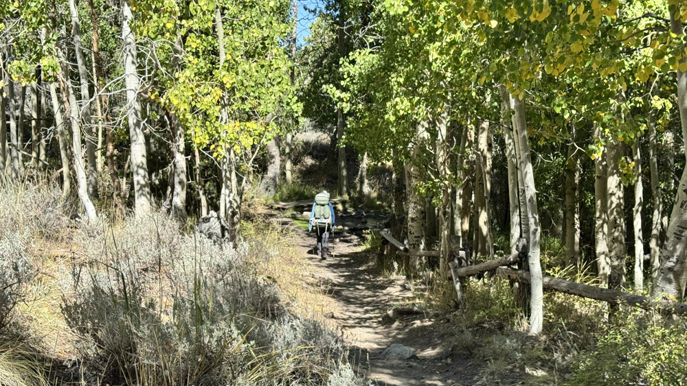
The hike started out exposed but quickly gets under canopy and stays there for about a quarter of a mile as you hike on the trail next to the Silver Lake Resort. After you emerge from it, most of the rest of the nearly 2-mile hike up is almost entirely exposed as you head toward Agnew Lake.
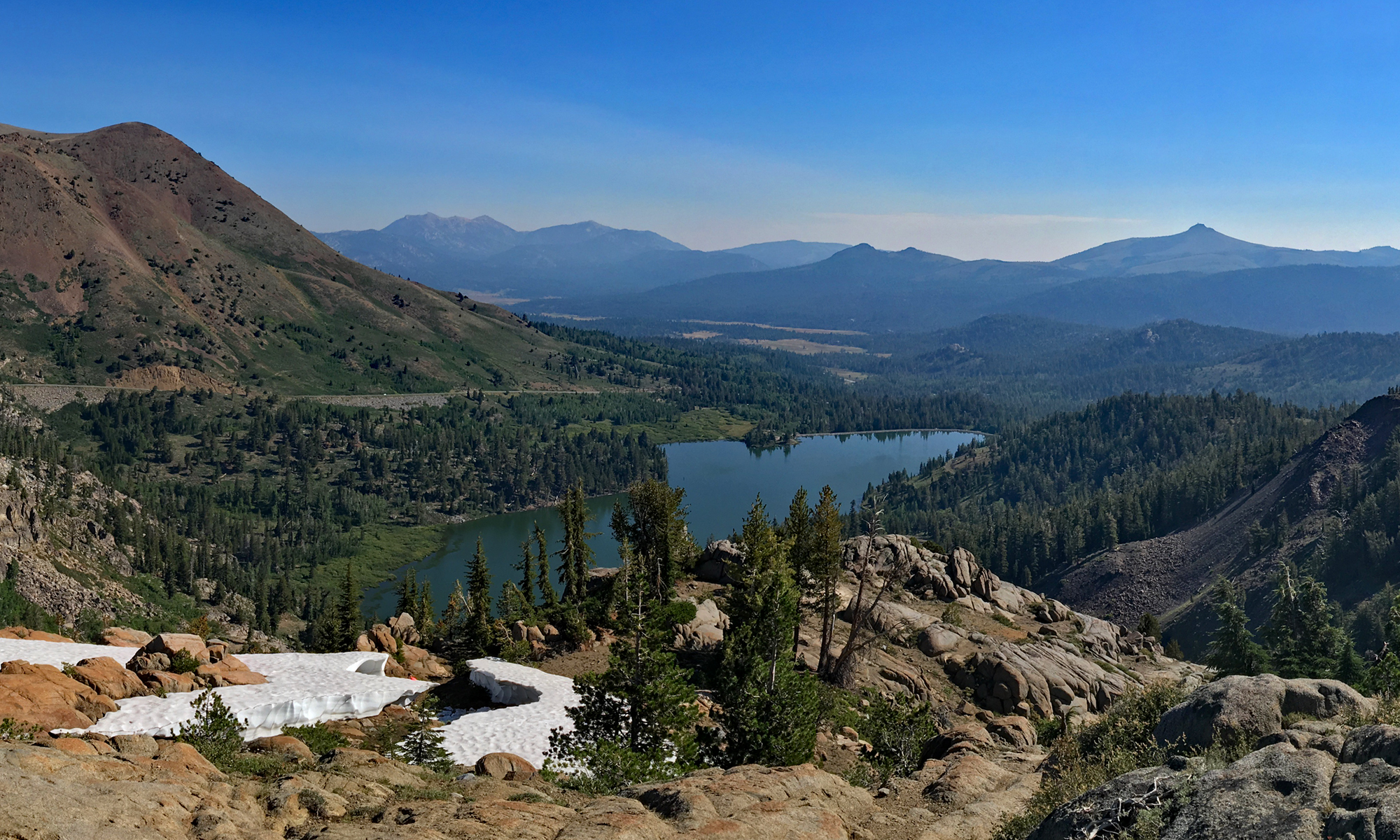
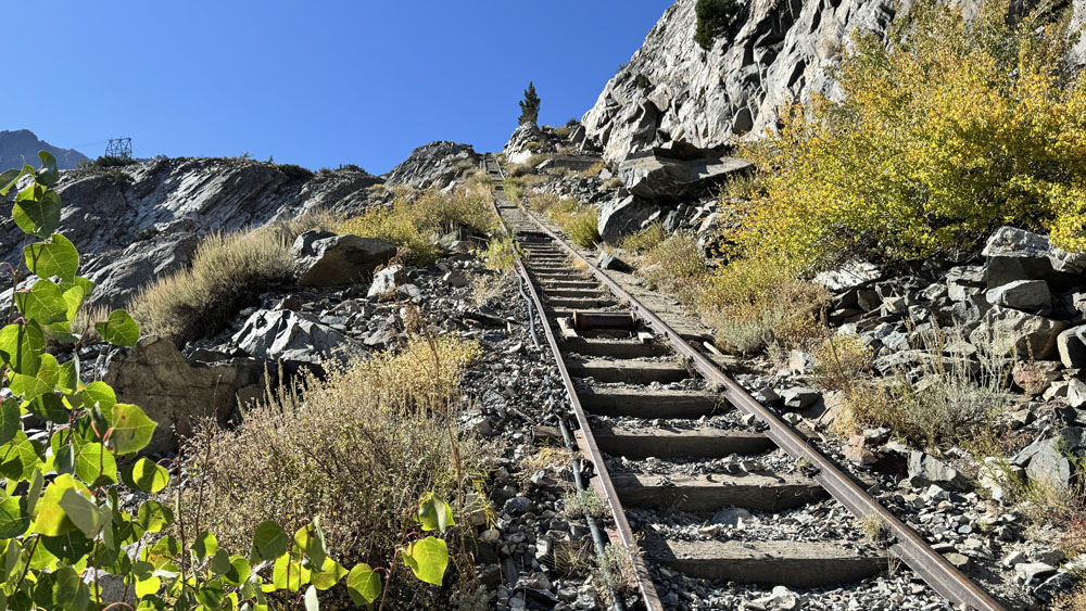
While hiking up, it looks daunting as you look to the distance of where you will be climbing to. It takes time, but it’s not difficult, unless it’s hot. As you climb, you can look down on Silver Lake and out over the landscape that you see more and more of as you ascend. Eventually, you’ll come to the Agnew Tracks used to service the Agnew Lake dam and Gem Lake dam. The trail crosses them. It looks easier to hop on the tracks and climb up them, and while some do, it isn’t recommended.
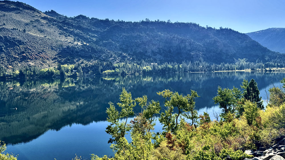
Follow the trail for a little more than half a mile over several switchbacks and then down to the area of the damsite. The trail crosses the tracks again and goes into a work area near where the dam is and continues past it. The climb can be a little rough in places where there’s more climbing on uneven terrain. We came out at an outcropping next to the trail that overlooked Agnew Lake. We had some lunch, took in the view looking up to the dam at Gem Lake and then headed back down.
Directions: From Lee Vining head south on US 395 for 5 miles and turn right onto California Highway 168 South. Follow Highway 168 for 8.6 miles and turn into the parking lot where the Rush Creek Trailhead is.
The Skinny
Trail: Rush Creek Trail To Agnew Lake
Trailhead Coordinates: 37.782883, -119.128433
Trailhead Elevation: 7253 Feet
Distance: 4.9 Miles – Out And Back
Level Of Difficulty: 🟡
Average Grade: 10.3%
Steepest Grade: 42.6% Over 393 Feet
Ascension: 1707 Feet
Trail Condition: 🟢🟢🟢
Scenery: 🟢🟢🟢
Nearest Town: June Lake
Challenges: Uneven Ground In Places
Traffic: 🥾
Highlights: Scenery
Best Time: Summer, Fall
Hazards: Exposure
Wildlife Concerns: Black Bears, Mountain Lions, Rattlesnakes
Cell Service: 📵📱
Would I Do This Hike Again?: No
Parking: Free At The Time Of This Writing
Restrooms: At The Trailhead