Updated May 23, 2021
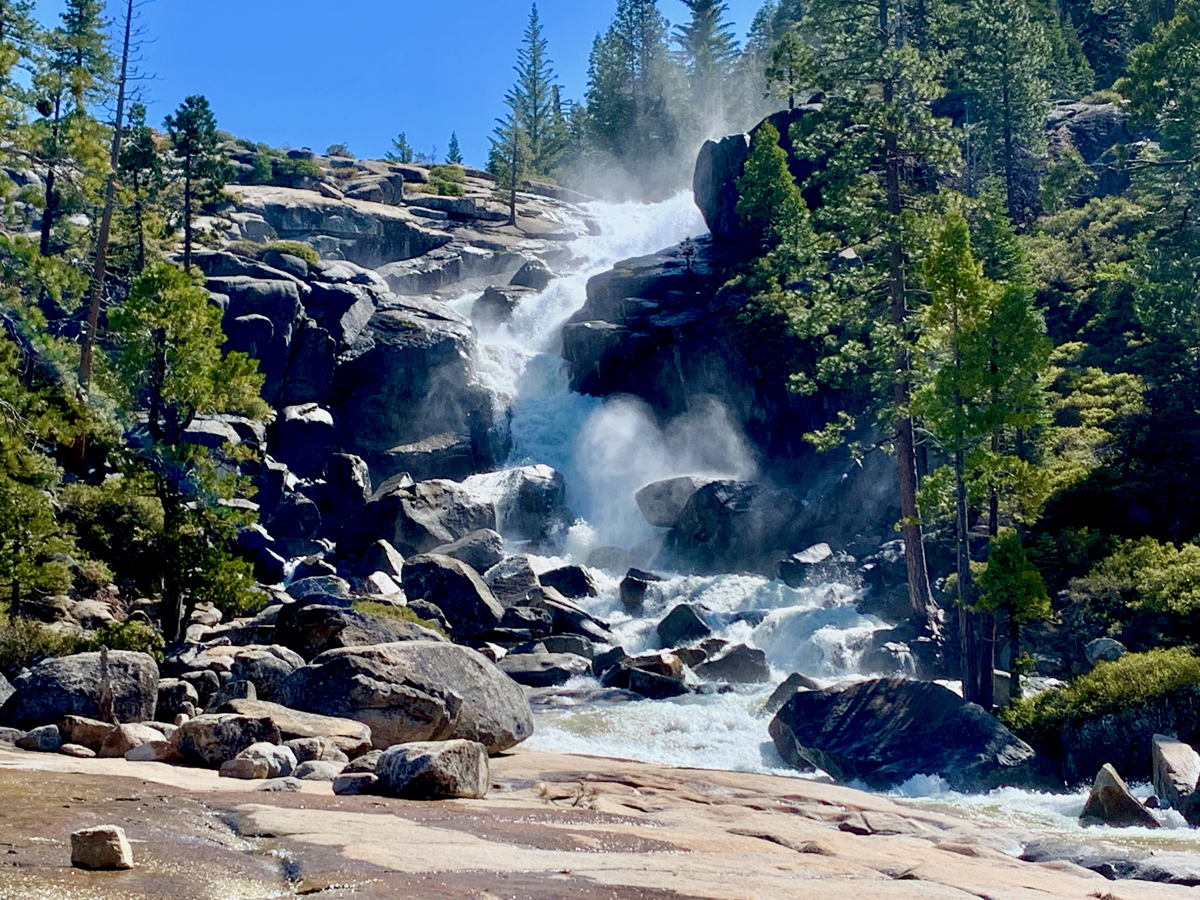
Bassi Falls is a spectacular show of natural force as it tumbles and crashes 109 feet off granite rocks before the water hits the bottom and flows away. To see the falls at their most powerful, it’s best to go before the end of May while the snowmelt is still good. After May, the flow slows and eventually becomes a trickle.
![]()
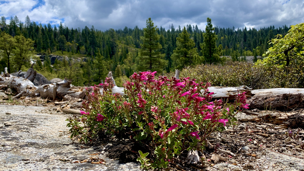
From the trailhead, the hike to the falls is about two miles and meanders through forest and over granite, but it may seem longer, especially if you’re visiting for the first time. I had to ask a hiker if I was on the right trail, and on my way back, I had to give direction to incoming hikers.
While the trail is easy, it can also be easy to lose your way both coming and returning. The problem is that there are areas where it looks like the trail forks, and you don’t know which way to go. There are some trail markers on the trees along the way, and they are helpful when you see them. The trail to the falls is pretty well defined in most places, but in some areas the ground makes it look like there are offshoot trails that run in other directions. They are not trails. Though they are sometimes far between, look for carins along the way to guide you once you start hiking on the granite.
While we were at the falls, we could see people at the top where the water spilled over. There is no defined trail that goes up to it, but there are a few ways up, and we experimented. You can download my tracks to follow what we did, but I would recommend you follow my track up the way we came down. It’s steep and over loose gravel on the way up and down, but it would have been an easier climb than how we went up.
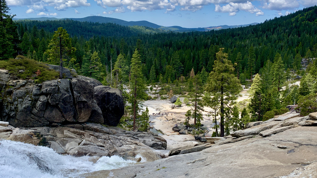
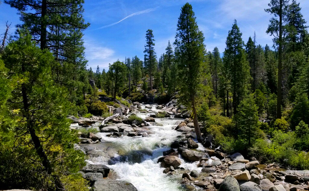
The view from the top can be stunning. We even hiked back a little ways next to the flowing water of Bassi Fork until more heavier climbing would have started. We sat on the granite and marveled at the area around us before we headed back.
While the falls are running, if you go on the weekend, it’s a good idea to get to the trailhead by 9 or 9:30 in the morning, but earlier is better, in that the parking area fills up, and you’ll have to start parking back on the unpaved road in. Not that big of a deal – it just means you’ll have to hike a little further. Also, the earlier you’re there, the less people there will be at the falls where you can enjoy it before it becomes more crowded.
Directions: From Sacramento, Take Highway 50 East to Ice House Road. Follow Ice House Road to Forest Road 12N32A, which is unmarked, and drive to the parking area. Parking is here: 38.8840500, -120.3557500. After you park, you hike south down the road to the camp about .15 miles and you will come to the trailhead.
The Skinny:
Trail: Bassi Falls
Trailhead Coordinates: 38.884050, -120.355750
Trailhead Elevation: 5041 Feet
Distance: 4.9 Miles – Out and Back
Level of Difficulty: 🟢
Average Grade: 4.5%
Steepest Grade: 16.1% Over .1 Miles
Ascension: 373 Feet
Trail Condition: 🟢🟢🟢
Scenery: 🟢🟢🟢🟢
Nearest Town: Kyburz
Challenges: Staying on the Trail (See Notes)
Traffic: 🥾🥾
Highlights: The Waterfall
Best Time: April and May
Hazards: Wet Granite Can Be Very Slick
Wildlife Concerns: Bears, Mountain Lions
Cell Service: 📱 (AT&T)
Would I Do This Hike Again?: Yes
Parking: Free
Restrooms: None