Exploring the Stebbins Cold Canyon Loop, (also called the Homestead-Blue Ridge Loop or the Homestead Blue Ridge Trail), starts off easy as you hike through the canyon, but it becomes a workout as you ascend to the great views of Lake Berryessa. I have hiked this trail more times than I can count, and I will continue to hike it. I love it for its views and its challenge.
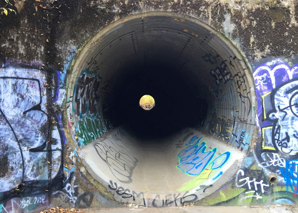
The way to the trail starts off from the parking lot is where you hike under Highway 128 by going through a drainage tunnel that runs under it. If there is water rapidly running through the tunnels and too high (which doesn’t have to be high at all) to walk in, use common sense. If you even think it could be dangerous for yourself or those with you, don’t attempt to walk against the moving water.
Once on the other side of the tunnels, you have a choice. To your left is the Homestead Trail which runs through Cold Canyon, and to the right leads up to the Blue Ridge Loop.
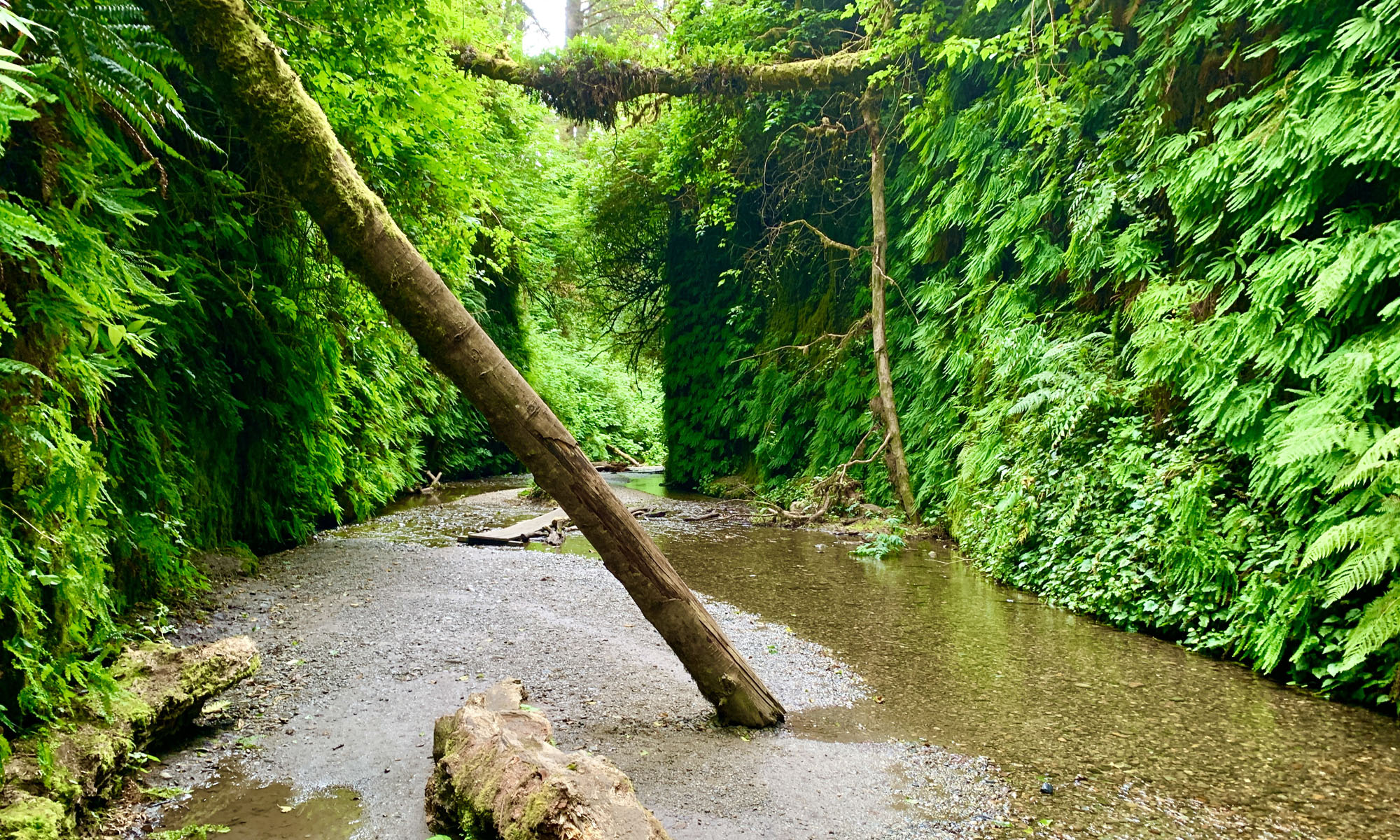
In the spring, the Homestead Trail is green, full of wildflowers, butterflies, is beautiful to behold and can be humid – especially if Cold Creek is running. There are some ups and downs with steps along the Homestead Trail, but nothing to make you catch your breath over until about the creek crossing.
If you decide to go up the Blue Ridge Loop, the climb starts out on a more upward hike, but nothing to make you breathe heavy for quite a while, but I’ll come back to that.
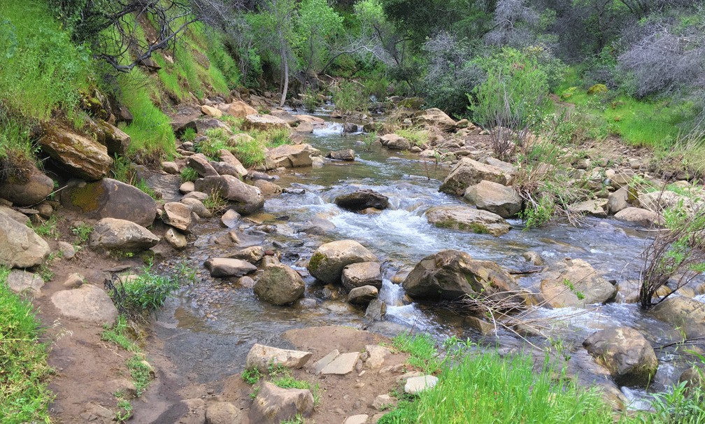
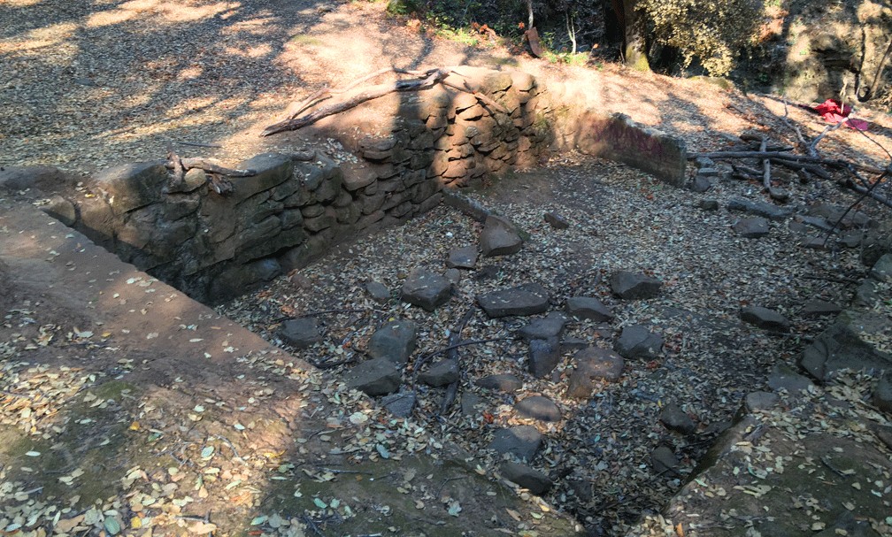
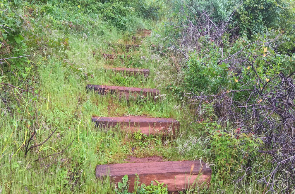
About .7 miles in if you take the Homestead Trail, you come to where the creek crosses the trail if water is flowing. Watch your step, and check the rocks for stability before you put your full weight on them. On up the trail a little further, there is a fork – take the stairs. If you go straight, the trail will run out shortly, but you will come across remnants of the old homestead and a cold storage house.
Once you take the stairs, the climbing begins, and it’s gentle until you get to the serious stairs. Over the next .4 miles, you will climb 400 feet from an elevation of 926 feet to 1,324 feet. It doesn’t sound like much, but that little leg is a 19 percent grade, and the steps aren’t small like regular steps, and you have to step higher than an average step to step up. You will breathe hard by the time you get to the end. Conversely, if you decide to start on the other end of the loop, coming down on these steps can be quite jarring on the knees. This is why I start with the Blue Ridge Loop, hike to the junctions discussed below and turn around and head back on the Blue Ridge Loop. This makes for a longer hike, but for me it’s more enjoyable.
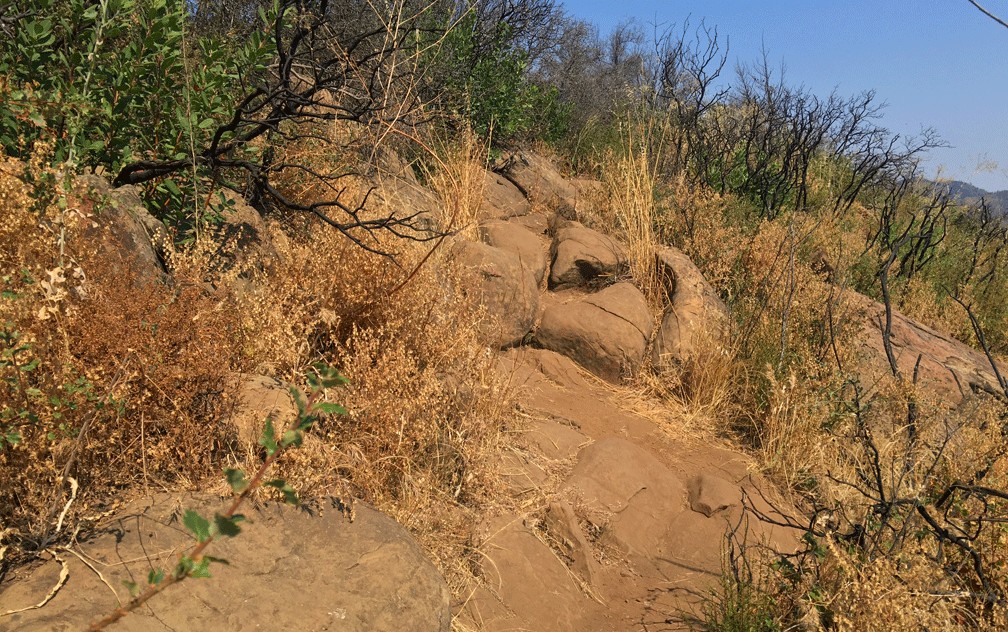
Once at the top of the Homestead Trail, you come to a three-way junction. Going straight ahead, you’ll hike down Annie’s Trail. Turning north, you start an ascent on the Blue Ridge Trail where you’ll dip and climb as the Turkey Vultures eventually soar below you. Once you start to the Blue Ridge Loop, you will be hiking exposed while on the ridgeline, so a hat, sunglasses and plenty of sunscreen are recommended. Water is mandatory, especially in the summertime.
I’ve seen people on this trail with 16 ounces of bottled of water. When I encounter them, many are more than a mile in, and their water is almost gone, they think the trail will be easy. They run out of water long before the trail ends, and the trail can become agonizing before the end. I once read the emergency services have been to called to the trail because people suffer from dehydration on it. In the summer, if you choose to hike it in the heat, take a gallon of water for yourself, and each person you are with should have a gallon as well. For some reason, people think this is an easy trail – it’s not; if you are not prepared, it can be brutal. I’ve experienced that myself the first time I hiked it. For some reason, people new to the trail don’t think it’s going to be as challenging as it is and aren’t prepared.
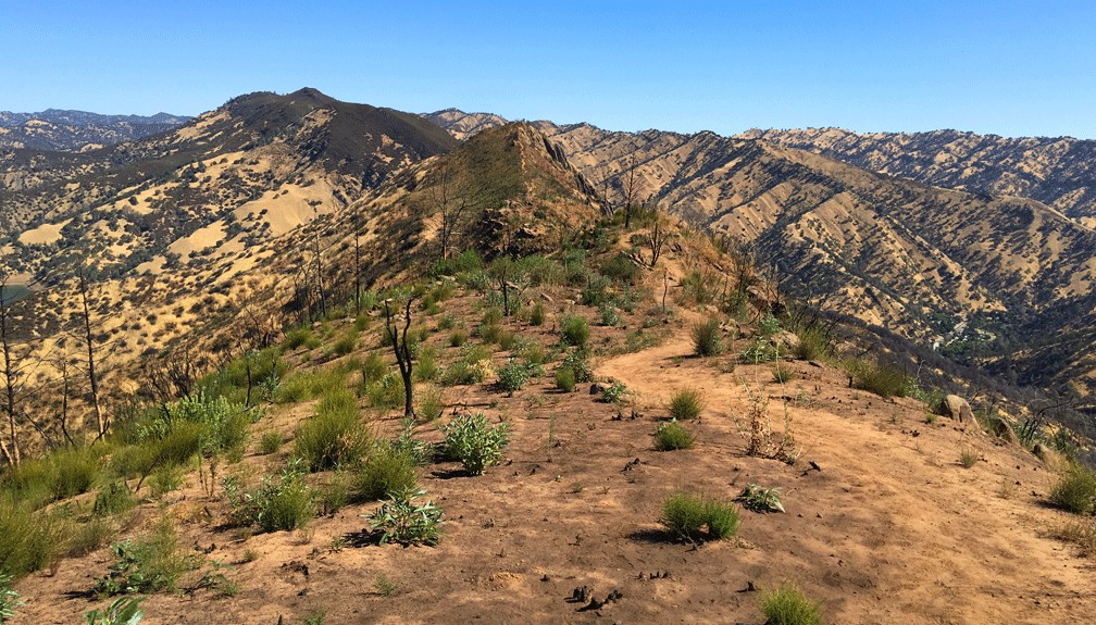
About .2 miles from the junction, you climb to about 1,450 feet and get your first glimpse of the views of Lake Berryessa, parts of the Sacramento Valley to the east and the foothills to the west. If you do this hike on a warm spring day or in the summer, you may be graced with a cool breeze you won’t want to leave.
After a 500-foot climb you come up to another high on the trail, and there are rocks to sit on and look out to the west. You can see a little more of Lake Berryessa and the sweeping views of the surrounding foothills.
About a mile further, you reach the high point with more views of Lake Berryessa and the surrounding area. Coming up or going down from this peak on the north end may require you to use both your hands and your feet to climb. But at the top, if a breeze blows to cool you down, it’s even the better. Just stop and let it cool you off.
There are parts of this trail where it just seems to run out and you have to kind of figure out where it picks back up. Just watch your step, and you’ll pick the trail back up.
This trail is very popular, and it is crowded on the weekends. It will challenge you, but the views are very worth it, and in the end, you may feel like you’ve accomplished something.
While dogs are prohibited in this area on the trails, people take them anyway. If you choose to take your dog with you, which I do not advocate, make sure you take plenty of water for your dog so he or she does not dehydrate. Dogs wear out too, and I’ve seen people having to carry them on the trail as it is too much for some of them.
Directions: From Winters, take Highway 128 about nine miles just over the Putah Creek Bridge to the parking area off the road on the right.
The Skinny
Trail: Stebbins Cold Canyon Loop
Trailhead Coordinates: 38.509080, -122.097371
Trailhead Elevation: 549 Feet
Distance: 5.29 Miles – Loop
Level of Difficulty: 🟠
Average Grade: 5.1%
Steepest Grade: 13.2% over 1.4 miles
Ascension: 1,383 Feet
Trail Condition: 🟢🟢🟢 – Some Scrambling
Scenery: 🟢🟢🟢
Nearest Town: Winters
Challenges: Hot summers, rock scrambling
Trail Traffic: 🥾🥾 to 🥾🥾🥾 on Weekends
Highlights: Sweeping views
Best Time: Spring, Fall
Hazards: Some scrambling over rocks; tips of rocks sticking up in trail creating trip hazards; temperatures higher than 90 degrees Fahrenheit.
Wildlife Concerns: Mountain Lions; Rattlesnakes
Cell Service: 📱📱 At the top of Blue Ridge Trail on the Ridge (AT&T)
Would I Do This Hike Again?: I have done this hike many times. Yes.
Parking: Free
Restrooms: Vaulted toilet in the parking lot