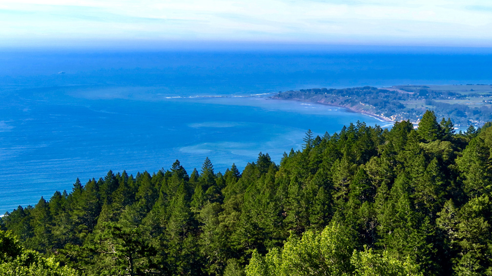
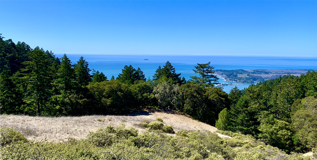
If the weather is right, the views from the Coast Trail on Mount Tamalpais of the Pacific Ocean can be striking. During the right time of the year, the hills are beautifully green with a beautiful blue ocean background to the west, or sweeping green hills as you look north and south.
We started the hike from a little parking area at Trojan Point where the trail picked up across the road. We mapped out where the trail from Trojan Point connects to the Coast Trail, but somehow we hiked passed where we should have cut down to it – .22 miles from the trailhead. The descent would have been steep, but where we ended up going down was worse – a 38 percent grade. It was difficult for some of us to keep our footing until we made it down the hill on the little trail we found that took us to the Coast Trail. See my tracks and go down where we came up at the end.
The trail is a single track, so you will have to step aside for trail runners or hikers coming in your direction. And the trail is narrow on the side of hills, so caution is advised in these areas.
There are also a few areas the trail goes by where you can get off it, walk away from it in the direction of the ocean and just look out at it. We walked out, plopped down on the ground, had lunch and just took it in for quite a while. The day were there, the water was peaceful, and there were few clouds in the sky.
The trail itself is popular and well maintained for the most part. I’ve hiked the trail twice, and both times there were a few points where had to climb over fallen trees, but in our case, they weren’t that big of a deal.
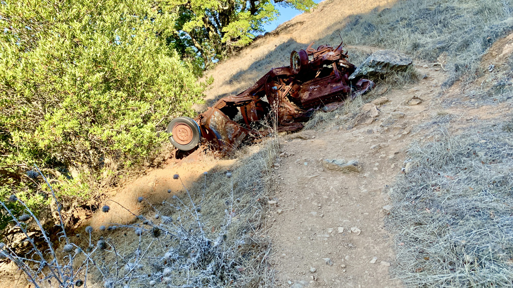
There is also a rusted out vehicle next to the trail that must have at one time fallen down the hill from the road above, which is interesting to stop and look at. From the looks of it, you wonder if the person or persons inside it survived the crash.
We hiked the Coast Trail to the McKennan Gulch Trail where we took it to the end and looked out over Bolinas from above. We took in the view for a little while and then headed back.
Coming back near the end, we had to ascend an 18.3 percent grade over .3 miles to get back up to the trailhead near Trojan Point. That was where the heavy breathing happened, and was the most stressful part of the hike.
Directions: From Mill Valley, take Panoramic Highway and make a sharp left onto E Blithedale Avenue; turn right onto Millwood Street, and then turn left onto Miller Avenue; turn right onto Montford Avenue and then turn right onto Molino Avenue; continue straight onto Edgewood Avenue, and Edgewood Avenue turns left and becomes Sequoia Valley Road; take a sharp right onto Panoramic Highway, and then turn right onto Pantoll Road. Parking is here: 37.906370, -122.614830
The Skinny
Trail: Mount Tamalpais – Trojan Point to McKennan Gulch Trail via the Coast Trail
Trailhead Coordinates: 37.906280, -122.614860
Trailhead Elevation: 1848 Feet
Distance: 6.8 Miles – Out And Back
Level of Difficulty: 🟡
Average Grade: .8%
Steepest Grade: 18.3% Over .3 Miles
Ascension: 2883 Feet
Trail Condition: 🟢🟢🟢
Scenery: 🟢🟢🟢🟢
Nearest Town: Mill Valley
Challenges: Steep Climb
Traffic: 🥾🥾🥾
Highlights: The Views
Best Time: Spring, Summer, Fall
Hazards: Single Track Trail Near Drop Offs
Wildlife Concerns: Mountain Lions, Rattle Snakes
Cell Service: 📱📱 (AT&T)
Would I Do This Hike Again?: Yes
Parking: Free, Parking is here:
Restrooms: Find Cover