If you love dirt and sand, Desolation Canyon at Death Valley National Park is for you. If you don’t, the view at the end and colors in the canyon walls is may be worth the hike, but getting there can be a chore.
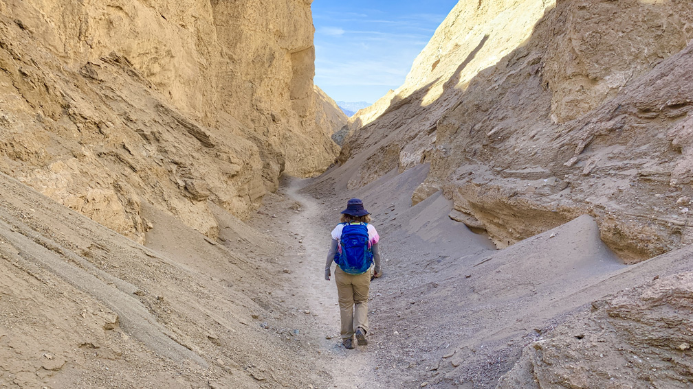
The hike starts off completely exposed, and you do not get to the canyon until about a mile in. You may even wonder if you’re on the right trail especially if the Death Valley sun is beating down on you. From the beginning, you are on an ascent, but it’s not bad until you get almost to the end near the top.
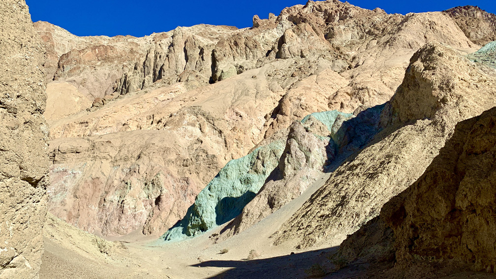
There were a few desert holly bushes here and there in the canyon, but that’s all the growth you’re probably going to see. The walls of the canyon are mostly tan, but there are places where the canyon walls are green, red and brown. As I hiked between the canyon wall, it got me to thinking Jawas could pop up at any moment. Parts of Star Wars was filmed not very far from this canyon.
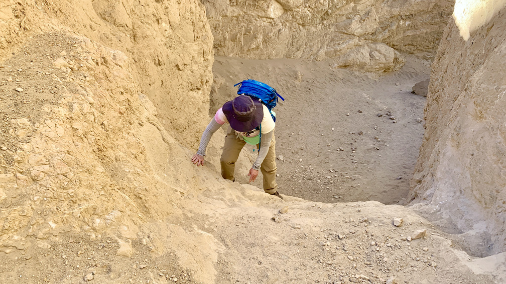
There are three places in the canyon where you actually have to climb up using your hands as there are short “walls” you have to overcome. The highest one is a about 8 feet. Going up on them may take some effort, but where you really have to take care is when you’re climbing back down and where you have to place your feet while hanging on with your hands. It’s not easy to place your feet on small footholds you can’t see and hope are there with a drop below you. This can be scary.
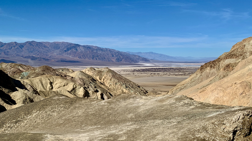
From the view at the top you can look across to Panamint Mountain Range and Telescope Peak. You can see portions of Cottonball Basin, Middle Basin and Badwater Basin. Once you’ve enjoyed the view, head back the way you came. It doesn’t take as long to get back as it did to get to the end point.
Make sure you take plenty of water.
Directions: From Furnace Creek, follow California Highway 190 south to Badwater Basin Road. Drive Badwater Basin Road for 3.7 miles and turn left onto Desolation Canyon Road for .5 miles to the trailhead. Parking is here: 36.395860, -116.838890
Video 1: Hiking Desolation Canyon
Video 2: Climbing In Desolation Canyon
The Skinny
Trail: Desolation Canyon
Trailhead Coordinates: 36.395770, -116.838530
Trailhead Elevation: -62 Feet (That’s Correct – 62 Feet Below Sea Level)
Distance: 3.8 Miles – Out And Back
Level of Difficulty: 🟡
Average Grade: 7.8%
Steepest Grade: 16% Over .1 Miles
Ascension: 815 Feet
Trail Condition: 🟢🟢🟢🟢
Scenery: 🟢🟢
Nearest Town: Furnace Creek
Challenges: The Heat
Traffic: 🥾
Highlights: Colored Canyon Walls, Views
Best Time: Winter
Hazards: Climbing Up And Down Walls (See Summary)
Wildlife Concerns: Rattlesnakes
Cell Service: 📵 (AT&T)
Would I Do This Hike Again?: No
Parking: Parking At The Trailhead. $30 At The Time Of This Writing To Enter The Park; Good For 7 Days.
Restrooms: None