The hike to Bear Gulch Reservoir at Pinnacles National Park starts off on the High Peaks Trail as you hike under oak trees and ascend to the Moses Spring Trail junction.
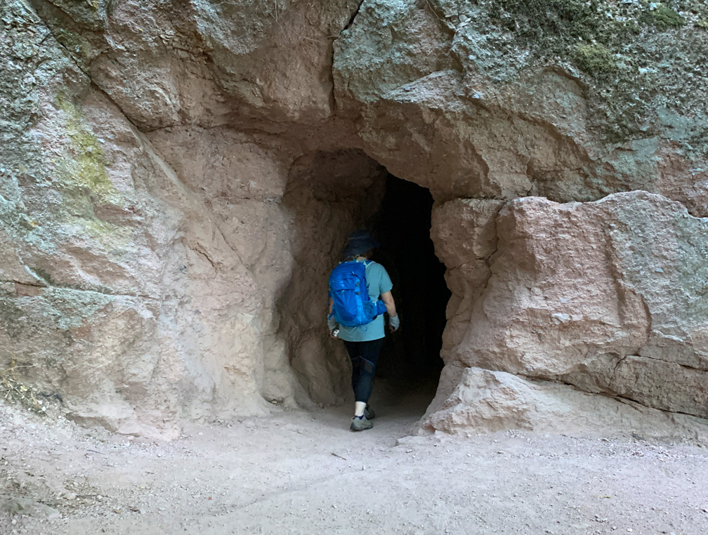
As the trail ascends, you start to hike amongst rock formations that take you to the caves on the Moses Spring Trail. If you are not comfortable with caves, there is a bypass trail that will also take you to Bear Gulch Reservoir on up past the Moses Spring Trail junction that leads to the Rim Trail, but the caves are worth exploring.
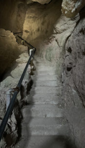
That said, while worth checking out, the caves are not easy to navigate and difficult to traverse in some places. You will need a flashlight or headlamp, as there are places where the caves are pitch dark.
There are many, many stairs in the caves that are carved in to the stone, and it seems like you continually climb, and it can become tiring. There are places where you have to duck. There was a spot where I had to crawl on a metal grate as I moved out of the caves, and my hiking partner had to crab walk. I also had to crabwalk in another part of the caves. You’re either going to love the caves, or you are not.
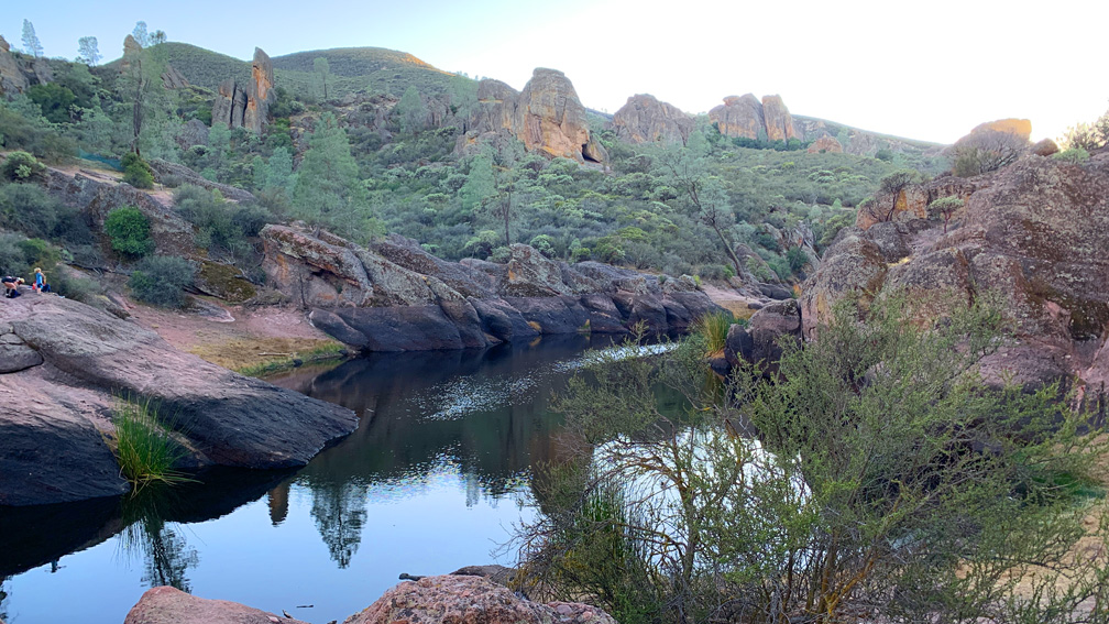
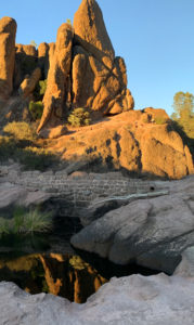
Once you emerge from the caves, you will climb some more up to Bear Gulch Reservoir. You’ll see where a small dam was built, and you can look out on the water. The trail goes on to North Chalone Peak nearly three miles away.
When we headed back, we decided to make a loop out of the hike on the Rim Trail instead of going back down through the caves.
The hike back on the Rim Trail is scenic, and offers views of the hills to the east. The trail connects up with the High Peaks Trail, and you can follow it back to the trailhead.
Check the park website before you go to check to see if the caves are open. There are times when they have to be closed down.
Directions: From Hollister, take Highway 25 south for 28.2 miles. Turn right on Highway 146 which will take you into the park. Follow it to the Bear Gulch Day Use Area and follow the road to the end where parking lot is. If parking is filled back track to another parking area you passed coming in. This parking area is small, so arrive early in the morning to get a spot. Parking is here: 36.478512, -121.183574
The Skinny
Trail: Moses Spring Trail to Bear Gulch Reservoir
Trailhead Coordinates: 36.478512, -121.183574
Trailhead Elevation: 1365 Feet
Distance: 1.5 Mile – Lollipop
Level of Difficulty: 🟠
Average Grade: 7.8%
Steepest Grade: 20% for 296 Feet
Ascension: 400 Feet
Trail Condition: 🟢🟢🟢🟢
Scenery: 🟢🟢🟢
Nearest Town: Tres Pinos
Challenges: Low Ceilings and Narrow Passages in the Caves
Traffic: 🥾🥾
Highlights: The Caves
Best Time: Spring, Fall
Hazards: Low ceilings and narrow passages in the caves, Heat
Wildlife Concerns: Mountain Lions, Rattlesnakes
Cell Service: 📵 (AT&T)
Would I Do This Hike Again?: Yes, But Not Through the Caves
Parking: Parking Lot At The Trailhead, But It Is Small. $30 To Enter The Park Good For 7 Days
Restrooms: At the Trailhead in the Parking Area