The hike to Carter Falls is a climb for sure, but it offers a nice view of the falls, and then on up a little further, there’s Madcap Falls is just ahead.
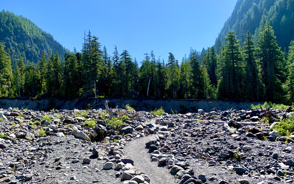
We started this trail near the Cougar Rock Campground where it hooks into the Wonderland Trail off of Paradise Road. The trail descends down into the Nisqually river bed, which is laden with large rocks, so you may want to watch your step.
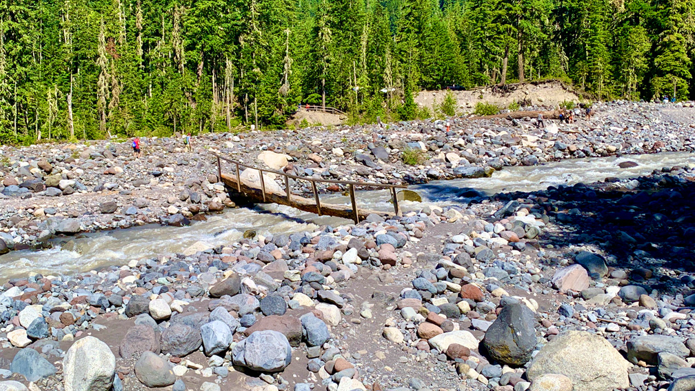
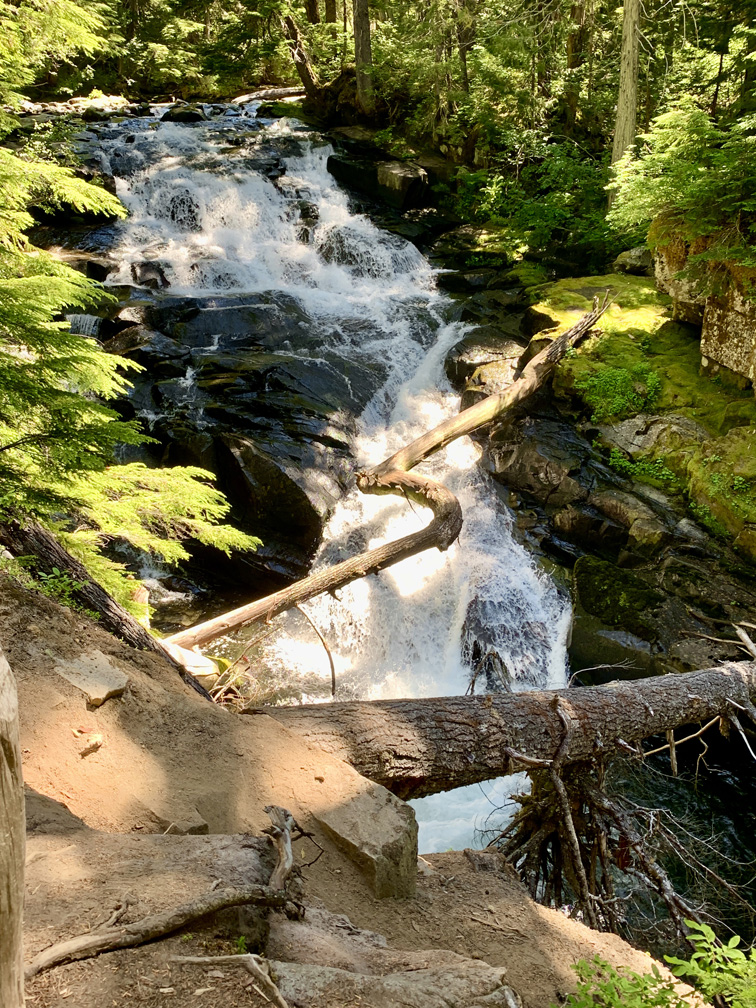
Before you can hike to Carter Falls, you’ll have to cross a “bridge” over the Nisqually River. The crossing is a log with wood railing attached to it with fast running water under it. It’s a good idea to hold the railing as you’re crossing in that river flowing fast under you may make you feel disoriented. There’s also a high water warning sign stating the river can fluctuate with changes in temperature and is unadvisable to cross with water running over the bridge.
Once you cross the Nisqually River, you’ll start your climb to Carter Falls. The hike is moderate, but it is uphill for about 1.15 miles, which may cause you to stop here and there to rest or catch your breath. The hike up is under canopy, so that will help mitigate some of the heat you produce once you really start climbing.
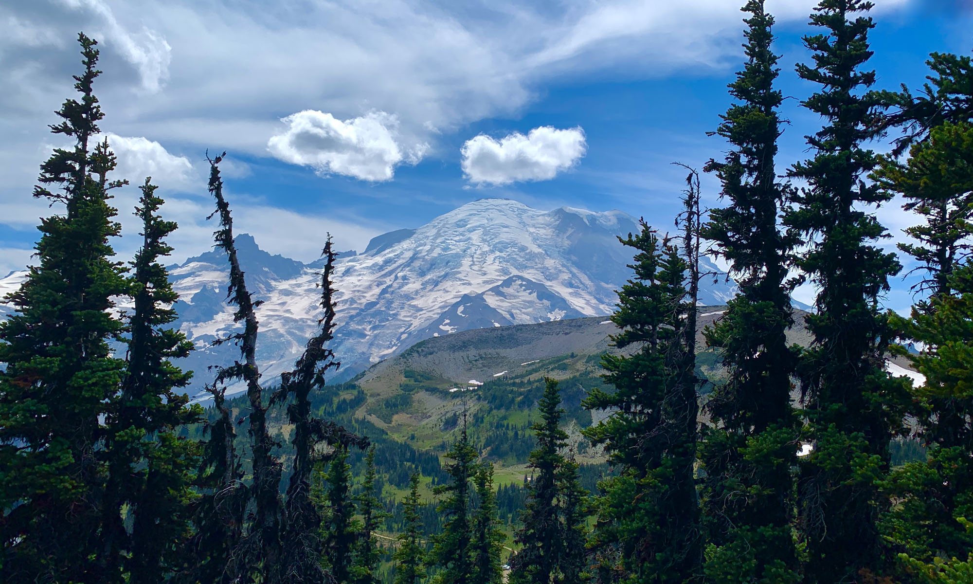
As you hike, you will be able to hear the Paradise River as it runs slightly out of view of the trail as you hike amongst old-growth trees including Douglas fir and western hemlock.
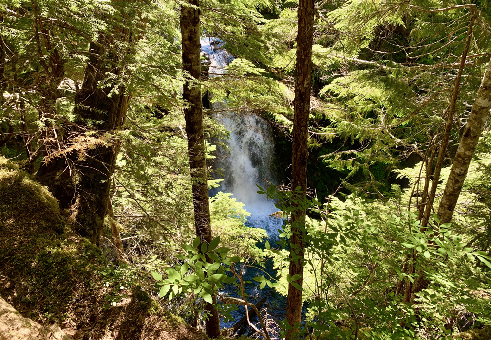
As you ascend, the mumble of the Paradise River raises to a rumble as you approach Carter Falls where the water tumbles over a 53-foot drop. It’s a beautiful sight to see, but there’s more if you hike up about another .2 miles to Madcap Falls. Most people turn around at Carter Falls, so the trail and viewing becomes a little less busy as you move on.
At Madcap Falls a viewing area was created behind railing to see the falls, were the water plummets 34-feet over rocks and continues on. Take it in. It’s beautiful.
From here you can continue on the Wonderland Trail, or you can head back. We did go on a little further before we turned back, and while there was more climbing, it was beautiful to hike through the forest, and the hikers really thinned out.
Directions: From Ashford, take Highway 706, which turns into Paradise Road, for about 14.5 miles. Parking is along side the road next to the trailhead, which is here: 46.766636, -121.791039 or here 46.768583, -121.790674 if parking is on the road is full.
The Skinny
Trail: Cougar Rock Camp to Carter Falls
Trailhead Coordinates: 46.766608, -121.791012
Trailhead Elevation: 3191 Feet
Distance: 2.6 Miles – Out and Back
Level of Difficulty: 🟡
Average Grade: 9.7%
Steepest Grade: 26.2% over 504 Feet
Ascension: 686 Feet
Trail Condition: 🟢🟢🟢🟢
Scenery: 🟢🟢🟢
Nearest Town: Ashford
Challenges: Constant Ascension
Traffic: 🥾🥾
Highlights: Waterfalls, Old-Growth Forests
Best Time: Summer
Hazards: River Crossing
Wildlife Concerns: Bears, Mountain Lions
Cell Service: 📵
Would I Do This Hike Again?: Possibly
Parking: $30 good for 7 Days
Restrooms: In Cougar Rock Campground