Normally, I wouldn’t rate a hiking trail like Round Top Lake to Winnemucca Lake with a 🟠. It’s not a difficult hike, but the altitude might slow you down as you approach the 9000-foot mark. Even if it makes you huff and puff, it’s well worth it.
This hike has fantastic views as you approach Round Top Lake and look behind you to the north down on Caples Lake and the mountains beyond. Leaving the small parking lot, you’ll cross over Woods Creek on a bridge and then shortly after you’ll leave the pavement to your right and start hiking the trail.
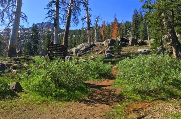
About one mile in, you’re going to encounter a sign at a junction that gives you distances to hiking locations. The way the sign is positioned, it’s difficult to tell which way to go, but either way will take you to Round Top Lake. If go straight, the trail will take you to a gorgeous waterfall that you’ll have to cross over and the trail continues on.
As you continue on, you will come to an unmarked junction. You will want to go left. There is a trail to the right, but it dead ends with a great view of the Woods Lake. There are no signs that the trail stops at the overlook, and it looks like if you cross over another waterfall, there might be a lesser maintained trail. You could venture on guessing where the trail could be based on what looks like “could have been a trail” at one time but may be scarcely maintained. It’s one of those, “if you’re looking for it you will find it,” scenarios where there is really nothing there.
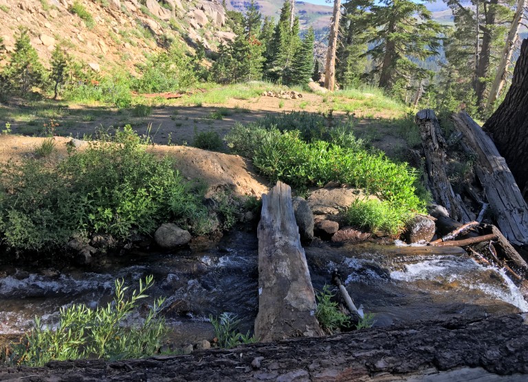
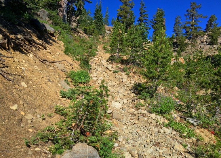
Back at the sign, if you choose to turn right, you will hike up an old mountain road. This is the way I went. Even going this way, you’ll come across a waterfall to cross., but if you choose to cross, do it carefully.
After crossing on the log, the trail continues on up, and it gets a little encumbered as the trees and vegetation become thick that you have to hike through for just a little bit. The climbing gets a little intense along the rocky trail close to a drop-off, but it doesn’t last long, and you can look down as water runs down the hill below you if it’s a good run-off year.
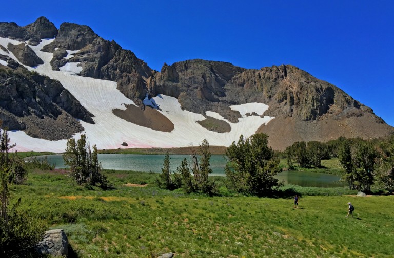
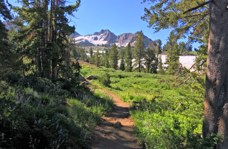
The climb starts to smooth out as you turn a corner and look out into a meadow with bare granite mountains in the backdrop. The trail continues and makes it to the Mokelumne Wilderness boundary at 8900 feet it rounds a corner that takes you alongside a meadow full of wildflowers. The Sisters, which rise above Round Top Lake also come into view, as well as Round Top, which towers at 10,381 feet. Continue on for about another mile as you climb about another 430 feet to Round Top Lake.
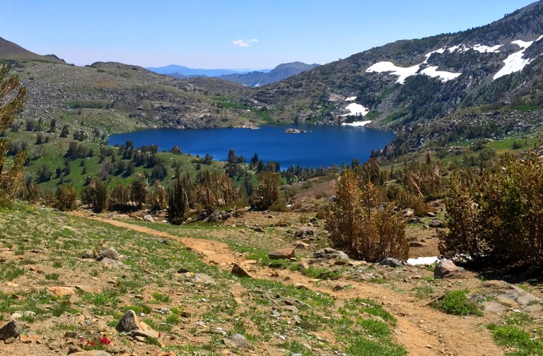
Stop and take the small lake in as the Sisters tower over it. It’s a good place to have lunch, and on a heavily trafficked day, you’ll probably see other hikers or campers stopped under the trees by the lake doing the same.
At Round Top Lake, there is a junction where you can go in several different directions. If you want to go higher to the top of Round Top, you can do that. If you want to go west, along the lake you can do that, the trail goes to Fourth of July Lake. Along the way, you come across camp sites along Round Top Lake. Go off the trail and take in the views to the North. You can also go east to Winnemucca Lake, which is about a mile away and the trail mostly descents.
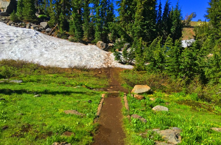
Even late in the summer, there might be some snow left to hike through that covers the trail, but it doesn’t last long – just use caution.
When you make it to Winnemucca Lake, you’ll have to cross a picturesque little stream flowing out of it. This is lake is popular, so expect people – even anglers. But it’s beautiful to behold, so stick around awhile and enjoy the view.
When you’re ready to leave, you’ll come across a fork with a sign that goes to Carson Pass or Woods Lake. Take the Woods Lake path, and you’ll descend two miles to the parking lot. Along the way, there are more wild flowers where you could see red, purple and yellow. This loop is an outstanding hike!
One thing to note, you can do this trail opposite the way I went, but when you get to Winnemucca Lake, climbing about a mile to get to Round Top Lake can take it out of you. The trail isn’t hard but rather the altitude that may get to you while climbing. I’ve seen people do it with no problem, but I’ve also seen seasoned hikers struggle with it.
Directions: From Sacramento, take Highway 50 to the Sly Park Exit. Turn right onto Sly Park Road and follow it and turn on Mormon Emigrant Trail (it’s a road usually closed in the winter after the snow starts to fall) and follow it to Highway 88. Turn left on Highway 88 and head to Woods Lake Road.
The Skinny
Trail: Round Top Lake to Winnemucca Lake
Trailhead Coordinates: 38.690883, -120.009500
Trailhead Elevation: 7912 Feet
Distance: 6.4 Miles – Loop
Level of Difficulty: 🟠
Average Grade: 1.2%
Steepest Grade: 13.6% for .2 miles
Ascension: 1674Feet
Trail Condition: 🟢🟢🟢
Scenery: 🟢🟢🟢🟢
Nearest Town: Markleeville
Challenges: Hiking at altitude
Trail Traffic: 🥾🥾 to 🥾🥾🥾
Highlights: Lakes, Waterfalls, Mountaintops, Wildflowers
Best Time: Summer, Fall
Hazards: Temperatures higher than 90 degrees Fahrenheit, Sudden Thunderstorms
Wildlife Concerns: Bears, Mountain Lions
Would I Do This Hike Again?: Yes
Parking: $10 at the time of this writing
Restrooms: Vaulted toilets in the parking lot