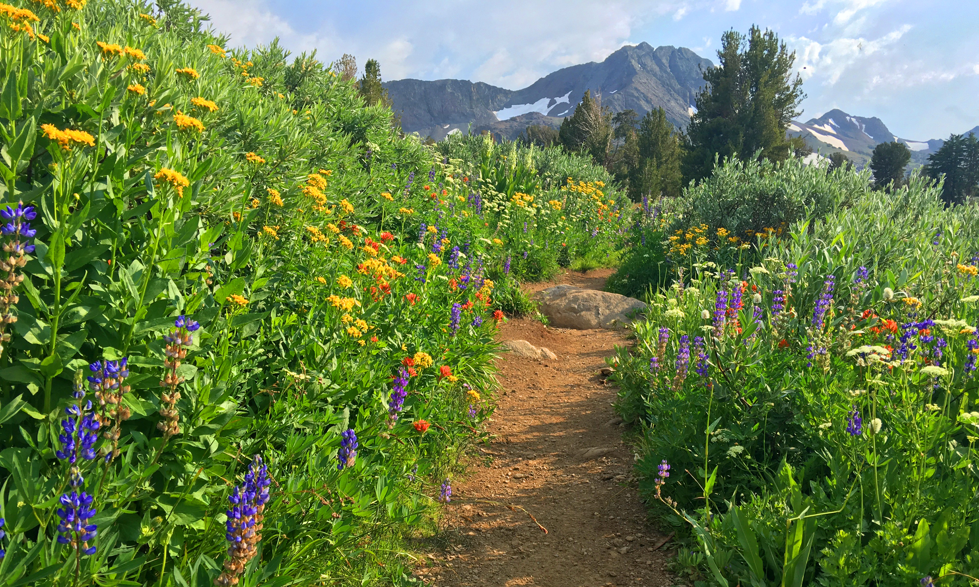
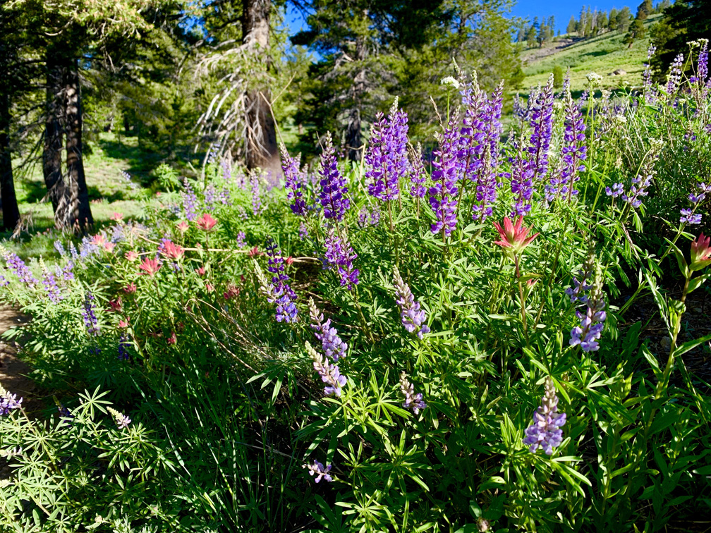
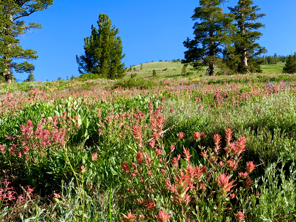
At the right time of the year, this is another “blow your mind” hike where wildflowers abound on the Schneider Camp Trail before you start the serious ascent to the junction that goes on to Showers Lake.
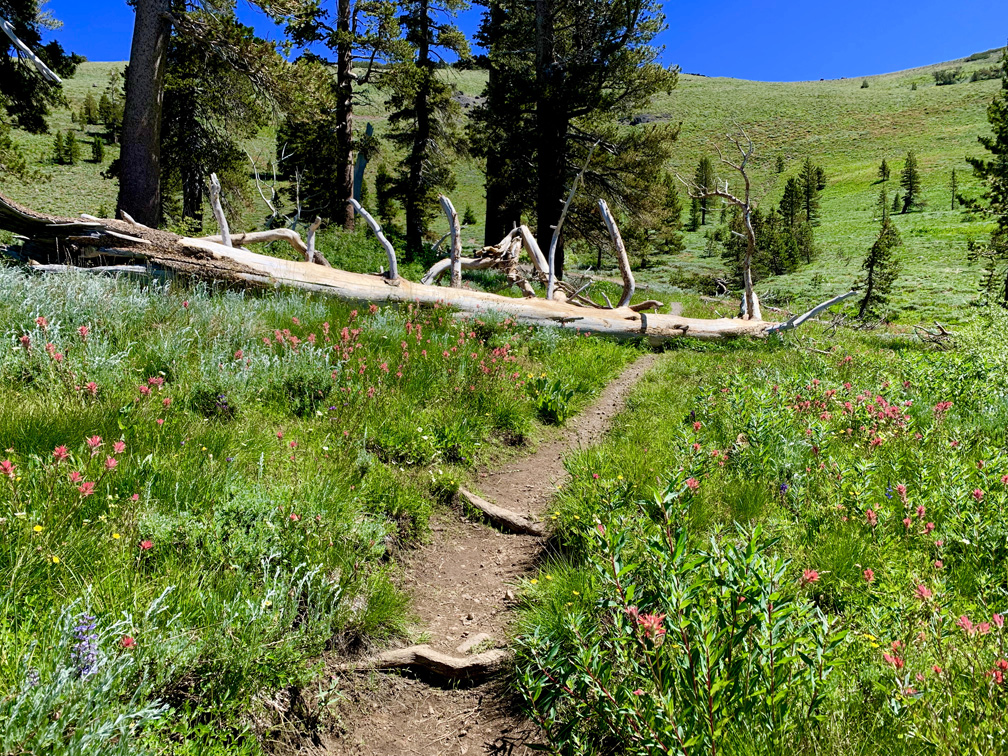
Don’t let the short mileage fool you. This hike will take your breath away; the day I was there, there was no wind, and I turned into a sweat drop. You can feel the elevation almost as soon as you start hiking. At half a mile in (seems like longer), there is a downed tree that crosses the trail. This is a good place to stop and rest, but there are also some shade trees very nearby. If you’re going just for the wildflowers, this a great place to stop, take in the area and head back.
Just up the trail a bit, the switchbacks begin and then you start an angled ascent for the next half mile on a 17.4% grade. It’s not easy, and even before the switchbacks where I sat on the downed tree, trail runners came past me… walking. It was rough even for even them.
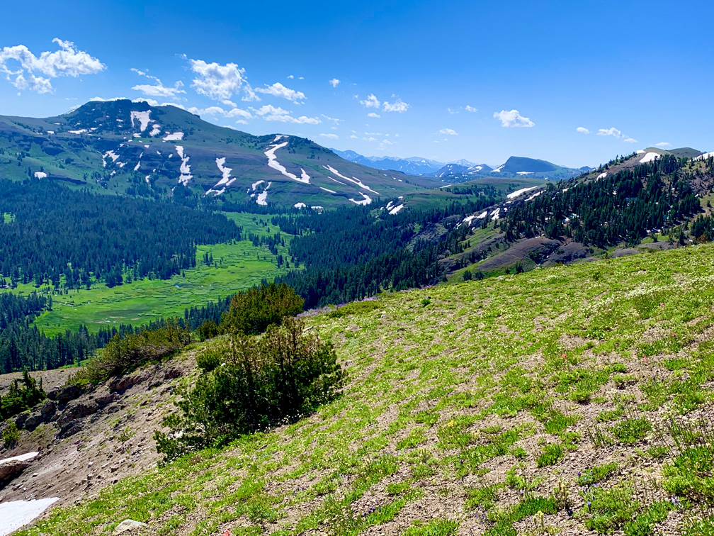
Once you make it to the top, there is a junction that heads north to the Pacific Crest Trail and Showers Lake, and one not on any map I have that heads south. From the point at the junction, there are sweeping views to the northwest where you can see Thunder Mountain and Lake Tahoe in the distance to the north. To the south, you can see Elephants Back near Carson Pass. As I looked out and took in the views, I felt like I should have seen Grizzly Adams himself along with Ben, Mad Jack, Nakoma and Number 7.
From the junction, you can go on, or you can head back to the trailhead.
The parking area is inadequately small and fills fast.
Directions: From Sacramento, take Highway 50 to the Sly Park Exit. Turn right onto Sly Park Road and follow it and turn on Mormon Emigrant Trail (it’s actually a road and is closed in the winter) and follow it to Highway 88. Turn left on Highway 88 and head East for 14.2 miles and turn left off the highway onto Schneider Cow Camp Road. Drive two miles to the trailhead/parking area. It is recommended a vehicle with ground clearance and four-wheel drive or all-wheel drive be used once the pavement runs out on the forest service road. The parking coordinates are here: 38.725910, -120.047910
The Skinny:
Trail: Schneider Camp Trail to Showers Lake Trail Junction
Trailhead Coordinates: 38.725970, -120.047840
Trailhead Elevation: 8366 Feet
Distance: 2.3 Miles – Out and Back
Level of Difficulty: 🔴
Average Grade: 13%
Steepest Grade: 17.4% for .5 miles
Ascension: 803 Feet
Trail Condition: 🟢🟢🟢🟢
Scenery: 🟢🟢🟢🟢
Nearest Town: Markleeville
Challenges: High Temperatures, Steep Climb
Traffic: 🥾 on Weekdays, 🥾🥾 on Weekends
Highlights: Views, Wildflowers
Best Time: Summer, Fall
Hazards: Exposure
Wildlife Concerns: Black Bears, Mountain Lions
Cell Service: 📱 (AT&T)
Would I do this hike again? Yes
Restrooms: None at the Trailhead
Parking: Free