River Canyon Trail at Calaveras Big Trees State Park is the poorest maintained trail I’ve ever hiked. Parts of the trail should be closed as a safety hazard due to the poor upkeep of it. If the trail were maintained, this could be a really nice hike through the forest down to the North Fork of the Stanislaus River. Instead, I should have worn my heavier off-trail boots for parts of this trail.
I hate to start the hiking season off with a downer summary, but I want to get the word out before anybody might consider going to this state park.
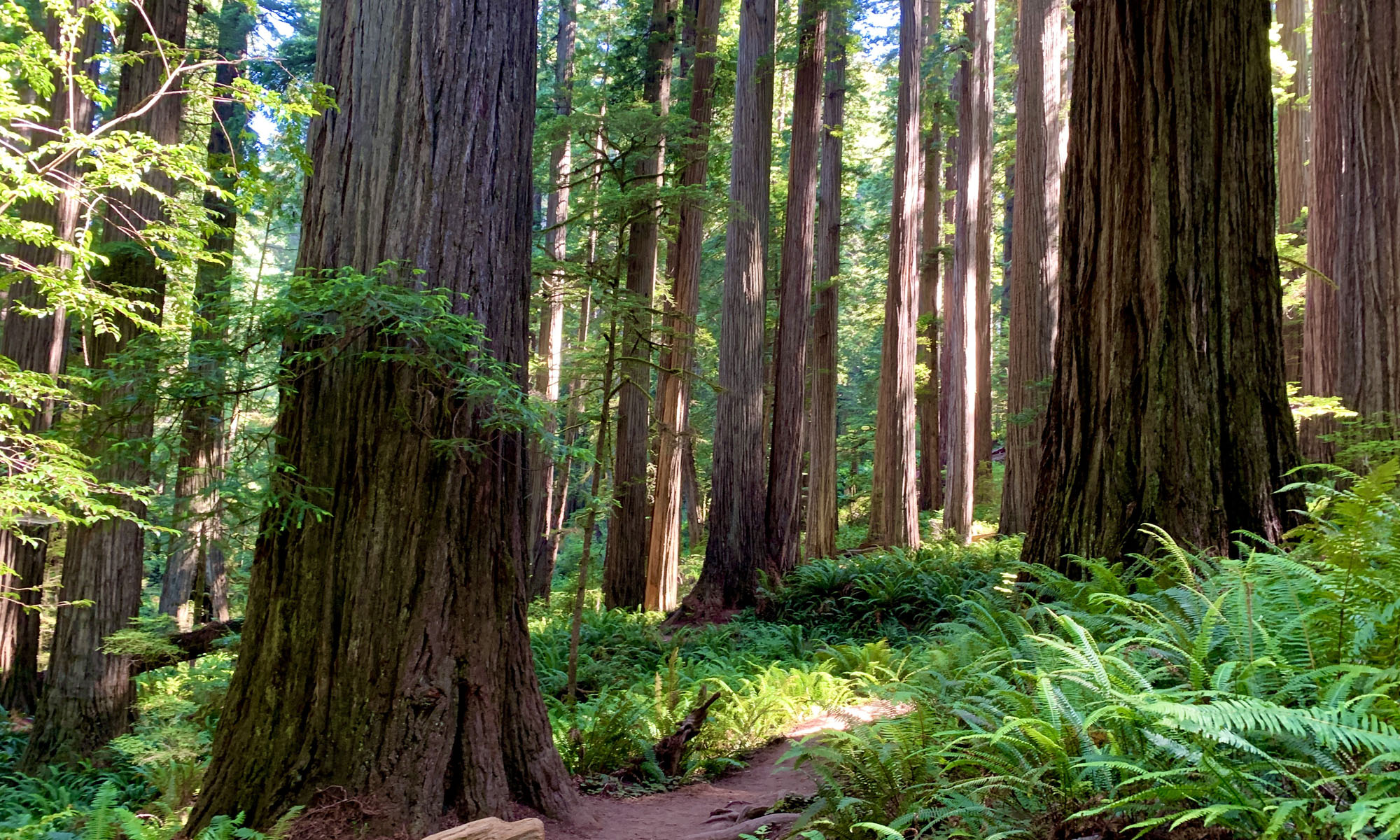
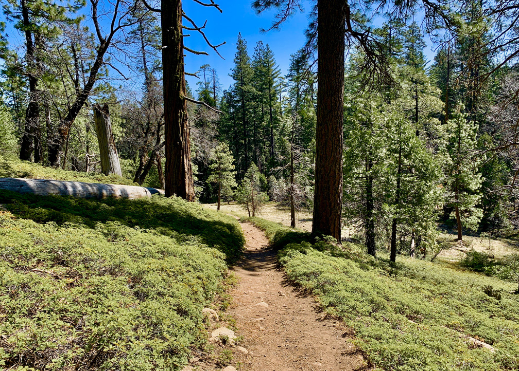
We started from the main parking lot .2 miles on the North Grove Trail until we came to a trail intersection. From there we left the North Grove Trail and followed another one (unnamed) for .7 miles until we came to Old Moran Road, which is paved. We hiked it to the Dardanelles Overlook Road to the end where it stops at a vaulted restroom. From there, the River Canyon Trail Starts.
Before you take the trail, know that you will descend 2.7 miles on an 8.5 percent average grade. This means you will have to climb back up it. If the trail were maintained, it would not be a challenge and not really worth noting.
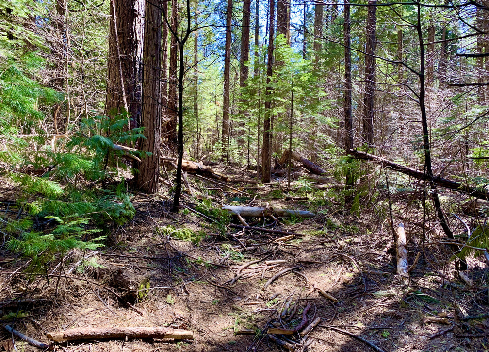
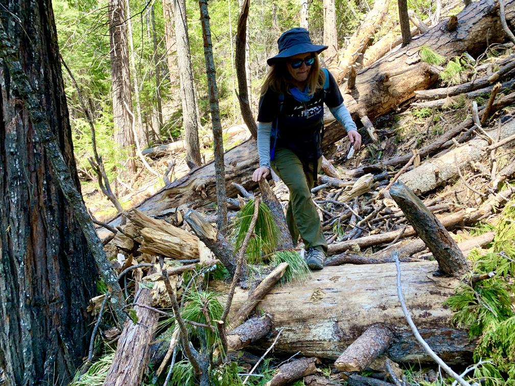
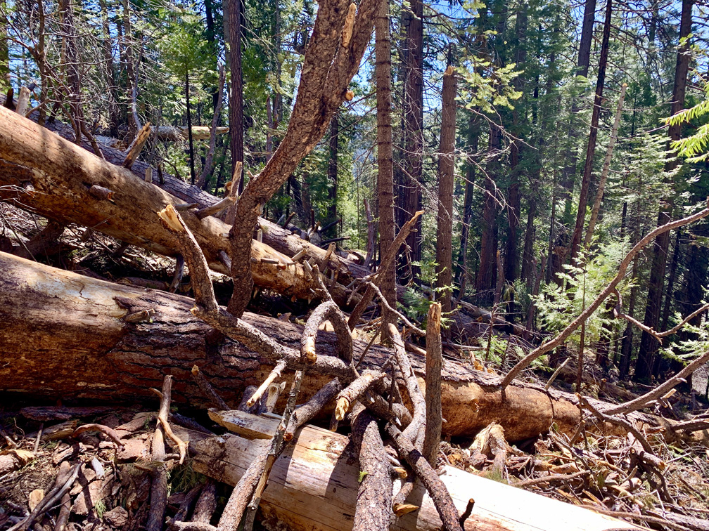
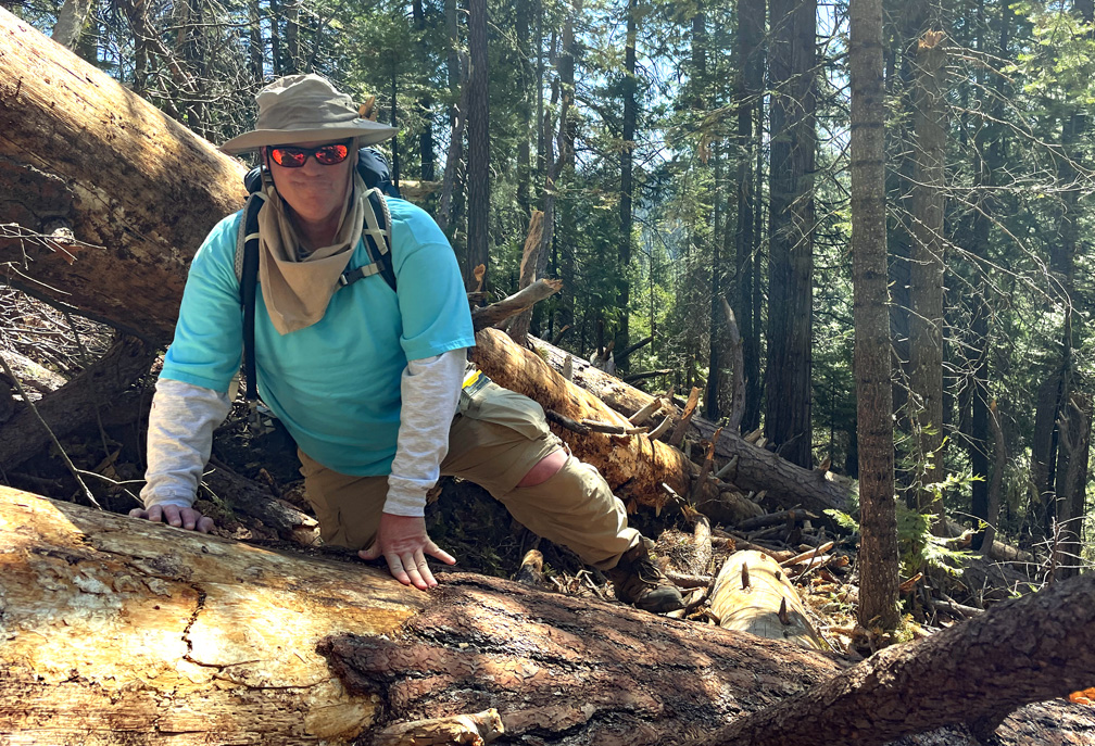
When you hike in the wilderness you are responsible for your own safety, and the government agencies that oversee wilderness areas are mostly not liable for your safety. That’s understood and accepted. But there are areas that are managed by the overseers that they should be held accountable for. This trail is so poorly maintained that numerous trees laid across the trail in one area spanning about 100 feet. Because of the poor trail maintenance, this made climbing over very large fallen trees very difficult. The ground to maneuver over was highly unstable and the ground obstructed. A person could easily fall and impale themself on broken limbs sticking up in various places is very real.
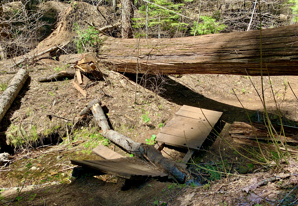
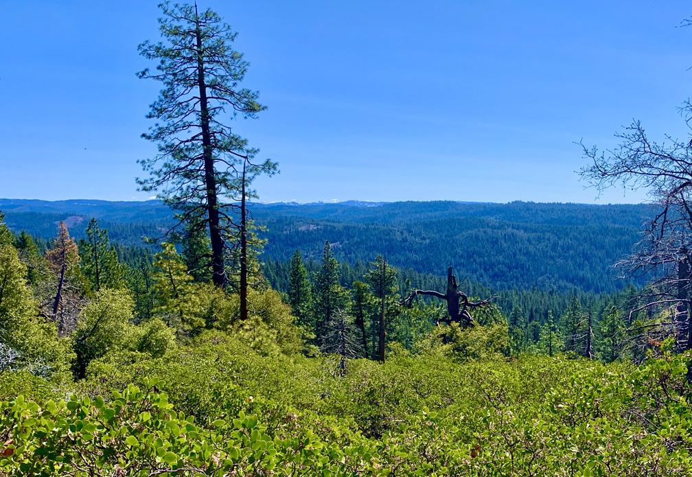
This section of the trail begins as you descend down to the North Fork of the Stanislaus River after crossing the paved road just down from the Oak Hollow Campground.
There was no signage anywhere stating the conditions of the trail, which was the very least the park could have done.
Once we made it down off the hard part, we crossed another section of paved road and followed it downhill just a little further with signage to the right where the trail picks up and goes down to the river.
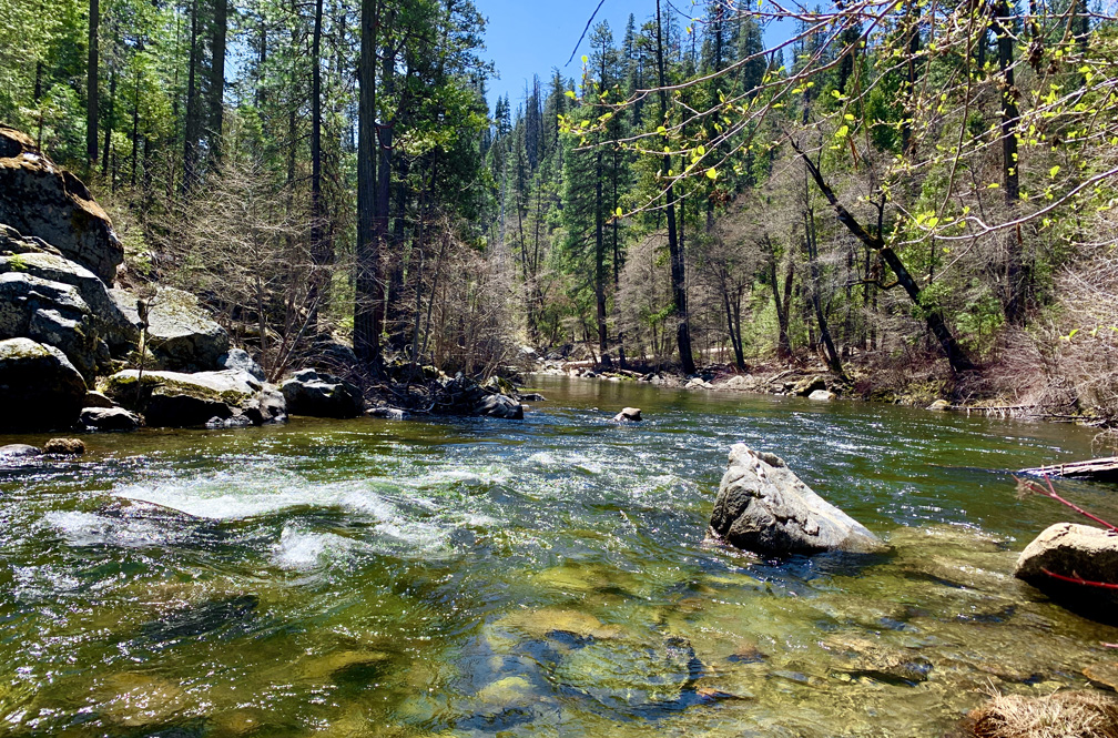
The little area next to the river is quite beautiful. When we were there, the river flowed over small rapids in front of us. It was meditative. There wasn’t room for a lot of people, but we managed to find a spot along the river and enjoy it.
Going back, we had to make a choice, and a sad choice it was. Because of the hazardous conditions of the trail, we opted to hike back up on the paved road. We hiked it for 1.6 miles on a 5.6 percent grade. It was really pretty easy, and since the road was closed, we did not have to contend with any traffic.
We came to the point where we first crossed the road near Oak Hollow Campground and followed the trail back the way we came.
Directions: From Arnold, follow Highway 4 East for 3.0 miles to the park entrance, here: 38.277328, -120.309909
The Skinny
Trail: River Canyon Trail
Trailhead Coordinates: 38.279100, -120.307200
Trailhead Elevation: 4808 Feet
Distance: 9.1 Miles – Out And Back
Level of Difficulty: 🟡 (🔴 – See Summary)
Average Grade: 8.3%
Steepest Grade: 11.6% Over .7 Miles
Ascension: 1854 Feet
Trail Condition: 🟢
Scenery: 🟢🟢🟢
Nearest Town: Arnold
Challenges: Climbing Over Distance
Traffic: 🥾
Highlights: Hiking In The Forest, Seclusion, Stanislaus River
Best Time: Spring, Summer, Fall
Hazards: Temperatures over 90 degrees
Wildlife Concerns: Bears, Mountain Lions, Rattlesnakes
Cell Service: 📵 (AT&T)
Would I Do This Hike Again?: No (See Summary)
Parking: $10 at the time of this writing – In its current state, this trail is not worth the entrance fee
Restrooms: Toilets in the parking lot