Originally posted June 8, 2018
Updated April 30, 2023
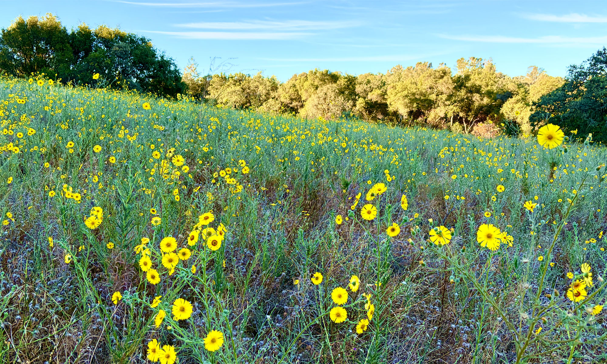
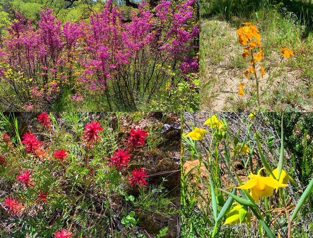
We hiked Redbud Trail in April 2023 after the California’s massive rainstorms earlier in the winter and spring. What resulted were superblooms in locations. For as often as I have hiked the Redbud Trail, I have never seen the wildflowers on the trail I saw in late April. The wildflowers included Indian Paintbrush, Warrior Paintbrush, Common Fiddlestick, Western Wallflower, Diogene’s Lantern, and many other colorful wildflowers.
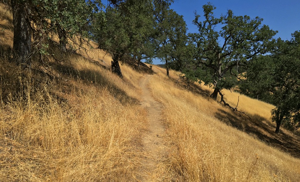
Hiking the Redbud Trail as it meanders along hillsides next to oak trees and descends down to Baton Flat and Cache Creek is a pleasant hike through the foothills.
The trail starts off out of the parking lot on a service road and then to the right you’ll see a sign with Redbud Trail marked on it. Take the trail away from the road and hike along the edge of the foothills until you come to a creek bed that you have to cross.
Once you step out of the creek bed, you have a choice to make. You can either follow the signs that say trail, or to your right is an old service road. If you hike the service road, you’ll go up on a steeper climb than if you take the trail, but it’s worth it. It also helps to turn the trail into a loop until you come back to the junction near the creek bed.
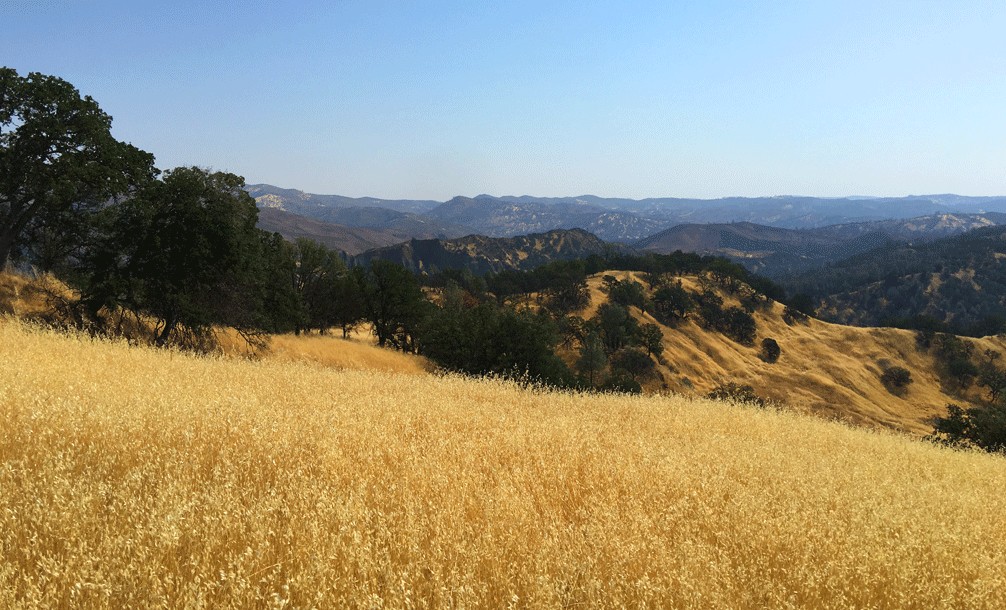
The Redbud Trail meanders along hillsides next to oak trees. After going a little more than a quarter of the way up, you can turn and see the flat below you and the hills across Highway 20 better. Turn, and you will continue to climb. You’ll seemingly climb some more until it finally levels off for a bit and then turns again and then takes a brief upturn around the bend puts you up on ridge where you can head to the Redbud Trail junction and down to Baton Flat.
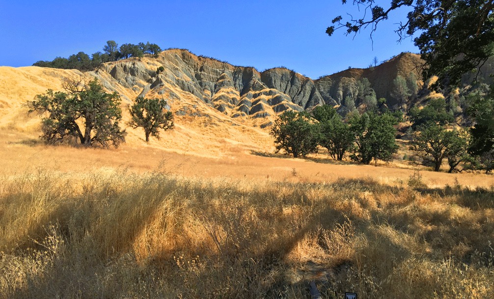
Along the way, you’ll begin to hear the roar of Cache Creek below and then gain sweeping views of the hillside canyon while walking amongst an oak forest. There are vista points along the way where you can walk off the main trail and to near drop-offs while looking down the creek.
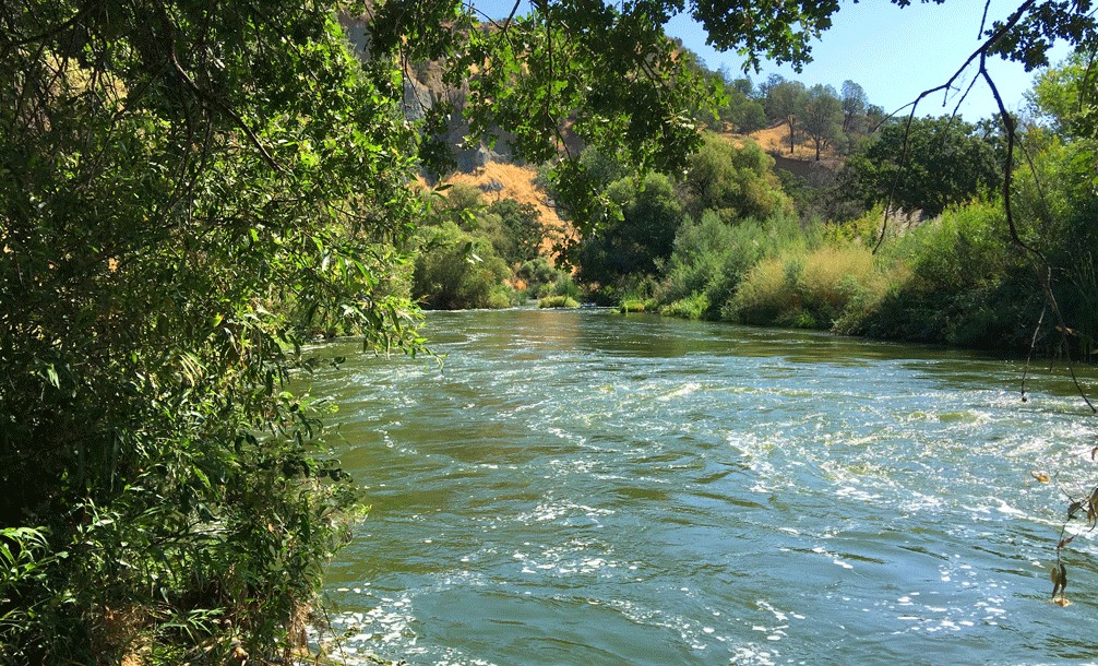
Follow the trail further, and you’ll come down into Baton Flat. If the creek is not flowing, you can cross and pick up the trail on the other side and follow into Wilson Valley, but if you cannot cross, that’ s okay too. To the north, Baton Flat offers a fantastic view of the cliffs overlooking it. When the creek is flowing, sometimes you can watch the beavers as they swim around in it.
As in any area where hunting is permitted, you should be aware if hunters are in the vicinity. I have seen game hunters in this area on four separate occasions the seven times I’ve hiked this trail. The hunters I’ve encountered are cordial and usually aware of my presence, but all the same use common sense and just be careful.
The trail is wonderfully maintained, and it makes the majority of the switchback ascension back from Baton Flat easier to take – especially on a hot summer day. On a hot day above 90 degrees though, you will sweat. The hills of the Cache Creek Wilderness can be unforgiving in the summertime. If you choose to hike this area in the summer, the best time to start out is in early in the morning. One thing that isn’t in short supply in the summertime is thick Star Thistle. Spring and fall are best for hiking this trail.
For a continuation beyond Baton Flat, ready my summary for Baton Flat to Wilson Valley.
Directions: From Interstate 5 at Williams, take Highway 20 west about 29 miles to the North Fork Cache Creek/Redbud Trailhead. The trailhead provides parking, maps and information for hiking and equestrian access. From Clearlake Oaks, travel east on State Highway 20 for 8 miles to the trailhead.
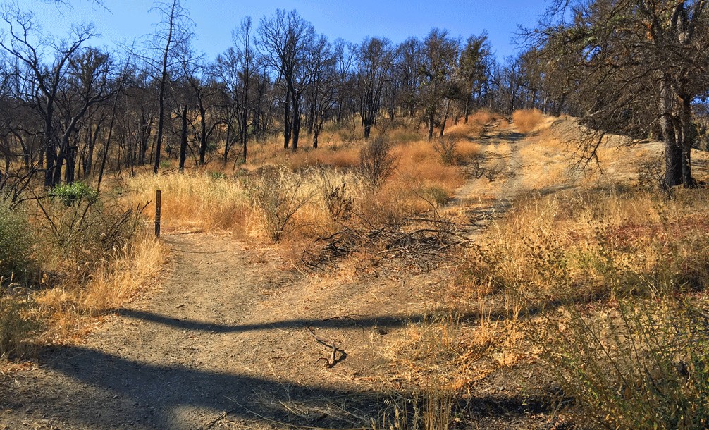
Fire burned through Lake County in 2015 where the Redbud Trail was in way. While many of the trees burned, much of the ground vegetation has been recovering.
The Skinny
Trail: Redbud Trail
Trailhead Coordinates: 38.986934, -122.539491
Trailhead Elevation: 1,013 Feet
Distance: 5 Miles – Lollipop
Level of Difficulty: 🟡
Average Grade: 2.5%
Steepest Grade: 17.8% over .6 Miles
Ascension: 1,200 feet
Trail Condition: 🟢🟢🟢
Scenery: 🟢🟢
Nearest Town: Clearlake Oaks
Challenges: Summer heat
Trail Traffic: 🥾
Highlights: Views, Cache Creek
Best Time: Spring, Fall
Hazards: Temperatures higher than 90 degrees Fahrenheit; Presence of hunters during hunting season
Wildlife Concerns: Black Bears, Mountain Lions, Rattlesnakes, Wild Boar
Cell Service: 📱 (AT&T)
Would I Do This Hike Again?: I have done this hike many times and taken offshoot trails I haven’t written about. Yes.
Parking: Free
Restrooms: Vaulted toilet in the parking lot