Ihave written about hiking to Round Top Lake and Winnemucca Lake in a previous post, but I want to revisit the hike from a different way. If you like summer wildflowers, this is absolutely the hike for you.
Instead of starting out at Woods Lake, on this hike you start from Carson Pass, just a few more miles up on Highway 88.
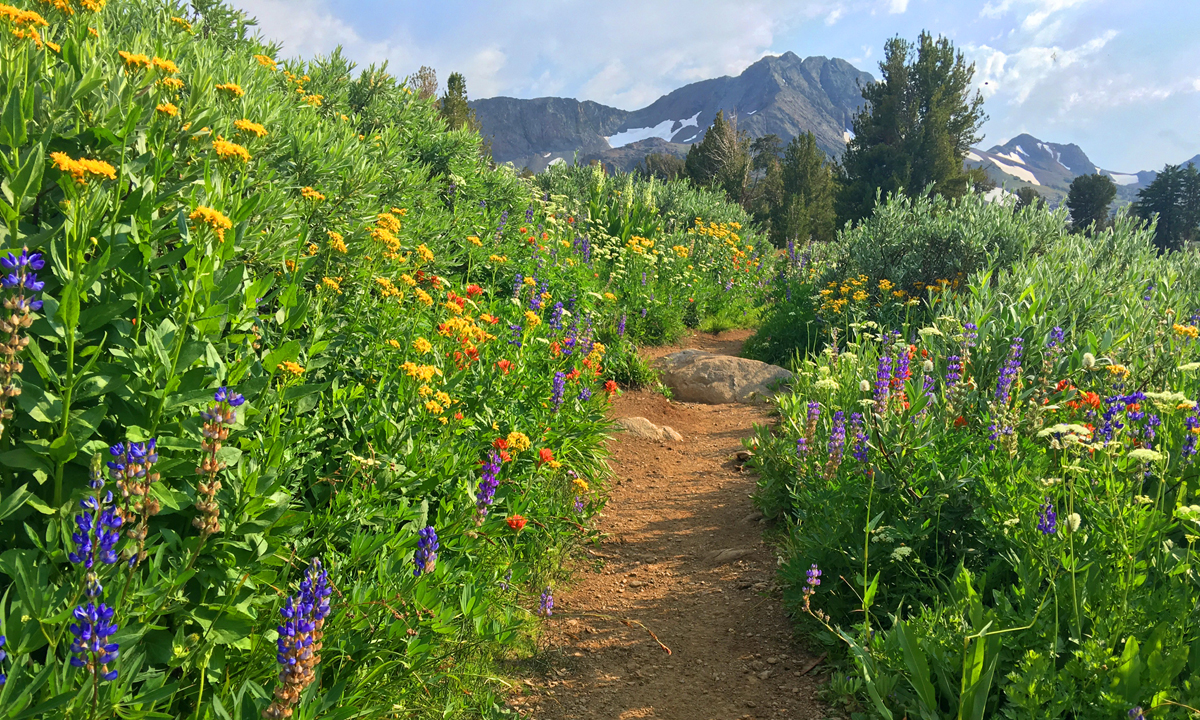
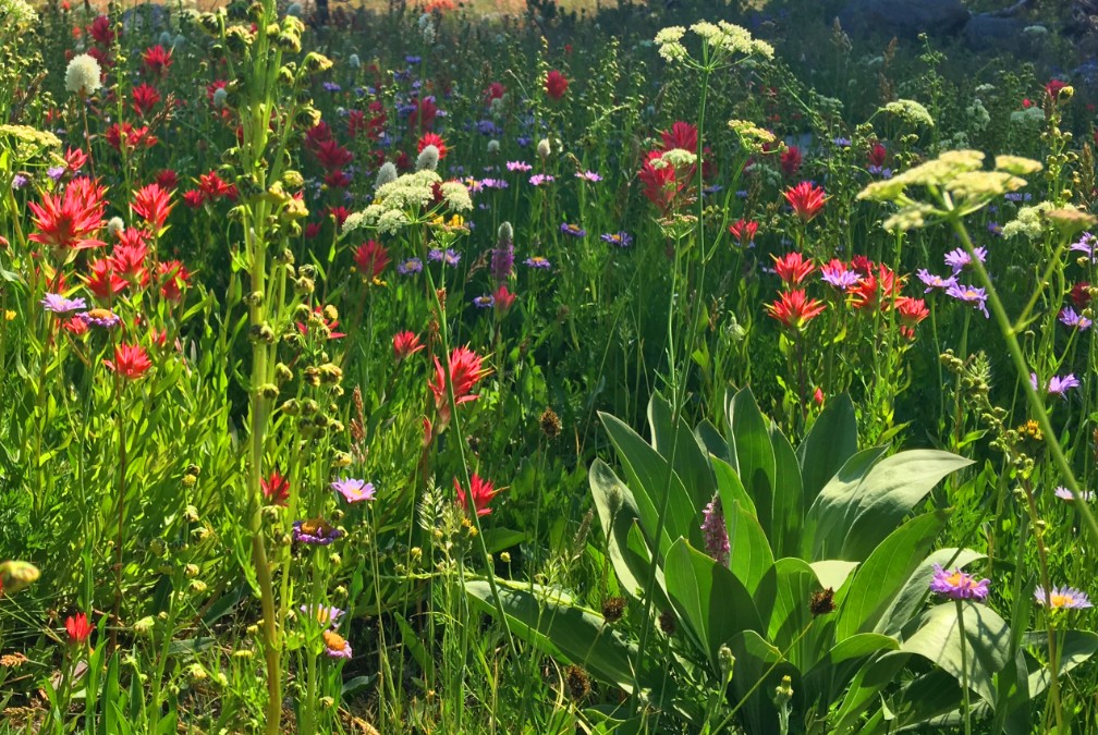
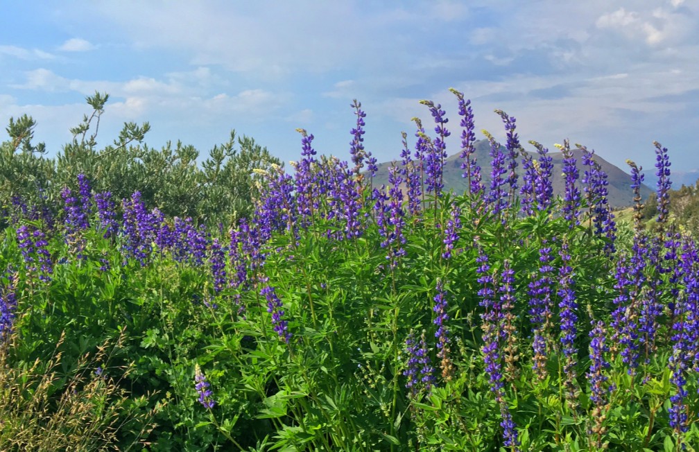
The wildflower display on the trail to Winnemucca Lake, I’m told, is “world renowned.” I don’t know if that’s true, but I can attest to the beauty along the trail to the lake like I’ve never encountered on in the wild before. There is lupine, Indian Paintbrush, and a host of flowers I don’t know the names of, but are blue, purple, yellow and white. It’s an explosion of color, and in all the times I’ve hiked this trail, I’ve seen not only hikers, but photographers out on the trail too. About 1.5 miles in, you get into the wildflower burst. There is some uphill, but it’s not bad to this point, so it’s more than worth going just for this. If you were to just go to Winnemucca Lake and turn back, the wildflowers alone would make it a five-star day and the lake a bonus.
If you want to take a detour on your way to the wildflowers, you’ll come to a junction at around one mile that will take you to Frog Lake. The southern tip of Frog Lake offers a kick-butt view of Hope Valley and Red Lake right below. Just sit and take it in.
From there, you can go back the way you came, or you can circle the lake and come back to the main trail.
Once you’re back on the main trail, continue on to the wildflowers. Even if you’re not a photographer, take it all in. Remember, the hike is the destination.
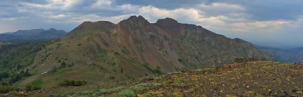
When you make it to Winnemucca Lake, it’s another stopping point. It may be crowded along the points at the edge with people. Round Top Mountain is just above, and is the main source of where the snow runs off that feeds the lake. Just marvel at it. This is also a good point to look to the skies to the south. The afternoon is when thunderclouds start to form and blow in. If they’re light in color, you’re probably okay. If they’re dark, rain, thunder and lightning may be coming your way, and you might want to consider turning back.
At this point, if you decide to continue on to Round Top Lake, you’ll have to cross a small creek over a pair of logs, and then you’ll need to stop and think. From here, the trail ascends. It doesn’t look like much, but there’s also altitude gain involved while you hike. Starting here, you’re at about 9000 feet, and you will be going up. I’ve seen seasoned hikers having to sit on the sides of the trail resting and recouping their strength before they go on, but at the same time, I’ve seen elderly hikers zip on up to the 9400-foot mark where about the trail tops out before there is a descent to Round Top Lake. Four hundred feet doesn’t sound like much as you hike up about three quarters of a mile, but you have to keep in mind the altitude of where you are.
As you come to the peak of the trail, you will start to descend to Round Top Lake.
Stop and take in the lake as the Sisters tower over it. It’s a good place to have lunch, and on a heavily trafficked day, you’ll probably see other hikers or campers stopped under the trees by the lake doing the same. Contemplate hiking up another 1000 feet up Round Top Mountain and take in the views from there.
You can also choose to continue on a trail around the Sisters that goes down to Fourth of July Lake. The hike to Fourth of July Lake is not a day hike, as getting there and then coming back up out of the canyon and back to the trailhead can be too much for most people to do in a day. Most people who hike to Fourth of July Lake set up camp there.
There is a minor trail that really isn’t on any map I have that goes to the top of Fourth of July Peak, which doesn’t overlook the lake. Looking at it, it seems like an easy climb, but the grade is 16.6%. It starts out easy enough, but switchbacks turn to loose rock, and there are points where you have to stop and look to see where the trail actually is. Once you make it to the top, you will have commanding views to the north and Caples Lake below and Roundtop Mountain and the Sisters directly to your northeast. The day I was there, the views to the south were obscured by dark clouds, but on a clear day, you might be able to see the peaks to the south down in what is probably the Stanislaus National Forest.
The thing to note about climbing to this peak is the loose rock you’ll have to hike over, and going down is even more tricky. I have trekking poles, and they helped me keep my balance on the unstable rocks while descending over it until I got to the more stable trail.
Directions: From Sacramento, take Highway 50 to the Sly Park Exit. Turn right onto Sly Park Road and follow it and turn on Mormon Emigrant Trail (it’s a road usually closed in the winter after the snow starts to fall) and follow it to Highway 88. Turn left on Highway 88 and head to the Carson Pass Pullout for around half an hour, which will be on the right 38.695499, -119.989671. There is overflow parking just before this point on the left.
The Skinny
Trail: Winnemucca Lake Trail to Fourth of July Peak
Trailhead Coordinates: 38.694668, -119.989412
Trailhead Elevation: 8194 Feet
Distance: 11 Miles – Out and Back
Level of Difficulty: 🟡 or 🟠 (See Summary)
Average Grade: 3.9%
Steepest Grade: 10.4%
Ascension: 2278 Feet
Trail Condition: 🟢🟢🟢
Scenery: 🟢🟢🟢🟢
Nearest Town: Markleeville
Challenges: Hiking at altitude
Trail Traffic: 🥾🥾 to 🥾🥾🥾
Highlights: Lakes, Waterfalls, Mountaintops, Wildflowers
Best Time: Summer, Fall
Hazards: Temperatures higher than 90 degrees Fahrenheit, Sudden Thunderstorms
Wildlife Concerns: Bears, Mountain Lions
Cell Reception: 📱 (AT&T) after rounding the Sisters and looking toward the ridge in front of Kirkwood Village
Would I Do This Hike Again?: Yes – to Winnemucca Lake (It’s easier to come in from Woods Lake).
Parking: $5.00 at the time of this writing
Restrooms: Vault toilets in the parking lot