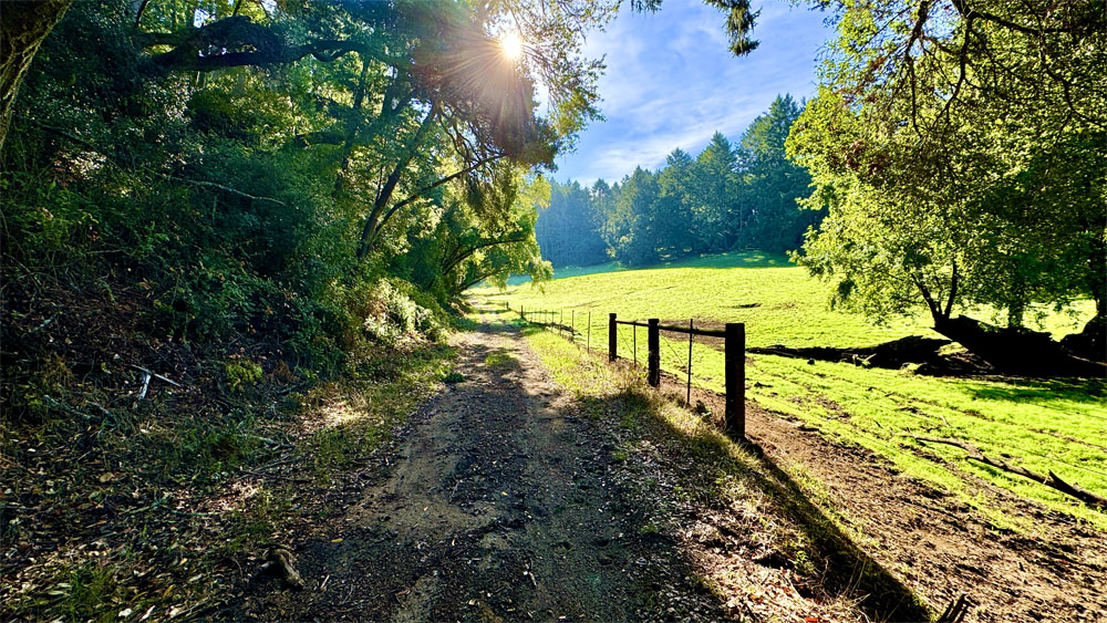
Hiking the Arnold Rim Trail to the “Top of the World”

The Sierra Nevada Mountain Range can be seen from the "Top of the World" on the Arnold Rim trail with snow caps in the distance.
The Sierra Nevada Mountain Range can be seen from the “Top of the World” on the Arnold Rim trail with snow caps in the distance.

The Arnold Rim Trail is a hike through a part of the Stanislaus National Forest that leads to a fantastic point dubbed the “The Top of the World” where the view is incredible. From the Sierras, you can see over to the Coastal Range and Mount Diablo nearly 90 miles away on a clear day.

Continue reading “Hiking the Arnold Rim Trail to the “Top of the World””

Hiking Upper Ritchey Canyon at Bothe-Napa Valley State Park

The forest at Bothe-Napa Valley State Park on the Upper Ritchey Canyon Trail are recovering from a fire that occurred in 2020.

The hike to Upper Ritchey Canyon at Bothe-Napa Valley State Park is challenging, but along the way you can see a forest that is in recovery from a fire that burned through parts of it in 2020.

Continue reading “Hiking Upper Ritchey Canyon at Bothe-Napa Valley State Park”

Hiking Old Man’s Beard and Sam the Eagle at Moore Creek Park

A trail is cut through an oak forest foothill during the springtime when the grasses are green and lush.
Old Man’s Beard at Moore Creek Park can be green and beautiful in the springtime.

Like the other hikes we’ve done at Lake Hennessey, Old Man’s Beard and Sam the Eagle trails at Moore Creek Park are pleasant when hiked in the springtime with green hills, wildflowers as the foliage is coming back to the trees.

Continue reading “Hiking Old Man’s Beard and Sam the Eagle at Moore Creek Park”

Hiking Grand Canyon Of The Yellowstone To Ribbon Lake

Lower Yellowstone Falls from Artist Point.
The view from Artist Point at Yellowstone National Park of Lower Yellowstone Falls and the Grand Canyon of the Yellowstone can be spectacular.

The Grand Canyon of the Yellowstone is an incredible sight to see and hike along in Yellowstone National Park. From different vantage points, you can marvel at Lower Yellowstone Falls. The forest along the hike was tranquil and mediative, and once we left the crowds, we probably saw a little more than a dozen people.

Continue reading “Hiking Grand Canyon Of The Yellowstone To Ribbon Lake”

Hiking Lost Palms Trail at Joshua Tree National Park

Hiking to the Lost Palms Oasis at Joshua Tree National Park is like hiking through a garden in the desert.

Hiking to Lost Palms at Joshua Tree National Park is like hiking through a desert garden. If you’re up for hiking through the desert, there really is a lot to see as far as plant life goes on this hike, along with great landscape vistas.

On this hike, you will more than likely come across cholla cacti, indigo bush, jojoba, California juniper, creosote bush, mistletoe, Mojave yucca, Mormon tea, barrel cacti, granite rock, palm trees, but no Joshua trees in this part of the park.

Continue reading “Hiking Lost Palms Trail at Joshua Tree National Park”

Mist Trail To Nevada Fall in Yosemite National Park

Nevada Fall in Yosemite National Park from a distance running down the granite rock with forest trees in the fore and background.
Nevada Fall in Yosemite National Park is a stunning waterfall.

The hike from Yosemite Valley up to Vernal Falls and then over to Nevada Falls is incredible, and one of many of many spectacular attractions of Yosemite National Park. But even hiking through the beauty of the forests, it does take work to make it to the top of either waterfall.

Continue reading “Mist Trail To Nevada Fall in Yosemite National Park”

Hiking Steep Ravine/Matt Davis Loop at Mount Tamalpais State Park

The Matt Davis Trail at Mount Tamalpais offers sweeping views of the Pacific Ocean.

The Steep Ravine Trail at Mount Tamalpais State Park is a beautiful trail to hike, and I’ve written about it previously. I combined this trail with the Matt Davis Trail to make a loop on the west side of Mount Tamalpais.

Continue reading “Hiking Steep Ravine/Matt Davis Loop at Mount Tamalpais State Park”

Hiking the Grand Loop at Mount Diablo State Park

The view from Mount Diablo can be stunning when the surrounding hills are green.

The views from Grand Loop Hike at Mount Diablo  State Park are sweeping from all directions, and we wanted to see what we could see from the grand loop hike. While worth it, this is not an easy hike.

We hiked the trails that circled the top of Mount Diablo in February to see the hills when they were green and to avoid summer heat exhaustion and dehydration issues. The scenery was beautiful, and we could see into downtown San Francisco in the distance as we looked out from above the Juniper Campground on an offshoot trail.

Continue reading “Hiking the Grand Loop at Mount Diablo State Park”

Hiking Trojan Point to McKennan Gulch Trail via the Coast Trail at Mount Tamalpais State Park

The view from the Coast Trail on Mount Tamalpais from the north the south can offer a stunning green and blue contrast.

If the weather is right, the views from the Coast Trail on Mount Tamalpais of the Pacific Ocean can be striking. During the right time of the year, the hills are beautifully green with a beautiful blue ocean background to the west, or sweeping green hills as you look north and south.

Continue reading “Hiking Trojan Point to McKennan Gulch Trail via the Coast Trail at Mount Tamalpais State Park”

Hiking Meadow Trail to Mt. Wittenberg Trail at Point Reyes National Seashore

While the grasses and some of the undergrowth along the trails in the Meadow Trail/Mt. Wittenberg Trail area at Point Reyes National Seashore are green, many of the trees are burned out from a 2020 fire that swept through the area.

Meadow Trail at Point Reyes National Seashore up to Sky Trail is a tough climb, but sometimes the rewards are great if you like wildlife. Both times I hiked the trail I was treated to seeing Black Tail Deer once in a meadow and once running in the forest.

Continue reading “Hiking Meadow Trail to Mt. Wittenberg Trail at Point Reyes National Seashore”

Hiking Crags Trail to Castle Dome at Castle Crags State Park

A pair of crags tower over the end of the Crags Trail at Castle Crags State Park.

Iwon’t sugar coat this. The hike to Castle Dome at Castle Crags State Park is not easy… especially on a hot day.

The hike starts off easy enough on the wide Root Creek Trail under forested canopy, but then you come to a junction about .3 miles in where you make a left turn, and then the climbing begins. Roughly after 500 feet, you will intersect with and cross over the Pacific Crest Trail.

Continue reading “Hiking Crags Trail to Castle Dome at Castle Crags State Park”

Hiking Creamery Meadow, Bluffs, Panorama and Ridge Trail at Andrew Molera State Park

The view from Panoramic Trail looking over the Pacific Ocean from above the marine layer.

Andrew Molera State Park at Big Sur offers beautiful views of the Pacific Ocean and the nearby mountains. While the hike to see some of the views is challenging in places, it is worth it.

Continue reading “Hiking Creamery Meadow, Bluffs, Panorama and Ridge Trail at Andrew Molera State Park”

Hiking Silver Lake to Spanish Peak in the Bucks Lake Wilderness

The view from the top of Spanish Peak is vast and sweeping with Mt. Lassen vaguely visible in the distance.

In 2021,  the Dixie Fire burned much of the area, so the landscape may be different now than when we were there about a month or so before the fire occurred.

Hiking to Spanish Peak from Silver Lake in the Plumas National Forest is not easy, but the views are a spectacular payoff. The terrain is diverse. You start off in the forested area at Silver Lake, then you hike exposed over granite as you climb, and then you hike through forested areas again.

Continue reading “Hiking Silver Lake to Spanish Peak in the Bucks Lake Wilderness”

Hiking the Historic Orchard at Jack London State Historic Park

The Historic Orchard at Jack London State Historic Park once produced apples, apricots, pears, plums, and prunes.

The hike to the Historic Orchard at Jack London State Historic Park is mild. The one-time 100 acre orchard once produced apples, apricots, pears, plums, and prunes. The orchard is a casual hike, but getting there is a hike up and down hills and through forests.

Continue reading “Hiking the Historic Orchard at Jack London State Historic Park”

Hiking the Burma Blast at Mount Diablo State Park

The views from Mount Diablo are far and sweeping.

This hike up Burma Road, the Burma Blast, at Mount Diablo State Park is a son of a b*tch. So a friend really wanted to this hike because it was labeled the “the toughest hike in the Bay Area.” I don’t know if it’s the toughest, but it was a challenge. And the views over the Bay Area, to the north, east and south were worth it.

Continue reading “Hiking the Burma Blast at Mount Diablo State Park”

Hiking Mountain Trail to Cowan Meadow Trail

The view from the high point on Mountain Trail at Jack London State Historic Park is spectacular.

Jack London State Historic Park is becoming one of my favorite places to hike. It has redwoods, oak forests, foothills, ridges and very scenic views. The hike up Mountain Trail to High Point is worth the effort and is spectacular.

The hike starts off on the Lake Trail to London Lake from the Upper Parking Lot. As you begin, you hike past a picnic area, winery ruins and the distillery and turn and hike past a vineyard. Follow Mountain Trail which is a service road next to the wooded area. We stayed on Mountain Road as we passed an intersection where another trail leads to London Lake.

Continue reading “Hiking Mountain Trail to Cowan Meadow Trail”

Hiking Snow Mountain East Peak

The view from Snow Mountain East Peak into the Sacramento Valley.

As when I wrote about my hike to the West Peak of Snow Mountain, the same two words apply: “peaceful desolation,” but the scenery has drastically changed since 2018 when I was there last.

A little less than a month after I hiked to the West Peak, the Ranch Fire broke out, and the area was closed for nearly two years for restoration. Then it was opened it up, but then the August Fire broke out in 2020, and the forest closed back down for a few months.

Continue reading “Hiking Snow Mountain East Peak”

River Canyon Trail at Calaveras Big Trees State Park

"This

River Canyon Trail at Calaveras Big Trees State Park is the poorest maintained trail I’ve ever hiked. Parts of the trail should be closed as a safety hazard due to the poor upkeep of it. If the trail were maintained, this could be a really nice hike through the forest down to the North Fork of the Stanislaus River. Instead, I should have worn my heavier off-trail boots for parts of this trail.

I hate to start the hiking season off with a downer summary, but I want to get the word out before anybody might consider going to this state park.

Continue reading “River Canyon Trail at Calaveras Big Trees State Park”

Hiking Bald Mountain at Sugarloaf State Park

The view from Bald Mountain is sweeping. This panoramic photograph does not capture the curvature of the earth as you turn 360 degrees to look around you.

You have to work for it, but the view from the top of Bald Mountain is spectacular on a clear day. What makes it so spectacular is that as you take in a 360 degree view from the top, you can see the earth curve as you turn your head from landmark to landmark in all directions – something no picture can capture.

Continue reading “Hiking Bald Mountain at Sugarloaf State Park”

Hiking Deafy Glade to Summit Springs

Once you climb high enough, you look out into the Sacramento Valley from the Deafy Glade Trail.

Deafy Glade Trail is a butt kicker. After about a mile in and a creek crossing, it’s 3.5 miles of climbing that pulls on your calves, hamstrings and other lower body muscles. If you want buns of steel, this trail can make it happen for you. The view from the top where the Deafy Glade Trail meets the Summit Springs Trail offers views down into the Sacramento Valley and even the Sutter Buttes on a clear day.

Continue reading “Hiking Deafy Glade to Summit Springs”

Hiking Smittle Creek Trail

Lake Berryessa
Lake Berryessa

The hike on the Smittle Creek Trail is an easy rolling hill hike along the shores of Lake Berryessa, but it really isn’t that impressive. I hiked it in the fall, but it may come alive in the spring when the hills are green and wildflowers are in bloom. I’m told this trail is popular with birdwatchers. I’m not knocking this trail… it has its place, and viewed in context, it makes for a pleasant Sunday stroll with a picnic by the lake. Continue reading “Hiking Smittle Creek Trail”

Hiking to Scott’s Lake is full of Fall Color

The fall color along the trail to Scott's Lake can be unbelievable.
The fall color along the trail to Scott’s Lake can be unbelievable.

If you hike the trail to Scott’s Lake in the fall when the aspens are turning color, it will knock your socks off.

The hike starts off at the trailhead parking lot just off Highway 89 on Luther Pass, which is part of the larger Tahoe Rim Trail. You hike a pleasant .1 a mile before you come upon Highway 89 and have to cross it. Listen for traffic, as you should be able to hear it before you can see it coming around the two corners. Continue reading “Hiking to Scott’s Lake is full of Fall Color”

Hiking Fleming Trail Loop in Eldorado National Forest

Hiking among the trees on the Fleming Loop in the Eldorado National Forest is a place that offers peaceful contemplation.

If you’re in the frame of mind for this type of trail, the Fleming Meadow Loop rocks. There are no sweeping vistas, not an abundance of wildflowers or much running water – just a hike among the trees in some areas with very dense forest. My experience was awesome for contemplation and meditation.

The Fleming Meadow Loop in the Eldorado National Forest is one of the best marked and maintained trails I’ve come across in a national forest. When you hike Trail 8, you will come across many junctions with roads and other trails, but Trail 8 is marked so it is easy to follow. This trail is taken advantage of by hikers, mountain bikers, equestrian riders and the locals who know its secret. Continue reading “Hiking Fleming Trail Loop in Eldorado National Forest”

Hiking to Feather Falls

Feather Falls in Butte County plummets more than 400 feet down into the Feather River.

How can you be a hiker in Northern California and not hike to Feather Falls? The falls are an awesome to sight to behold, and the hike isn’t so bad either – depending on when you go and the condition of the trail. At about .4 miles from the trailhead, you’ll have decision to make when you come to fork.

If you want to make a loop out of this hike, it might be best to go to the left, as the trail will head downhill. Coming back up this way could be strenuous. If you do decide to come back up this way, there are a series of benches along the trail for resting. This way is shorter taking about 3.3 miles to get to the overlook. Continue reading “Hiking to Feather Falls”

Hiking Juniper Lake to Horseshoe Lake

Horseshoe Lake is peacefully serene in the morning. Stop and take it in.

Horseshoe Lake in Lassen Volcanic National Park offers an awesome view, and is what makes this hike worth it. I got to experience the lake early in the morning before I saw any other hikers. It was beautiful, and even though I consider the entire hike the destination, just looking at Horseshoe Lake is a destination. Continue reading “Hiking Juniper Lake to Horseshoe Lake”

Hiking Prospect Peak in Lassen Volcanic National Park

Mt. Lassen through a smokey haze from Prospect Peak.

What makes the hike up to Prospect Peak in Lassen Volcanic National Park worth the effort are the views from the 8340-foot summit. First, I have to admit, the views would have been spectacular when I was there, but there were several wildfires burning at the time. The Carr Fire near Redding and the Whaleback Fire near Susanville along with others in the state made for very hazy views when the wind blew in the smoke. Continue reading “Hiking Prospect Peak in Lassen Volcanic National Park”

Hiking Eagle Pass to Paul Thomas Trail

Black Butte Lake from Eagle Pass is a green and alive in the springtime.

The hike from Eagle Pass to the Paul Thomas Trail can only be done in the springtime while the grasses are green before the summer sets in and the weather is still cool enough to be outside in the valley. The view from Eagle Pass you hike up to is incredible. It looks over to Black Butte, the lake itself to the west and the Coastal Mountain Range that spans the horizon running from the north the south that disappears to sight. Continue reading “Hiking Eagle Pass to Paul Thomas Trail”

Hiking Snow Mountain West Peak

The Sutter Buttes, the Sacramento Valley and the Sierra Nevadas can be seen in the distance from Snow Mountain.

Note: This portion of the forest was severely burned in 2018 shortly after I hiked it, and most the trees are now burned out. See my Snow Mountain East Peak summary for an update.

Peaceful desolation. That’s what the hike up Snow Mountain in the Snow Mountain Wilderness is. The trails are defined, the wildflowers are in bloom in the summer and people are scarce. The trails in this Northern California area are a hidden gem, as they are under-hiked and seemingly unknown to most.

Though not recommended to hike in the summer as the heat can be brutal, I happened to catch the mountain on an unseasonably cool July day with overcast and a smattering of rain. The wildflowers were in bloom from red to purple, yellow, blue and orange. The hike starts out exposed and meanders for a little more than a mile before you start to get under the cover of the tall pine trees as you climb.

Continue reading “Hiking Snow Mountain West Peak”

Hiking Blue Ridge Trail to Fiske Peak

The view from the Blue Ridge Trail is sweeping as it looks into the Mendocino National Forest in the distance with Cache Creek in the foreground.

I love this hike! Hiking the Blue Ridge Trail to Fiske Peak in Northern California starts with a mild climb through an oak forest. It’s the only canopy you’ll be under during the hike. As the trail meanders up the open hillside, you’ll hike into a clear view of Glascock Mountain across the highway. Once you get to this point, the real ascension quickly begins. Continue reading “Hiking Blue Ridge Trail to Fiske Peak”

Upper Bidwell Park: North Rim Trail to Middle Trail

The North Rim Trail in Upper Bidwell Park comes alive with color in the springtime.

It isn’t often that I hike a city park and let alone write about it, but Upper Bidwell Park in Chico is laden with hiking trails in the hills is an exception. Over the years I’ve heard so much about the hiking trails in Upper Bidwell Park, I finally decided to check it out in the spring. I hiked the North Rim Trail and Middle Trail Loop. Continue reading “Upper Bidwell Park: North Rim Trail to Middle Trail”

Hiking Thunder Mountain

The views to the south of Thunder Mountain can be spectacular if the climatic conditions are right and there is at least some snow on the mountaintops in the distance.

This sometimes heavy breather of a hike to Thunder Mountain has outstanding views of mountaintops and ranges and overlooks vast swaths of trees and granite, meadows and forested hiking. At slightly over three miles in, and after some of the heaviest climbing on the trail, you come to the vista that can make you stop hiking and just gaze at the landscape. As you look to the south, you can see mountain peaks in the distance – probably in the Stanislaus National Forest – some with snow on them. If there are clouds in the over them, it’s an even more powerful view. Continue reading “Hiking Thunder Mountain”

Hiking High Bridge Trail

The views of the summer foothills from High Bridge Trail can be staggering at times.

The High Bridge Trail hike starts off on a brief service road going down to Bear Creek. Follow the trail signs, and they will point you to where the crossing should be, and you can see where the trail picks up on the other side of the creek. However, depending on what the water level is like, you may not be able to safely cross, and you may have to improvise your own way. If the water is running, you will have to use your own best judgment as to if crossing is wise, or if you should try it at another time. Continue reading “Hiking High Bridge Trail”

Billy’s Hill and Glascock Mountain

The north end of Capay Valley from Glascock Mountain where some of the farms can be seen.

The hike up Billy’s Hill and then over to Glascock Mountain can be a butt kicker, but it is worth it. This land is overseen by the Bureau of Land Management, so you can hike on it. Once you climb over the green gate, you will see there is no trail up Billy’s Hill, so the best way, albeit steep, is to hike a game trail. You may have to stop and rest on the up, which took me a little more than an hour to climb the 19 percent one-mile grade. The 980 foot ascent takes you from a starting elevation of 798 feet to 1778 feet. Continue reading “Billy’s Hill and Glascock Mountain”

Hiking Tomales Point Trail at Point Reyes National Seashore

Tomales Point looks north into Bodega Bay.

Ihave hiked the Tomales Point Trail at Point Reyes National Seashore several times, and depending on the time of year you go, you may or may not actually see the ocean as you move along the cliffed peninsula with the Pacific Ocean below you on the west side, Tomales Bay on the east side and Bodega Bay to the north. Continue reading “Hiking Tomales Point Trail at Point Reyes National Seashore”

Carson Emigrant National Recreation Trail

The Carson Emigrant National Recreation Trail offers scenic views of Caples Lake and the surrounding mountains.

The Carson Emigrant National Recreation Trail is not too often hiked but is a walk with history. As you hike it, it’s difficult to imagine how thousands of people in covered wagons made it along this terrain, and this trail isn’t anywhere near other difficult terrain they encountered on their way up Covered Wagon Peak. You won’t go that far if you turn around where I did, but you can. Continue reading “Carson Emigrant National Recreation Trail”

Round Top Lake to Winnemucca Lake

Round Top Lake sits below the Sisters, which tower over the lake at 9,000 feet in elevation.

Normally, I wouldn’t rate a hiking trail like Round Top Lake to Winnemucca Lake with a 🟠. It’s not a difficult hike, but the altitude might slow you down as you approach the 9000-foot mark. Even if it makes you huff and puff, it’s well worth it.

This hike has fantastic views as you approach Round Top Lake and look behind you to the north down on Caples Lake and the mountains beyond. Leaving the small parking lot, you’ll cross over Woods Creek on a bridge and then shortly after you’ll leave the pavement to your right and start hiking the trail. Continue reading “Round Top Lake to Winnemucca Lake”

Hiking Big Meadow Trail to Round Lake

Big Meadow is vast and the trail cuts through it on the way to Round Lake.

If you like hiking through meadows like I do, then this hike through Big Meadow is absolutely for you.

The hike starts off at the Big Meadow trailhead parking lot just off Highway 89 on Luther Pass, which is part of the larger Tahoe Rim Trail. You hike a pleasant .1 a mile before you come upon Highway 89 and have to cross it. Listen for traffic, as you should be able to hear it before you can see it coming around the corners. Continue reading “Hiking Big Meadow Trail to Round Lake”

Hiking Annie’s Trail

The view from Annie's Rock is incredible in the spring when everything is green. On a clear day, Mt. Konocti and Snow Mountain can be seen.
The view from Annie’s Rock is incredible in the spring when everything is green. On a clear day, Mt. Konocti and Snow Mountain can be seen.

Hiking to the Annie’s Trail trailhead can be a feat within itself, as you have to hike the Homestead Trail and climb many steps up a 19 percent grade over 400 feet to get to it. By the time you reach the trailhead, you’ve already hiked about two miles overall. Once you’ve made it this far, you’ll find yourself at a junction. To take Annie’s Trail, hike straight ahead and follow the trail south along an ascending path. You’ll do some ducking under limbs, but it’s not bad. Continue reading “Hiking Annie’s Trail”

Stebbins Cold Canyon Loop Hike

The Blue Ridge Trail offers sweeping views of the foothills and surrounding area from about 1600 feet.

Exploring the Stebbins Cold Canyon Loop, (also called the Homestead-Blue Ridge Loop or the Homestead Blue Ridge Trail), starts off easy as you hike through the canyon, but it becomes a workout as you ascend to the great views of Lake Berryessa. I have hiked this trail more times than I can count, and I will continue to hike it. I love it for its views and its challenge.

The way to the trail starts off from the parking lot is where you hike under Highway 128 by going through a drainage tunnel that runs under it. Continue reading “Stebbins Cold Canyon Loop Hike”

Stevens Trail Along the American River

The American River Canyon from the Stevens Trail.

The Stevens Trail just outside of Colfax starts off pleasantly as you hike amongst lush greenery on both sides of the trail under the shade from oak tree canopy. The 1400 foot 3.7 mile descent to the American River is gentle, and the traffic sounds of the traffic on Interstate 80 fade into the distance as you venture away from the trailhead. Continue reading “Stevens Trail Along the American River”

Hiking Around Loon Lake

Loon Lake from the trail.

There’s nothing difficult about hiking this scenic trail along Loon Lake on the Rubicon Trail, which offers picturesque images of the lake if you venture off the forested trail a little bit for the views. Along the way you will hike past granite rocks and hills as the trail is a gateway to Desolation Wilderness. This hike is purely about the scenery and not much of a challenge, as the trail is nicely maintained. Continue reading “Hiking Around Loon Lake”

Hiking The Mount Konocti Trail

Buckingham Peak with Clear Lake in the background from Wright Peak on Mount Konocti.

Hiking up Mount Konocti to Wright Peak is about a six-mile round-trip hike from the Upper Parking Lot near the access gate on Konocti Road. You will climb approximately 1,600 feet, and along the way, you hike past past walnut and apple orchards, through an amazing Canyon Oak grove to the Mary Downen cabin, which was built in 1903 and preserved. The trail continues up to Wright Peak to the no longer used CalFire lookout tower. You can also hike to Buckingham Peak and Howard Peak, which would make the entire mountain nearly a 9-mile hike. Continue reading “Hiking The Mount Konocti Trail”