We were pleasantly surprised by this trail on the Oregon Coast. When looking for trails to hike with some distance to them on the Oregon Coast, there weren’t too many choices showing, but this turned out to be a jewel of a hike.
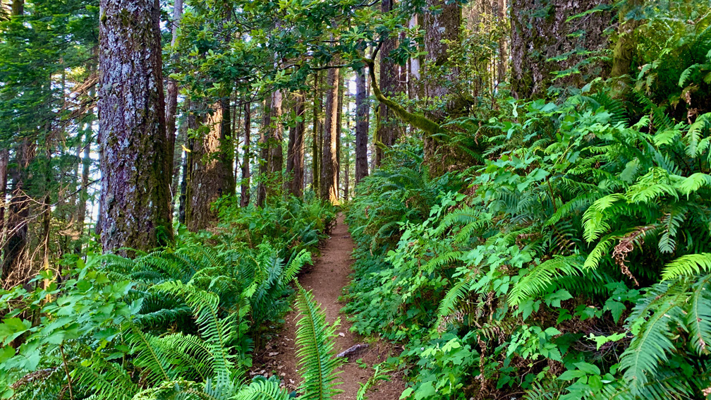
The 2.3-mile climb begins at the trailhead in a myrtle grove. By the time I got to the first switchback .3 miles in, I decided to shorten my stride and take smaller steps to preserve energy, and it worked. The overall climb is on an overall 13 percent grade to the top, but there are areas where the grade increases. While beautiful, the climb can get to you.
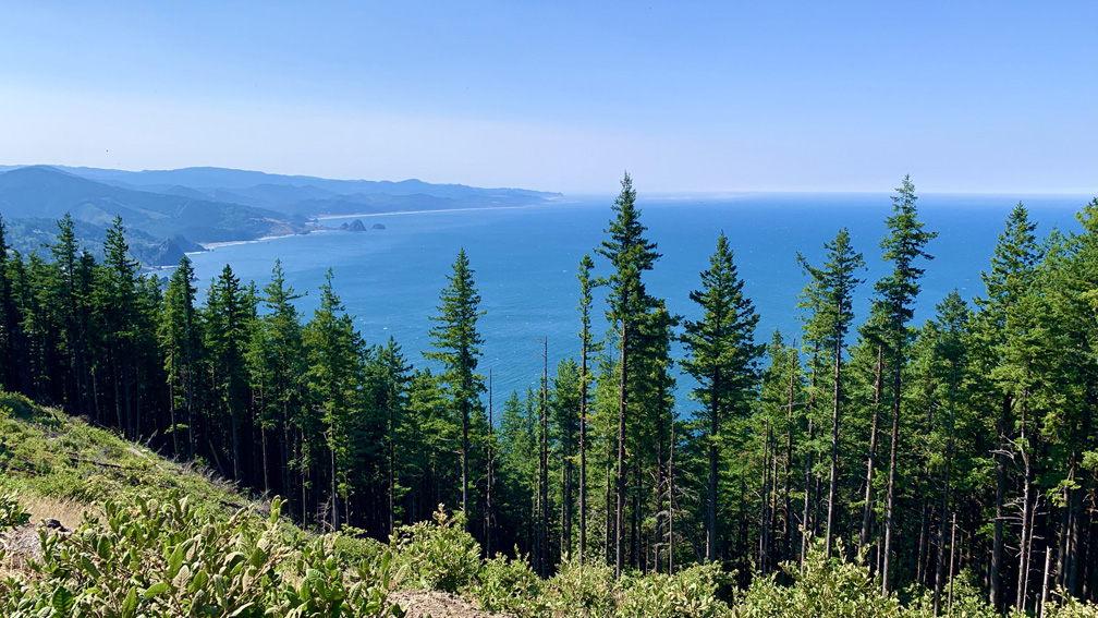
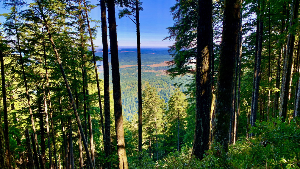
While hiking, you will be under canopy almost the entire way both up and back down. The trees are thick, but there are areas where the view opens up, and you can see out to the Pacific Ocean and up the coast line on the western side, and you can see some of the inland landscape on the eastern side as you peer through the trees.
As you hike the green trail, you will see Douglas fir trees, western hemlock, maple trees, sword ferns, rhododendrons and tan oak among other trees and plants.
The highlight of the trail is the lookout at the top of Humbug Mountain. You can see out to the Pacific Ocean from around 1760 feet. There are a couple of benches at the top to sit and enjoy the views from with the coastline to the south of you, and pine trees in the foreground in front of you.
We went early on a Saturday morning, and there were only a few cars in the parking area, and it was nice to only see a few people on the trail. When we got back, there were many more cars in the parking lot, so if you want to avoid people, go early.
Directions: From Gold Beach, Oregon take Highway 101 North for 22.5 miles. The parking area is on the right, and is here: 42.687807, -124.439353
The Skinny:
Trail: Humbug Mountain Loop Trail
Trailhead Coordinates: 42.687700, -124.439367
Trailhead Elevation: 124 Feet
Distance: 5.2 Miles – Lollipop
Level of Difficulty: 🟡
Average Grade: 13%
Steepest Grade: 30% over .3 miles
Ascension: 2659 Feet
Trail Condition: 🟢🟢🟢🟢
Scenery: 🟢🟢🟢
Nearest Town: Gold Beach
Challenges: The Climb
Traffic: 🥾 – When We Were There
Highlights: The Views
Best Time: Spring, Summer, Fall
Hazards: Poison Oak at the lower levels of the trail
Wildlife Concerns: Mountain Lions, Rattle Snakes
Would I Do This Hike Again?: Yes
Parking: Free
Restrooms: None