This trail is now closed
Hiking up Pleasants Ridge Trail starts off easy enough, but the hike quickly becomes a heart-pounding, heavy-breathing workout. At the time of this writing, Alltrails.com rates this trail as moderate (recently re-rated as hard). It is not, and this short trail is no way for the inexperienced hiker by any means. With grades at nearly 46 percent in some sections, this trail can actually be dangerous on the descent. I’ve never used my “hiker safety” category on a trail summary before, but this one is an exception.
To get to the trailhead, you need to walk under Highway 128 by going through one of two tunnels that Cold Creek runs through for drainage. If there is water rapidly running through the tunnels and too high (which doesn’t have to be high at all) to walk in, use common sense. If you even think it could be dangerous for yourself or those with you, don’t attempt to walk against the moving water.
Once on the other side of the tunnels, you have a choice. To your left is the Homestead Trail. Head up to it, and then turn left again like you’re heading back to Highway 128, and you’ll come to the unmarked trailhead, but you will know the trail when you see it.
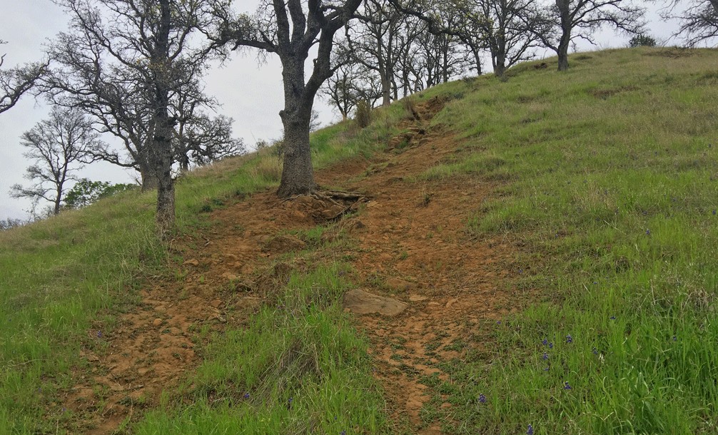
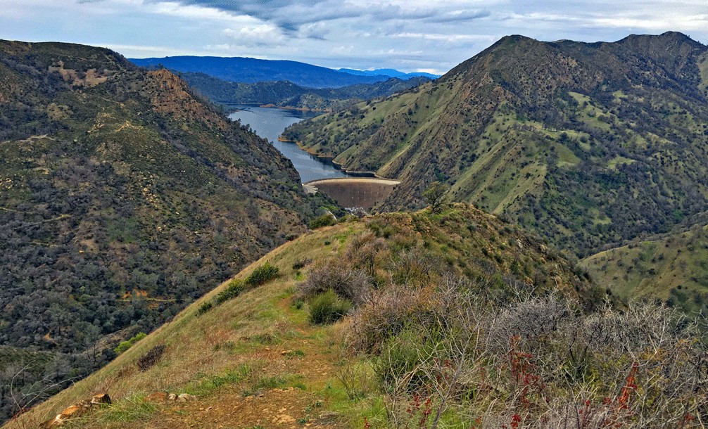
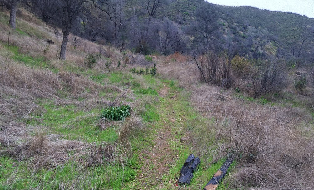
The trail begins gently enough and then starts to ascend, but it’s still not bad. After a short turn, you start to really climb. Trekking poles come in very handy, and you can use them for leverage to help pull yourself up, but there is still much steeper climbing to come. Stop under the trees, sit, catch your breath and take in the views. Look around and down on Highway 128. Look across to the hikers on the Stebbins Cold Canyon Loop trails. Take in the dam at Lake Berryessa and the water behind it. If the time of year is right, California Poppies will be growing along the side of the trail. Once you’ve rested and taken it in, you can continue your climb. You can push yourself on or take breaks as the grade steepens. It’s not a race, even if you are only by yourself.
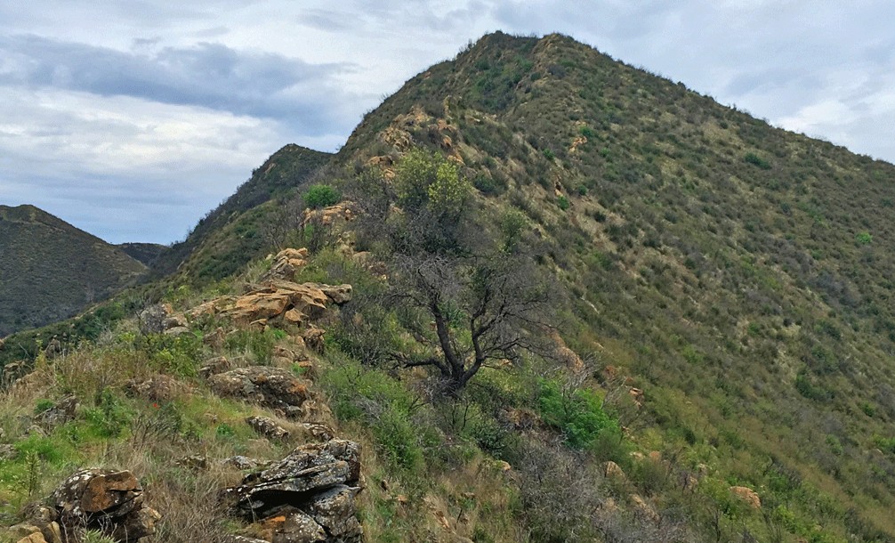
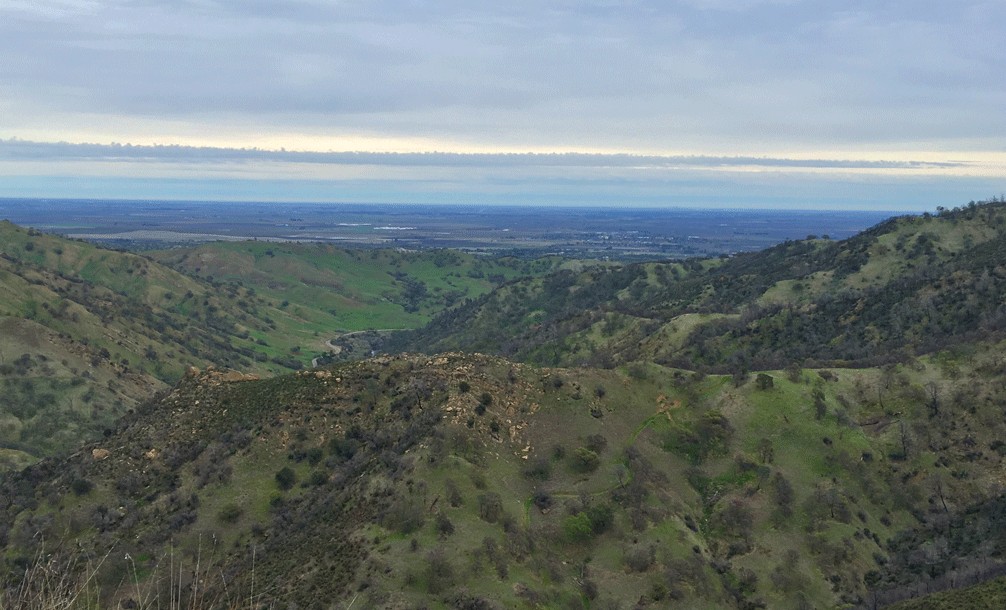
After you finish the hard climb, you start to see the Sacramento Valley to the east, and the view of the hills around you.
If you look at the track where I stopped, you can hike on and climb higher, but I didn’t. I could not make out a trail, and I didn’t feel safe. Others have gone on, so you’ll have to make your own judgment call.
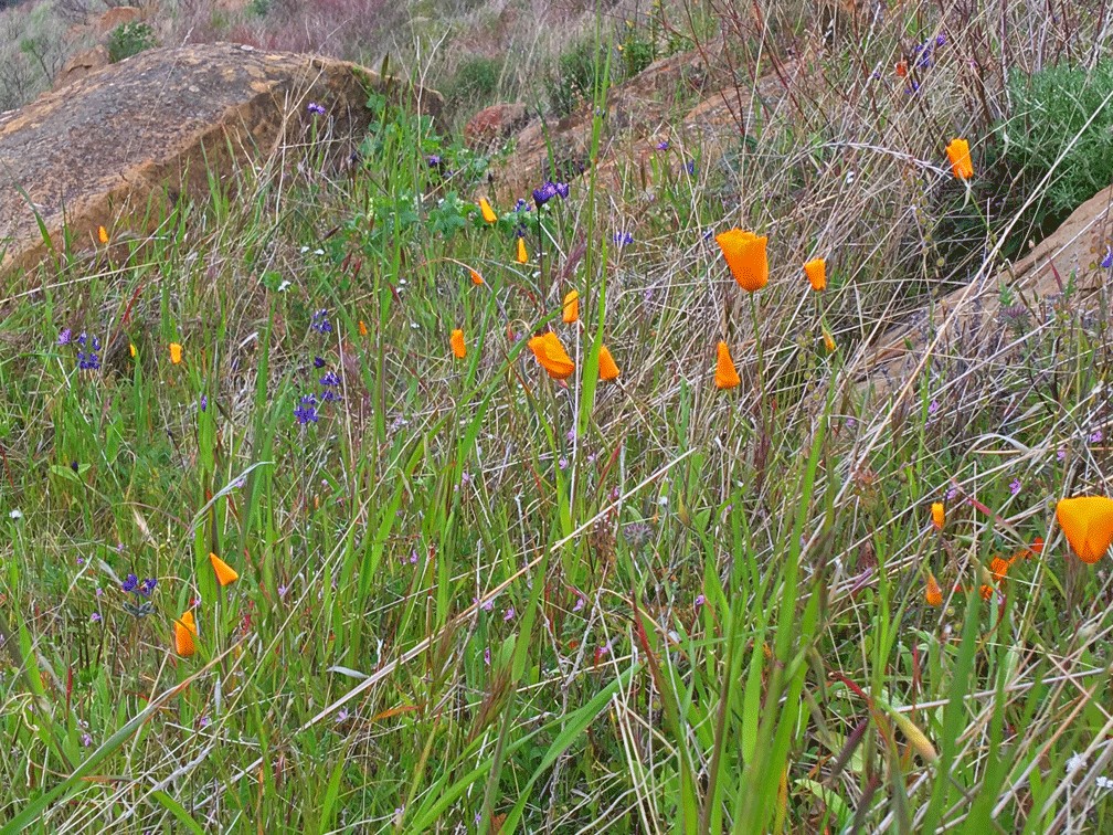
Spring and fall are best for weather conditions for hiking this strenuous trail, with spring being preferred in that most things are green and the wildflowers are in bloom, but poison oak is also coming out of dormancy. Forget about this trail in the summer. It’s very difficult, and the added heat would not make it enjoyable.
Hiking back down is a serious challenge and not for the inexperienced hiker. The grade is so steep, 46 percent in places, that I had to stop and figure out how I was getting down. As I eyed the trail, I knew that since it was so steep, I was going to fall. I made the choice to engage in a controlled fall, and I only came out with a small bruise on my right ankle and slightly skinned knee. In other places, my trekking poles were crucial, as I used them to brace against the ground and lean against to keep me from tumbling down the hill as I descended.
Directions: From Winters, take Highway 128 about nine miles just over the Putah Creek Bridge to the parking area off the road on the right.
The Skinny
Trail: Pleasants Ridge Trail
Trailhead Coordinates: 38.508876, -122.096994
Trailhead Elevation: 291 Feet
Distance: 1.5 Miles – Out and Back
Level of Difficulty: ⚫️
Average Grade: 22.1%;
Steepest Grade: 45.9% at some short points
Ascension: 1137 Feet
Trail Condition: 🟢🟢
Scenery: 🟢🟢
Nearest Town: Winters
Challenges: Hot summers, very steep grades
Trail Traffic: 🥾
Highlights: Sweeping views
Best Time: Spring, Fall
Hazards: On the way down, the grade is so steep in places, you will have to make the choice of letting gravity have its way with you or you can try to engage in a controlled fall; temperatures higher than 80 degrees Fahrenheit; poison oak
Wildlife Concerns: Mountain Lions; Rattlesnakes
Would I Do This Hike Again?: No
Parking: Free
Restrooms: Vaulted toilet in the parking lot