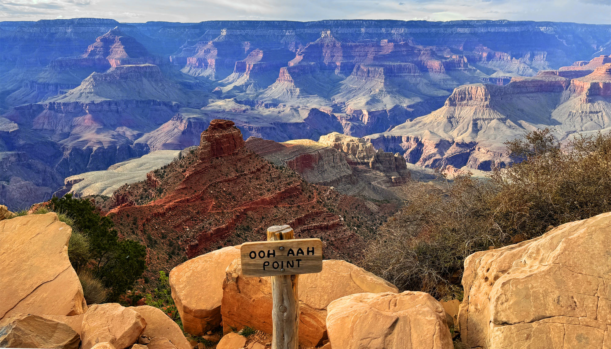
The hike to Ooh Ahh Point, a short one-mile hike, is pretty easy on the way down. The way back up is another story and on an average of 11.2 percent grade for about a mile. Once you get to Ooh Ahh Point, it’s easy to see why it’s named what it is.
Looking out at the Grand Canyon is breathtaking from here. The colors and the vastness of the canyon are awe-inspiring as you look across to the horizon and down into the canyon where you can see the trails far below you go.
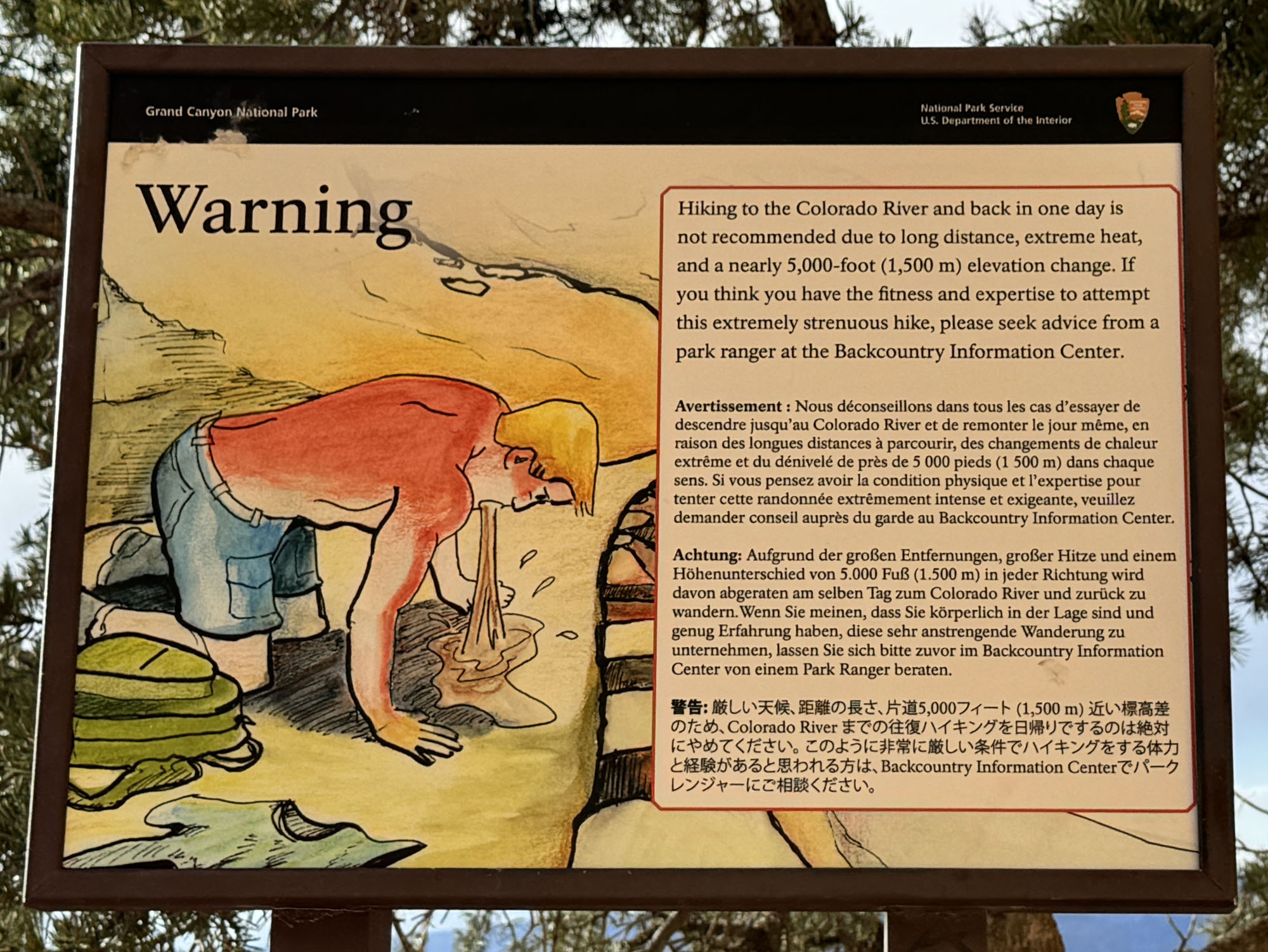
The trail goes on further down into the Grand Canyon, but we stopped at Ooh Ahh Point. We knew the climb would be difficult coming back up. This was reinforced when we saw a sign like I’ve never seen before. In multiple languages it showed someone throwing up and warning about the potential consequences for trying to make a hike down to the Colorado River and back up in a day which is about a 5,000-foot elevation change. This is due to the extreme heat and distance.
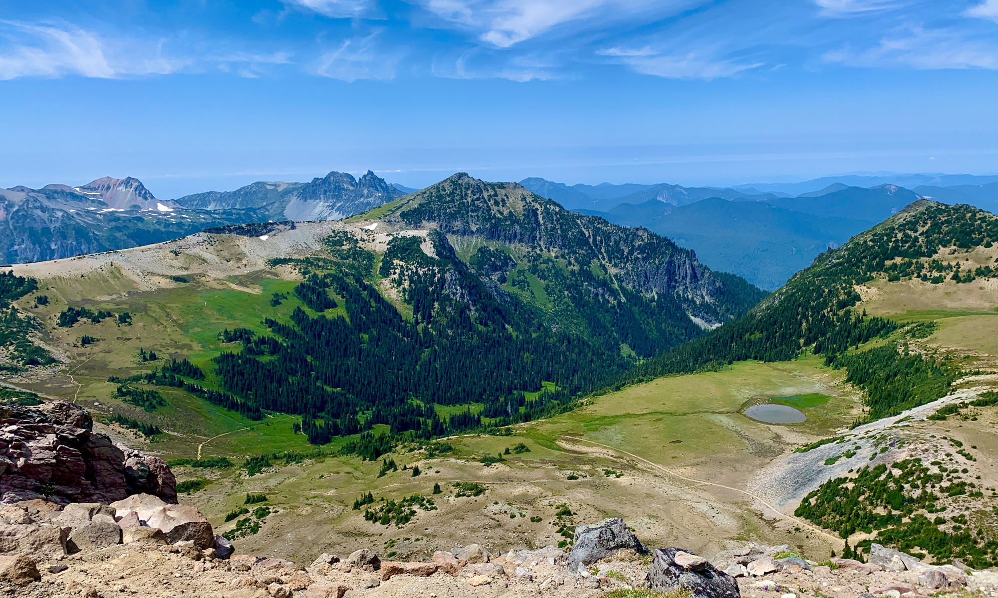
When we arrived at the Grand Canyon, it was snowing. I’ve mentioned it before, but I have to say it here again. If you have an iPhone and use the Weather app it comes with, cross reference what it says with other weather apps. It showed it was going to be sunny during our stay. The day we arrived, it told us it was sunny and 64 degrees Fahrenheit where we were. In actuality, it was snowing on us as we entered the park, and it further snowed on the two nights we were there. Don’t use this app by itself to make your travel plans by.
Directions: From the Grand Canyon Village, take the South Entrance Road, Yavapai Lodge Road 8 miles to Arizona Highway 64. Turn left on Highway 64 and travel 1.1 miles and turn left onto Yaki Point Road to South Kaibab Road for .5 miles. If you cannot find parking, go back to Highway 64, and look for possible parking there and hike in.
The Skinny
Trail: South Kaibab Trail To Ohh Ahh Point
Trailhead Coordinates: 36.052950, -112.083850
Trailhead Elevation: 7201 Feet
Distance: 2 Miles
Level of Difficulty: 🟠
Average Grade: 11.2%,
Steepest Grade: 53% Over 55 Feet, 13% Over .46 Miles
Ascension: 983 Feet
Trail Condition: 🟢🟢🟢🟢
Scenery: 🟢🟢🟢🟢
Challenges: Climbing Back
Traffic: 🥾 🥾🥾
Highlights: Scenery
Best Time: Spring, Fall
Hazards: Heat Exposure
Wildlife Concerns: Rattlesnakes
Cell Service: 📵 Verizon
Would I Do This Hike Again?: Yes
Parking: Difficult. We Had To Park About Half A Mile Away On East Rim Drive In A Small Parking Area.
Restrooms: At The Trailhead
If you’re interested in downloading this track, it’s a mess. The canyon walls at the beginning of the trail interfered with the signal, but the general information is in the track.