Andrew Molera State Park at Big Sur offers beautiful views of the Pacific Ocean and the nearby mountains. While the hike to see some of the views is challenging in places, it is worth it.
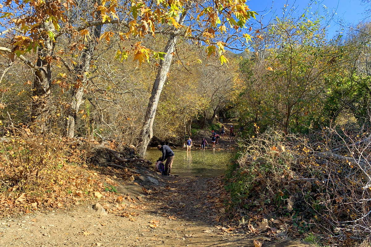
The hike starts off at the entrance of the park along a dirt road for about .15 miles when you come to the Big Sur River. If it’s low, it’s fine to cross in boots maybe, but it would be best to bring water shoes or sandals. It was too deep for us to wear our boots across, and we had to take them off and roll up our pants. The crossing was painful as we stepped on the rocky bottom while moving through the river. It might be a good idea to hike with a trekking pole to help with stability while crossing. It’s easy to lose your footing in the water and on the rocks.
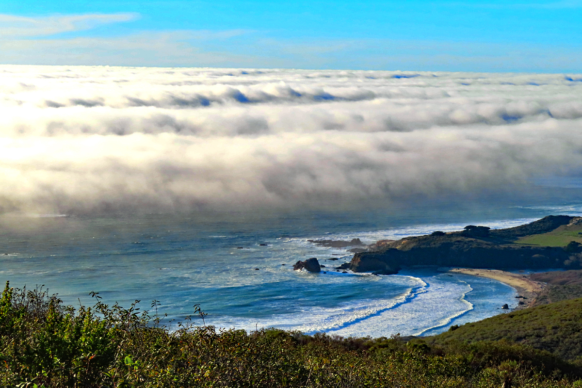
Once you reach the other side, the road continues on for about .7 miles where it comes to an intersection. Take the trail to the left, and hike for about another 400 feet when you come to another intersection. We chose to go right which took us out to the bluff that overlooked the Pacific Ocean. At this point, you lose any kind of canopy and will hike exposed along the Bluffs and Panorama Trails for nearly 3 miles. Take sunscreen.
After about 1.5 miles, the hike along the BluffsTrail becomes the Panorama Trail and starts to ascend. The climb is on an 11.7 percent grade over 1.7 miles taking you up 1090 feet. This is where it starts to get a little tough. The plus point is you can stop at any time, rest and enjoy the views before you continue on. The higher you get, the better the views.
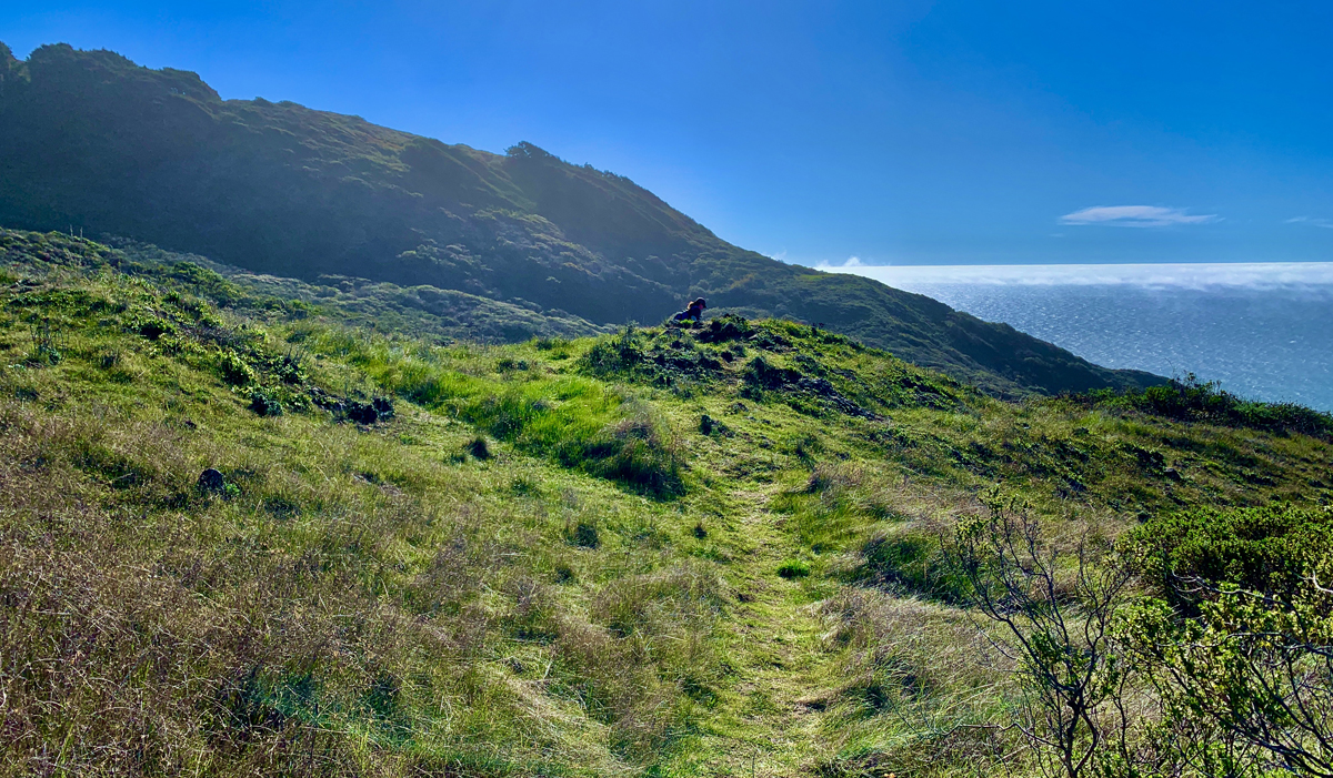
The Panoramic Trail takes you to Pfeiffer Ridge. This is a good place to stop, rest and take in the views before you head back down on the Ridge Trail.
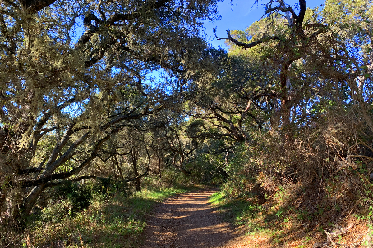
Unlike the Bluffs and Panoramic Trails, the Ridge Trail is covered with canopy for good portions before you hike back into exposure, but it is quite enjoyable as you descend down. You will come to the intersection where you turned to take the Bluff Trail.
We followed the trail down to the road we came in on, but we decided we didn’t want to go back just yet, so we went left and headed to the beach before heading back. The beach is worth seeing and spending time at.
Directions: From Carmel-by-the-Sea, take Highway 1 South for 22 miles. Turn right at Coast Road and head to the parking area. Parking is here: 36.287098, -121.843468
The Skinny
Trail: Creamery Meadow, Bluffs, Panorama and Ridge Trail
Trailhead Coordinates: 36.286983, -121.843333
Trailhead Elevation: 55 Feet
Distance: 8.6 Miles – Lollipop
Level of Difficulty: 🟠
Average Grade: 4.6%
Steepest Grade: 17% Over .4 miles
Ascension: 1724 Feet
Trail Condition: 🟢🟢🟢
Scenery: 🟢🟢🟢
Nearest Town: Carmel-by-the-Sea
Challenges: Climbing
Traffic: 🥾
Highlights: Scenic Views
Best Time: Spring, Summer, Fall
Hazards: Sun exposure, Foot injury crossing Big Sur River especially if barefoot
Wildlife Concerns: Mountain Lions
Cell Service: 📵 (AT&T)
Would I Do This Hike Again?: Yes
Parking: $10 at the time of this writing
Restrooms: Vault toilets in the parking lot