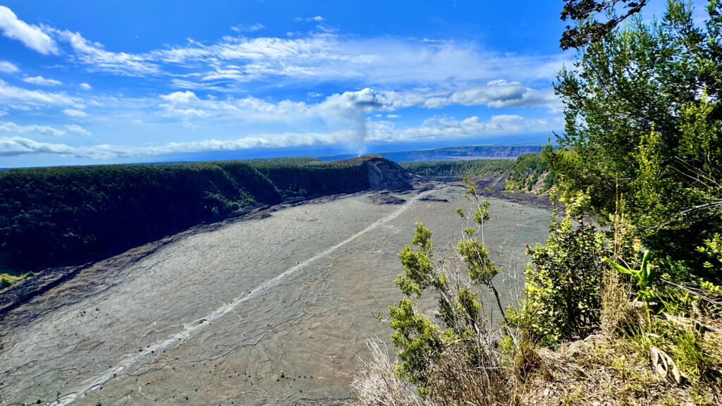
Having never hiked in an environment like this before, I was really impressed by the climate. The trail that went through the rainforest was humid and lush, and by contrast, the Kīlauea Iki crater was exposed, burned out and covered with lava rock where growth emerged through cracks in it where lava flowed in 1959.
Waimoku Falls on the Pīpīwai Trail at Haleakalā National Park.
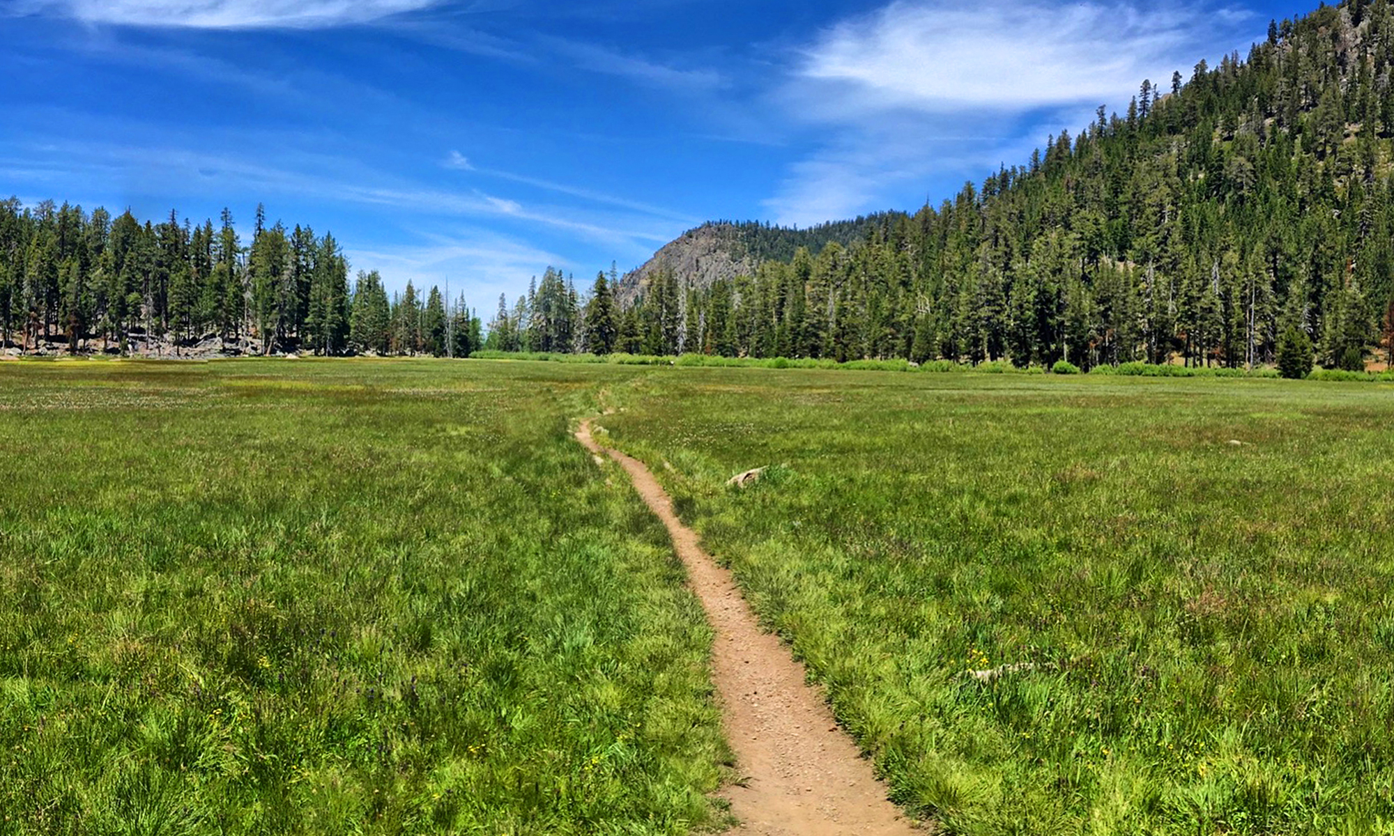
The hike to Waimoku Falls on the Pīpīwai Trail is a beautiful lush hike through bamboo forests on the island of Maui. While not a difficult hike, it does offer challenges in the way of heat and humidity. That said, I would do this hike again and again.
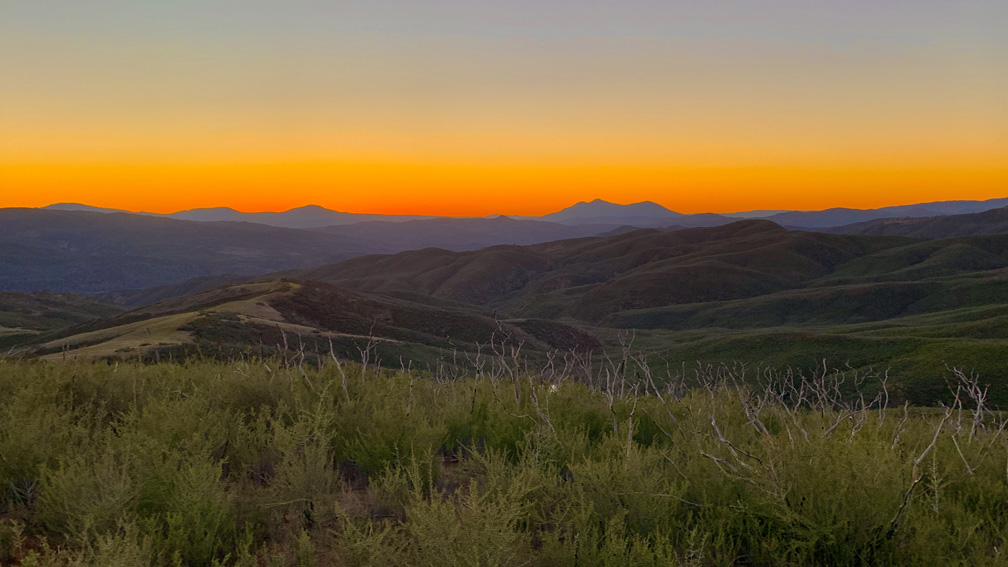
The sunset with Mount Konocti on the horizon as viewed from the Judge Davis Trail about 18.5 miles away.
The hike on the Judge Davis Trail down to Cache Creek was a son of a b*tch and should not be done as an out and back day hike but rather as a point to point backpacking trek.
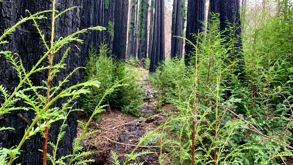
The forest at Bothe-Napa Valley State Park on the Upper Ritchey Canyon Trail are recovering from a fire that occurred in 2020.
The hike to Upper Ritchey Canyon at Bothe-Napa Valley State Park is challenging, but along the way you can see a forest that is in recovery from a fire that burned through parts of it in 2020.
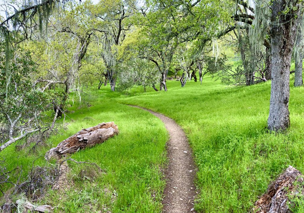
Old Man’s Beard at Moore Creek Park can be green and beautiful in the springtime.
Like the other hikes we’ve done at Lake Hennessey, Old Man’s Beard and Sam the Eagle trails at Moore Creek Park are pleasant when hiked in the springtime with green hills, wildflowers as the foliage is coming back to the trees.
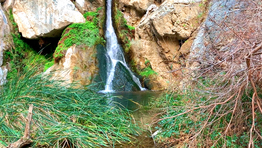
Darwin Falls is a spring-fed waterfall at Death Valley National Park.
A waterfall at Death Valley National Park? Yep, there certainly is, and the hike to Darwin Falls is pretty easy for the most part.
The hike starts off from the parking lot and follows a Darwin Wash back to the waterfall. We didn’t start to notice water until about .7 miles from the trailhead that flowed from the waterfall in a stream. As we ventured further back, we went from a dry desert wash to trees, cattails and other greenery, including ferns, fed by the water.
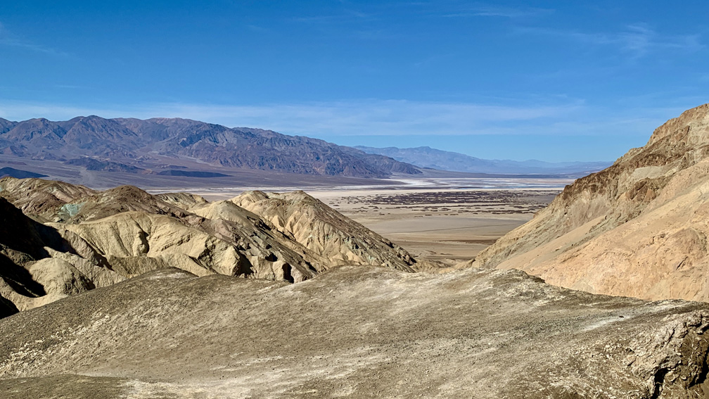
From the high point of the Desolation Canyon Trail at Death Valley National Park, you can see the Panamint Mountain Range, Telescope Peak, portions of Cottonball Basin, Middle Basin and Badwater Basin.
If you love dirt and sand, Desolation Canyon at Death Valley National Park is for you. If you don’t, the view at the end and colors in the canyon walls is may be worth the hike, but getting there can be a chore.
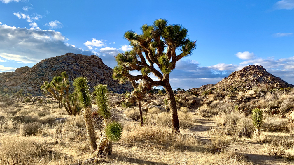
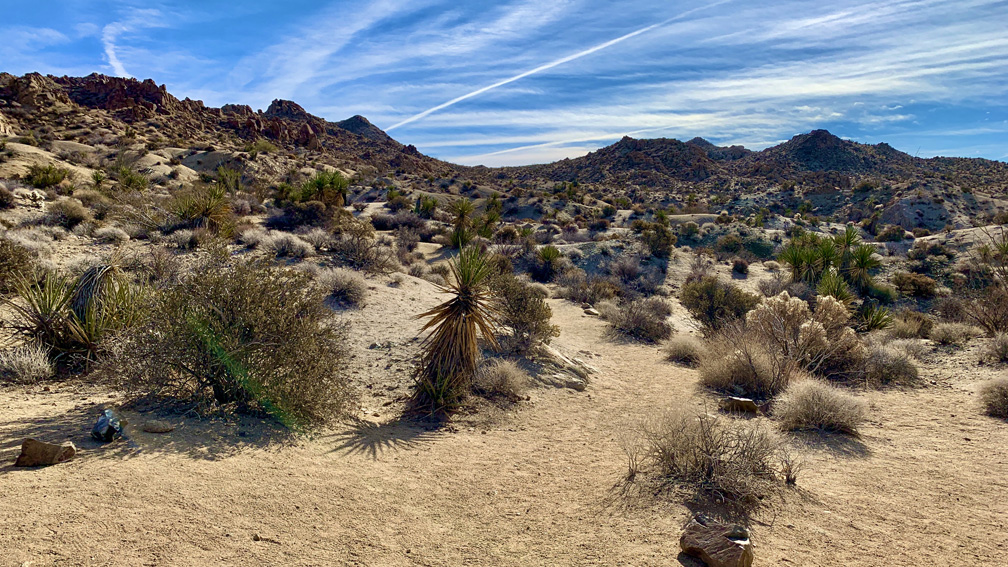
The desert landscape on the Maze hike is full of desert vegetation, trees, and land formations.
I’ve heard for years about The Maze at Joshua Tree National Park, and I finally got the opportunity to hike it. Maybe it was because of the hype I heard that I was expecting more than what it offered, but even with that said, I was in no way disappointed.
Hiking to the Lost Palms Oasis at Joshua Tree National Park is like hiking through a garden in the desert.
Hiking to Lost Palms at Joshua Tree National Park is like hiking through a desert garden. If you’re up for hiking through the desert, there really is a lot to see as far as plant life goes on this hike, along with great landscape vistas.
On this hike, you will more than likely come across cholla cacti, indigo bush, jojoba, California juniper, creosote bush, mistletoe, Mojave yucca, Mormon tea, barrel cacti, granite rock, palm trees, but no Joshua trees in this part of the park.
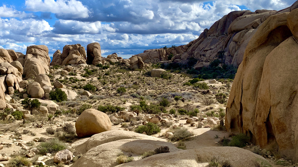
The desert landscape at Joshua Tree National Park is striking, but pictures do not do it justice. It needs to be experienced to be truly appreciated.
This is the hike that made Joshua Tree National Park my favorite park. The Skull Rock Nature Trail/Split Rock Trail for me were over the top with scenery and ease. The video below and pictures do not do it justice. This hike needs to be experienced.
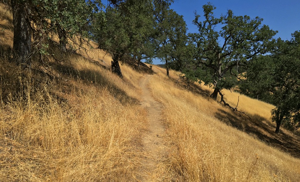
The Redbud Trail meanders through the oak laden hillsides of the Cache Creek Natural Area.
Originally posted June 8, 2018
Updated April 30, 2023
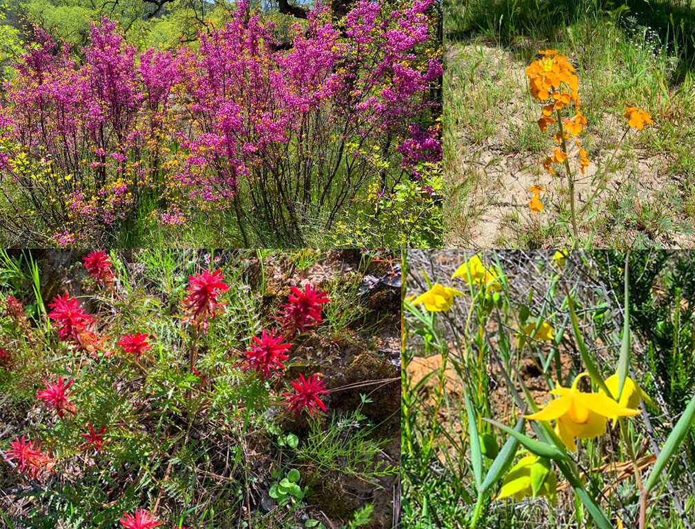
We hiked Redbud Trail in April 2023 after the California’s massive rainstorms earlier in the winter and spring. What resulted were superblooms in locations. For as often as I have hiked the Redbud Trail, I have never seen the wildflowers on the trail I saw in late April. The wildflowers included Indian Paintbrush, Warrior Paintbrush, Common Fiddlestick, Western Wallflower, Diogene’s Lantern, and many other colorful wildflowers.
Hiking the Redbud Trail as it meanders along hillsides next to oak trees and descends down to Baton Flat and Cache Creek is a pleasant hike through the foothills.
The trail starts off out of the parking lot on a service road and then to the right you’ll see a sign with Redbud Trail marked on it. Take the trail away from the road and hike along the edge of the foothills until you come to a creek bed that you have to cross. Continue reading “Hiking Redbud Trail to Baton Flat”
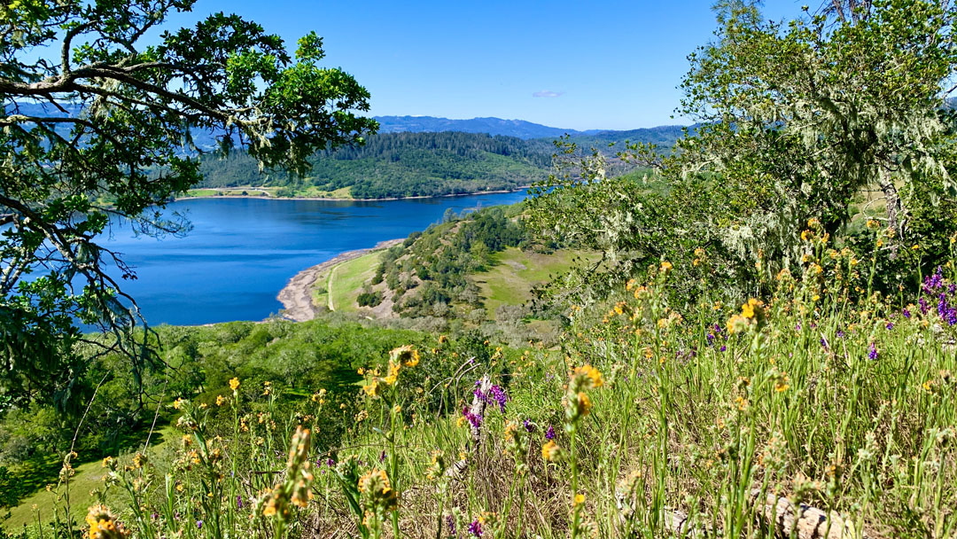
Lake Hennessey from the spur trail to the top of Conn Peak.
This is a very pleasant trail in the Napa Foothills where you eventually end up looking over Lake Hennessey from Conn Peak, especially in the springtime when the hills and trees are all green and the wildflowers are popping.
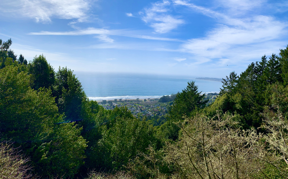
The Matt Davis Trail at Mount Tamalpais offers sweeping views of the Pacific Ocean.
The Steep Ravine Trail at Mount Tamalpais State Park is a beautiful trail to hike, and I’ve written about it previously. I combined this trail with the Matt Davis Trail to make a loop on the west side of Mount Tamalpais.