It isn’t often that I hike a city park and let alone write about it, but Upper Bidwell Park in Chico is laden with hiking trails in the hills is an exception. Over the years I’ve heard so much about the hiking trails in Upper Bidwell Park, I finally decided to check it out in the spring. I hiked the North Rim Trail and Middle Trail Loop.
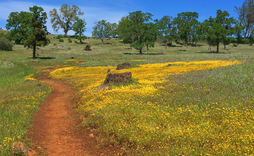
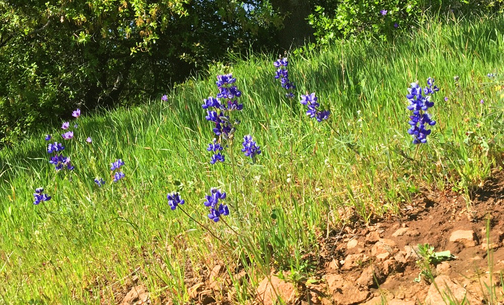
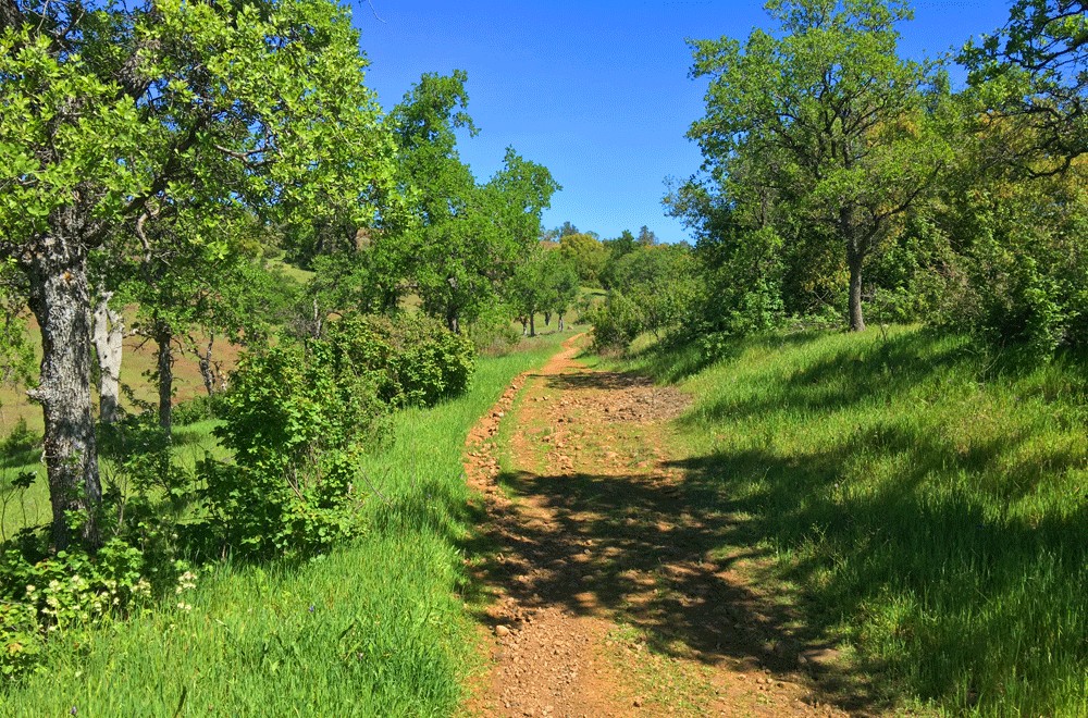
The springtime is the best time to take this hike as the Northern California summers in the valley can be very hot, and the North Rim is exposed to the sun. In the spring the hills are green and the wildflowers are in bloom.
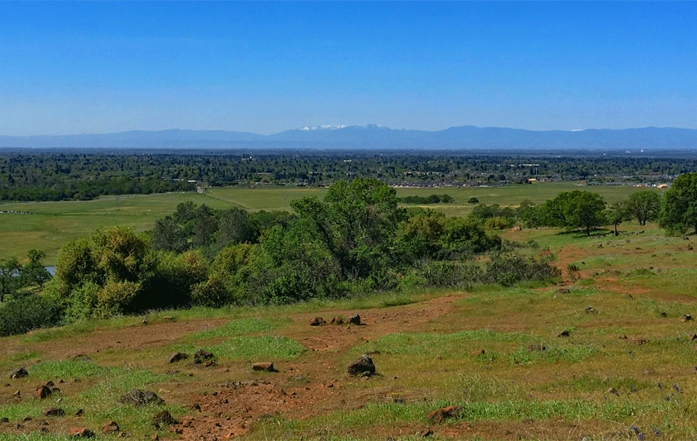
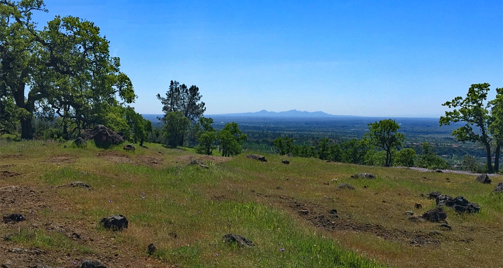
The hike up to the North Rim Trail can make your heart pound a little, but once you’re there on the rim, it levels out and is pretty tame. At the time of this writing, AllTrails.com rates this trail as hard, but I disagree. In the beginning, there is some huffing and puffing as you climb the .4 miles over a 13 percent grade, but after that, it’s not a difficult hike. There’s little canopy on the North Rim Trail, so it is exposed. From the top, you can see across the valley on a clear day to Snow Mountain to the west and the Sutter Buttes to the south. Once you get to this point, the crowds start to thin out, and you almost have the trail to yourself.
Continue on to the east on the trail, which is solid hard rock and eventually turns to dirt. Besides the fantastic views of the Sacramento Valley as you head east, you hike among scattered oak trees and volcanic rocks that landed on the bluffs. I’m not sure where they blew from, but it was probably either Mt. Lassen or Mt. Shasta.
As you hike there are various opportunities to look down on Bidwell Park to the south of you. You may see hikers and other recreators below. In the spring, it’s green and serene.
At about 3.5 miles on the trail, you’ll come to a marker and an intersection. The North Rim Trail goes on for a little ways, but it ends. If you take the turn, you’ll start a descent on a trail that will take you to Middle Trail, and it will head back toward the parking lot.
This trail isn’t as wide as the North Rim Trail, and you begin to hike under canopy. I also encountered a couple of hikers coming back up after they passed me on the North Rim Trail. They said they saw a snake while hiking but couldn’t identify it, and they turned around. As I went on, I kept an eye out for it, but it must have moved on by the time I reached the point where they encountered it.
Hiking the Middle Trail and getting to it isn’t as gentle as the North Rim Trail, but it’s not difficult. This trail is more up and down, and you need to keep an eye out for mountain bikers, as they ride this trail too. If I do this trail again, and I would like too, I would stay on top and go back the way I came.
Directions: From the Greater Sacramento Area, take Highway 99 North to Chico and turn off at exit 386 for East 1st Avenue and then make a left on Longfellow Avenue. Turn right on Manzanita Avenue and then turn left on Madrone Avenue. From there turn right onto Manzanita Avenue, and then at the traffic circle, take the 2nd exit onto Wildwood Avenue. The parking lot will be on your left here: 39.772917, -121.779167
The Skinny
Trail: North Rim Trail to Middle Trail
Trailhead Coordinates: 39.772960, -121.778515
Trailhead Elevation: 235 Feet
Distance: 8.5 Mile – Loop
Level of Difficulty: 🟡
Average Grade: .03%
Steepest Grade: 13.3% over .04 Miles
Ascension: 1432 Feet
Trail Condition: 🟢🟢🟢🟢
Scenery: 🟢🟢🟢🟢
Nearest Town: Chico
Challenges: Sun Exposure
Traffic: 🥾🥾🥾 to 🥾 – see the notes
Highlights: The Views, Wildflowers
Best Time: Spring
Hazards: Heat Over 85 Degrees, Sun Exposure
Wildlife Concerns: Mountain Lions, Rattlesnakes
Would I Do This Hike Again?: Yes – along the North Rim Trail and back.
Parking: 39.772900, -121.779200 – Free at the time of this writing
Restrooms: In the parking lot and around the park – nothing on the trail