This is the hike that made Joshua Tree National Park my favorite park. The Skull Rock Nature Trail/Split Rock Trail for me were over the top with scenery and ease. The video below and pictures do not do it justice. This hike needs to be experienced.
Because we combined multiple trails, there are two places that could be started from, and we chose to start at Skull Rock.
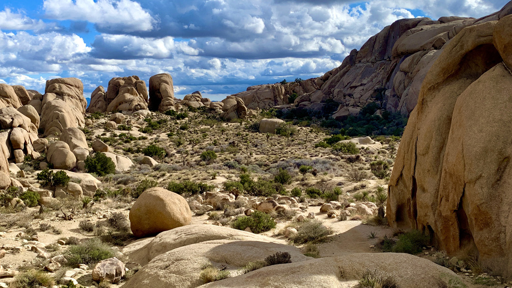
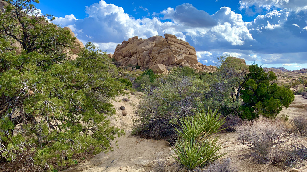
The granite rock formations are incredible and can be climbed on. The desert landscape in this area is different than anywhere else we were at in the park – it had it all. We hiked past Mojave Yucca, Creosote Bush, Cotton Thorn, Pencil Cholla, Jojoba, Wild Buckwheat, California Juniper, Desert Pine Trees, Mojave Desert Oak Trees, Joshua Trees, Paperbag Bush, cholla cacti, colorful lichen in rocks in places, dikes in the rocks, and much more. This hike is a feast for the visual senses!
We started off on the Skull Rock Nature Trail and quickly found ourselves surrounded by the granite rock formations. About .10 miles in, we came to a junction where the trail intersects with the Discovery Trail. We will hike that next time we visit the park. Probably the toughest part of the hike was right in front of us. We had to squeeze past some huge rocks in the trail in a narrow canyon, but after that, it was pretty smooth sailing.
As we continued on, we could see this area of the park gets water. Though we saw none, that’s why it’s greener than other parts of the park with desert oak trees and desert pine trees, which was unexpected and delightfully surprising to see. As we hiked on, we came back to Park Boulevard and had to cross it, which took us through Jumbo Rocks Campground.
It was neat to see the granite rock formations in the campground, as we went to where the Skull Rock Nature Trail picked back up. This trail has all kinds of plant-life on it, and there are interpretative placards all along it identifying them that are interesting to read. This trail over rocks and through a wash leads to Skull Rock.
We made it to Skull Rock, crossed Park Boulevard and made it to the trailhead, but the Split Rock trailhead is also in the same place where the Skull Rock Nature Trail starts, and this time we headed to Split Rock.
The path was a little confusing, and we lost the trail shortly after we started, but we used our GPS to keep us going in the right direction, and we quickly found the trail again. We came to a short slot canyon, and once we emerged, there was a placard highlighting some of the lichen on the rock walls.
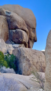
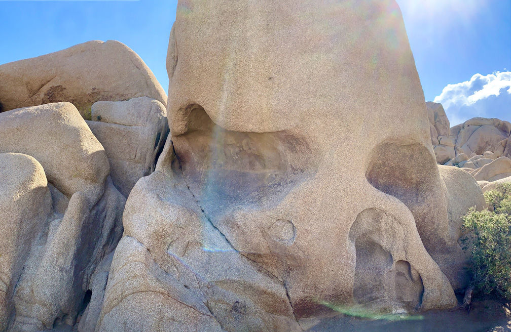
We hiked on and came to Face Rock, where the rock formation can be interpreted to look like a human face. From there, we hiked on another .10 miles, and we got confused. We could not tell where the trail was. It went through a wash, but we could not recognize it. There was another trail to the left of it, but it was blocked off with rocks across it. We did what we weren’t supposed to do and crossed over the rocks and hiked on the trail that was blocked off. I kept my GPS out so I could see where we were in relation to where we were supposed to be. The trail were on quickly joined the main trail. On our way back, we found our way out the way were supposed to come in and saw what we were supposed to do.
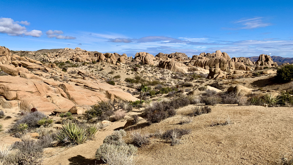
About another 220 feet from where we rejoined the trail, we came to a fork, and this is where the Split Rock Trail lolliopped, and we went to the right. As if where we came from wasn’t visually spectacular enough, it just got better with the plant-life and rocks. We came across rock climbers in different locations in this area, and as the granite rocks towered high enough for this to happen, we stopped and watched them for a while.
We continued on toward the Split Rock trailhead parking lot, and we came to where we could see Split Rock, took it in, and then continued on.
This area of the hike becomes more open and has lower ground vegetation for about .6 miles, and to be honest, this is a less spectacular portion of the hike. It does not last long, and the hike gets back into the character of what the area was like before we got to the Split Rock trailhead.
For about .6 miles, we followed the trail, took in the landscape, and then we came to where the trail looped back to where we came from. From there, we followed it back the way we came to the trailhead.
We did this hike in January, and we started off wearing jackets. When the sun came out from behind the clouds, it really warmed up and we took them off. Then the sun went back behind the clouds, and we very quickly felt the drop in temperature. This occurred multiple times back and forth throughout our hike.
There are places on this trail where it could be easy to get off it and not know it until you figure something is not right, and you may become lost. Pay attention to where rocks have been laid across where it looks like there may be another trail. This is an indicator that this is not a way to go. Unless you really know what you’re doing, you need to stay on the trail you are on. Also, see my post, Getting Lost: The Holy Sh*t of Hiking.
Directions: There are two places to park. We started from where Skull Rock was. From Twentynine Palms, take Utah Trail for 3.9 miles to Park Boulevard (the road changes names) for 7.5 miles. Parking is on the side of the road and limited. Parking is here: 33.997809, -116.059963. To hike from the Split Rock trailhead, take Utah Trail for 3.9 Miles to Park Boulevard for 6.8 miles. Turn right onto Split Rock and follow it for half a mile to the end. Split Rock is a dirt/gravely road. Parking is here: 34.009393, -116.055667
The Skinny
Trail: Skull Rock Nature Trail/Split Rock Trail
Trailhead Coordinates: 34.009550, -116.055770
Trailhead Elevation: 4325 Feet
Distance: 4.7 Miles – Loopy Lollipop (See Tracks)
Level of Difficulty: 🟢
Average Grade: .04%
Steepest Grade: 13.6% over 359 Feet
Ascension: 507 Feet
Trail Condition: 🟢🟢🟢🟢
Scenery: 🟢🟢🟢🟢
Nearest Town: Twentynine Palms
Traffic: 🥾🥾 (Probably Heavy On Weekends)
Highlights: The Views
Best Time: Fall, Winter, Spring
Hazards: Cacti – Avoid Touching Them!, Heat
Wildlife Concerns: Rattlesnakes
Cell Service: 📵
Would I Do This Hike Again?: Yes
Parking: Parking At The Trailhead. $30 At The Time Of This Writing To Enter The Park; Good For 7 Days
Restrooms: Vault Toilets At Jumbo Rocks Campground; Vault Toilets At The Split Rock Trailhead Parking Area