Note: This portion of the forest was severely burned in 2018 shortly after I hiked it, and most the trees are now burned out. See my Snow Mountain East Peak summary for an update.
Peaceful desolation. That’s what the hike up Snow Mountain in the Snow Mountain Wilderness is. The trails are defined, the wildflowers are in bloom in the summer and people are scarce. The trails in this Northern California area are a hidden gem, as they are under-hiked and seemingly unknown to most.
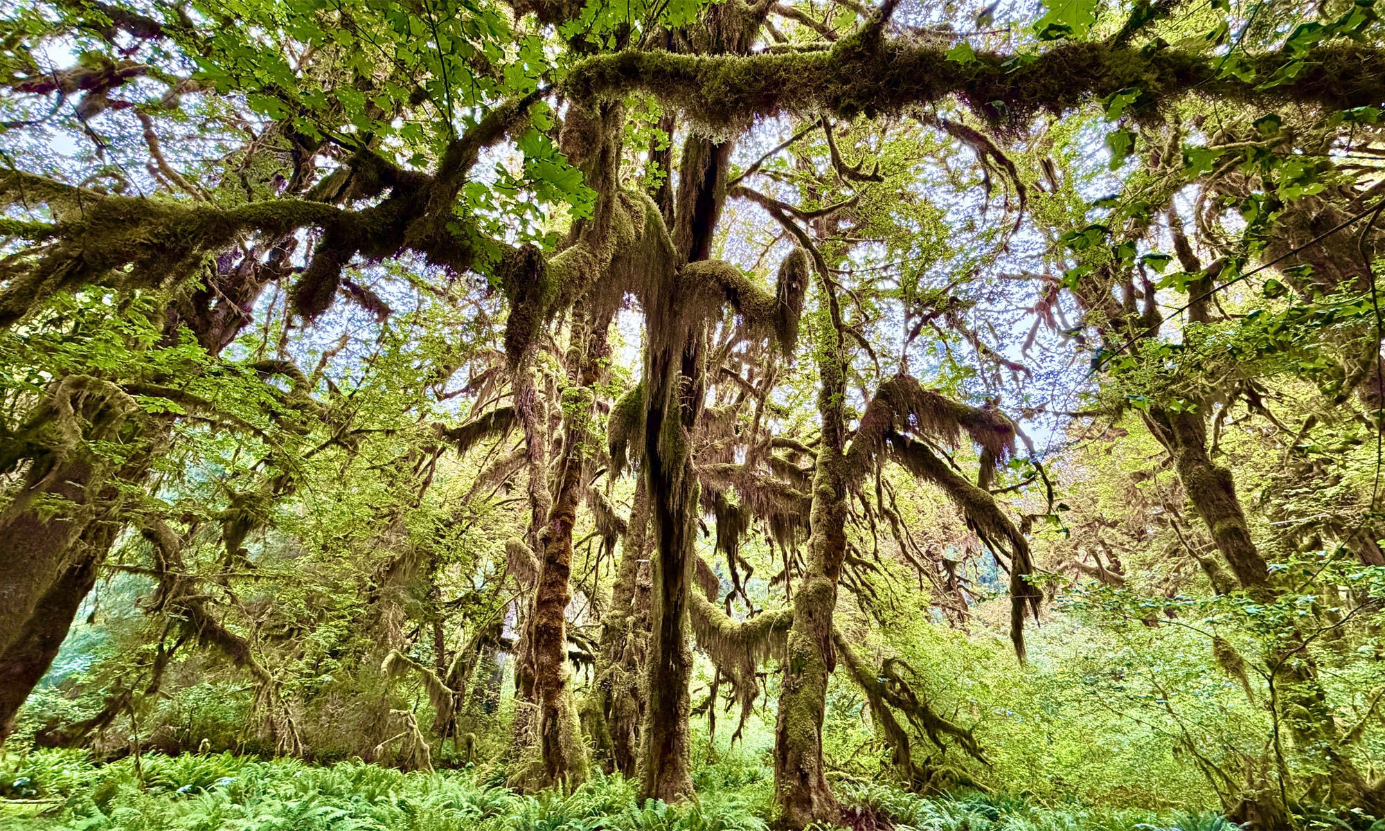
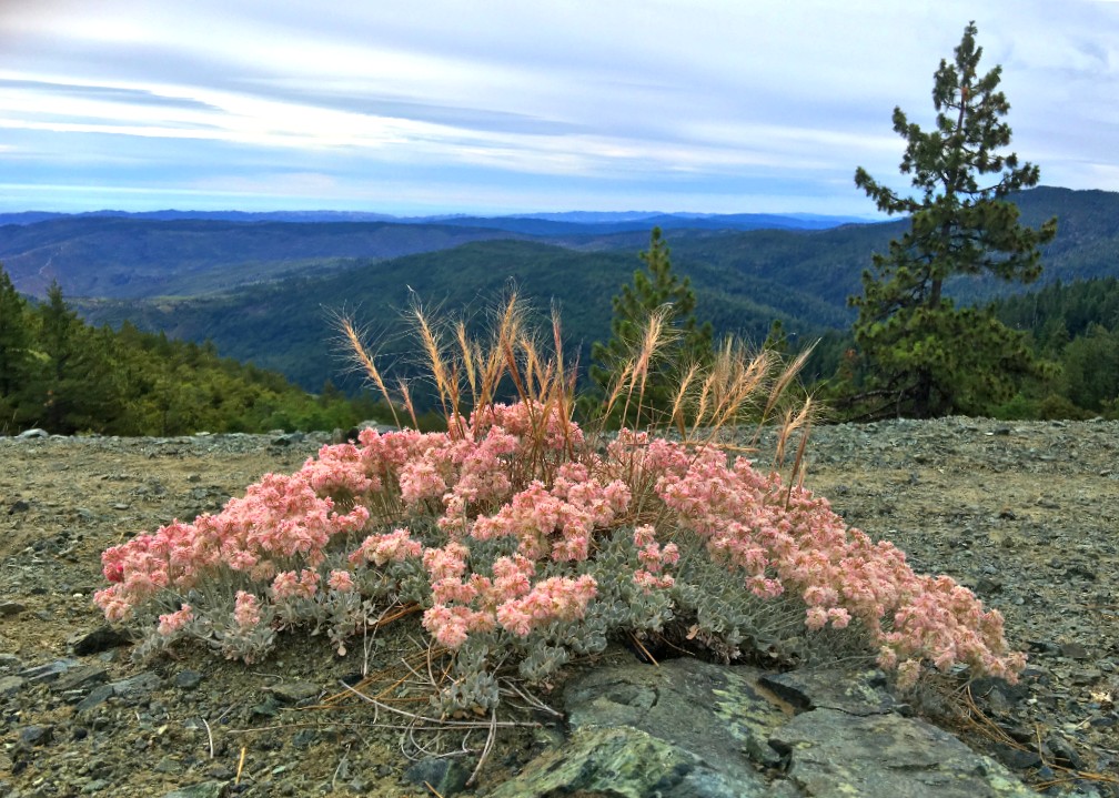
Though not recommended to hike in the summer as the heat can be brutal, I happened to catch the mountain on an unseasonably cool July day with overcast and a smattering of rain. The wildflowers were in bloom from red to purple, yellow, blue and orange. The hike starts out exposed and meanders for a little more than a mile before you start to get under the cover of the tall pine trees as you climb.
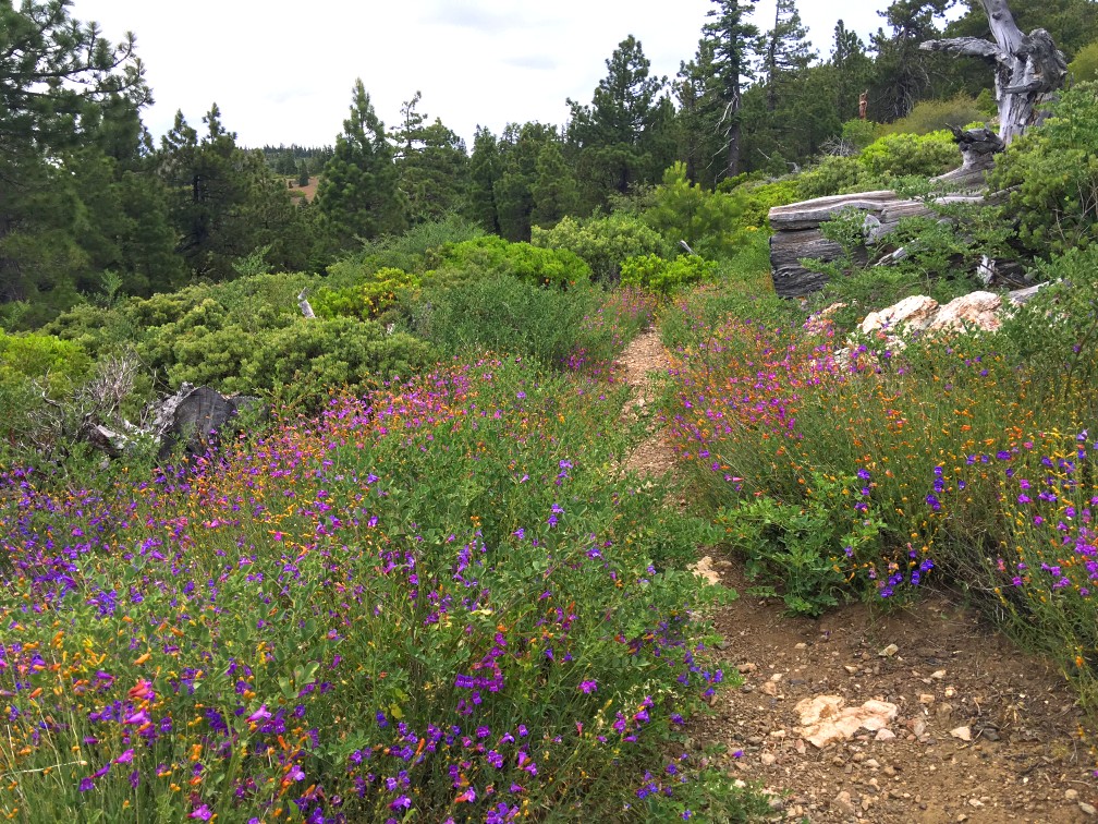
As you emerge from the forest into the Summit Basin, wildflowers are abundant at the right time of the year, but the basin is also mostly exposed with scattered trees. While the vast majority of the hiking trail is wonderfully maintained, there are some areas in the basin that could use some maintenance. Shorts are not recommended, as stickery leaved plants encroach on both sides of the trail and reach out to greet you. Along the way, you will also finding yourself climbing over a fallen tree or two. As you hike through the bowl, marvel at the solitude of the natural beauty around you.
In the bowl, you’ll start to climb a little more. The entire trail is a climb, but it’s not bad at all, where you ascend more than 2,000 feet. It doesn’t start to feel steep until you get to about 5.5 miles where you find yourself at a junction where you can go to the West Peak, the East Peak or on down to the Milk Ranch Loop Trail. I went up the West Peak.
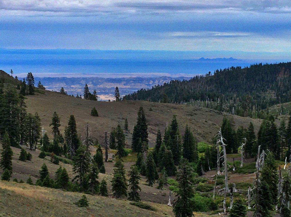
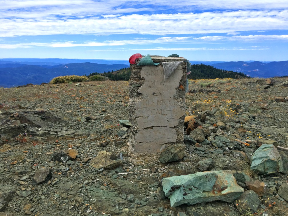
I chose the West Peak in part because it was a cloudy hazy day, and I decided I would return another day to climb the East Peak when the skies are more clear, and I could have a better view of the Sacramento Valley to the east. A cool breeze greeted me at the top, and the views from the West Peak are commanding as you look over ridges of mountains covered with trees and glades to the north, the west and down to the south. You can see Mt. Konocti in the distance to the south. Sit and enjoy the views from the top before you decide to head back, but do it before dark.
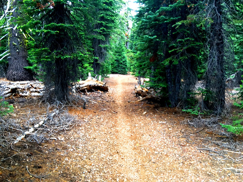
Hiking back is just as pleasant as the hike up but takes less time as you’re mostly headed down all the way. Take your time and enjoy the hike through the forest.
At a little bit in on the trail, you will come to a board with signs on it. There is also a place to sign in. Please do it. If you become lost, searchers will have an idea of where to start looking for you. Right after this, you have a choice to go right or left. Both ways will loop you around to the same junction. If you go right, you will do some steeper climbing and hike exposed – I’ve been told that while the trail is still there and in good shape, this trail has been abandoned in favor of taking the trail to the left. If you go left, the climb is more gentle, and you will walk under trees for a short way.
Directions: From Stonyford (39.375075, -122.544572), take Market Street to Fouts Springs Road. Shortly after the Deafy Glade Trailhead, the pavement runs out and you will travel on a unpaved forest road, and take a right at the junction onto Forest Route 18N01. Follow it until you come to a junction where you will have four choices. Take 17N06 Road (second from the right) and proceed up hill. While not necessary, four wheel drive could come in handy and is recommended. Follow it to the Summit Springs Trailhead Parking area (39.345899, -122.752093).
The Skinny
Trail: Summit Springs Trail to Snow Mountain West Peak
Trailhead Coordinates: 39.345871, -122.752081
Trailhead Elevation: 5261 Feet
Distance: 9.4 Miles – Out and Back
Level of Difficulty: 🟡
Average Grade: 7.2%
Steepest Grade: 9.2% over .7 miles
Ascension: 2220 Feet
Trail Condition: 🟢🟢🟢🟢
Scenery: 🟢🟢🟢🟢
Nearest Town: Stonyford
Challenges: Summer Heat
Traffic: 🥾
Highlights: Scenery
Best Time: Fall, Spring
Hazards: If you get hurt, there may be nobody around for days
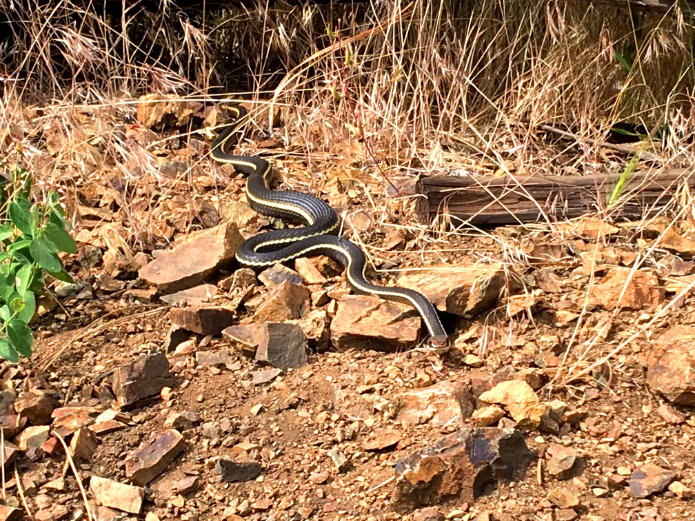
Wildlife Concerns: Bears, Mountain Lions, Rattlesnakes
Cell Service: 📱 (AT&T)
Would I Do This Hike Again?: Yes
Parking: Free
Restrooms: Vault toilet near trailhead