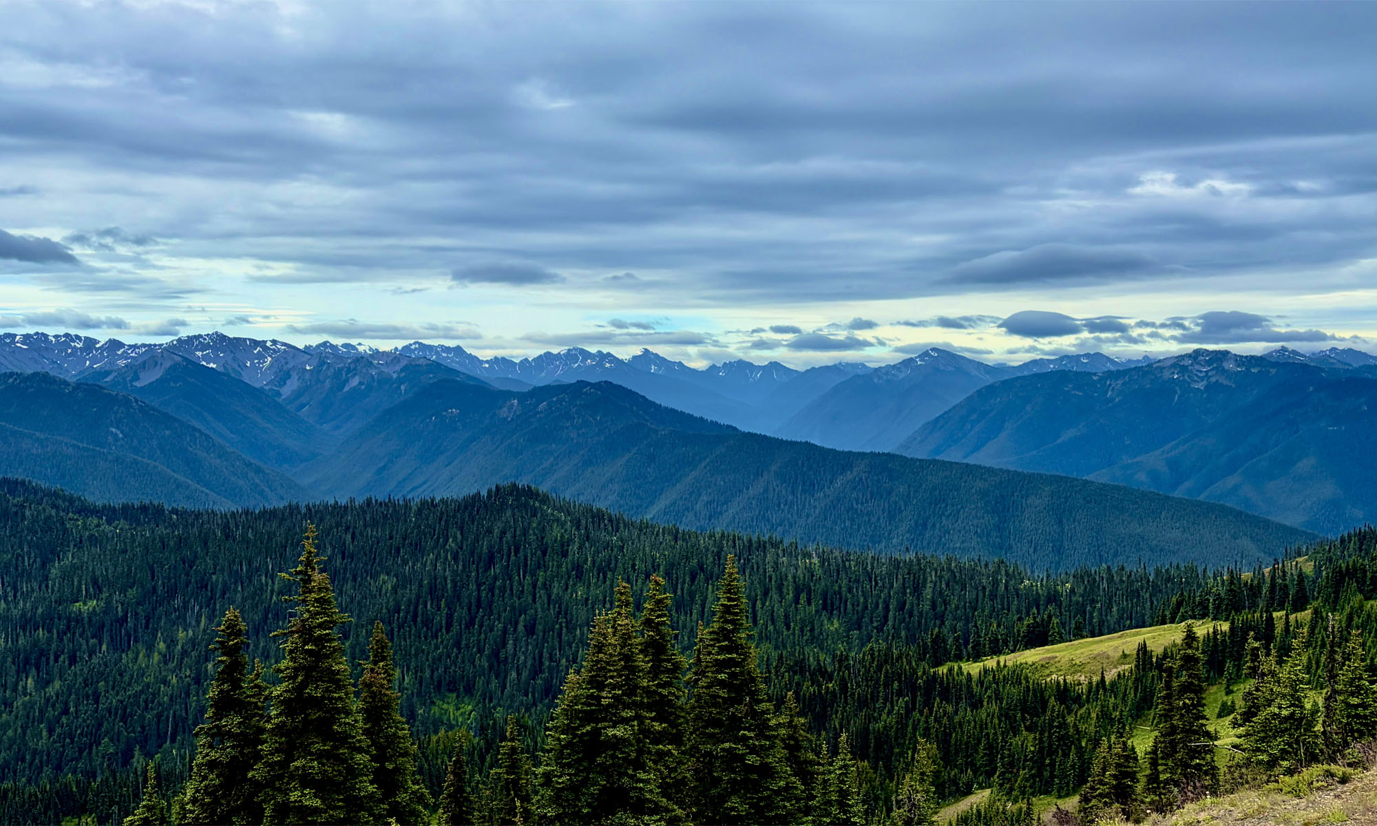
Parts of the hike to First Burroughs Mountain from the Sunrise Visitor Center are fairy-tale spectacular where you see vibrant wildflowers, green meadows surrounded by thick forested trees, and stunning views of Mount Rainier.
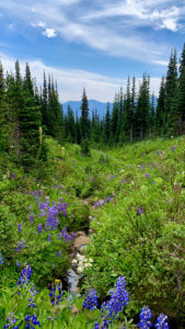
From the Sunrise Area at Mount Rainier National Park, we started on the Shadow Lake Trail headed toward First Burroughs Mountain Trail, and the first mile and a half is filled with forest, colorful wildflowers such as Mountain Indian Paintbrush, Washington Lupin and Elephant’s Head Lousewort among others, meadows, and the hike is really a pretty easy… in fact… delightful.
At about 1.2 miles, we came to Shadow Lake. Instead of heading straight on the trail, we detoured and hiked around the lake. It was cool and reflective when we were there. Overall, the trail around the lake is nice, but at about 500 feet as you hike around the lake, the trail gets a little tight as it goes up into the trees for a few feet before you come back down to the shore. As you hike around the lake and come back around, take in the view. At the right time of the year, wildflowers adorn the meadow to the northwest. Instead of going full circle, we headed back to the Shadow Lake Trail up some steps that took us back to it.
Shortly after rejoining the Shadow Lake Trail, we came to an intersection at the beginning of another meadow where going north will take you to Sunrise Camp where restrooms are available. We continued on, and from there, the trail became the First Burroughs Mountain Trail. However, we had to come to a sudden stop. About 300 feet from us, a black bear was feeding on vegetation on a hill. Along with other hikers, we stopped and watched it go about it’s business. It didn’t care that we were there. After watching it for a few minutes, we continued on.
After this point, for about the next 1.2 miles, you will climb, and this is where the trail becomes both difficult and awe inspiring as Mount Rainier seems to come even closer. The overall grade of the climb is 13.9 percent.
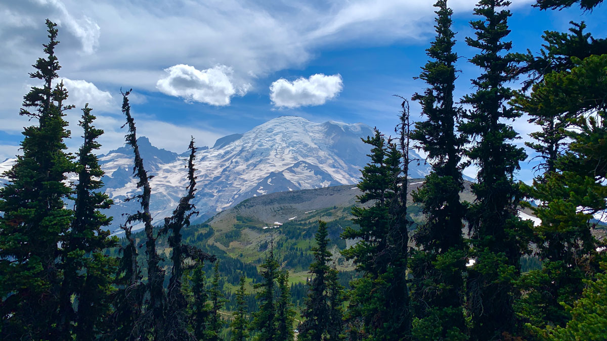
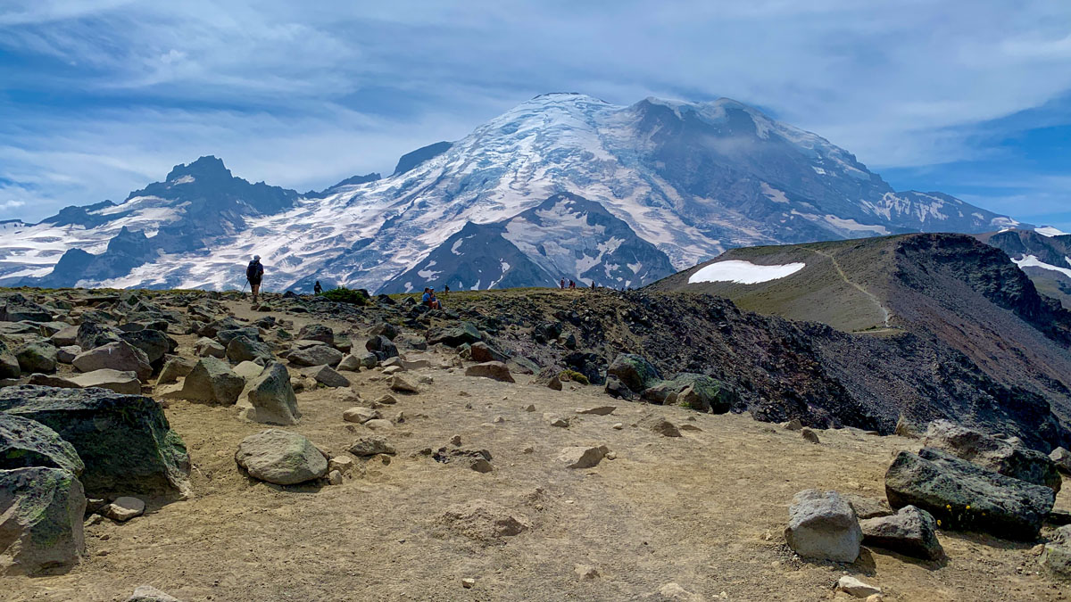
As you reach the 1.8 mile mark on the hike, if you follow my track, you’ll round a corner at Emmons Overlook where you see your first close stunning view of Mount Rainier. Just below a greenish lake. It isn’t named on any map I have, but another hiker on the trail called it Glacier Lake. Regardless of the name, take it in.
From here to the top, you climb for .8 miles on a 19 percent grade and eventually get above the tree line and enter an alpine tundra. There is some ground vegetation, but there is also a lot of shale. At one point, you also hike next to drop off if you were to fall over the side, the results would not be favorable. When we were climbing, there was a work crew working to enhance part of the trail. Just don’t hike near the edge and all should be fine.
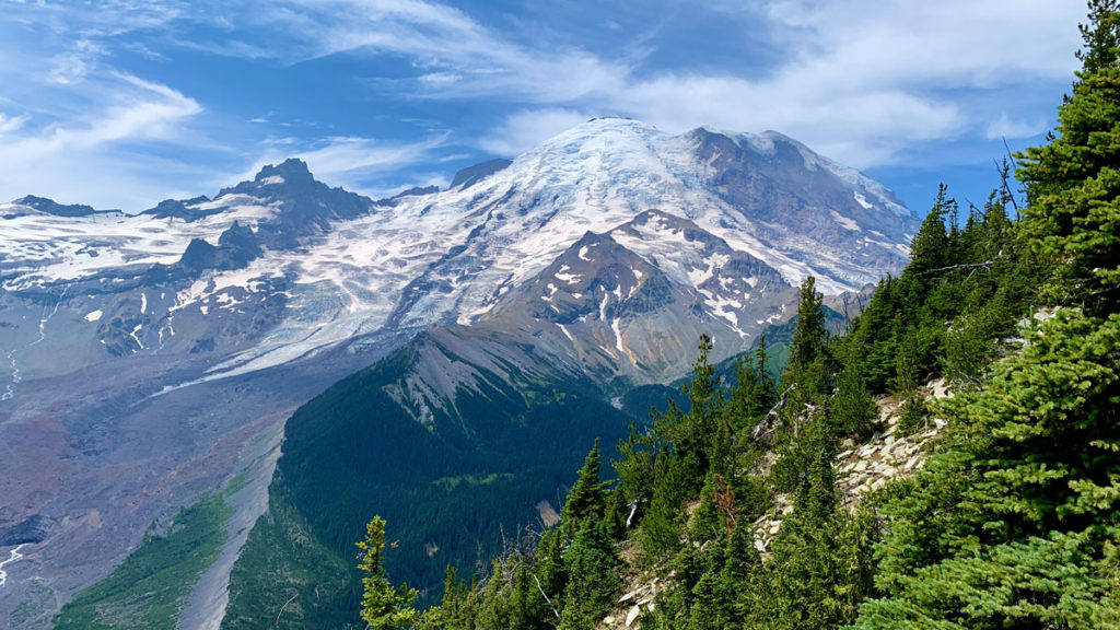
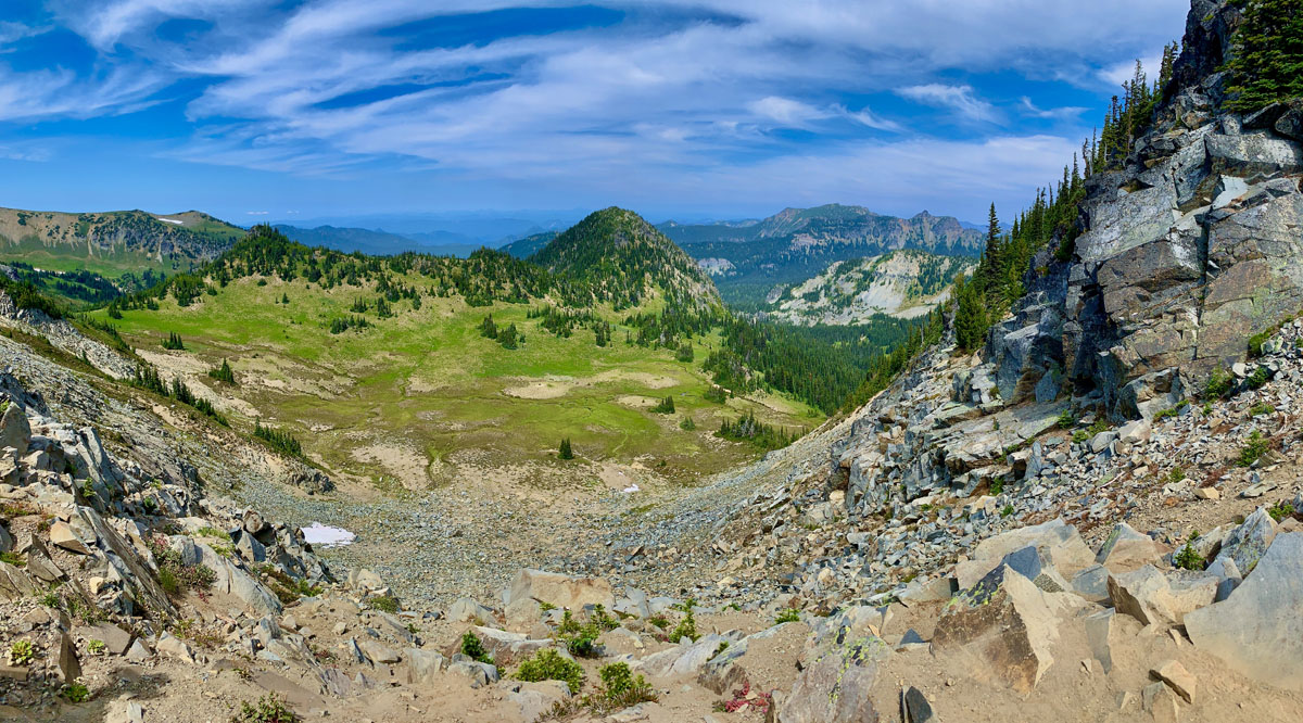
At about 2.6 miles, you come to where the grade is a calm 1.9 percent that takes you to a trail junction on First Burroughs Mountain at 2.8 miles in. If you choose to end your hike here before heading back, stop here and take in the views of the valley to the north, and Mount Rainier and its glaciers to your west in its magnificence. Every direction you look, it’s awesome. You can see trails below you to your north, and you can see the Mount Freemont Look out to the north and the trail to it. We had lunch here before we headed back down toward Frozen Lake and the Sourdough Ridge Trail.
Hiking down to Frozen lake was a relief comparted to the climb we made up, but we were still above the trees. Frozen Lake had some ice around one side of it, and it was fenced off so people cannot get into it. Is serves as the water source for the Sunrise Area of the park.
After viewing the lake, the remaining 1.4 miles back to the Sunrise Area offers beautiful views as you get back down into the tree line. Take it all in. This is a hike I’ll remember for a very long time.
When we went, it was toward the end of July when the wildflowers were in bloom. The area would be beautiful during anytime of the summer, but this made it extra special.
Directions: From Packwood, head north of Highway 123 and turn left on Highway 410 heading west. Turn left onto Sunrise Park Road/White River Road and arrive at the Sunrise Visitor Center. Parking is here: 46.914561, -121.639462
The Skinny
Trail: First Burroughs Mountain
Trailhead Coordinates: 46.914017, -121.641917
Trailhead Elevation: 6386 Feet
Distance: 5.1 Miles – Loop
Level of Difficulty: 🟠🟠🟠
Average Grade: .2%
Steepest Grade: 27.7% over .1 mile
Ascension: 1411 Feet
Trail Condition: 🟢🟢🟢🟢
Scenery: 🟢🟢🟢🟢
Nearest Town: Packwood
Challenges: Steep Climbs
Traffic: 🥾🥾
Highlights: Scenery, Wildlife
Best Time: Summer, Fall
Hazards: Hiking next to steep falls
Wildlife Concerns: Bears, Mountain Lions
Cell Service: 📵 to 📱
Would I Do This Hike Again?: Yes!
Parking: $30, which is good for 7 days in park
Restrooms: In the parking area and at Sunrise Camp