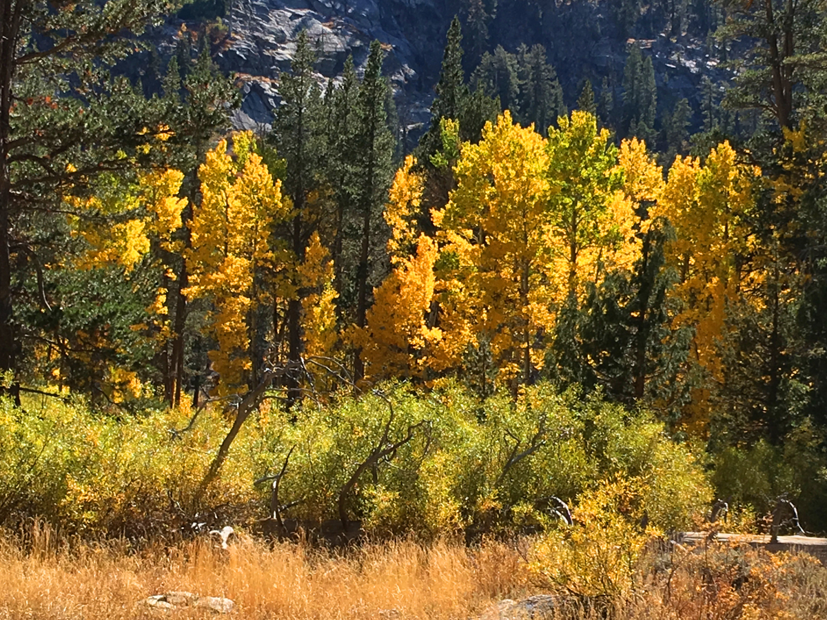
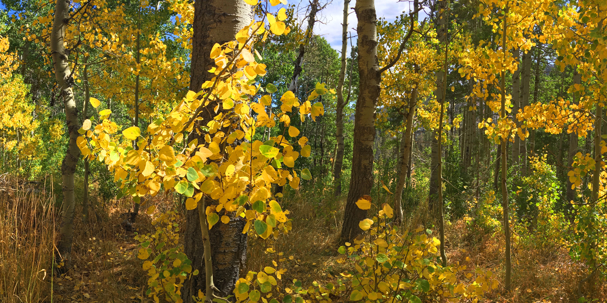
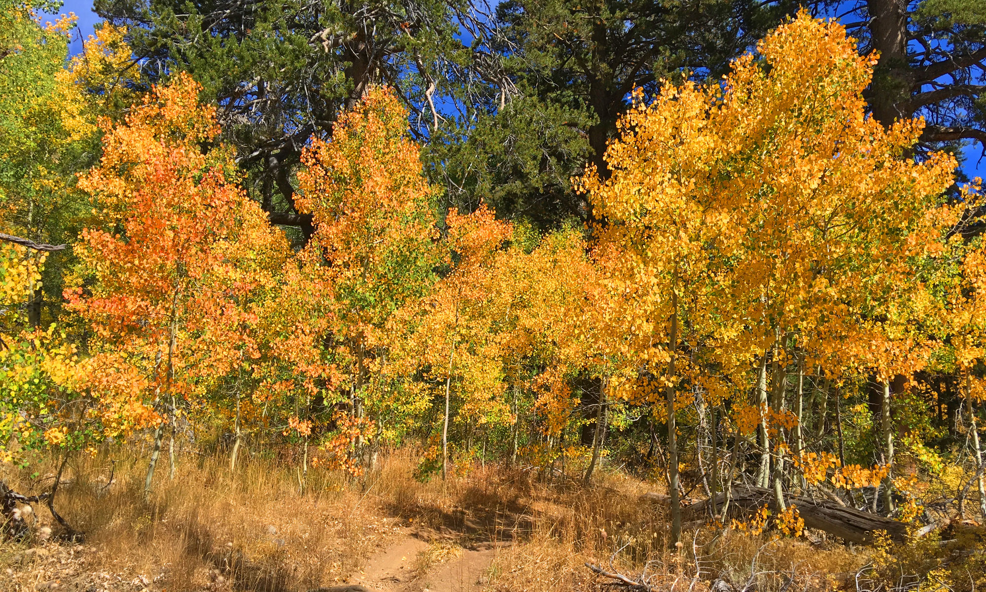
If you hike the trail to Scott’s Lake in the fall when the aspens are turning color, it will knock your socks off.
The hike starts off at the trailhead parking lot just off Highway 89 on Luther Pass, which is part of the larger Tahoe Rim Trail. You hike a pleasant .1 a mile before you come upon Highway 89 and have to cross it. Listen for traffic, as you should be able to hear it before you can see it coming around the two corners.
When you make it to .07 miles from the trailhead, you will come to a fork. Go left, but before you get there, and along the way, take in the sounds of flowing Big Meadow Creek, the pine trees and chipmunks running here and there. You will also take in splashes of fall color if you take this trail in mid to late September.
While you are on this trail to Scott’s Lake, you are ascending the entire time, but it doesn’t really feel like it. When you are hiking it, the trail does feel like it’s longer than it is. As I hiked, I kept calling Scott’s Lake “the lake that moves down the trail” as it seemed to be forever out of reach.
Along the way, the vegetation is more than passable, but it gets close to the trail on both sides in certain places, but at that same time you just want to stop and look at it. This is where “the hike becomes the destination” in places.
You will eventually come to a fence on the trail with a gate. When I hiked it, there was a sticker on it that said “county line” but nothing on it looked official. When I returned home, I checked my GPS coordinates with other maps, and it found this not to be the case. Even though you start the trial in El Dorado County and end up at Scott’s Lake in Alpine County, the line is at another location.
Scott’s Lake is a trip, but getting down to it is not. While on the trail, you will see an offshoot down to the lake. It is steep, but not too steep. Going down in is fine, but coming back up to the main trail may make your heart beat a little stronger.
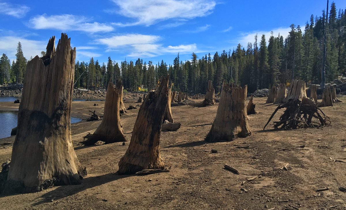
The lake was low when I went in the fall, and hiking along the shoreline was interesting. On the north side, there are tree stumps – too many to count – that made me think of the Walking Dead. It was eerie but in a fascinating kind of way. Instead of human zombies, the stumps looked like they could come alive as you walked passed them.
Directions: From South Lake Tahoe, take Highway 89 South toward Luther Pass. Follow it until you come to the Big Meadow Trailhead sign and turn here: 38.789619, -119.999513. Once off the highway, follow the road to the parking area here: 38.789436, -120.000183.
The Skinny
Trail: Scott’s Lake Trail
Trailhead Coordinates: 38.788500, -120.000812
Trailhead Elevation: 7284 Feet
Distance: 7.1 Miles – Out and Back
Level of Difficulty: 🟡
Average Grade: 5.1%
Steepest Grade: 9.9% over .2 miles
Ascension: 1061 Feet
Trail Condition: 🟢🟢🟢🟢
Scenery: 🟢🟢🟢🟢 (Fall Color)
Nearest Town: South Lake Tahoe
Challenges: None
Traffic: 🥾
Highlights: Fall Colors
Best Time: Spring, Summer, Fall
Hazards: Exposure
Wildlife Concerns: Mountain Lions, Bears
Cell Service: 📵 (AT&T)
Would I Do This Hike Again? No question about it: yes (in the fall)
Parking: Free
Restrooms: Vault toilets in the parking lot