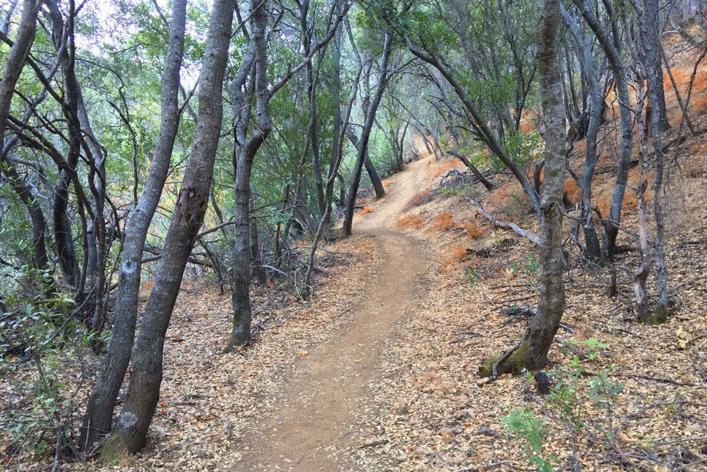
I love this hike! Hiking the Blue Ridge Trail to Fiske Peak in Northern California starts with a mild climb through an oak forest. It’s the only canopy you’ll be under during the hike. As the trail meanders up the open hillside, you’ll hike into a clear view of Glascock Mountain across the highway. Once you get to this point, the real ascension quickly begins.
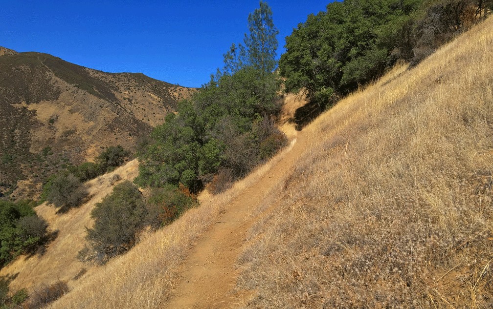
As you hike onward and upward, you’ll come to the switchbacks. Going up them this fine, but coming back, you should be careful as you can pick up speed going down in certain places, which could be hazardous if you’re not careful.
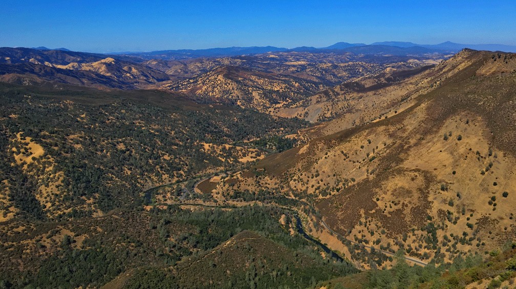
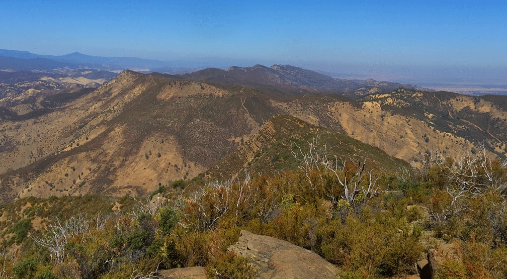
Once you reach the top, the trail levels out, and in a few minutes, you’ll come to a junction. Go left to stay on the hiking trail to Fiske Peak, or you can turn right to take an offshoot trail. You’ll meander through high chaparral and eventually lose the trail. But in the north westerly direction where you might do some scrambling, there’s a perch that looks down in the direction of the parking lot and a sweeping view of the hills and mountains from north to south. You can look over to Glascock Mountain and the Cortina Ridge.
When you’re done sitting and enjoying the view from the perch, head back south toward Fiske Peak to rejoin the trail. Because of the growth you may not find the exact way you came in order to get back down to the trail, but as long as you’re not directionally challenged, you should find it.
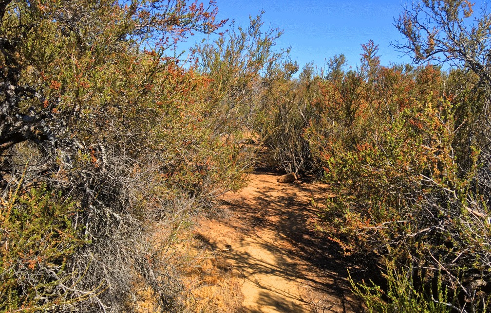
Fire burned through the area a few years back, but it is recovering with the returning growth very well – even to the point it makes the trail very narrow to hike through because of the chaparral on each side that reaches out in places and pokes you.
Continue on to Fiske Peak. The views out to the Sacramento Valley can be incredible, as well as the view of the Sutter Buttes on clear days. Parts of Capay Valley and the farms can be seen as well as Cache Creek as it enters the valley.
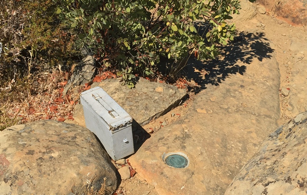
There is a log at the top of Fiske Peak in an ammo box where you can read what other visitors to the top have written about their trek and themselves. After you’ve read about them, log your visit.
It was getting late in the day, and I turned back here, but the trail does go further on to the south and eventually loops around making it around a 17-mile hike.
This trail can give you a workout, and in the summertime, the heat can be harsh. There is no water, so bring at a minimum a gallon with you, and if the temperatures make it to 85 and above, you will sweat as the sun beats down on you.
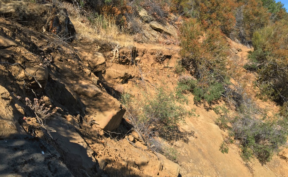
This hiking trail has some rough areas, but not many. Overall, it is well maintained, but just building this trail was an amazing achievement. As I hiked the trail, and the terrain became difficult, an appreciation of the people who constructed it often came to mind.
Directions: From Interstate 5 at Woodland, take Main Street through town where it turns into State Highway 16 and head west for about 38 miles to Cache Creek Canyon Regional Park. The parking lot is on the right where parking is not free, but if you turn left and drive down County Road 40 just a little bit, you can park on the side of the road for free. At the time of this writing, County Road 40 is closed before you get to the low water bridge. In 2017, I read that funding had been approved to make the bridge usable for traffic again, but it did not say when the work would begin.
To get to the trailhead, cross the Low Water Bridge over Cache Creek and approach the sign. The trailhead is to the left after you walk off the bridge. Climb up the trail and come to a dirt road and follow it back around and you will come to the trailhead.
The Skinny
Trail: Blue Ridge Trail to Fiske Peak
Trailhead Coordinates: 38.909917, -122.306929
Trailhead Elevation: 458 Feet
Distance: 7.7 Miles – Out and Back (from parking area)
Level of Difficulty: 🟠
Average Grade: 12.6%
Steepest Grade: 16.6% over .3 Miles
Ascension: 2,697 Feet
Trail Condition: 🟢🟢🟢
Scenery: 🟢🟢🟢
Nearest Town: Rumsey
Challenges: Steep Switchbacks, Rocky Areas of Trail, Hot Summers
Trail Traffic: 🥾
Highlights: Views, Capay Valley, Sutter Buttes
Best Time: Spring, Fall, Winter
Hazards: Temperatures higher than 85 degrees Fahrenheit
Wildlife Concerns: Mountain Lions, Rattlesnakes
Cell Service: 📵 (AT&T)
Would I Do This Hike Again?: Yes
Parking: See Above
Restrooms: In the park