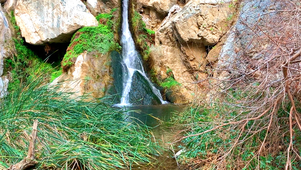
A waterfall at Death Valley National Park? Yep, there certainly is, and the hike to Darwin Falls is pretty easy for the most part.
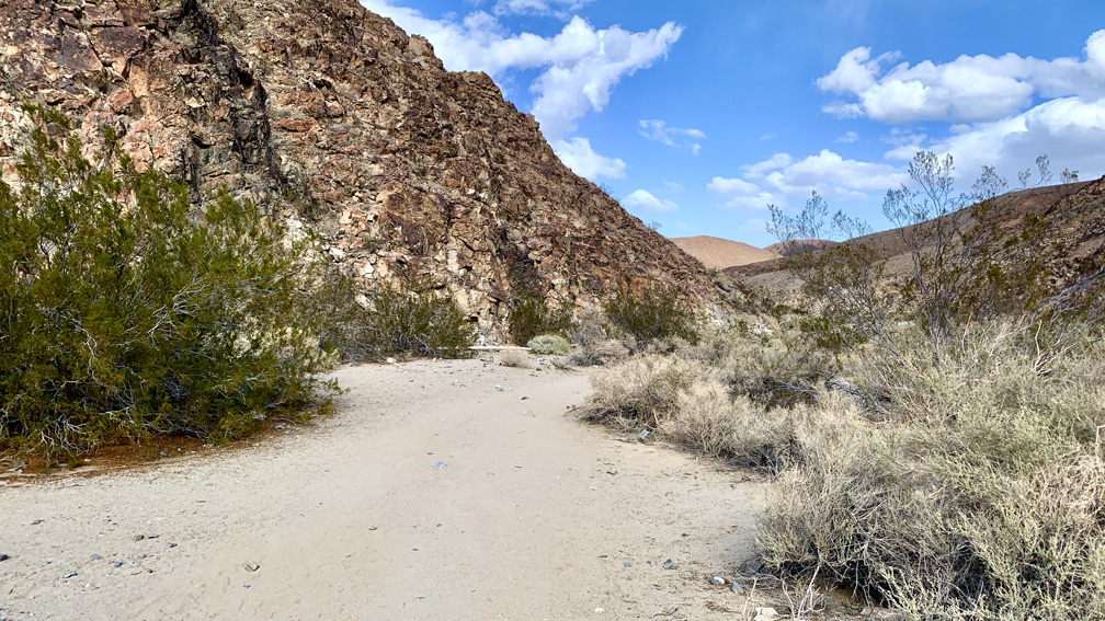
The hike starts off from the parking lot and follows a Darwin Wash back to the waterfall. We didn’t start to notice water until about .7 miles from the trailhead that flowed from the waterfall in a stream. As we ventured further back, we went from a dry desert wash to trees, cattails and other greenery, including ferns, fed by the water.
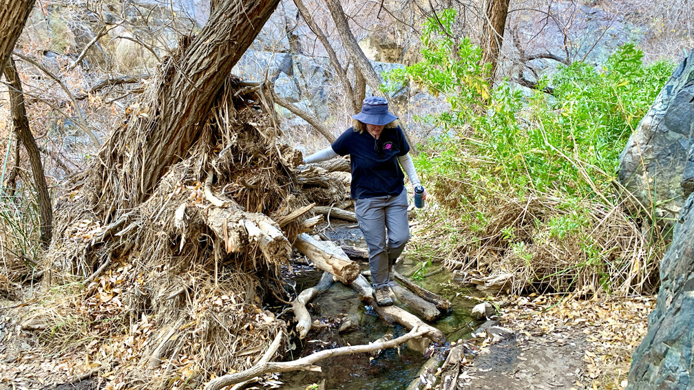
There is climbing/scrambling over some rocks on the way in and out, but it’s not that difficult, and it doesn’t last too long before you’re back on the dirt trail. Although, if your feet/footwear are wet from crossing the stream, the rocks can become slick.
We reached the 18-foot waterfall where the water pooled at the base. We hung out under a tree for a little bit and took it in. We didn’t stay too long, as the space there was limited, and there were hikers coming and going.
Darwin Falls is spring-fed, so it’s a year-round fall. It’s on the outskirts of the park, but it’s worth seeing. We stopped there on our way out of the park. While we visited the site in January, in the summertime or when it’s warm, swimming is prohibited, as the water is the drinking source for Panamint Springs. You’ll see the piping along the trail as you hike in.
If you choose to hike this trail in the summer, it is advised you do not start hiking after 10 a.m. due to the heat.
Directions: From Panamint Springs, head southwest on California Highway 190 for 3.3 miles to Old Toll Road. Turn right onto Old Toll Road and follow it for 2.3 miles to the parking area. Parking is here: 36.328002, -117.514453. Old Toll Road is not paved, is rocky and can be rough.
The Skinny
Trail: Darwin Falls
Trailhead Coordinates: 36.327830, -117.514650
Trailhead Elevation: 2497 Feet
Distance: 2.2 Miles – Out And Back
Level of Difficulty: 🟢 (See Summary)
Average Grade: 7.4%
Steepest Grade: 16.3% Over 317 Feet
Ascension: 524 Feet
Trail Condition: 🟢🟢🟢
Scenery: 🟢🟢
Nearest Town: Panamint Springs
Challenges: Muddy Water Crossings, Hiking Over Rocks
Traffic: 🥾🥾
Highlights: The Waterfall
Best Time: Fall, Winter, Spring
Hazards: Hiking Over The Rocks, Heat
Wildlife Concerns: Rattlesnakes
Cell Service: 📵 (AT&T)
Would I Do This Hike Again?: No
Parking: Parking At The Trailhead. $30 At The Time Of This Writing To Enter The Park; Good For 7 Days. The Parking Area Is Small.
Restrooms: None