Cronan Ranch Regional Trails Park is a playground of trails in the foothills. We hiked in the valleys and over high points that showed off the snowcapped Sierra Nevada Mountain range in the distance.
On this hike, we covered portions of several trails on our 11.5 mile hike. We hiked the River Trail to the Gerle Loop Trail; Down and Up Trail to the Cronan Ranch Road; South Fork American River Trail to the West Ridge Trail. We hiked back to the Cronan Ranch Road and the Down & Up Trail to Sky Ridge Trail. We reconnected with the Connector Trail and back to the Gerle Loop Trail. Wow, that’s a lot of trails!
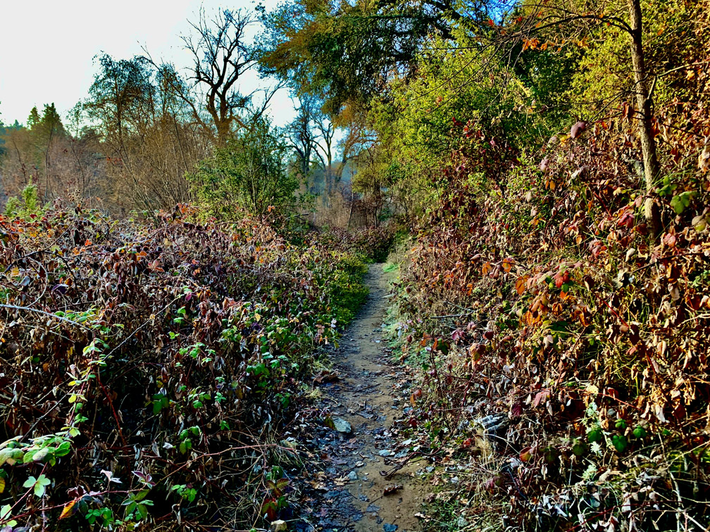
We started our hike on the River Trail from the Greenwood Creek River Access parking lot. This particular trail needs to be trekked with caution because of the heavy poison oak close to the trail on both sides for up to half a mile. I hiked this trail in January, and the poison oak was not dormant and still thick with leaves. As beautiful as this part of the hike is, I would not advise this portion of the trail in the summer.
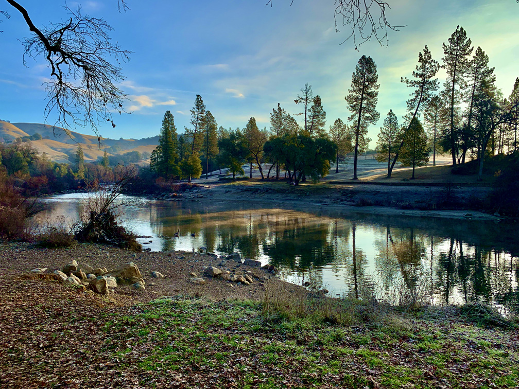
The trail along the river is nice. We were there early on a winter morning, so we didn’t see other people. In the summer it probably gets pretty heavy with people as the weather warms.
After 1.2 miles, you’ll come to a junction that heads up hill. It’s unmarked, but the River Trail heads up on a slope to the Gerle Loop Trail. Follow it through an oak forest that leads to an overlook of the South Fork of the American River at a picnic table. After you’ve enjoyed the view, continue on the trail that will take you into the forest where the trees start to change from oak to pine.
From there, we hiked along the Connector Trail which offered a bench to stop and take in another view of the South Fork of the American River. The views were sweeping. After snacking, we hiked until we came to the Down & Up Trail and went left and followed it toward the river under mostly oak canopy heading down a hill and then up.
We came to a junction where the Down & Up Trail intersected with Cronan Ranch Road, which we took and moved closer to the river. The road is well maintained, and it looked down on the river and homes across it. There are also three vault toilets on this road.
It was still early in the morning when we got to this point, and we only came across a few people; some were on horseback, others were on mountain bikes and hikers. The road turned inward away from the river at another junction, and we came across the “Love Comes Softly” movie set where only one cabin still stands and is fenced off. There were a couple of picnic tables under oak trees there as well.
We hiked on and then turned off the road onto South Fork American River Trail and followed it for .07 miles when we came to the West Ridge Trail where the harder climbing began for about a mile over a 10 percent to 11 percent grade. Normally this wouldn’t be too difficult, but considering the up and down 5 miles we already hiked, muscle fatigue started to set in.
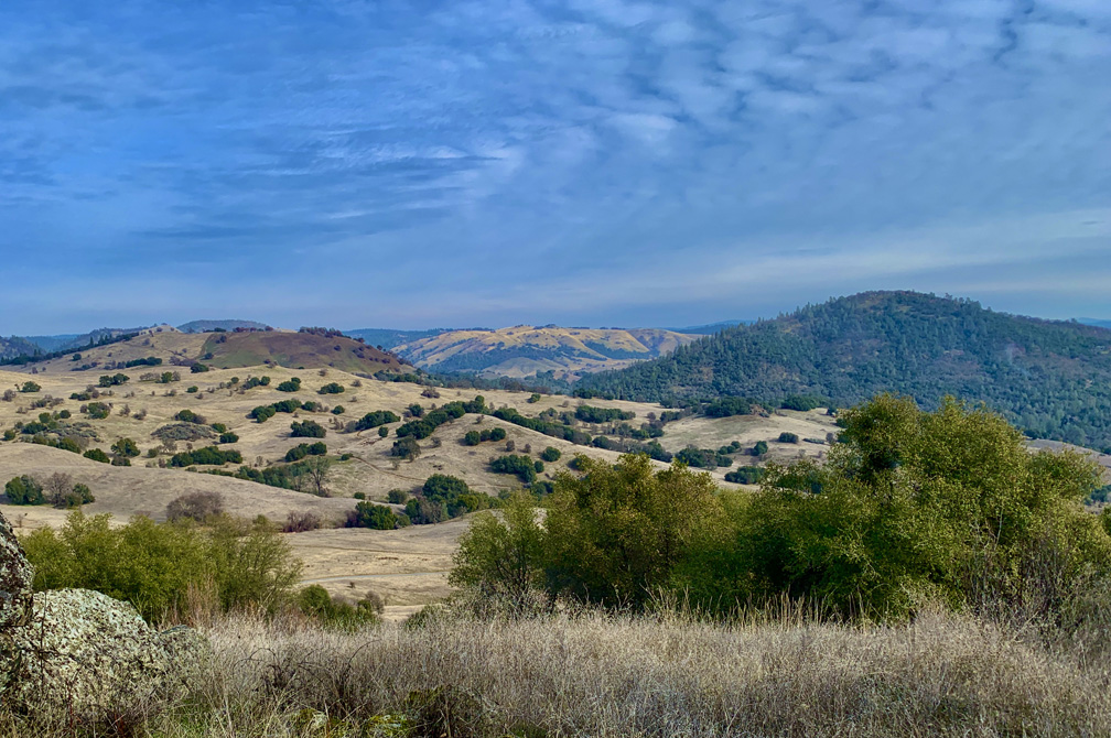
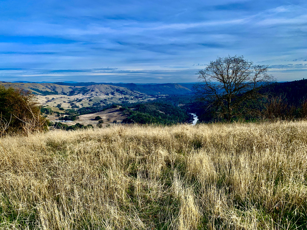
Once we got to the top, the views were incredible. To the east, we could see the snowcapped Sierra Nevada Mountains. Behind us to the west was a canopy covered ridge with homes dotting it. Both sights were beautiful.
We did notice when we were hiking up the West Ridge Trail, with very few exceptions, the vast majority of hikers, horseback riders and mountain bikers were coming against us. Clearly, we realized we came up the hard way. Climbing up the “popular” way is a 9 percent grade over a half mile stretch.
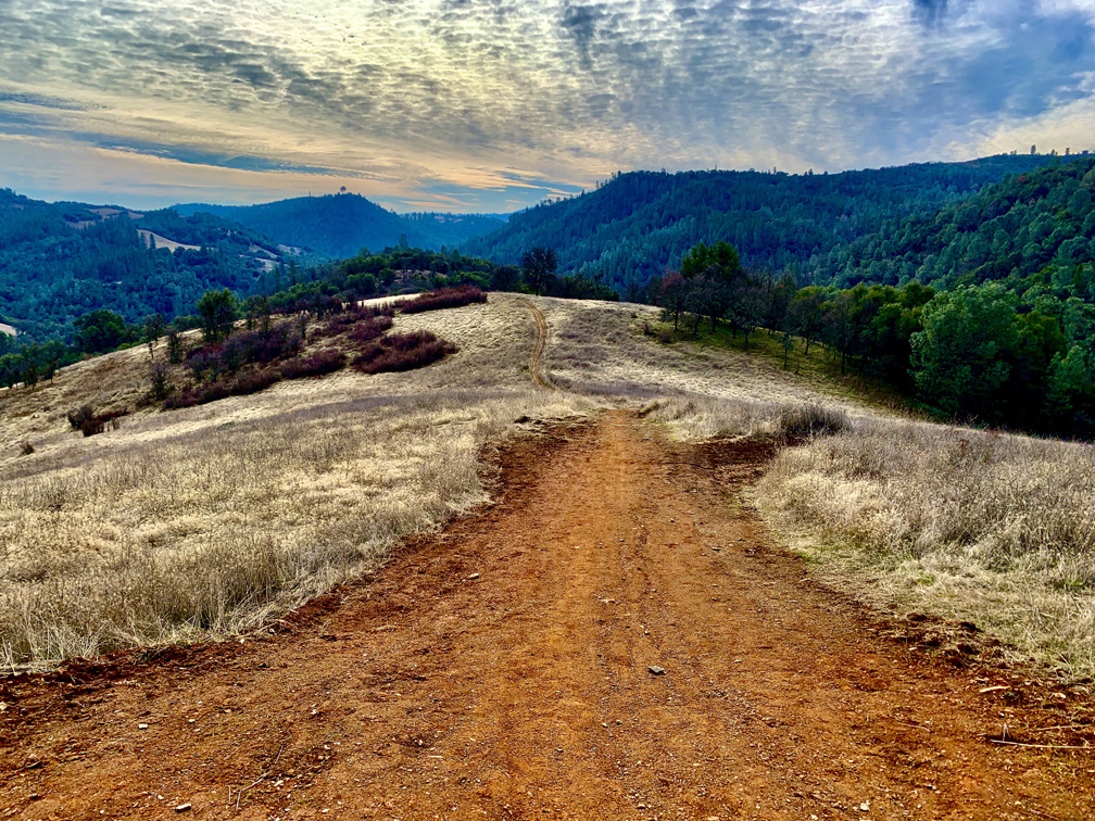
Once we got down off the grade, we were back on the Cronan Ranch Road, and we followed it for .01 miles until we came to the Down & Up Trail junction. We took it and hiked .09 miles to the Sky View Trail and started an exposed ascent.
The climb was on a 14.4 percent grade over .4 miles. It wouldn’t have been easy anyway, but given how muscle fatigued we were, it was a slow climb. Once we got to the top, the views were very similar and as striking as the views from the top of the West Ridge Trail. To the east, there is more of a look at the valley leading over to the West Ridge where we were. The climb was worth it.
Heading down was easy on a single track trail with a handful of switchbacks under canopy. From there, we reconnected with the Connector Trail and followed it around until we came out at a junction at the Gerle Loop Trail, and we followed it back exposed as it was butted up next to the foothills to the parking lot.
This was a fantastic hike. While I plan on going back to explore other trails at the Cronan Ranch Regional Trails Park, I will not attempt this particular hike again. The length was too long and tiring for the terrain it covered.
Note: I was using a Gramin GPS with version 3 of Topo West 24K, which is the current version at the time of this writing. None of the trails at Cronan Ranch Trails Park are on this version of their product. Cronan Ranch Trails Park has existed since 2006, so there’s no telling when or if Garmin will include the trails in their product. If you want to download maps to import on your Garmin handheld with the trail maps on them, visit GMapTool for OSM maps. All Trails also offers trail maps for this area for your smart phone.
Directions: From Shingle Springs, take the Highway 50 take exit 37, South Shingle Road and turn right onto North Shingle Road which turns into Green Valley Road. Green Valley Road turns into Lotus Road. Follow it to Highway 49 and turn left. Follow Highway 49 for 3.1 miles and turn left. Parking was here: 38.826415, -120.949143
The Skinny
Trail: Multiple Trails in Cronan Ranch Regional Trails Park
Trailhead Coordinates: 38.825643, -120.946704
Trailhead Elevation: 679 Feet
Distance: 11.5 Miles – Loop
Level of Difficulty: 🟠
Average Grade: 1.6%
Steepest Grade: 14.1% Over .4 Miles
Ascension: 2002 Feet
Trail Condition: 🟢🟢🟢🟢
Scenery: 🟢🟢🟢
Nearest Town: Lotus
Challenges: Steep Climbs, Distance
Traffic: 🥾🥾🥾
Highlights: Rolling Oak Forests, South Fork Of The American River, Views of the Sierra Nevada Mountain Range
Best Time: Fall, Winter, Spring
Hazards: Temperatures Higher Than 90 Degrees Fahrenheit, Poison Oak
Wildlife Concerns: Mountain Lions, Rattlesnakes
Cell Service: 📱📱📱 (AT&T)
Would I Do This Hike Again?: Yes and No; See Summary
Parking: Free
Restrooms: In the parking lot, along the River Tail and on Cronan Ranch Road