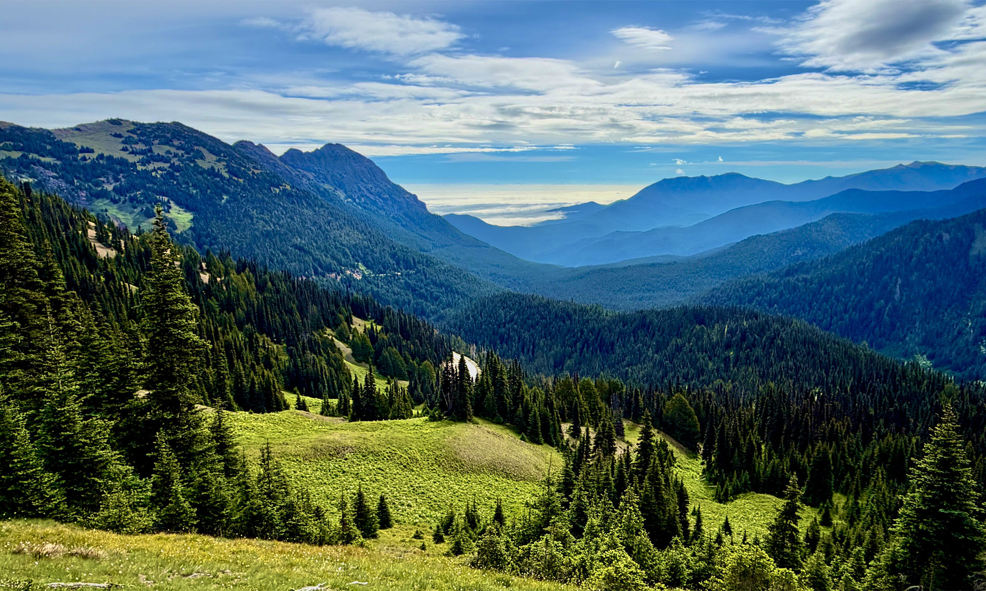
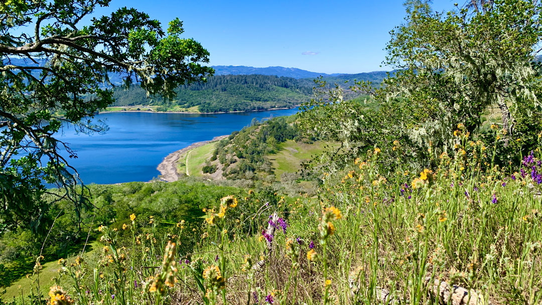
This is a very pleasant trail in the Napa Foothills where you eventually end up looking over Lake Hennessey from Conn Peak, especially in the springtime when the hills and trees are all green and the wildflowers are popping.
The hike through the hills is a climb all the way to the top, but overall, it’s not a difficult climb and under canopy most of the time. At the right time of the year, you can see California poppies, lupin, blue dicks, vetch, sticky monkey flower, and buttercups among others. Along the way, there are also three American century trees you’ll see.
If it’s a good spring, the lupin can be very bountiful. I wouldn’t go as far to say what we saw was a superbloom, but they were prolific on some of the hillsides and by the trail.

When I previously hiked the Lake Hennessey Unit, where Conn Peak is, I had to cross through a moving stream, but a small bridge has since been built. Take your time and enjoy the hills as you begin your ascent under oak forests on the single track trail.
At about .4 miles from the trailhead, you’ll come to a junction at the Whiskey Ridge Trail, and this is the way we went. After you make the turn, you’ll climb for about 1.1 miles on a 5.3 percent grade overall where you’ll come to a confluence of trails. The Whiskey Ridge Trail, the Alta Hennessey Trail and the Conn Peak Trail all converge. One of the nice things about this is on the Alta Hennessey Trail, there is a bench under the oaks you can sit on and gaze out at Lake Hennessey and the hills behind it.
When you’re ready to move on, you’ll hike for slightly more than half a mile on the Conn Peak Trail and will come to the Conn Peak Summit Spur. Take the spur, and then you’ll climb slightly more than .2 miles to the top on a 3.8 percent grade. Take your time as you venture to the top and take in the views. At the top there is a picnic table. Stay a while and continue to take in the views before heading back down.
When we headed back down the spur, we got back to the Conn Peak Trail and went to our right to continue on. You could also go back the way you came and instead of heading back down the Whiskey Ridge Trail, you can take the Alta Hennessey Trail back down. This will shorten your hike slightly and get you back to the parking lot sooner.
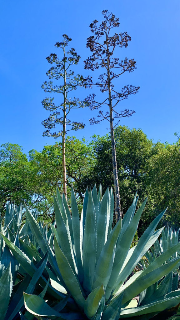
We continued on down the Conn Peak Trail to the Shoreline Trail. Along the way, there was a clearing where someone planted American century trees. We got off trail to look at them for a little bit and then continued on. We made our way to the Shoreline Trail, which is mostly level on a .1 percent grade overall. The Shoreline Trail is a actually a fire road, so it’s nice and wide. After about 1.35 miles, the road ends, and you’re back on the single track trail, the Chiles Creek Trail, which you actually started on, and you’ll come across the Whiskey Ridge Trail Junction you climbed up on as you hike past it to the parking lot.
One thing to note about this hike is that you will have to share the trail with mountain bikers. There are places where this can get really tight on the single track trails on sides of the hills where you may need to get out of their way. This can be difficult, as next to you is a downhill drop and on the other is an embankment that is too steep to hold your footing on.
Directions: From Winters take Highway 128 West and follow it to Lower Chiles Valley Road in Napa County. Follow Lower Chiles Road to Chiles Pope Valley Road to Moore Creek Park. The parking coordinates are here: 38.510050, -122.355620
The Skinny
Trail: Conn Peak at Moore Creek Park
Trailhead Coordinates: 38.510030, -122.355620
Trailhead Elevation: 418 Feet
Distance: 5.3 Miles – Lollipop
Level Of Difficulty: 🟡
Average Grade: 4.6%
Steepest Grade: 26.2% Over 441 Feet
Ascension: 1487 Feet
Trail Condition: 🟢🟢🟢🟢
Scenery: 🟢🟢🟢
Nearest Town: St. Helena
Challenges: Single Track Trail With Mountain Bikers
Traffic: 🥾
Highlights: Scenery, Wildflowers
Best Time: Spring, Summer, Fall, Winter
Hazards: Poison Oak, Temperatures Over 90 Degrees Fahrenheit
Wildlife Concerns: Mountain Lions, Rattlesnakes; An Occasional Bear
Cell Service: 📱 (AT&T)
Would I Do This Hike Again?: Yes
Parking: Free
Restrooms: Portable Toilet In The Parking Area