This is a continuation of the Redbud Trail summary I wrote about in 2018. The total length of Redbud Trail (one way) is about 7.5 miles to Wilson Valley where it meets the Judge Davis Trail at Cache Creek. To read about the first 2.5 miles of the hike, see my Redbud Trail to Baton Flat summary. We pick up here at Baton Flat.
When you get to Baton Flat, Cache Creek flows between the flat and the other side where the trail continues. Where the trail takes you may not be the best place to cross if there is water in the creek, as it is rocky and slick. If you don’t want to get your shoes/boots wet, it’s a good idea to bring water shoes or sandals. It’s also a really good idea to bring a trekking pole, as the algae on the rocks makes the crossing slick which will help you keep your stability. Two poles are better. So, we found a more “narrow” spot to cross just a little ways down from Baton Flat. Look at my GPS tracks to see where the crossing is. The current was a little strong, but not bad or too deep at the time we crossed.
After we crossed, we headed in the direction where the trail picked up. We also passed by a couple of fire rings, and the area would make a great place to camp. As we headed on, we found the trail about .10 miles from where we crossed the creek and started to follow it. At 38.976058, -122.517573 (mark this on your GPS) the trail looks like it heads on because it’s well defined, and the real trail is easy to pass by, which we did. While on the false trail, we came to another another fire ring, and we saw what looked like could be the trail going on, and we took it, and ended up getting exposed to poison oak and turned back around.
A check of my GPS showed we were off course but near the trail. Getting there was rugged and took us through more poison oak while on what looked like was a trail at one time. Once we made it to the actual trail, the going was a little easier, but we kept checking the bushes we passed to avoid any poison oak. On the way back, we managed to stay on the appropriate trail and saw very little poison oak.
As we moved on, the trail widened here and there, but we also had to straddle fallen trees in the way in a few places. The area also became less dense with vegetation close to the trail.
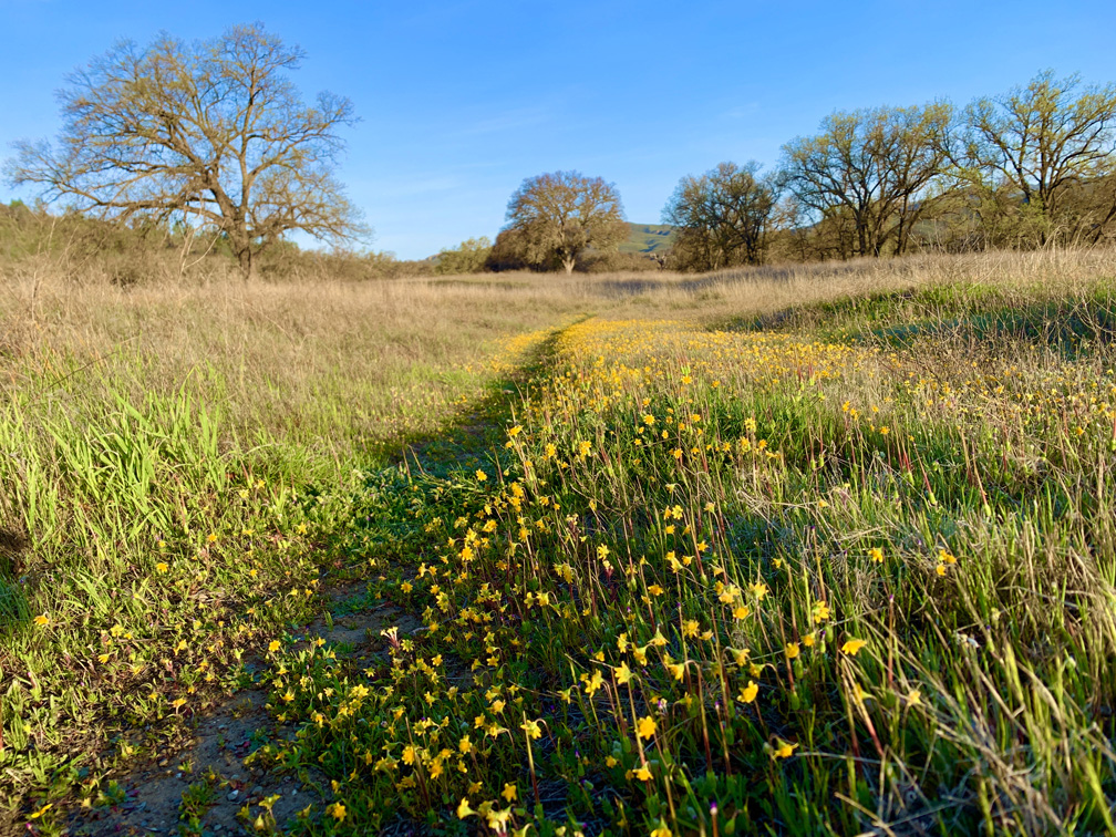
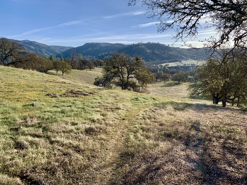
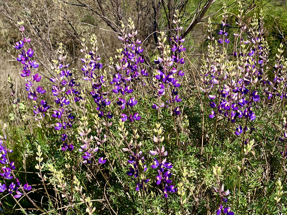
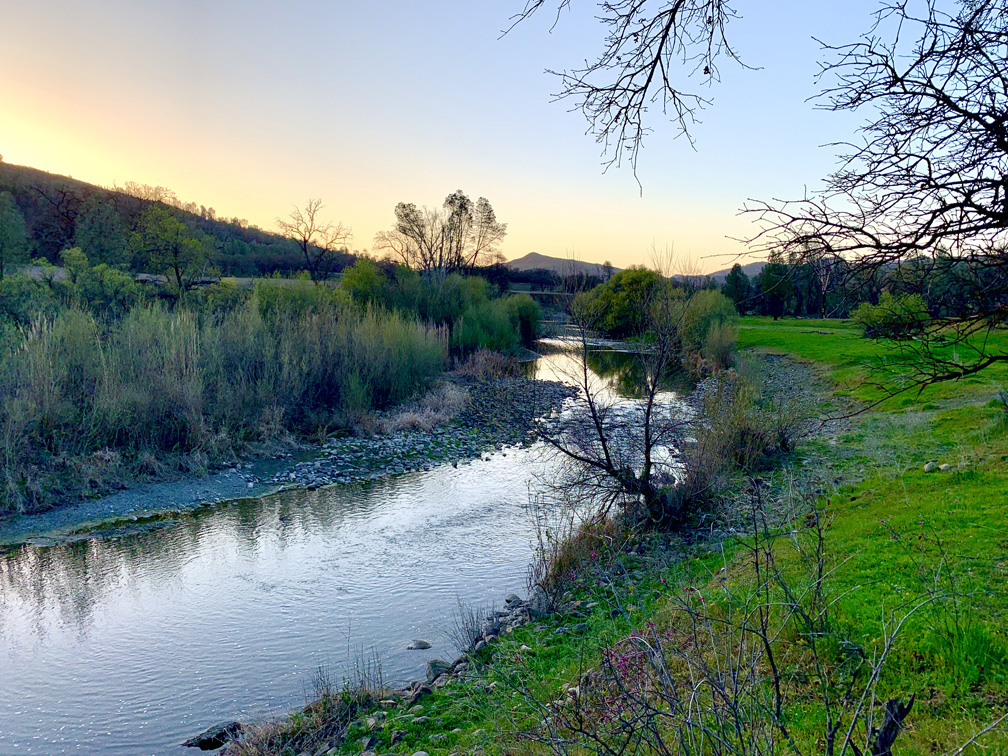
While hiking, there was an area we passed that opened up overlooking the creek that looked like it could have made for several great camping spots as we soldiered on and started to ascend. It was a nearly 10 percent grade over 1.4 miles. As you rise, you also start to come out from under the canopy, and the views of the hills are beautiful. In the springtime, wildflowers bloom, including California poppies, lupin, and redbud here and there, among other colorful flowers.
One constant along the hike was birdsong. Almost everywhere. We heard mourning doves, turkeys gobbling at one point, Western meadowlarks, California quail, acorn woodpeckers, a hawk, red wing blackbirds, a belted kingfisher and others I couldn’t identify by sound. At night when we camped by the creek, we listened to the frogs and crickets.
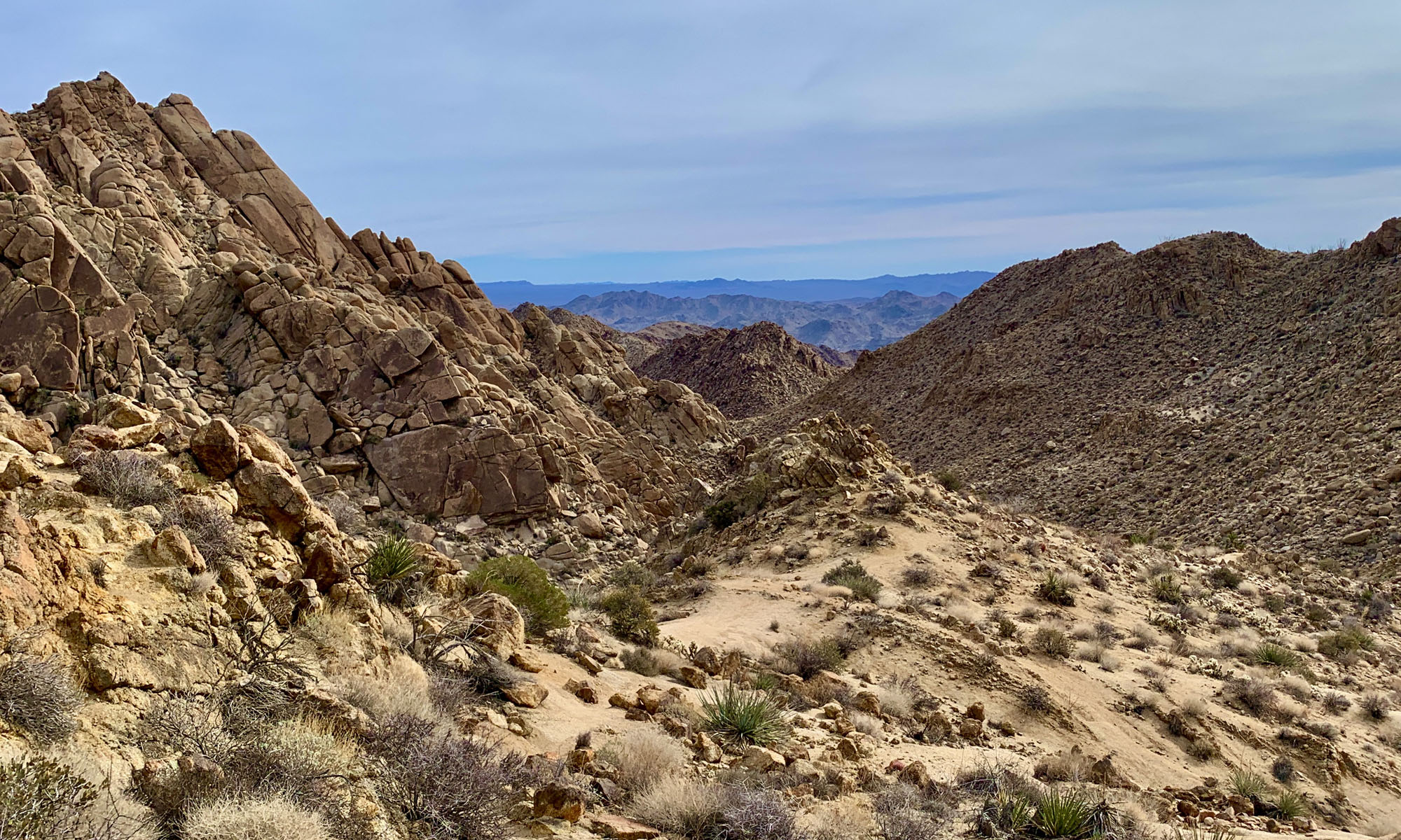
As we climbed to the highest point, from 1264 feet to 1339 feet, we hiked through high chaparral for about half a mile. It’s a pleasant hike if the weather is not too hot. Once you reach the peak, you start a .83 mile descent on a 9.5 percent grade back into a foothilly valley with oak trees. From the top it looks like it’s going to be a monster to climb back up, but it’s really not that bad. There were a couple of times we stopped to catch our breath on the way back and drink some water. When you finally get to where it flattens out on the descent, you come to Rocky Creek.
We could see where the trail picked up from Rocky Creek on the other side, and had to climb down into the creek bed to cross it over rocks. When we were there, the creek was dry. In a wet year, it may not be crossable as it was quite wide and very rocky. If the creek is not crossable, and you’re looking to camp, there is an open area if you were to follow Rocky Creek in the direction of Cache Creek. We did see a camper who set up there a couple of hundred yards from the trail.
Once on the other side of Rocky Creek, we entered Wilson Valley. It was beautiful and open with oak trees dispersed here and there, and yellow wildflowers along the trail. After about half a mile we didn’t know it, but we got off the main trail and started following another one. Once we got down off a small slope, we realized we weren’t on the trail. Where we lost the trail, the main trail wasn’t as “developed” as it had been, and we couldn’t distinguish it from game trails that ran through the area. I looked at my GPS to get us back on track, but really, all you have to do is have a good sense of direction, and you’ll figure out the general way you need to head in with Cache Creek to the north of you.
In about half a mile the trail ends at Cache Creek, but if the water is low enough, you can cross it to where there is great camping near the Judge Davis Trail. The crossing here is slick as well with algae on the rocks, and the water is a little deeper, so trekking poles really helped us cross the creek. While we were completely isolated, we found three fire rings up on the embankment overlooking Cache Creek. Two were in the open, but one was under some trees, and we made camp there.
We didn’t know it until the next morning, but there were other campers about .3 miles away from us. We never heard them or saw any light from their camp in the night, but we saw them when we were on our way out.
While I would not hike this trail again to camp where we did, I really did enjoy the hike and the camping. If I were to camp in the Redbud Trail area again, I would stay closer to Baton Flat after the creek crossing.
One thing to keep in mind is that while we were in the Baton Flat area, we encountered hunters on both days. Just be alert.
Directions: From Interstate 5 at Williams, take Highway 20 west about 29 miles to the North Fork Cache Creek/Redbud Trailhead. The trailhead provides parking, maps and information for hiking and equestrian access. From Clearlake Oaks, travel east on State Highway 20 for 8 miles to the trailhead.
This Skinny
Trail: Baton Flat to Wilson Valley
Trailhead Coordinates: 38.977380, -122.519450 (At Baton Flat)
Trailhead Elevation: 1,013 Feet
Distance: 15 miles – Out And Back
Level of Difficulty: 🟡
Average Grade: .03%
Steepest Grade: 13.7% over .3 Miles
Ascension: 1420 Feet
Trail Condition: 🟢🟢🟢 (Overall)
Scenery: 🟢🟢🟢
Nearest Town: Clearlake Oaks
Challenges: Summer heat
Traffic: 🥾
Highlights: Scenery, Isolation, Tranquility
Best Time: Fall, Spring
Hazards: Poison Oak, Temperatures over 90 Degrees
Wildlife Concerns: Mountain Lions, Rattlesnakes, Wild Hogs
Cell Service: 📵 (AT&T)
Would I Do This Hike Again?: Maybe
Parking: Free
Restrooms: Vaulted toilet in the parking lot