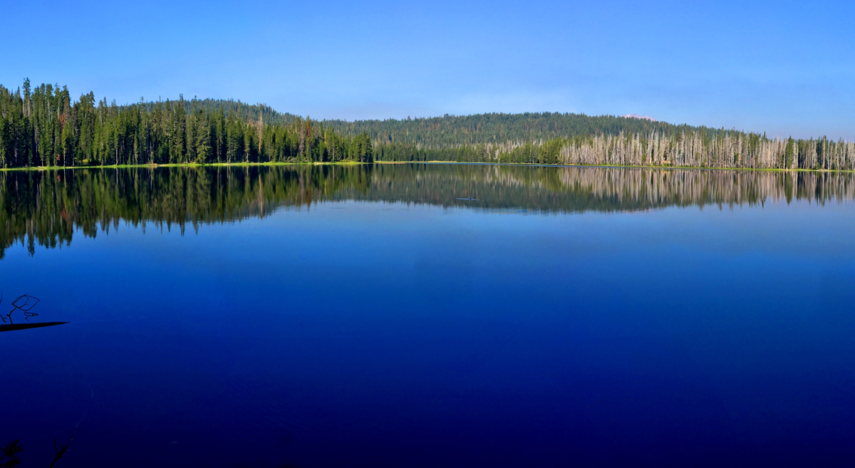
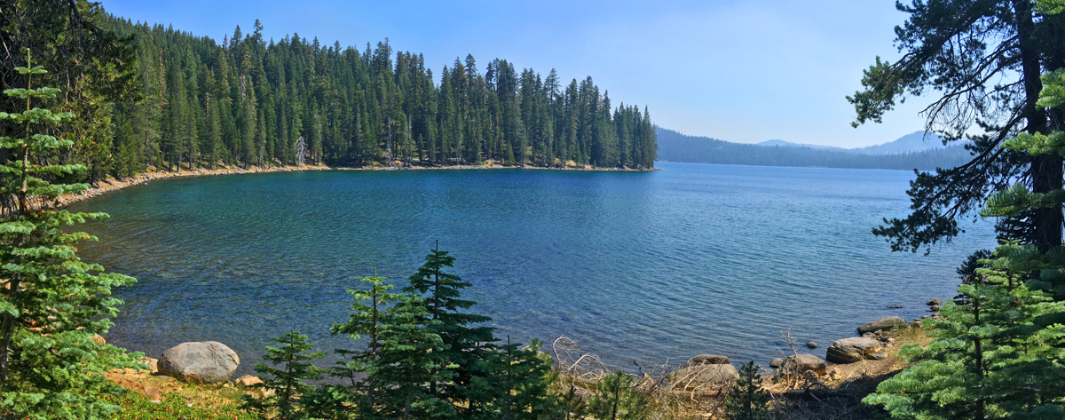
Horseshoe Lake in Lassen Volcanic National Park offers an awesome view, and is what makes this hike worth it. I got to experience the lake early in the morning before I saw any other hikers. It was beautiful, and even though I consider the entire hike the destination, just looking at Horseshoe Lake is a destination.
The hike to Horseshoe Lake begins on the north end of Juniper Lake and goes for slightly more than a mile before you come to a fork where you will want to take a left. The trail doesn’t go down to the shore of the Horseshoe Lake, but it starts to come into view a little more than a tenth of a mile from the fork. To see the lake, you’ll have to leave the trial and take a small jaunt down to the shore. The view is magnificent, and you can see the tip of Mt. Lassen over the tree line to the west of you. Just take the in the lake and the natural sounds.
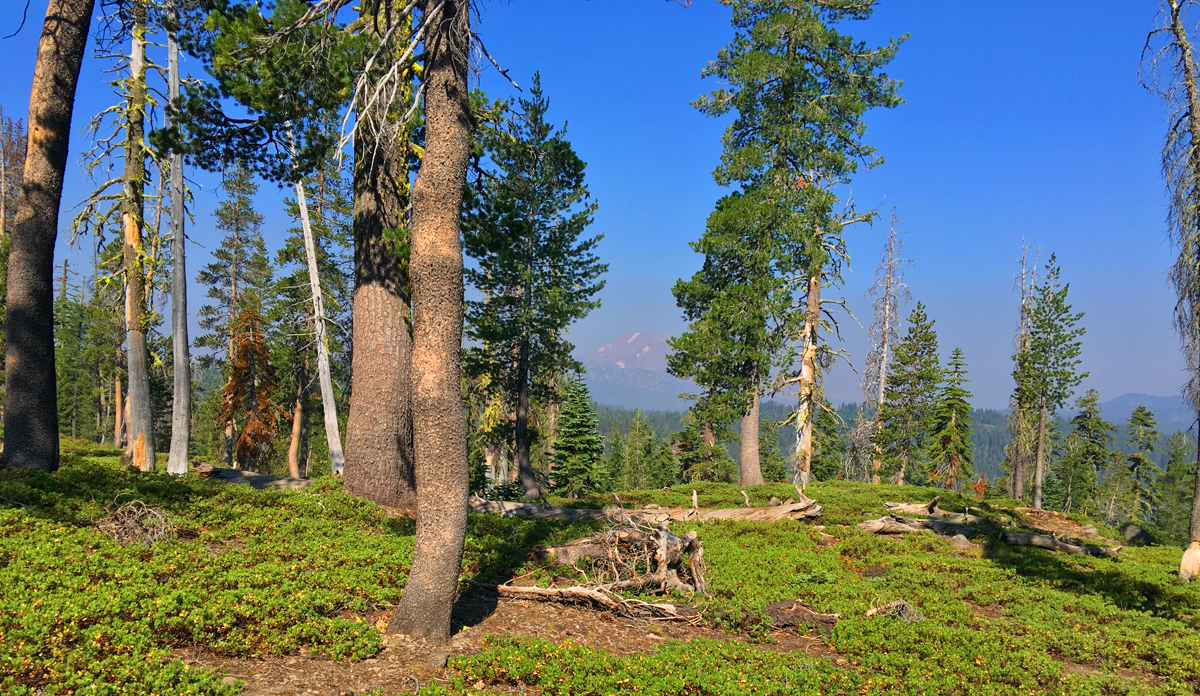
The climbing begins shortly after you leave the lake and move on for about a mile. The climb is only about 550 feet, but it’s on a nearly 12 percent grade. As you get higher, look behind you from time to time and peer out at Mt. Lassen as it rises over the tree line while you ascend.
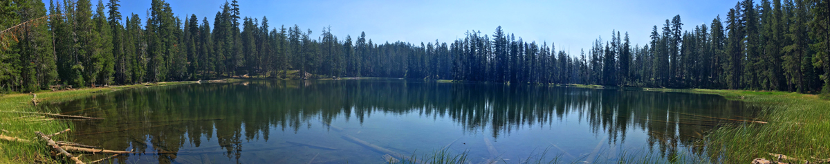
As you continue on, you’ll come to an offshoot trail to Indian Lake. It’s worth the .15 mile hike down to the lake where you can sit on a log or along the shore and rest or have a snack and enjoy the view of the small lake.
You will come to a junction at the final leg of the trail. Go north – it’s a little more than two miles back to the trailhead. Along the way, the hike gets kind of hilly going up and down and reaches no more than a 6 percent grade at its longest climb. The maps I have make it look like you’re hiking along the lakeshore, but that’s not actually the case. You’re up above it quite a bit, but while the views are beautiful, they are obscured by trees you’ll have to peer through mostly. The trail turns into a private road that is okay for hikers to use, but please don’t stray off the road and respect the privacy and rights of the people who own the cabins.
Directions: From Chester, take Feather River Drive to where it turns into Chester Juniper Lake Road. About 6.5 miles in, the pavement runs out at a fork in the road, but keep right. Follow it until the end where you’ll come to a parking area here: 40.466583, -121.308250 on the north end of Juniper Lake. The road does go on, but at that point, it becomes private.
The Skinny:
Trail: Juniper Lake to Horseshoe Lake Loop
Trailhead Coordinates: 40.466683, -121.309233
Trailhead Elevation: 6803 Feet
Distance: 7.5 Miles – Loop
Level of Difficulty: 🟠
Average Grade: 0% (Because It’s a Loop)
Steepest Grade: 12.1% over half a mile
Ascension: 1250 Feet
Trail Condition: 🟢🟢🟢
Scenery: 🟢🟢🟢🟢
Nearest Town: Chester
Challenges: The Ascent
Traffic: 🥾
Highlights: Horseshoe Lake
Best Time: Summer, Fall
Hazards: Exposure
Wildlife Concerns: Bears, Mountain Lions Cell Service: Scant (AT&T)
Would I Do This Hike Again?: Absolutely – to Horseshoe Lake
Parking: $25 (at the time of this writing) – Good for 7 Days
Restrooms: None