The views from Grand Loop Hike at Mount Diablo State Park are sweeping from all directions, and we wanted to see what we could see from the grand loop hike. While worth it, this is not an easy hike.
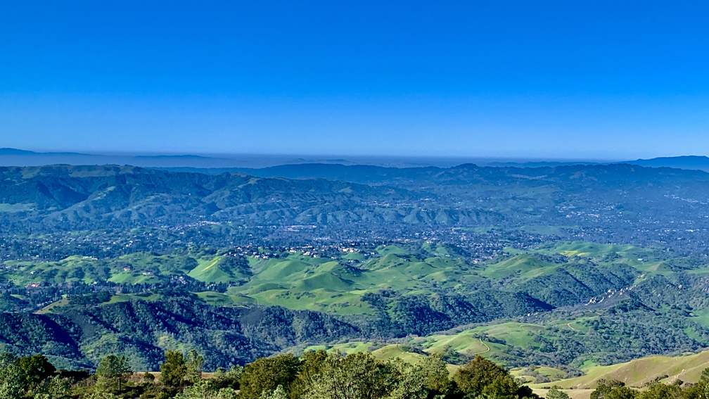
We hiked the trails that circled the top of Mount Diablo in February to see the hills when they were green and to avoid summer heat exhaustion and dehydration issues. The scenery was beautiful, and we could see into downtown San Francisco in the distance as we looked out from above the Juniper Campground on an offshoot trail.
We started hiking from Juniper Campground and started heading up toward the top of Mount Diablo on the Juniper Trail. This was not a bad climb, but it wasn’t easy either. About .2 miles in (it feels like more because of the climbing), you’ll come to a junction. If you go right, you’ll continue up to the top on the Juniper Trail. If you turn left, you’ll climb up and go out for nearly .4 miles and where you’ll have fantastic views of the terrain and features from south southwest to the east north east. The eyeful you’ll get is tremendous as you look around. The offshoot trail is worth it, but it’s not in the tracks below. Also, it can be windy and is exposed. The day we were there, the winds blew at least 20mph, so if you have a hat, hold on to it.
Back at the junction, we were under canopy cover, and we didn’t experience the wind to much at all. For the next .7 miles you will climb and come out under exposure, but with high growth on the both sides of the trail. As you climb, turnaround from time to time and look at the view behind you. Eventually, you will emerge on the Summit Road. Look to your right, and you’ll see where the trail picks a little way down the road, and you’ll continue your climb for another .10 miles as you come out in a parking lot. This is the last place on the hike where you’ll also come across a restroom. Follow the paved road out, and after about .15 miles, you’ll veer off to the right and rejoin the hike on the Summit Trail, where you start your overall descent for about 3.1 miles.
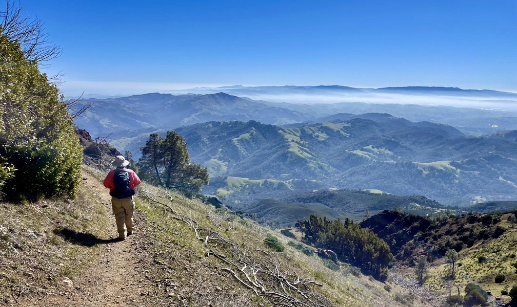
You’re only on the Summit Trail for about .3 miles before you drop down to an open pull out area next to Summit Road, but the hike continues on to your left on the North Peak Trail as you continue to head south. The views to the south and west are spectacular as you look out at the foothills. You’ll hike exposed for 1.15 miles from the Summit Trail to where the North Peak Trail turns and heads east.
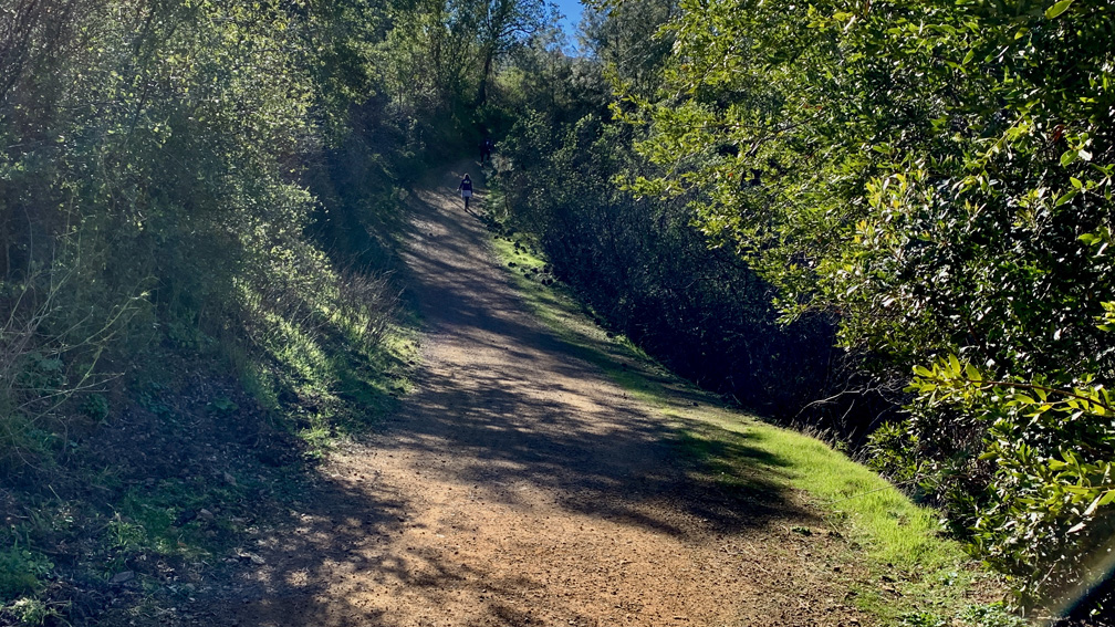
Once you turn east on the North Peak Trail, you’ll continue your overall descent for .7 miles. We soon ducked under canopy after heading east. This part of the single track trail gets a little technical in places, but it’s bad. You will need to watch your feet in places and you descend over rocks in the trail. In other places, the grade is a little steep, and the rocks are loose. We weren’t too worried about it at this point, but we were thinking it may have been a good idea to bring our trekking poles.
At the end of the North Peak Trail, we came to a junction where a road and three trails came together. To continue on the hike, take the Bald Ridge Trail to the left.
The Bald Ridge Trail descends for 1.75 miles, and this is where the hike becomes technical. There is a lot of up and down on this trail, and it’s not smooth. The downs are steep in places, and if you don’t have trekking poles to help you, you will have to hold on to trees to keep from falling as you watch where to put your feet on the rocky ground. It’s certainly doable, but you will need to take your time and pay attention to where you place your feet without them slipping out from under you on the steep or loose ground. This goes on a lot.
After 1.3 miles, you will come to Meridian Ridge Road, which you will hike back on. There are a couple of trails here in addition to the road, so go left and follow the road. For about .1 miles, it seems like it’s going to be a bowl of cherries, but that quickly comes to an end. You will come to a 21.2 percent descending grade for .3 miles. If you have knee issues, this may aggravate them. Trekking poles would have helped. After .3 miles, you will hit the low point of the hike, and then you start to climb.
You will hike 1.45 miles on an overall 8.4 percent grade until you come to Burma Road. There is a .2 mile stretch on this climb that is 16.5 percent, a .1 stretch that is 18 percent, a .2 mile stretch that is 17.7 percent, and then you emerge at the Deer Flat/Burma Road junction. Stop, take a breath and take in the views. There’s still more climbing to do, but you’re almost there.
As you start out on Deer Flat Road toward Juniper Campground, you’ll climb 17.9 percent for .2 miles. After this, you’re about half a mile from the end, and you’ll emerge at the campground. Follow the paved road around to the parking area.
Just to note, this hike is not for beginners. It gets technical on the east side, and even though I prefer to not take trekking poles, this hike would have been a lot better with them. I wouldn’t have really needed them for climbing until I got to Meridian Road, but they would have been much better to use as an aid for going down where the hike got technical.
Also, the way we went was counter to the most of the people we encountered hiked. Even through the grades were a little less overall going the way we went, it may have been better to hike the trail over a 3.1 mile climb on an overall 10 percent grade.
Directions: From Walnut Creek, head north on North Main Street and turn on right on Parkside Drive. Travel to N. Civic Drive and turn right. Follow the road and turn left onto Ygnacio Valley Road and then proceed to Walnut Avenue and turn right. You will come to a traffic circle – take the first exit onto Oak Grove Drive. Follow the road to N. Gate Road and turn left. Follow the road to the parking area: 37.876710, -121.930830.
The Skinny
Trail: Mount Diablo Grand Loop
Trailhead Coordinates: 37.876960, -121.930790
Trailhead Elevation: 2978 Feet
Distance: 6.4 Miles – Loop
Level Of Difficulty: 🔴
Average Grade: 10.25%
Steepest Grade: 18% For .2 Miles
Ascension: 2223 Feet
Trail Condition: 🟢🟢🟢
Scenery: 🟢🟢🟢🟢
Nearest Town: Walnut Creek
Challenges: Technical Hiking
Traffic: 🥾🥾
Highlights: The Views
Best Time: Fall, Winter, Spring
Hazards: Falling
Wildlife Concerns: Mountain Lions, Rattlesnakes
Cell Service: 📱 (AT&T)
Would I Do This Hike Again?: Yes
Parking: $10 Entrance Fee At The Time Of This Writing
Restrooms: At The Trailhead