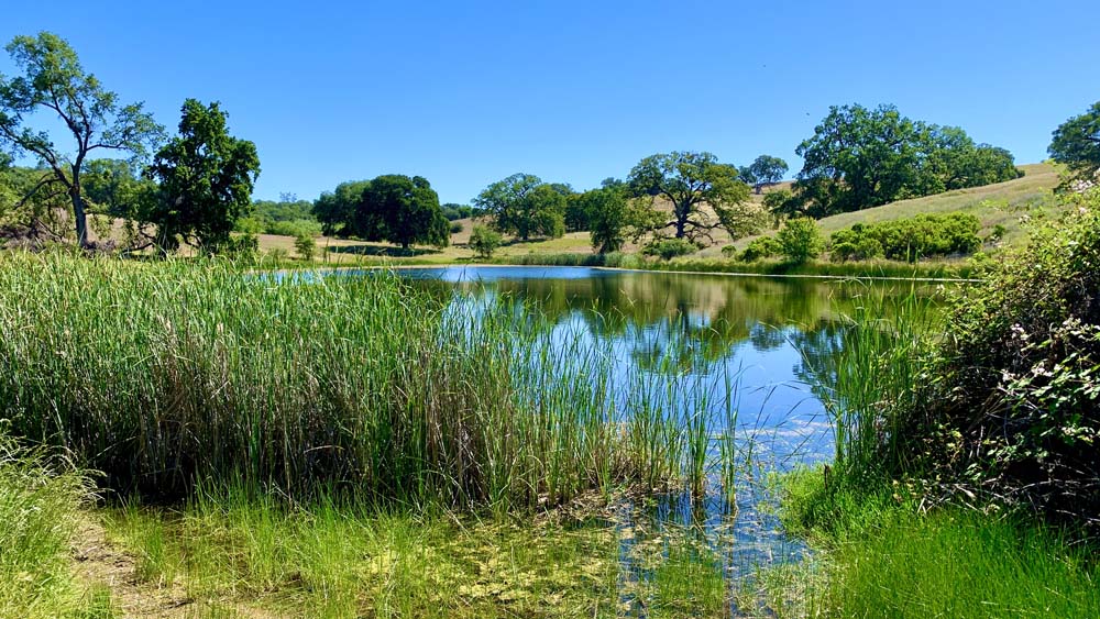
One of the ponds at the Auburn State Recreation Area emerges as you hike along the Olmstead Loop Trail from the canopy. This is one of three ponds in the area.
We hiked a portion of the Olmstead Loop Trail in the Auburn State Recreation Area on a warm spring morning when the hills were still green and wildflowers were still in bloom.
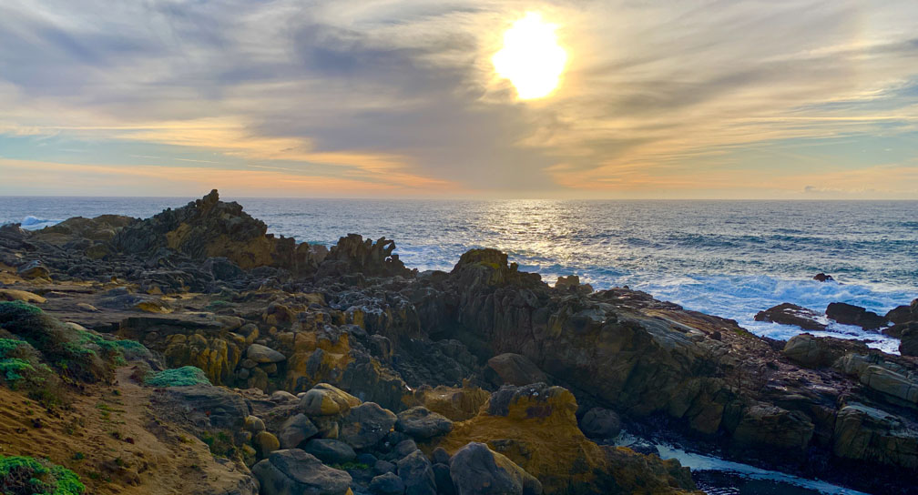
The sun sets over the Pacific Ocean at Salt Point State Park.
The hike at Salt Point State Park takes you through forests, over meadows, and by the seaside. The area is diverse while green and lush in parts while exposed and dry in others. Along the way you will hike amongst redwood trees, Douglas fir, and madrone among other trees.
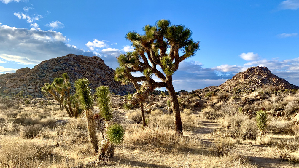
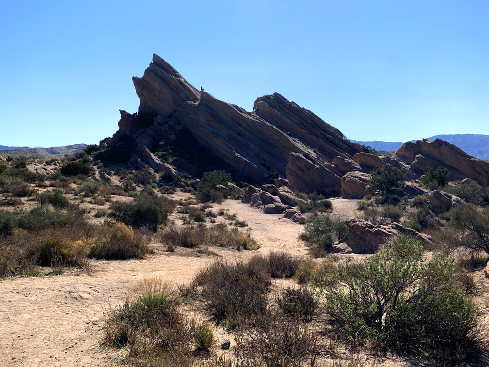
The desert landscape on the Maze hike is full of desert vegetation, trees, and land formations.
I’ve heard for years about The Maze at Joshua Tree National Park, and I finally got the opportunity to hike it. Maybe it was because of the hype I heard that I was expecting more than what it offered, but even with that said, I was in no way disappointed.
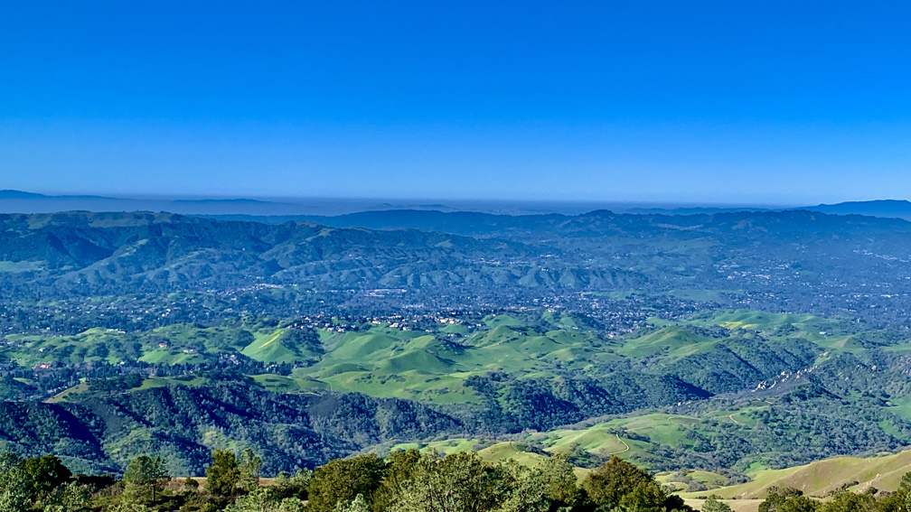
The view from Mount Diablo can be stunning when the surrounding hills are green.
The views from Grand Loop Hike at Mount Diablo State Park are sweeping from all directions, and we wanted to see what we could see from the grand loop hike. While worth it, this is not an easy hike.
We hiked the trails that circled the top of Mount Diablo in February to see the hills when they were green and to avoid summer heat exhaustion and dehydration issues. The scenery was beautiful, and we could see into downtown San Francisco in the distance as we looked out from above the Juniper Campground on an offshoot trail.
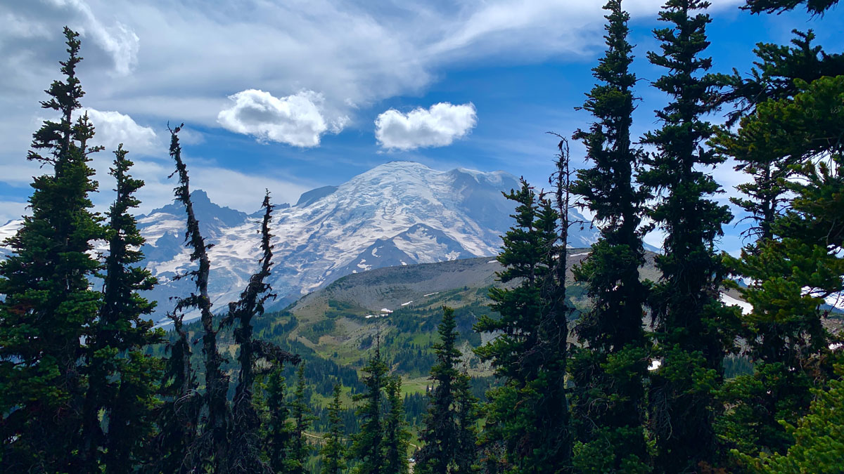
Mount Rainier in its magnificence from the trail to First Burroughs Mountain.
Parts of the hike to First Burroughs Mountain from the Sunrise Visitor Center are fairy-tale spectacular where you see vibrant wildflowers, green meadows surrounded by thick forested trees, and stunning views of Mount Rainier.
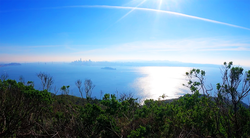
The views from the top of Angel Island offer a 360 degree view of the San Francisco Bay.
The views from the top of Mount Livermore on Angel Island State Park of the San Francisco Bay are incredible on a clear day. You can see the San Francisco Skyline, the East Bay, the Golden Gate Bridge and the hills of Marin County and much more.
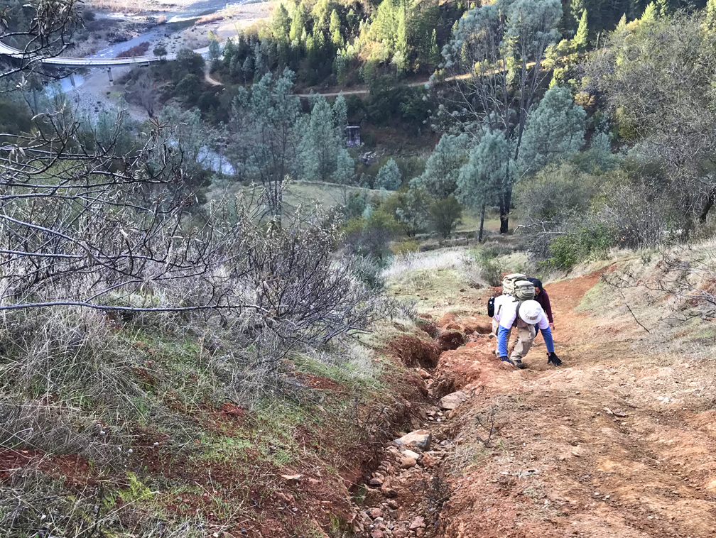
The climb up Kickass Hill has to be done with both hands and feet in places.
Kickass Hill in the Auburn State Recreation Area lives up to its name as soon as you start climbing. The hike is a complete workout and can give you a sense of accomplishment on a 31 percent grade over a heart pounding half mile.
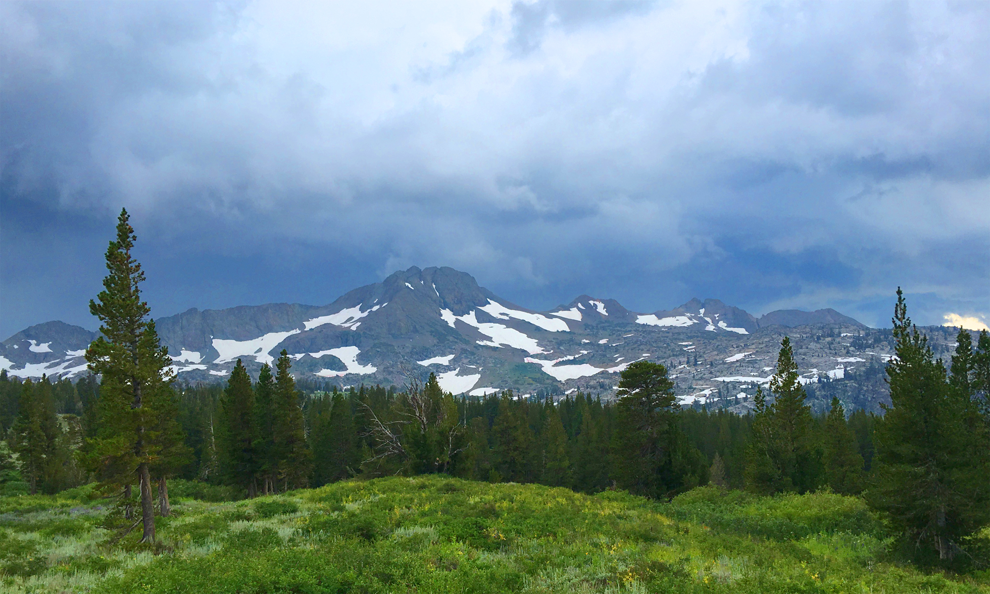
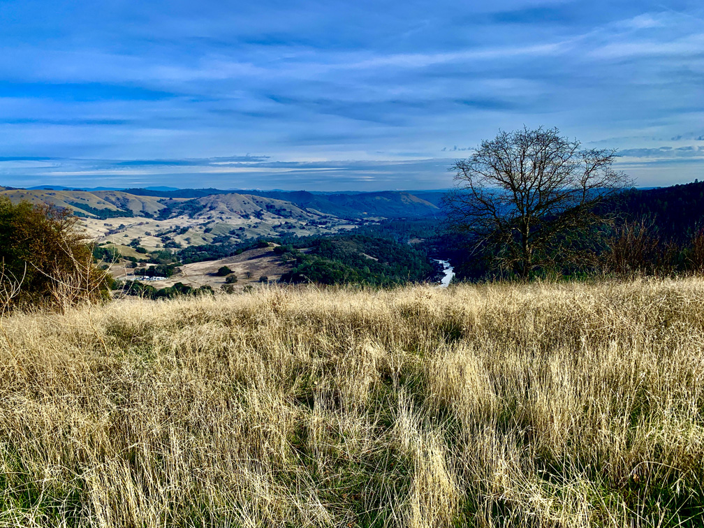
On a clear day, from Sky Ridge Trail at Cronan Ranch Regional Trails Park, you see the Sierra Nevada Mountain Range as you look east.
Cronan Ranch Regional Trails Park is a playground of trails in the foothills. We hiked in the valleys and over high points that showed off the snowcapped Sierra Nevada Mountain range in the distance.
On this hike, we covered portions of several trails on our 11.5 mile hike. We hiked the River Trail to the Gerle Loop Trail; Down and Up Trail to the Cronan Ranch Road; South Fork American River Trail to the West Ridge Trail. We hiked back to the Cronan Ranch Road and the Down & Up Trail to Sky Ridge Trail. We reconnected with the Connector Trail and back to the Gerle Loop Trail. Wow, that’s a lot of trails!
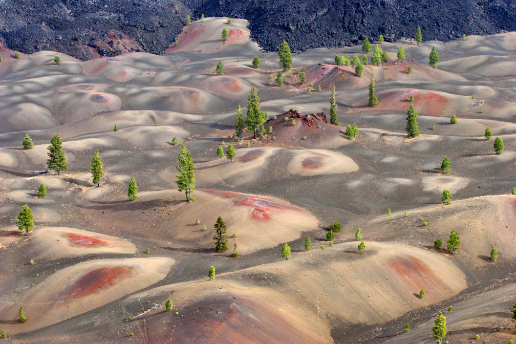
The Painted Dunes in Lassen Volcanic National Park from the top of Cinder Cone.
The views from Cinder Cone over the Painted Dunes at Lassen Volcanic National Park offer an incredibly “artistic” view of the landscape. But if you want to see this incredible view, you will have to work for it.
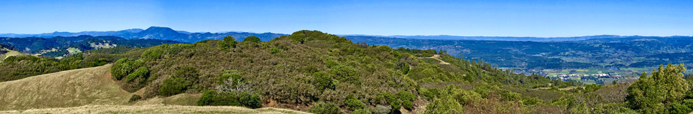
The view from Bald Mountain is sweeping. This panoramic photograph does not capture the curvature of the earth as you turn 360 degrees to look around you.
You have to work for it, but the view from the top of Bald Mountain is spectacular on a clear day. What makes it so spectacular is that as you take in a 360 degree view from the top, you can see the earth curve as you turn your head from landmark to landmark in all directions – something no picture can capture.
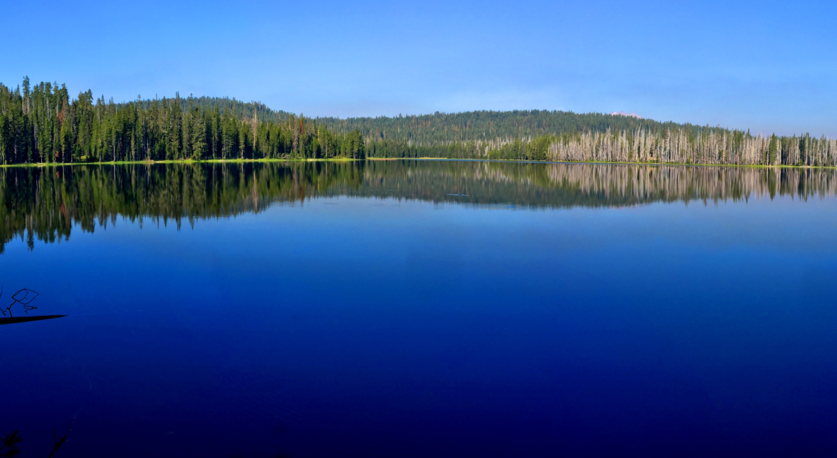
Horseshoe Lake is peacefully serene in the morning. Stop and take it in.
Horseshoe Lake in Lassen Volcanic National Park offers an awesome view, and is what makes this hike worth it. I got to experience the lake early in the morning before I saw any other hikers. It was beautiful, and even though I consider the entire hike the destination, just looking at Horseshoe Lake is a destination. Continue reading “Hiking Juniper Lake to Horseshoe Lake”
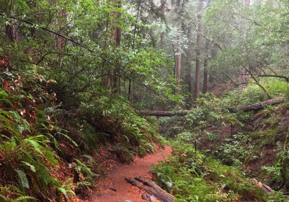
The Steep Ravine Trail on Mount Tamalpias follows Webb Creek through a lush Redwood forest.
If you like hiking under Redwood trees next to running water and waterfalls, then the Steep Raving Trail is the hike for you if you do it at the right time of the year. By that, it’s good to go during or after a good rain when the waterfalls will be flowing.
The trail is called Steep Ravine for a reason. You will descend 1,084 feet on a 9 percent grade slightly over 2 miles. For the most part, it’s gentle, but the beginning is steep. If the water is running, it’s worth it. Continue reading “Hiking the Steep Ravine Trail – Dipsea Trail Loop”