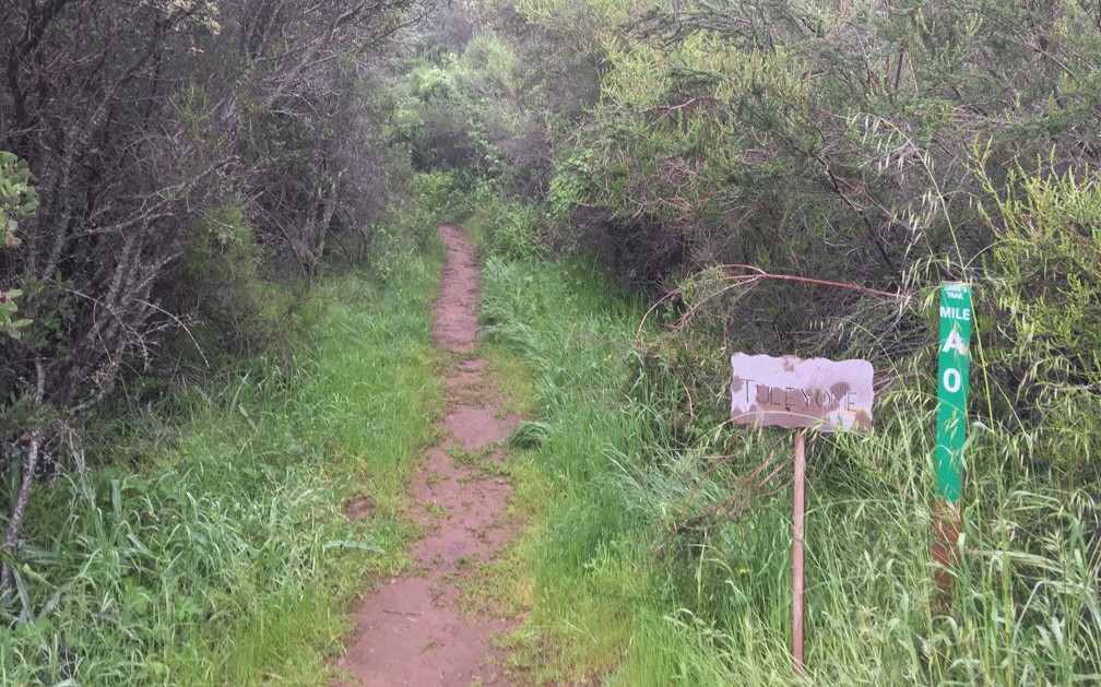
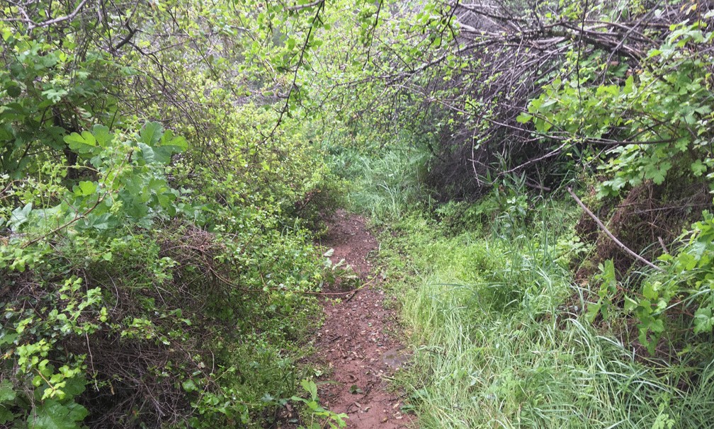
Hiking to the Annie’s Trail trailhead can be a feat within itself, as you have to hike the Homestead Trail and climb many steps up a 19 percent grade over 400 feet to get to it. By the time you reach the trailhead, you’ve already hiked about two miles overall. Once you’ve made it this far, you’ll find yourself at a junction. To take Annie’s Trail, hike straight ahead and follow the trail south along an ascending path. You’ll do some ducking under limbs, but it’s not bad.
About .2 miles from the beginning of the trail, you’ll come to a junction where it continues on or turns west into heavy canopy. The first time I tried Annie’s Trail, I hiked this way and lost the trail. I saw several ways it could have gone, and I strayed off it somehow. I retraced my steps back out of the canopy. Plus there was poison oak throughout.
This time, I didn’t take the trail into the canopy and continued straight. I figured I might be able to find my way through going in from the back, and this way worked. At .4 miles, the trail turns west and continues up becomes really tight in places with trees and bushes on both sides.
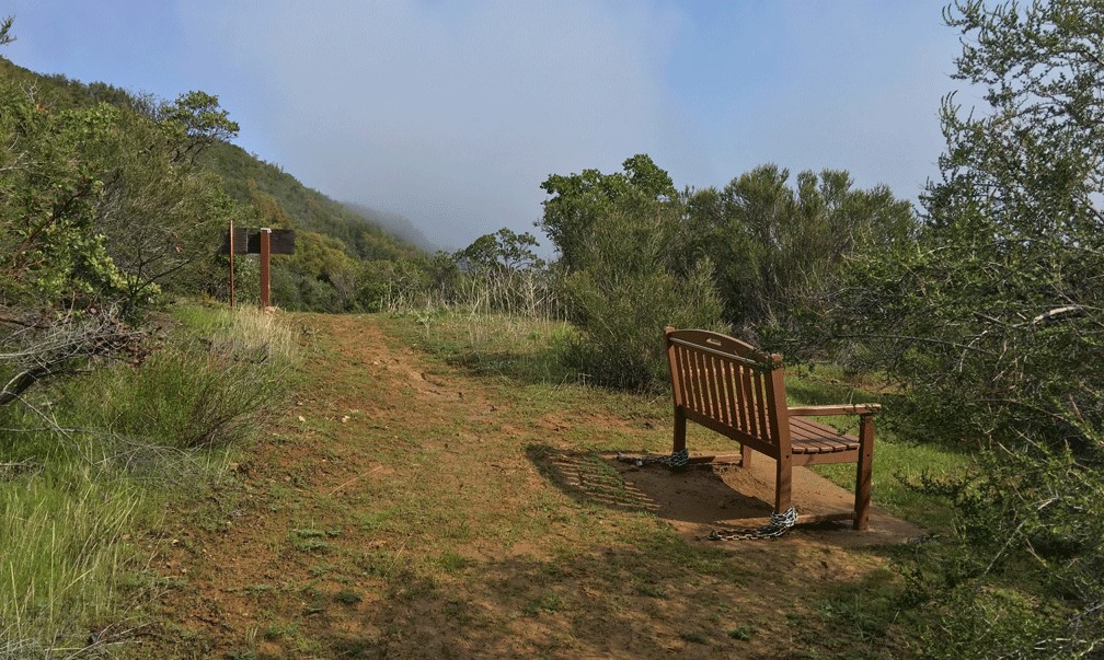
Don’t hike this trail in shorts or short sleeves. The vegetation is that close to the trail and it’s easy to get little cuts from the leaves or twigs sticking out, and sometimes you have to do some bushwhacking. At about .9 miles, you come to a bench which was put there as part of an Eagle Scout Project that overlooks the Cold Canyon headwaters. It’s a nice resting spot in the hot summer.
At 1.1 miles, there’s another junction in the trail with a sign pointing into a thick canopy to the north, and shortly in, a steep climb starts. You may have to reach out to hold onto trees to help pull you up and along the trail. In .2 miles, you come to another junction and head northeast along a ridgeline and in 300 feet turn northwest and down into more canopy. In about another 300 feet, you come to another junction that leads to the highlight of the trail – Annie’s Rock.
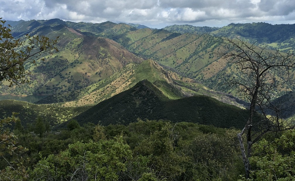
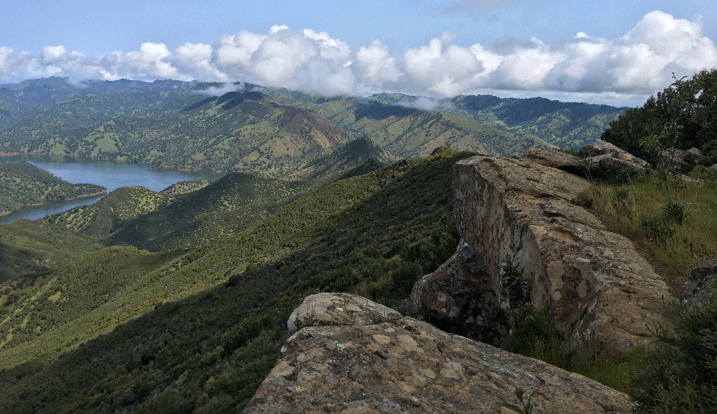
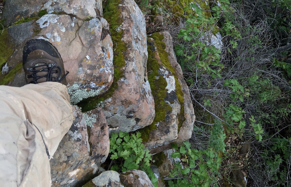
As you walk in toward Annie’s Rock, you need to watch your step over the rocks. Watch for rattlesnakes between the rocks and in the crevasses between them. Once you make it out to Annie’s Rock, the view looking out at Lake Berryessa and the foothills is incredible. The day I was there, I could make out Mt. Konocti in the distance. They say you can see Snow Mountain 100 miles away, but it was too cloudy the day I was there to see it.
After you’ve sat and enjoyed the view for as long as you like, you can head back, and here you have a choice when you get back to the junction. You can go back the way you came, or you can venture on. If you choose to venture on and head northeast, you need to know the trail can become very difficult for about the next mile.
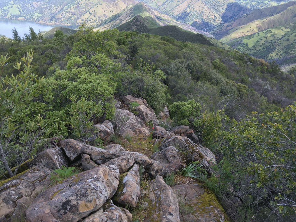
Along the way, you will emerge from the canopy and walk very carefully along a ridgeline across uneven rocks where the trail seemingly ends and scrambling is done over the very narrow way with drops on both sides until you reach the defined trail. Also along the way, the descent in places is sharp, and holding onto trees to help you stay on two feet in places is required. That said, I went down once and had to ride it out.
If I do this trail again, and I will, I’ll go in the same way I did this time, go to the rock, enjoy the view and then come back the way I went in. The view from the rock is worth it, but it will be slightly longer.
If you decide to take this hike on a warmer to hotter day, take, at a minimum, at least a gallon of water.
After I left Annie’s rock and ventured on back, I wondered who Annie is/was, and I thought she must have been rugged considering portions of the trail. It turns out the trail was named for Anne Schneider, a Tuleyome founder and board member who died in 2010. Anne seemed like a fascinating lady, and she passed away in 2010. To learn about Annie, you can read her obituary in the Davis Enterprise.
Tuleyome is an organization that restores and preserves the wilderness, constructs and repairs trails and educates the public environmental issues and conservation and is based out of Woodland, California.
From Winters, take Highway 128 about nine miles just over the Putah Creek Bridge to the parking area off the road on the right.
The Skinny
Trail: Annie’s Trail
Trailhead Coordinates: Annie’s Trail: 38.490611, -122.105005; Homestead Trail: 38.509080, -122.097371
Distance: Annie’s Trail – 2.7 miles: From Parking & Back – 6.6 Miles if Doing Loop; 7.8 miles – Out and Back If Going Back the Same Way
Level of Difficulty: 🟠
Average Grade: 10.3%
Steepest Grade: 20.7% over .2 miles
Ascension: 2162 Feet
Trail Condition: 🟢🟢
Scenery: 🟢🟢🟢
Nearest Town: Winters
Challenges: Hot summers, rock scrambling, very steep in places
Traffic: 🥾🥾 to 🥾🥾🥾 until Reaching Annie’s Trail. Annie’s Trail – 🥾
Highlights: Annie’s Rock
Best Time: Early Spring, Late Fall, Dry Winters
Hazards: Some scrambling over rocks; This is a long climb and arduous in places which makes heat – even temperatures higher than 80 degrees Fahrenheit dangerous because there is so much climbing; poison oak is prevalent and very to difficult not come into contact with; this is not a hike for beginners
Wildlife Concerns: Mountain Lions; Rattlesnakes are definitely present – first hand experience
Would I Do This Hike Again?: Possibly
Parking: Free
Restrooms: Vaulted toilet in the parking lot