There is an update to Deafy Glade trail that will be posed here. If you are contemplating doing this hike, as there are safety concerns and trail hazards to be aware of.
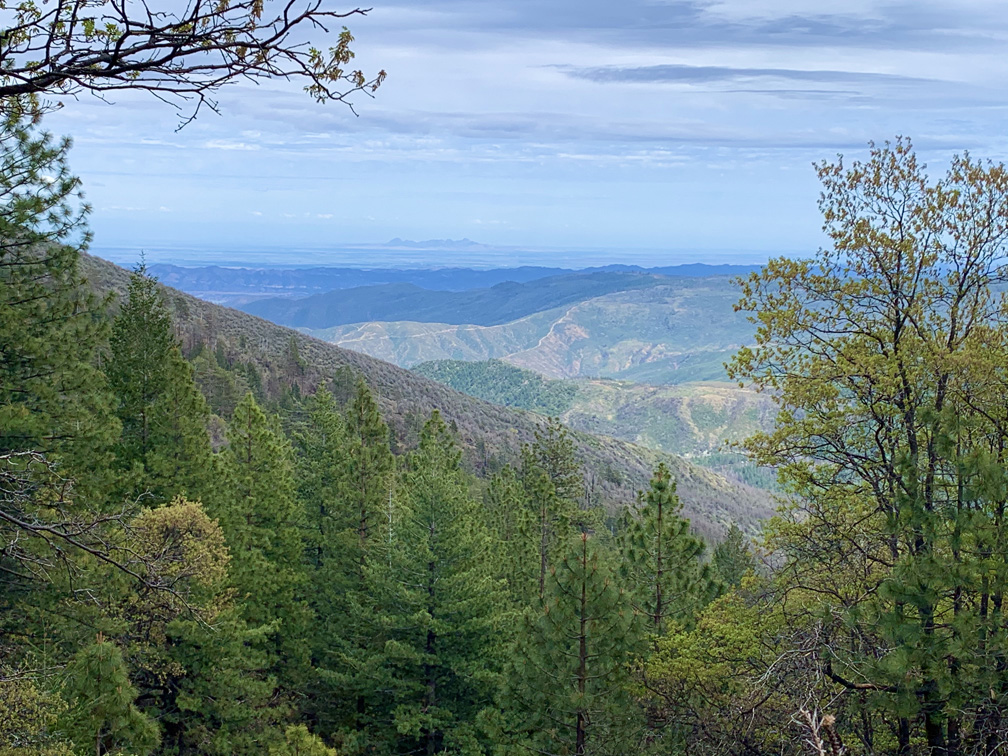
Deafy Glade Trail is a butt kicker. After about a mile in and a creek crossing, it’s 3.5 miles of climbing that pulls on your calves, hamstrings and other lower body muscles. If you want buns of steel, this trail can make it happen for you. The view from the top where the Deafy Glade Trail meets the Summit Springs Trail offers views down into the Sacramento Valley and even the Sutter Buttes on a clear day.
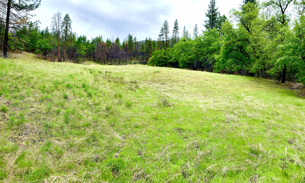
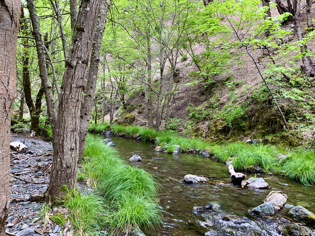
Parts of the area were burned out during the Ranch Fire in 2018, and many of the trees are bare during the first mile of the hike down to the South Fork Stony Creek, which you will have to cross. The trail picks up right across from the creek, and they should build a bridge across it. The creek is deeper than it looks, and the rocks on the bottom are slick. I was in the swiftly moving water up to my ankles and placed my trekking poles in front of me to gage the depth, but I stepped in a hole and went down. Use caution when crossing.
We went in early May, and the wildflowers were out. Along the first climb headed to Deafy Glade, we came across yellow irises.
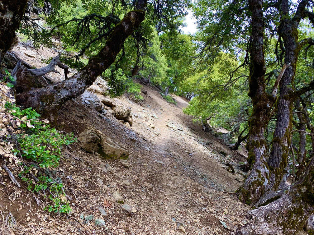
The trail was in need of maintenance with many fallen trees across it that have to be climbed over. The trail is also very narrow in some parts with long drop-offs on one side, so there are places where you need to watch your footing, especially when hiking back down where gravity can have its way with you if you’re not careful.
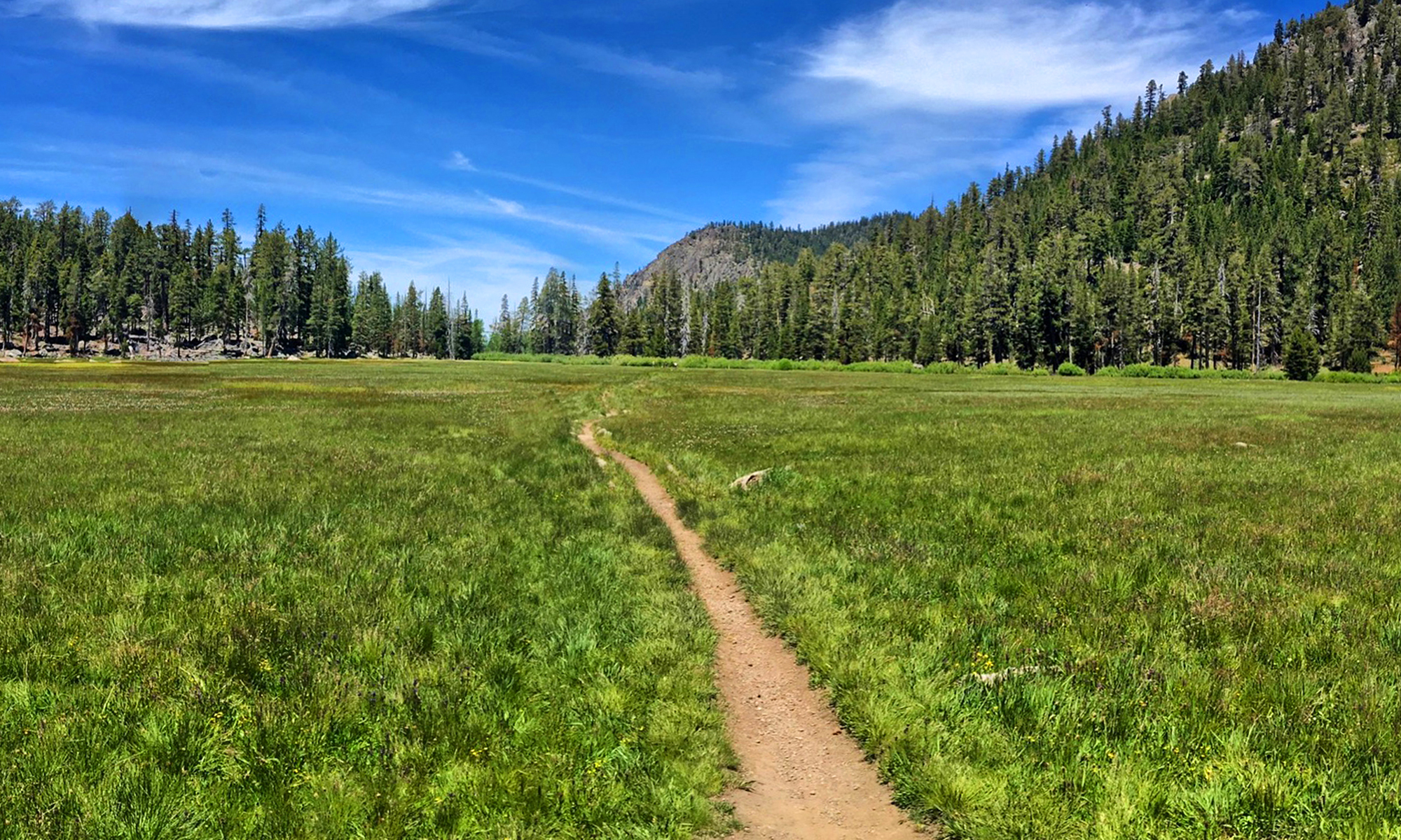
Deafy Glade is like a wide open meadow and is beautiful. While you hike under oaks, you can see where it gives way to pine trees you’ll soon be hiking under. As you pass under the oaks, you may see tents campers put up, and as you continue to climb, you’ll hike past along a cliff that looks down over green trees that you can hear a rushing stream running under them.
As you head on, you’ll come to a fork with a sign. Turn left and head to Summit Springs. As you pass Deafy Glade, you’ll hike under pine trees, and during the spring, you’ll see wildflowers including bluebonnets, California Poppies, more irises, and lupine. The hike is beautiful.
As you near the top at the Summit Springs Trail, you’ll start to come across a series of long switchbacks. When you get to where the trails converge, stay there and take a look around. You’ll see views of healthy forest and burned out areas. You can also look down into the Sacramento Valley, and up to High Rock. From here you can continue on and hike up to Snow Mountain or you can turn back. It takes about half the time to head back down as it did to climb up.
Make no mistake about it, this hike can offer great views and a wonderful experience, but you will be sore… maybe for days after you’ve finished it.
Directions: From Stonyford, 39.375075, -122.544572, take Market Street to Fouts Springs Road and travel to the trailhead at 39.333616, -122.710877. The trailhead will be on the right. If you go much further, the pavement on the road will run out, and you’ll know you passed it.
This Skinny
Trail: Deafy Glade to Summit Springs
Trailhead Coordinates: 39.333616, -122.710877
Trailhead Elevation: 3284 Feet
Distance: 8.9 Miles – Out and Back
Level of Difficulty: 🟠
Average Grade: 12.9%
Steepest Grade: 16% over 1.9 Miles
Ascension: 2487 Feet
Scenery: 🟢🟢🟢
Trail Condition: 🟢
Nearest Town: Stonyford
Challenges: Hot summers, Steep Climb That Doesn’t Seem To End
Trail Traffic: 🥾
Highlights: Wildflowers, Views of Sacramento Valley
Best Time: Spring, Fall
Hazards: Temperatures higher than 90 degrees Fahrenheit
Wildlife Concerns: Bears; Mountain Lions; Rattlesnakes
Cell Service: 📵 (AT&T)
Would I do this hike again? No
Restrooms: None at the Trailhead
Parking: Free
One Reply to “Hiking Deafy Glade to Summit Springs”
Comments are closed.