The Carson Emigrant National Recreation Trail is not too often hiked but is a walk with history. As you hike it, it’s difficult to imagine how thousands of people in covered wagons made it along this terrain, and this trail isn’t anywhere near other difficult terrain they encountered on their way up Covered Wagon Peak. You won’t go that far if you turn around where I did, but you can.
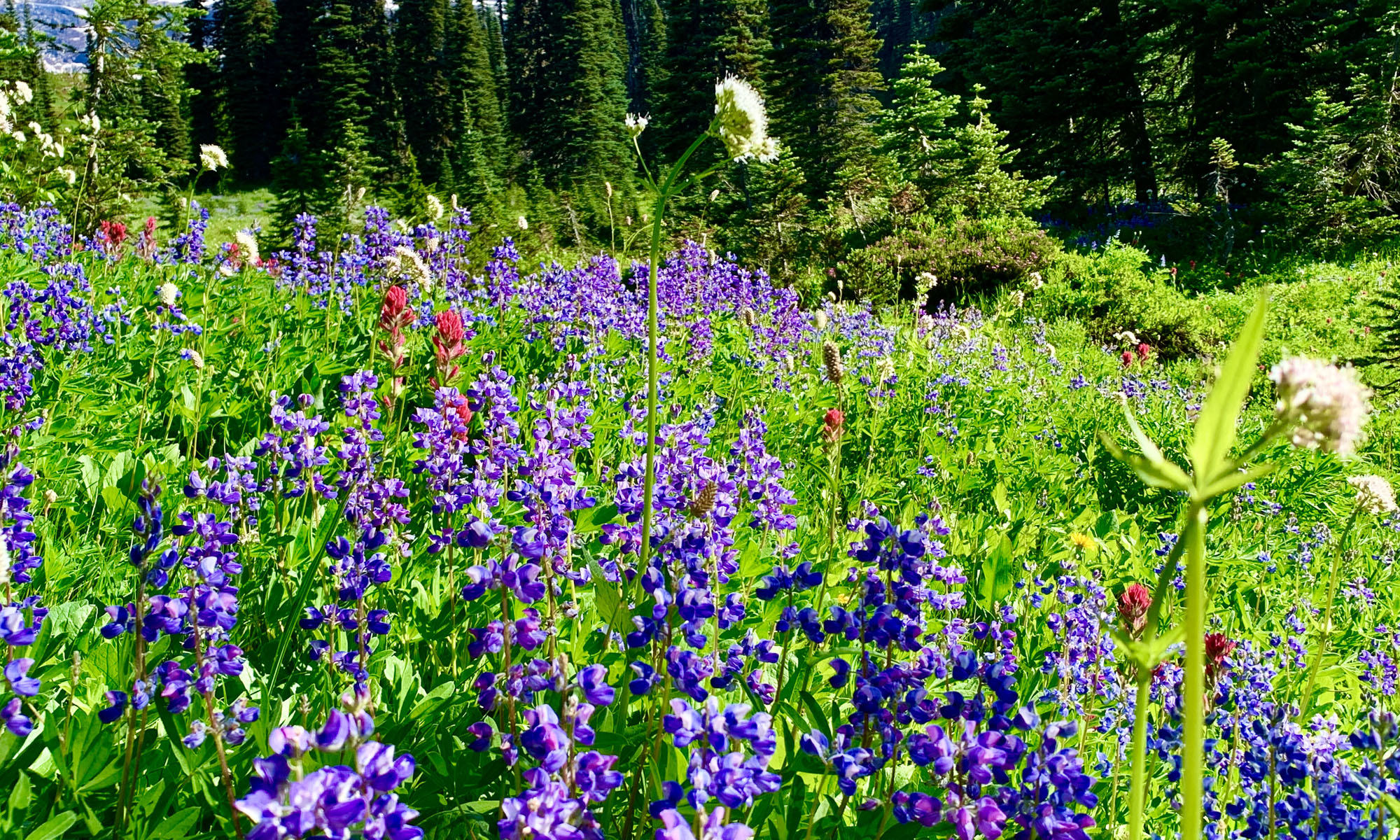
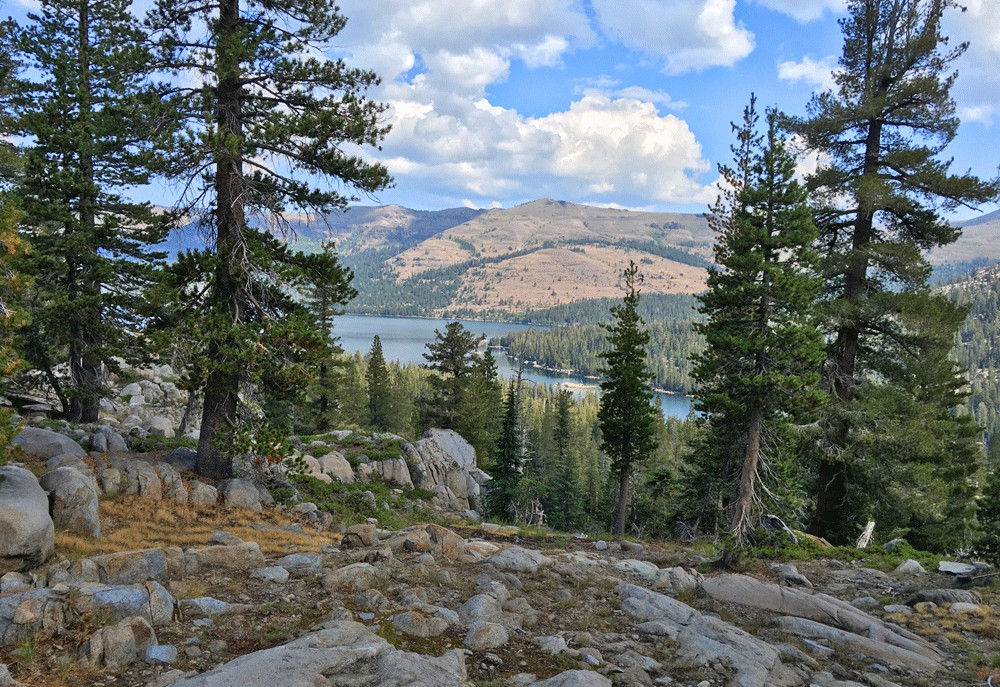
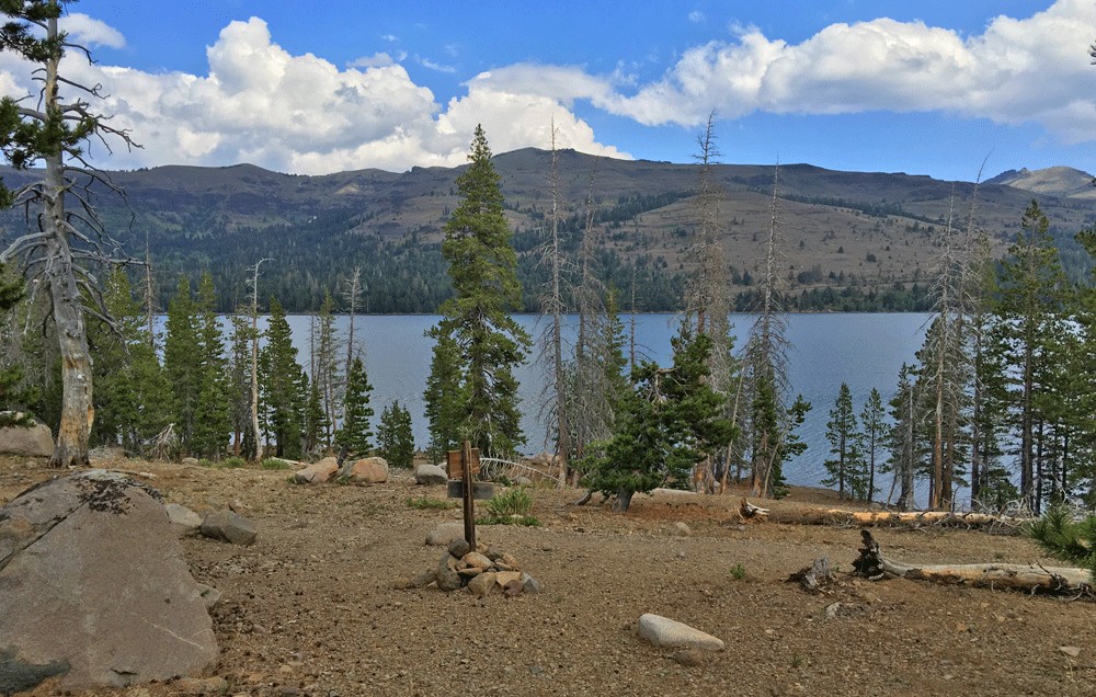
You start out hiking 1.1 miles along Caples Lake on the Emigrant Lake Trail, which can offer stunning views of the lake on one side and a heavily forested slope on the other. On either side, you’re looking at natural beauty.
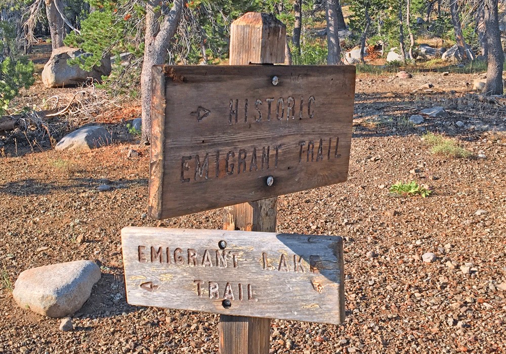
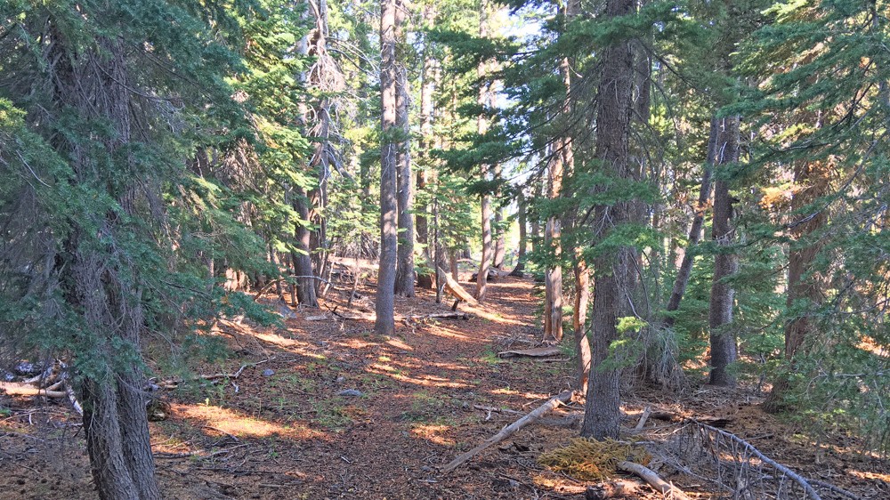
After hiking a little more than a mile, you’ll come to a fork. Going on along Caples Lake will take you up to Emigrant Lake. Turning off the trail will start an ascent in an open area where the trail is sometimes difficult to ascertain. It’s a good idea to have a GPS with the trail on it so you’ll know if you strayed from it and are heading in the wrong direction. There a are a couple of areas on the trail like this, and one of the pluses when I was on it was that someone made many cairns to help hikers along the way. Because this trail follows a historical route, once you make into the trees, the trees themselves have markers attached to them, so the trail is easy to follow.
Once you get into the trees, you’ll find that the trail is in need of maintenance. Usually a fallen tree on a trail is normal and no big deal. You just go around it if you can’t go over it. On this trail, I stopped counting how many times I had to go around or climb over the fallen trees.
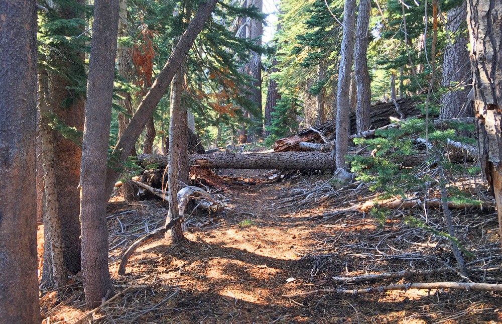
As you hike along the trail, you come across open spots where travelers from the 1800s may have stopped and camped for the night, and it’s easy to imagine how they may have set up camp.
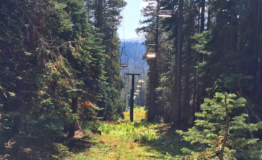
At about 3.3 miles, you’ll come across a mountain road. Just walk straight on across it and follow the trail. A little ways up, as you look off the trail, you’ll see a tall brick structure. It’s locked and used for something – perhaps monitoring the snow in the wintertime? Continue on, and you’ll come to a little meadow, and in the distance across it, you can make out a marker way across in the distance on tree. Head for it. You’re also entering the Kirkwood Ski Area, and you’ll start to see the ski lifts.
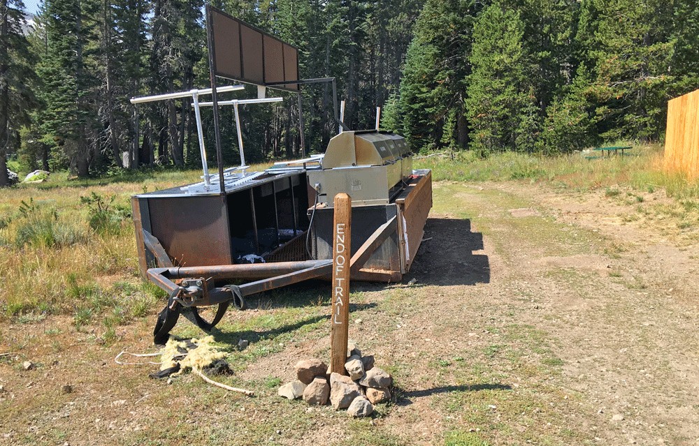
You’ll eventually hike under a ski lift and go back into the tree line, and after a short distance, you’ll come to an opening and another large open area operated by the ski resort, and then to a road. Hike on the road until you come to a post put in the road that says end of trail.
It’s not really the end of the trail, and as you look into the distance, you can see another trail marker on a tree across the meadow, but I chose to turn around at this point and head back.
Directions: From Sacramento, take Highway 50 to the Sly Park Exit. Turn right onto Sly Park Road and follow it and turn on Mormon Emigrant Trail (it’s a road and closed in the winter) and follow it to Highway 88. Turn left on Highway 88 and head to a small parking area at Caples Lake Dam. If the parking lot is full, you can park along the highway unless there are signs prohibiting it.
The Skinny
Trail: Carson Emigrant National Recreation Trail
Trailhead Coordinates: 38.702950, -120.065267
Trailhead Elevation: 7806 Feet
Level of Difficulty: 🟡
Scenery: 🟢🟢🟢
Nearest Town: Markleeville
Distance: 7.7 Miles – Out and Back
Ascension: 782 Feet
Average Grade: 1.9%
Steepest Grade: 5.1 over 1.2 Miles
Trail Condition: 🟢
Challenges: None
Trail Traffic: 🥾
Highlights: Scenery, Lake Views
Best Time: Spring, Summer, Fall
Hazards: Temperatures higher than 90 degrees Fahrenheit
Wildlife Concerns: Bears, Mountain Lions
Would I Do This Hike Again?: Not this section of the trail.
Parking: Free
Restrooms: Vault toilets in the parking lot