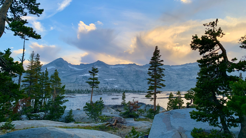
Lake Aloha on the Tahoe Rim Trail/Pacific Crest Trail is a gorgeous site to see with the forest in front of it and the mountains behind it.
The hike from Echo Lake to Lake Aloha is a beautiful Type 2 Fun hike along the Tahoe Rim Trail/Pacific Crest Trail in the Sierra Nevada Mountain Range. We backpacked into Desolation Wilderness and were there for two nights.
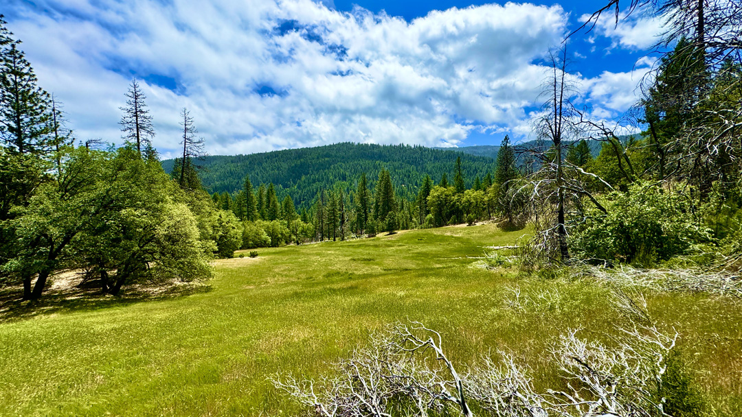
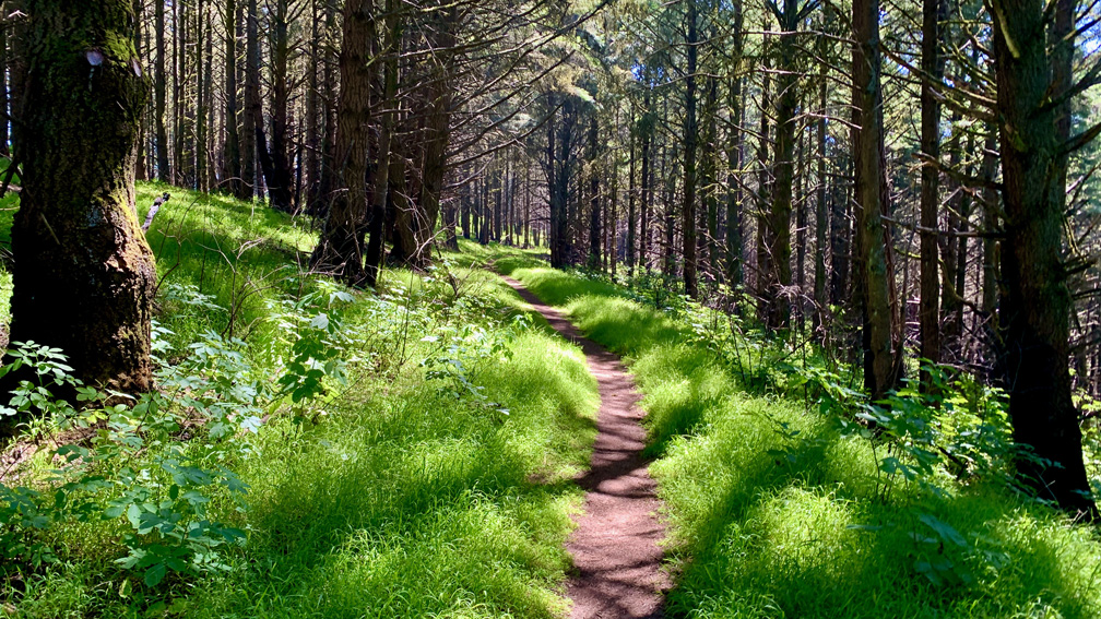
Deafy Glade displays beautiful green grasses in the springtime within the mountains of the Mendocino National Forest.
This is an update to the 2020 summary of the hike from the Deafy Glade Trailhead to Summit Springs due to changing trail conditions that now present a safety hazard to hikers and backpackers.
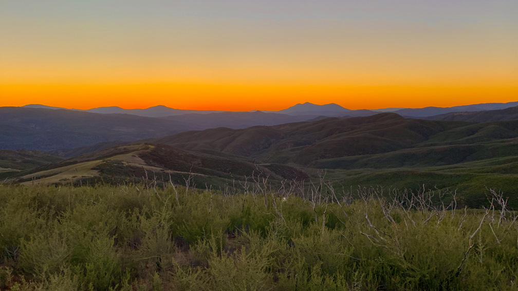
The sunset with Mount Konocti on the horizon as viewed from the Judge Davis Trail about 18.5 miles away.
The hike on the Judge Davis Trail down to Cache Creek was a son of a b*tch and should not be done as an out and back day hike but rather as a point to point backpacking trek.
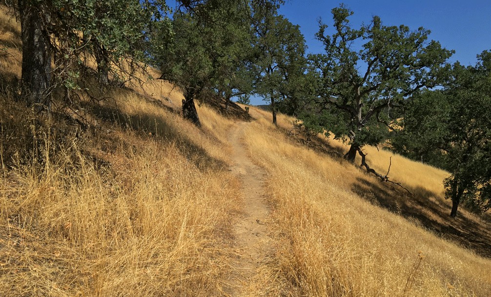
The Redbud Trail meanders through the oak laden hillsides of the Cache Creek Natural Area.
Originally posted June 8, 2018
Updated April 30, 2023
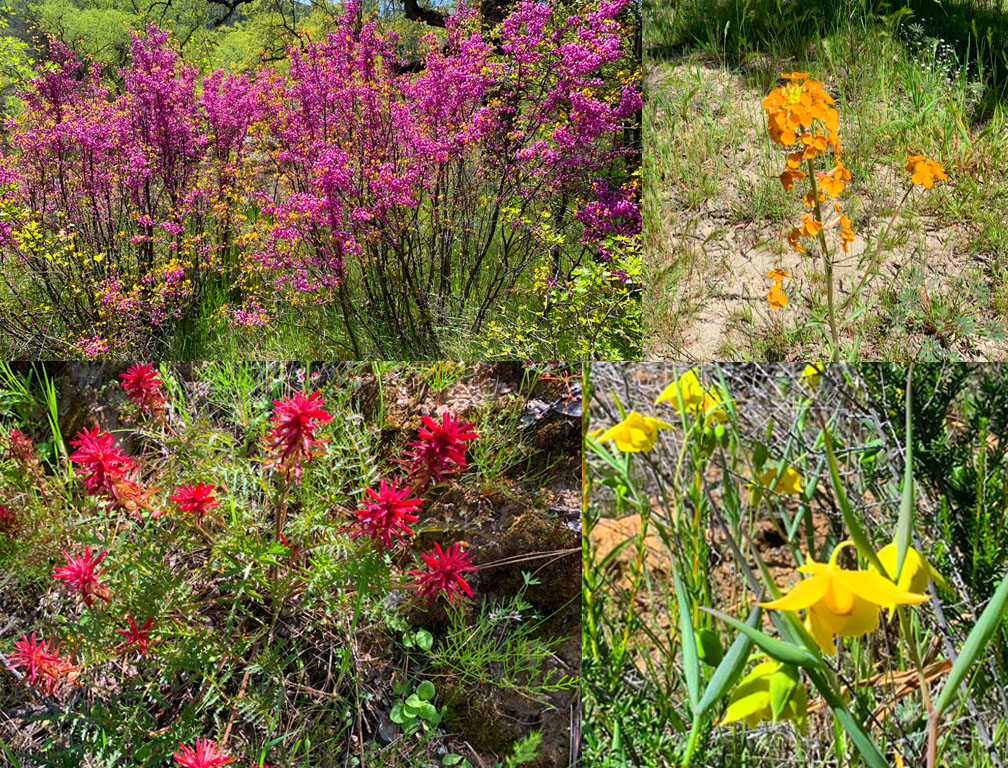
We hiked Redbud Trail in April 2023 after the California’s massive rainstorms earlier in the winter and spring. What resulted were superblooms in locations. For as often as I have hiked the Redbud Trail, I have never seen the wildflowers on the trail I saw in late April. The wildflowers included Indian Paintbrush, Warrior Paintbrush, Common Fiddlestick, Western Wallflower, Diogene’s Lantern, and many other colorful wildflowers.
Hiking the Redbud Trail as it meanders along hillsides next to oak trees and descends down to Baton Flat and Cache Creek is a pleasant hike through the foothills.
The trail starts off out of the parking lot on a service road and then to the right you’ll see a sign with Redbud Trail marked on it. Take the trail away from the road and hike along the edge of the foothills until you come to a creek bed that you have to cross. Continue reading “Hiking Redbud Trail to Baton Flat”
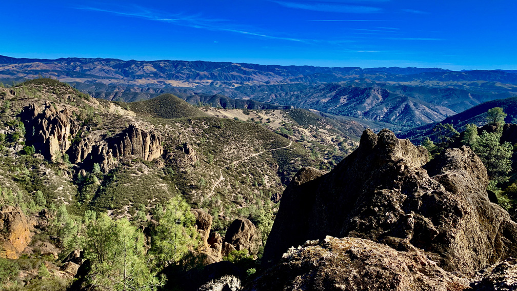
The view from the High Peaks Trail at Pinnacles National Park to the east is vastly expansive.
The High Peaks Trail at Pinnacles National Park is fun but is also physically exerting in places. There is also the possibility you will see California Condors perched or in flight.
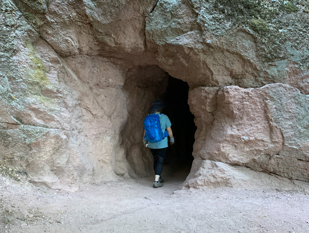
A hiker enters a cave on the Moses Springs Trail to Bear Gulch Reservoir at Pinnacles National Park.
The hike to Bear Gulch Reservoir at Pinnacles National Park starts off on the High Peaks Trail as you hike under oak trees and ascend to the Moses Spring Trail junction.
As the trail ascends, you start to hike amongst rock formations that take you to the caves on the Moses Spring Trail. If you are not comfortable with caves, there is a bypass trail that will also take you to Bear Gulch Reservoir on up past the Moses Spring Trail junction that leads to the Rim Trail, but the caves are worth exploring. Continue reading “Hiking Moses Spring Trail to Bear Gulch Reservoir at Pinnacles National Park”
While the grasses and some of the undergrowth along the trails in the Meadow Trail/Mt. Wittenberg Trail area at Point Reyes National Seashore are green, many of the trees are burned out from a 2020 fire that swept through the area.
Meadow Trail at Point Reyes National Seashore up to Sky Trail is a tough climb, but sometimes the rewards are great if you like wildlife. Both times I hiked the trail I was treated to seeing Black Tail Deer once in a meadow and once running in the forest.
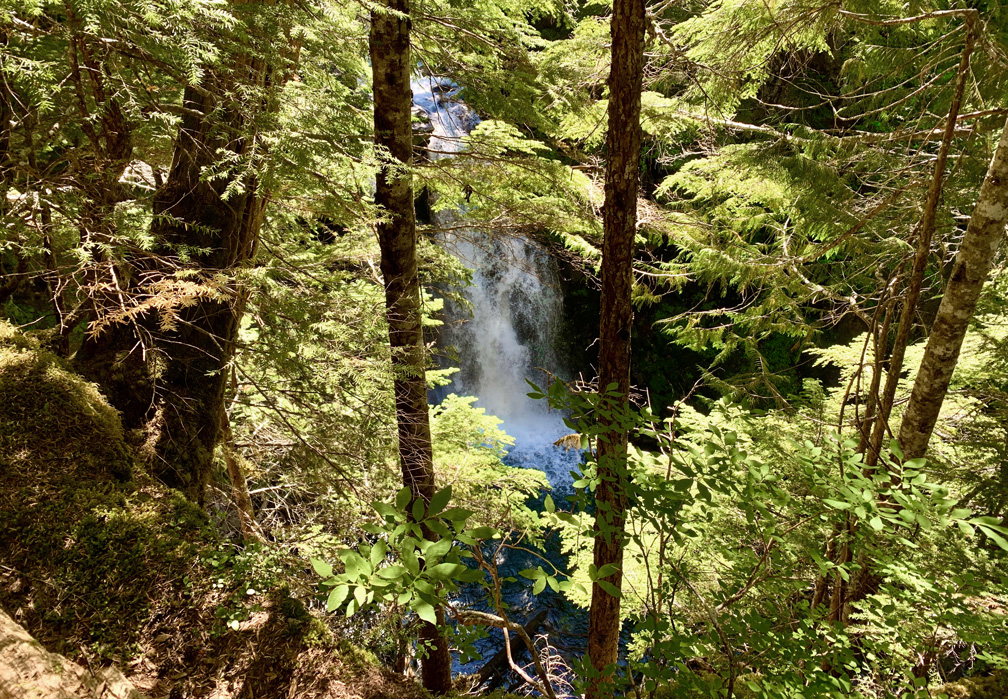
The hike to Carter Falls is a climb for sure, but it offers a nice view of the falls, and then on up a little further, there’s Madcap Falls is just ahead.
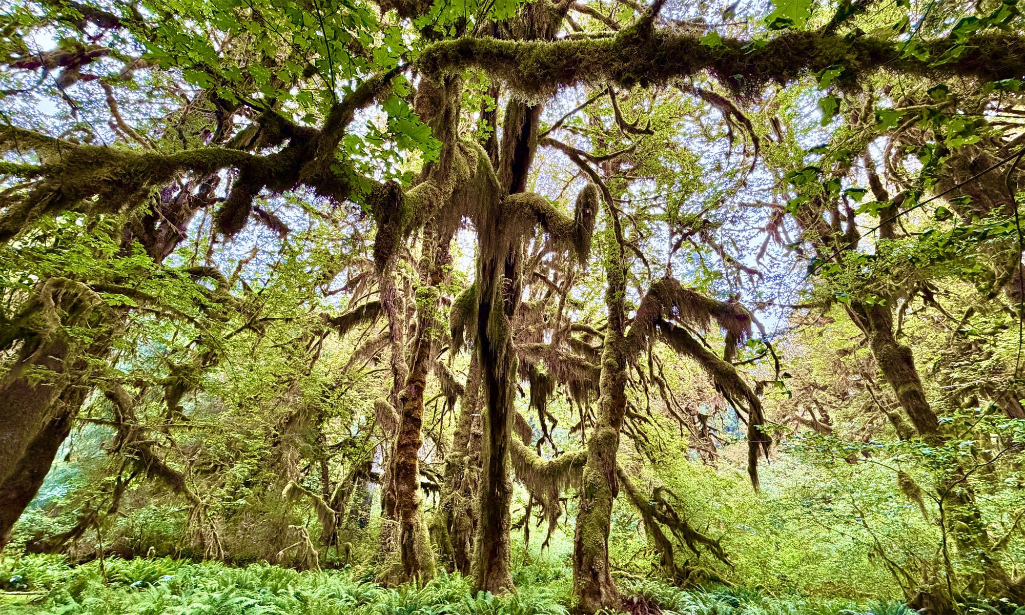
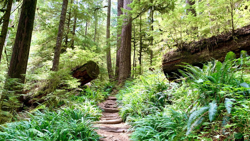
The Green Lake Trail at Mount Rainier National Park is a hike through an old-growth rainforest.
Hiking the Carbon River Trail in the northwest corner of Mount Rainier is pretty easy-going. You will hike next to old-growth Douglas-fir trees while hiking through a densely green rainforest.
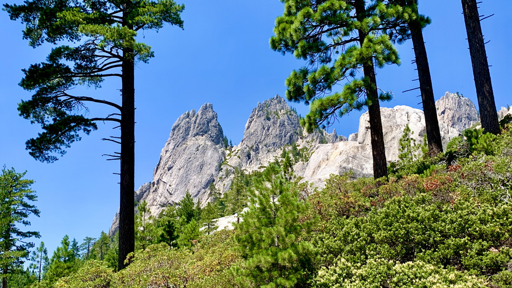
A pair of crags tower over the end of the Crags Trail at Castle Crags State Park.
Iwon’t sugar coat this. The hike to Castle Dome at Castle Crags State Park is not easy… especially on a hot day.
The hike starts off easy enough on the wide Root Creek Trail under forested canopy, but then you come to a junction about .3 miles in where you make a left turn, and then the climbing begins. Roughly after 500 feet, you will intersect with and cross over the Pacific Crest Trail.
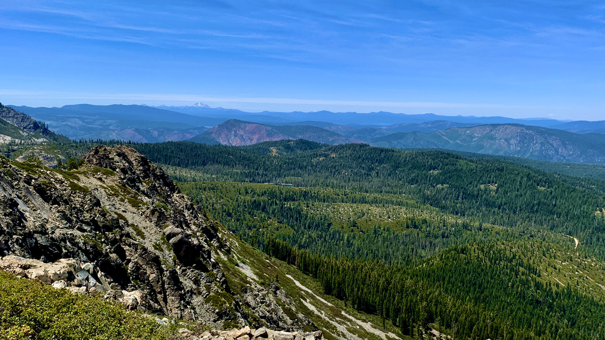
The view from the top of Spanish Peak is vast and sweeping with Mt. Lassen vaguely visible in the distance.
In 2021, the Dixie Fireburned much of the area, so the landscape may be different now than when we were there about a month or so before the fire occurred.
Hiking to Spanish Peak from Silver Lake in the Plumas National Forest is not easy, but the views are a spectacular payoff. The terrain is diverse. You start off in the forested area at Silver Lake, then you hike exposed over granite as you climb, and then you hike through forested areas again.
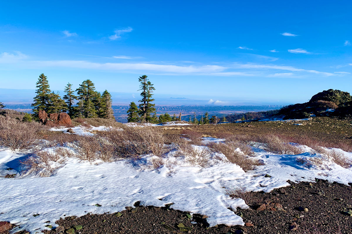
The view from Snow Mountain East Peak into the Sacramento Valley.
As when I wrote about my hike to the West Peak of Snow Mountain, the same two words apply: “peaceful desolation,” but the scenery has drastically changed since 2018 when I was there last.
A little less than a month after I hiked to the West Peak, the Ranch Fire broke out, and the area was closed for nearly two years for restoration. Then it was opened it up, but then the August Fire broke out in 2020, and the forest closed back down for a few months.
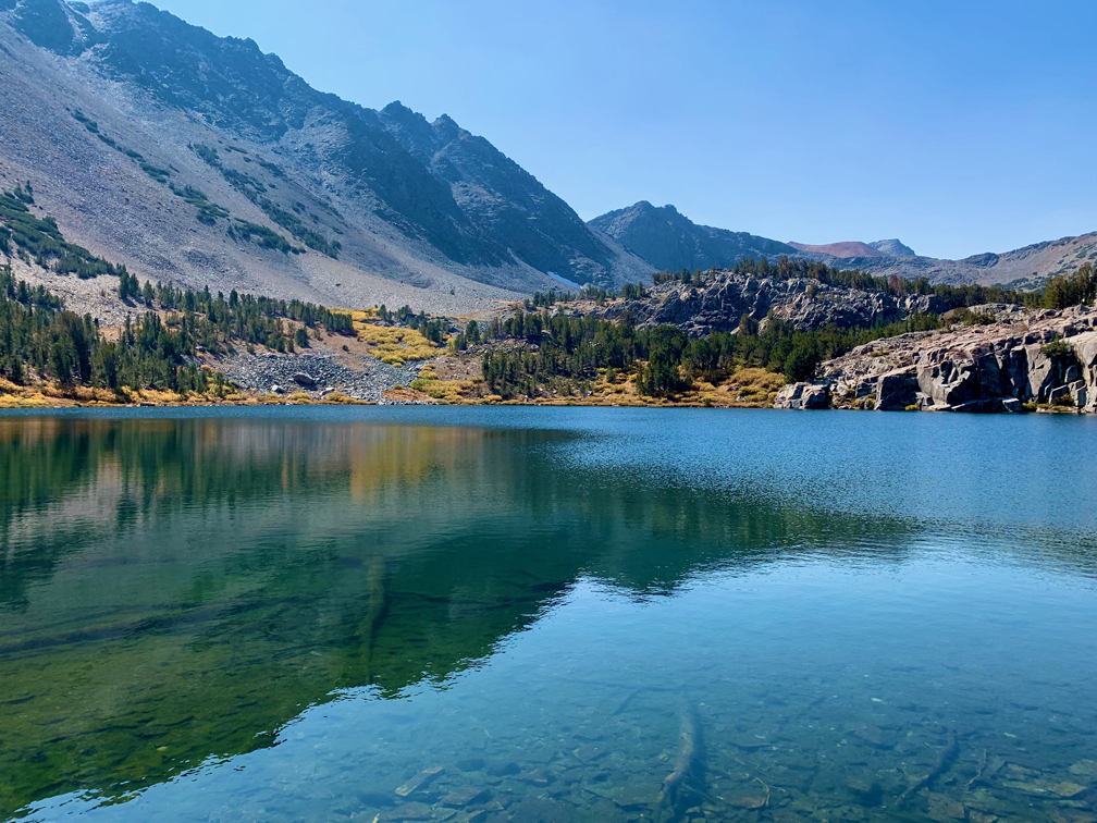
Cooney Lake on the Virginia Lakes Trail has really clear water through which the bottom can be seen.
Virginia Lakes in the Eastern Sierra’s is a feast for the eyes but a workout on the lungs. The peak on this trail reaches approximately 11,120 feet give or take, with a starting elevation of 9,846 feet.