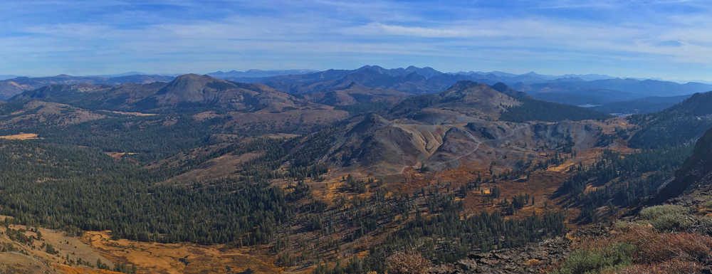
The only words I spoke to myself on this solo hike as I looked south to the mountain tops from the edge of Elephants Back were, “F*cking spectacular.” The pictures in this trail summary don’t do the view justice – it has to be experienced.
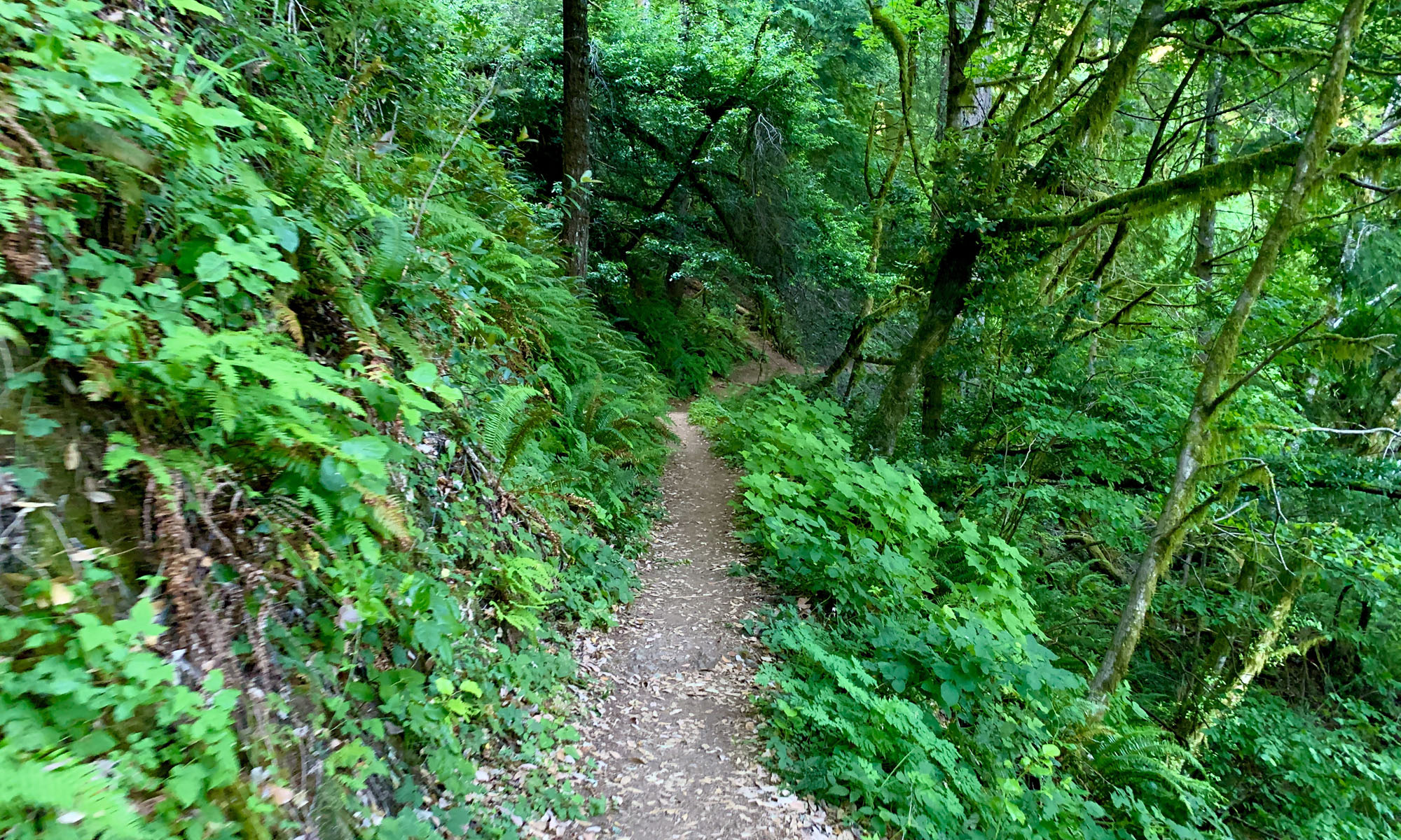
The hike from Carson Pass starts out like the others I’ve written about from there, but when I turned off the main trail, I blazed my own path, and it was not easy. The first time I saw Elephants Back in 2017, it called my name. I’ve hiked past it a few times and just looked up at it as I moved by.
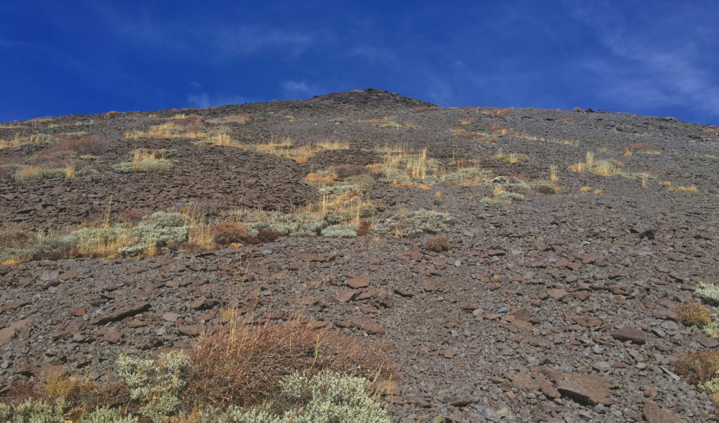
I encourage this off-trail climb, but it’s difficult. Once you leave the trail, you start to climb. I did this in October, so the ground wasn’t green and bushy, which made it easier to hike through. If you follow my GPS tracks, you will come to what I call a rock wall. It’s not really a rock wall, but there are so many large rocks in a line, you will have to scramble over them. You can also try to find another way around because as long as you keep the climbing point from my GPS tracks for Elephants Back in focus, you can free style it. You may find something easier than I did. Once you make it to the actual climbing point, it looks daunting.
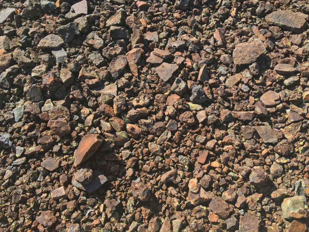
There is no trail, and going straight up is a mistake. You will have to go up at an angle. To make matters more challenging, you will be hiking on uneven, unstable and brittle lava rocks. You will need trekking poles for this climb, as it gets very steep and is easy to lose your footing. I also had to sit and rest a couple of times on the way up as I zigzagged it. The climb left me catching my breath and my heart pounding.
Once on top, you will still have to walk the ridge to the end-point. Even though you’re still ascending, it’s not challenging, but you are still hiking on loose lava rock. I got confident and put the trekking poles away. I lost my footing after a little bit on the shifting lava rock and took a bit a of a tumble, so even on this leg, it’s still a good idea to keep the trekking poles in play.
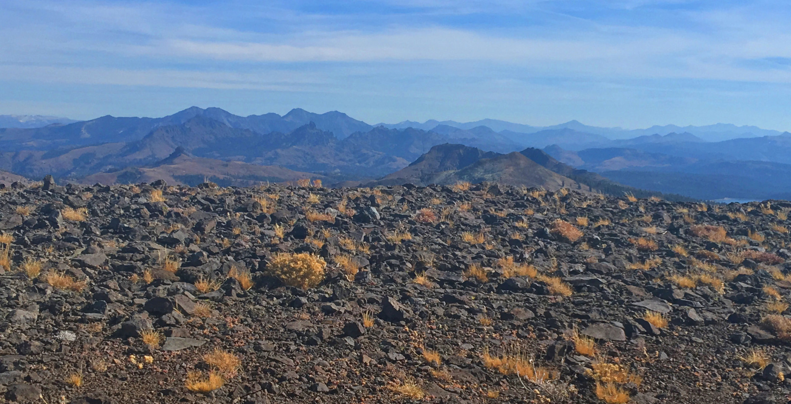
Once you get to the tip of Elephants Back, just take it all in. I looked down on Frog Lake, on parts of Red Lake below it, and the Pacific Crest Trail can be seen running just below Elephants Back. I looked down on Hope Valley to the east, and I turned further looking to the south where mountaintops disappeared to the horizon. Directly behind me as I hiked back to the descent point, I could see Winnemucca Lake and as the waters glistened under the sun with Round Top Mountain right behind it. Caples Lake beamed in the distance to the north, and portions of Woods Lake lay in the foreground.
As you will see from my GPS tracks, I went down on a different part of Elephants Back than when I climbed it. There was no way to descend where I ascended. Going down you will need your trekking poles. The lava rocks slipped under me, and I used the poles to slow or stop my descent when I needed to. Because I was descending on loose lava rocks, I got to “ride” down standing up in some places where I could control the slide. I was kind of fun, but it could be dangerous if not kept under control. I also looked for areas on the hill that weren’t covered with lava rocks but rather soil, and I took that when I could and would walk it. It was safer and more comfortable.
Once off Elephants Back, just head back to the trail and then stop off at Frog Lake or head straight back to the trailhead.
Directions: From Sacramento, take Highway 50 to the Sly Park Exit. Turn right onto Sly Park Road and follow it and turn on Mormon Emigrant Trail (it’s a road usually closed in the winter after the snow starts to fall) and follow it to Highway 88. Turn left on Highway 88 and head to the Carson Pass Pullout for around half an hour, which will be on the right 38.695499, -119.989671. There is overflow parking just before this point on the left.
The Skinny
Trail: Carson Pass to Elephants Back
Trailhead Coordinates: 38.694792, -119.989333
Trailhead Elevation: 8598 Feet
Distance: 5.3 Miles – Out and Back
Level of Difficulty: 🔴
Average Grade: 6.6%
Steepest Grade: 26% over .1 miles
Ascension: 1160 Feet
Trail Condition: 🟢🟢🟢🟢 and No Trail (See Summary)
Scenery: 🟢🟢🟢🟢
Best Time: Summer, Fall
Wildlife Concerns: Bears, Mountain Lions, Rattlesnakes
Best Time: Summer, Fall
Wildlife Concerns: Bears, Mountain Lions, Rattlesnakes
Cell Service: 📱 (AT&T at Elephants Back Peak)
Would I Do This Hike Again?: No
Parking: $5.00 at the time of this writing
Restrooms: Vault toilets in the parking lot