Hiking up Mount Konocti to Wright Peak is about a six-mile round-trip hike from the Upper Parking Lot near the access gate on Konocti Road. You will climb approximately 1,600 feet, and along the way, you hike past past walnut and apple orchards, through an amazing Canyon Oak grove to the Mary Downen cabin, which was built in 1903 and preserved. The trail continues up to Wright Peak to the no longer used CalFire lookout tower. You can also hike to Buckingham Peak and Howard Peak, which would make the entire mountain nearly a 9-mile hike.
The trail up Mount Konocti starts off just above the parking area on the service road behind a locked gate where there is an access area for hikers to use. As you hike up with views of Kelseyville below and the landscape behind it to the mountains. As you round the corner, you will deviate from the service road onto a trail that skirts an orchard. Just follow the signs and stay on the trail, as going off it will take you onto private property. The trail curves around the orchard and meets back up with the service road.
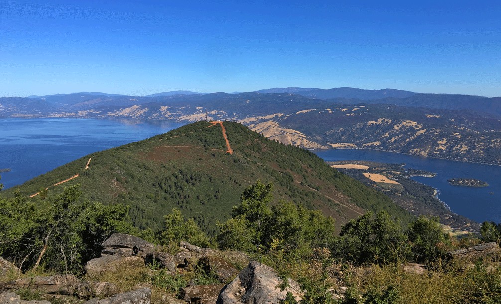
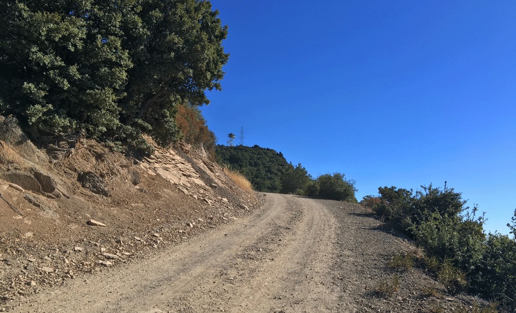
Once you are back on the service road, it climbs about 1.5 miles which can seem to go on forever, but you will come to a fork. If you go to the right, you’ll head to Wright Peak, where a closed CalFire tower sits. The climb is gentle as you hike along the side of the mountain in the shade during the right time of day. You’ll hike though a small oak forest until you round the corner on the southeast side where it is exposed, and the fire tower starts to come into view as you ascend, and take in the views to the southeast. As you get to about 3.5 miles the grade of the road gets a little steeper, and you may feel the pull a bit as it rounds a curve and ascends to the top of Wright Peak.
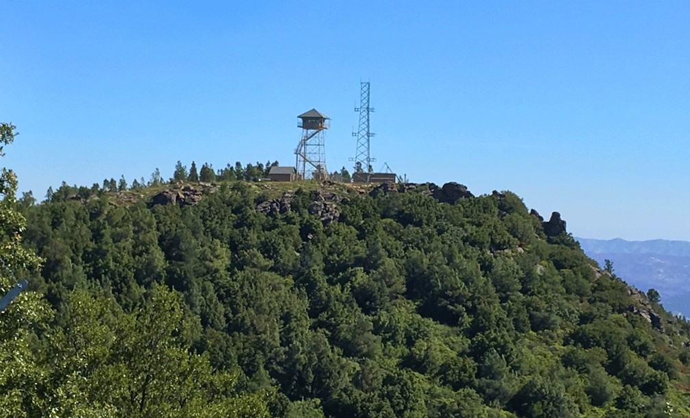
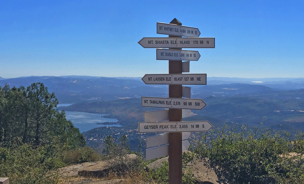
The lookout tower is fenced off, but there are picnic tables at the top. There are great views of Cobb Mountain to the south, and southern portions of Clear Lake can be seen. Much of Clear Lake is obscured by towering Pine Trees, but if you’re willing to go to Buckingham Peak, which can be a tough climb, you will have a commanding view of Clear Lake.

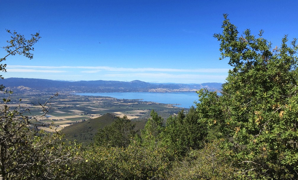
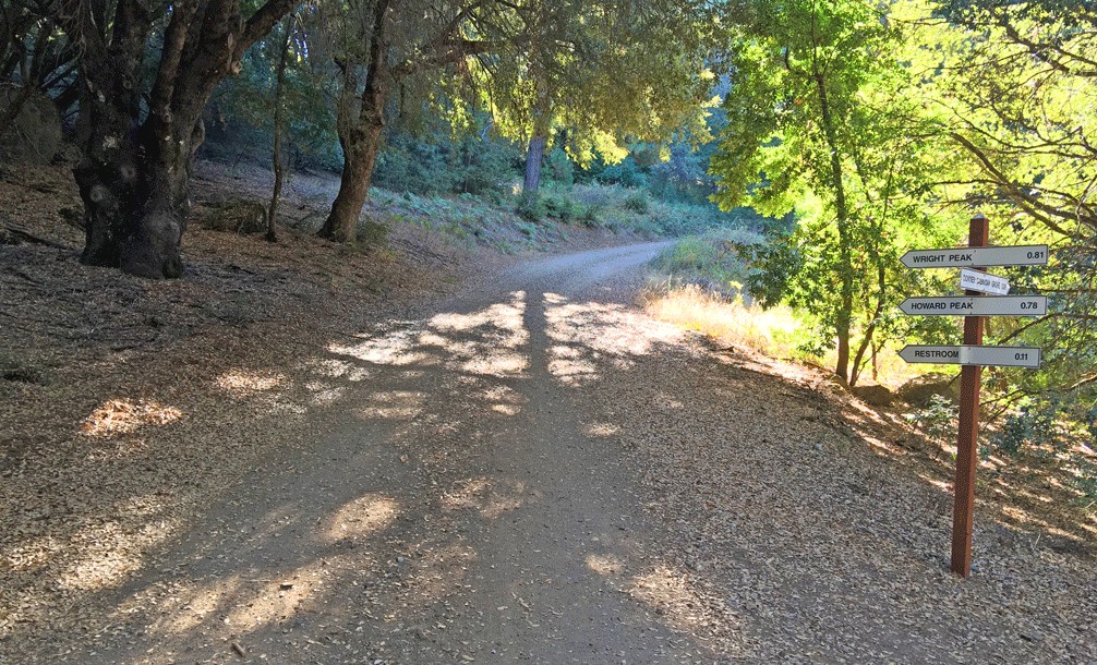
Head back down from Wright Peak, and in about a quarter of a mile, you’ll come to an offshoot service road you passed on your way up. The service road to Howard Peak is steep, and it’s easy to lose your footing as you get closer to the top, which leads to a telecommunications building. If you hike past it a bit more, you’ll find yourself with an impressive view of the valley and Clear Lake to the north. You can also view mountains in the southern tip of the Mendocino National Forest to the north.
Heading back down to the trailhead, you will come back to another offshoot you may have passed up on your way to the Wright Peak.
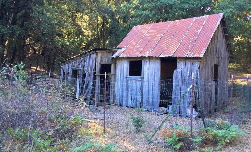
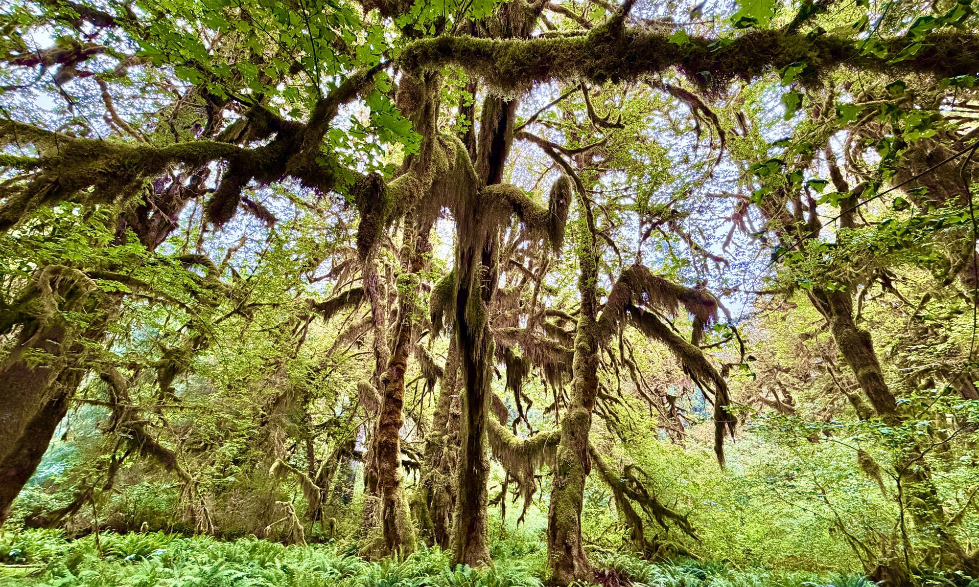
At about 38.971198, -122.776653 is an old cabin in ruin that belonged to a lady named Mary Downen that was built in 1903. She was one of the first settler’s of the mountain and was widowed and looking for a remote, peaceful place to live. Her son-in-law, Euvelle Howard, planted a walnut orchard in a glade near the cabin that can still be walked through.
Once you’ve walked though history, you can go back to the fork and choose to head toward to the parking lot, or you can take the fork to the right and hike up to Buckingham Peak. On Buckingham Peak, there are more telecommunication facilities that are fenced off all the way around. You can walk the perimeter of the fence that offers overviews of the Clear Lake and valley below, but in many areas the views from here are also obstructed by trees you have to peek through and between to see the lake. Obstructed by overgrowth, there is a bench on the east side of the peak that you can make your way to that offers views of parts of Clear Lake and the valley and ranges to the east.
Directions: From Kelseyville take Konocti Road one mile past the high school where the pavement runs out and turns into a dirt road. Follow the road for two more miles to reach the parking lot. If the parking lot is full, retreat back down to the overflow parking lot.
The Skinny
Trail: Mount Konocti
Trailhead Coordinates: 38.969937, -122.792331
Trailhead Elevation: 2725 Feet
Distance: 8.8 Miles – Out and Back
Level of Difficulty: 🟡
Average Grade: 3.7%
Steepest Grade: 10.2%
Ascension: 1,600 feet
Trail Condition: 🟢🟢🟢🟢
Scenery: 🟢🟢🟢
Nearest Town: Kelseyville
Challenges: Steepness/loose sand on Buckingham Peak
Traffic: 🥾
Highlights: Views, the Mary Downen Cabin
Best Time: Spring, Fall
Hazards: Temperatures higher than 90 degrees Fahrenheit, Poison Oak
Wildlife Concerns: Mountain Lions, Rattlesnakes
Would I Do This Hike Again?: I’ve hiked this trail at least three times, so probably.
Parking: Free
Restrooms: Vaulted toilets in the parking lot and along the trail