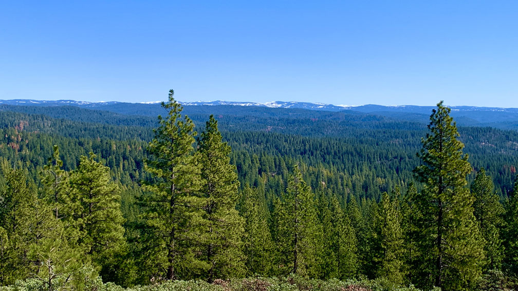
The Arnold Rim Trail is a hike through a part of the Stanislaus National Forest that leads to a fantastic point dubbed the “The Top of the World” where the view is incredible. From the Sierras, you can see over to the Coastal Range and Mount Diablo nearly 90 miles away on a clear day.
There are multiple places to start this well maintained trail from, and we started at the Sierra Nevada Logging Museum.
After about the first mile, you will hike on a paved trail before you come to a junction that will loop back around in the direction you came from. This is also where the pavement ends. From here, you continue into the forest where the trail is up and down, and by the end you may feel sore. Coming back there are a couple decent climbs. The trail is also very well marked, so getting lost takes work. You can also download a map with the trail markers on it. See the link below.
When you come to Marker 8, stay to the right. If you go to the left, the trail will take you to the “Top of the World” on an alternate route. When we came back, we chose to return on this route, as it gave a different scenery, and a different area to discover.
A lot of people take this hike to go to the San Antonio Falls. Since we were going to the “Top of the World,” we bypassed the trail to the falls, and you will see far fewer people on the trail.
Once we came to the junction at marker 11, we went to the left and we started climbing on switchbacks, where it got kind of tiring. The climb is about half a mile on a 13.5 percent grade.
When you reach the top of the switchbacks, you get your first glimpse of the views to come out to the northwest. We hiked on, still climbing, for about another half mile to another junction that will take you to Manuel Peak. It’s about .10 miles from the junction, and the views are sweeping from the north to the west. You can see Mokelumne Hill which is easily identifiable with its large antenna on top of it about 18 miles away. We could just make out Mount Diablo in the East Bay in the haze, the Coastal Mountain Range, and the forest in the foreground as the trees covered the hills below us.
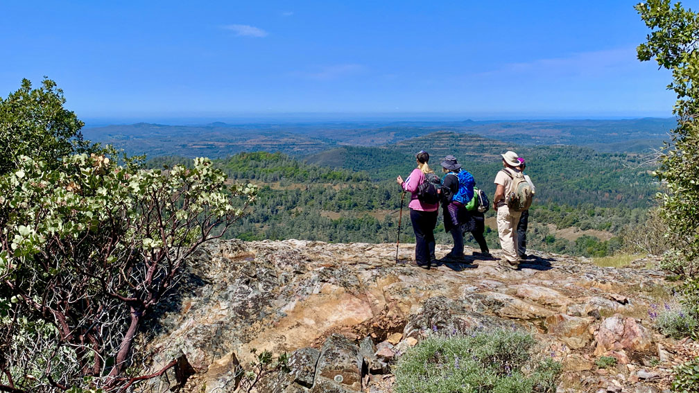
From there we backtracked to the trail junction and continued on another .3 miles to our endpoint at the “Top of the World.” The views to the northwest were similar to Manuel Peak, but to north and east we could see the snow on the peaks of the mountains at the higher elevations. We stopped there, had lunch and hung out before heading back.
Heading back, we had a choice, and instead of going back the way we came from the switchbacks, we took Manual Peak Road down, which is about .3 miles from the “Top of the World” to the right and headed down, and we started hiking a small lollipop. We followed the road for about 1.2 miles and we came back to Marker 8 and followed the trail back. There are some seemingly long uphill climbs on the way back. They may seem longer and more tiring than they really are because of the long hiking that has already been done.
When we got back to where the pavement started, about a mile from the trailhead, we opted to go to the left and not the way we came in. The trail took us down to an overlook of the San Antonio Creek and then we followed the trail to Mandel Road, which is forest road, and turn right to head back to the parking area.
For a map of the Arnold Rim Trail, go to https://arnoldrimtrail.org, and then look for the Avenza Maps app link and follow the directions on that page.
Directions: From Angels Camp, take Highway 4 East for 18.9 miles and turn left onto Dunbar Road. Follow it for .7 miles and turn into the Sierra Nevada Logging Museum. Pay attention to where you can park, as some spots are reserved for those who are visiting the museum. Parking is here: 38.265002, -120.344437, and is limited.
The Skinny
Trail: Arnold Rim Trail To The “Top Of The World”
Trailhead Coordinates: 38.265166, -120.345082
Trailhead Elevation: 3963 Feet
Distance: 11.6 Miles
Level Of Difficulty: 🟠
Average Grade: 2.5%
Steepest Grade: 14.1% For .5 Miles
Ascension: 2208 Feet
Trail Condition: 🟢🟢🟢🟢
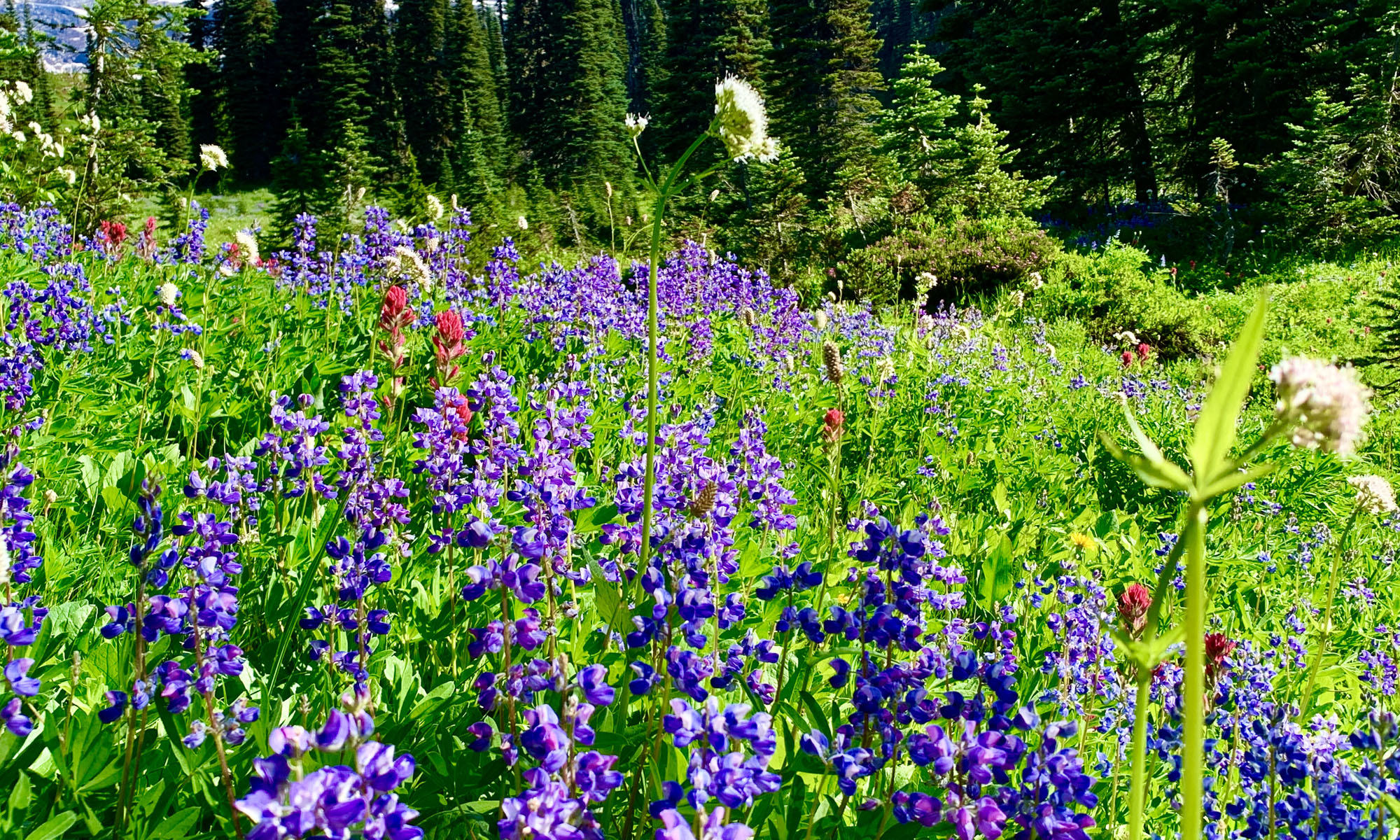
Scenery: 🟢🟢🟢
Nearest Town: Arnold
Challenges: Single Track Trail With Mountain Bikers
Traffic: 🥾🥾
Highlights: Scenery
Best Time: Spring, Summer, Fall, Winter
Hazards: Temperatures Over 90 Degrees Fahrenheit
Wildlife Concerns: Bears, Mountain Lions, Rattlesnakes
Cell Service: 📱📵 (AT&T)
Would I Do This Hike Again?: Maybe
Parking: Free At The Time Of This Writing
Restrooms: None