This hike takes you under lush canopy at Mount Tamalpais State Park, up steep stairs, gives you a fantastic view overlooking the Pacific Ocean, and then you hike among the Redwoods at Muir Woods National Monument. But it’s also difficult for me to get excited about this hike.
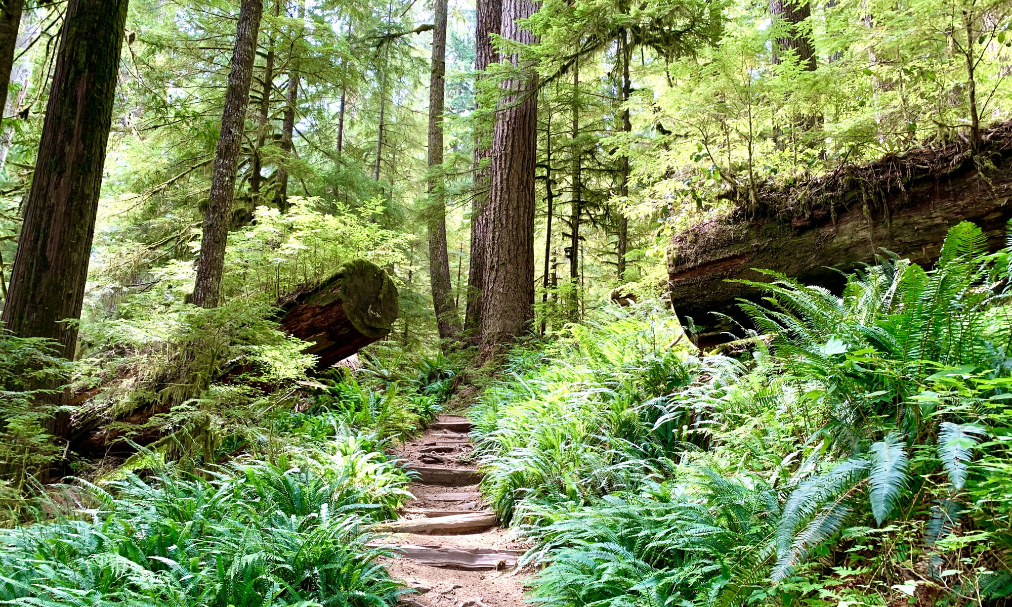
We started the hike at the Stinson Beach parking lot and made our way to the Dipsea Trail. We crossed the Panorama Highway and then followed the trail. At about 1 mile from the trailhead, we crossed Hill 640 Fire Road. Keep going straight and you’ll soon start hiking under canopy. After .2 miles, you will come to the Steep Ravine Trail. Turn left, and hike next to the ravine, and you’ll come to a bridge to the right after about 400 feet. While you’re hiking this part of the Steep Ravine Trail, take in the ferns, trees and maybe running water in the ravine.
Once you cross the bridge, you will begin the big climb. There were too many stairs to count, but the heavy climb went on for .3 miles on a 15 percent grade. The steps are grueling, but coming back down them is very knee jarring and trekking poles are recommended to help ease the pressure put on them. Some of the hikers in our group had to stop on the way up to rest before they went on, and one sat down the steps for a bit. As you climb the steps, you will be amongst ferns, lots of canopy and redwood trees. As the trail smooths out, it gets easier to hike as you still climb. Overall, you will climb .7 miles on a 14.6 percent grade. This part of the hike seems more trafficked than the rest, and trail runners really seem to like it.
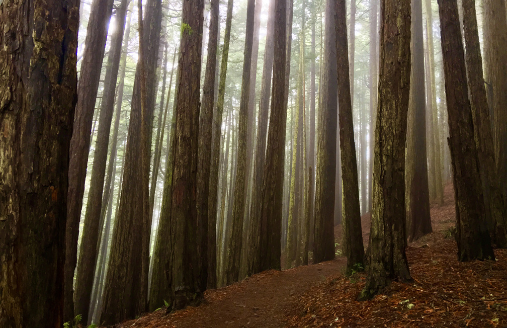
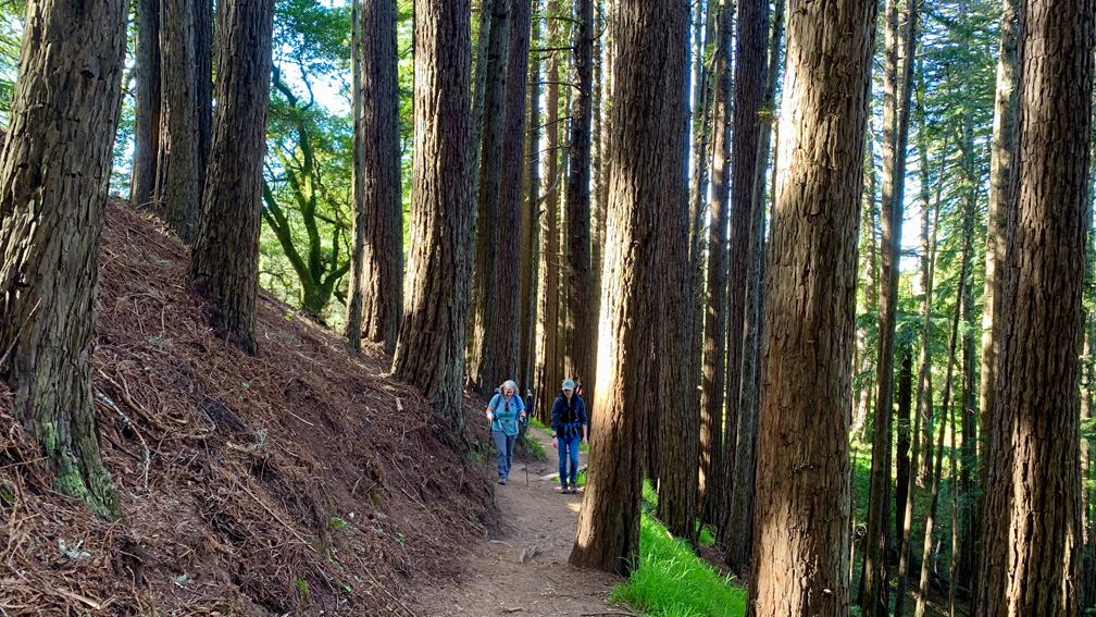
Enjoy the redwoods as you hike amongst them. The tall trees and greenery are peaceful to walk next to. Continue on, and you’ll eventually follow the trail up an embankment and emerge from the from the canopy. Shortly, in a little way, you will and come to a fantastic view of the Pacific Ocean at 2.1 miles.
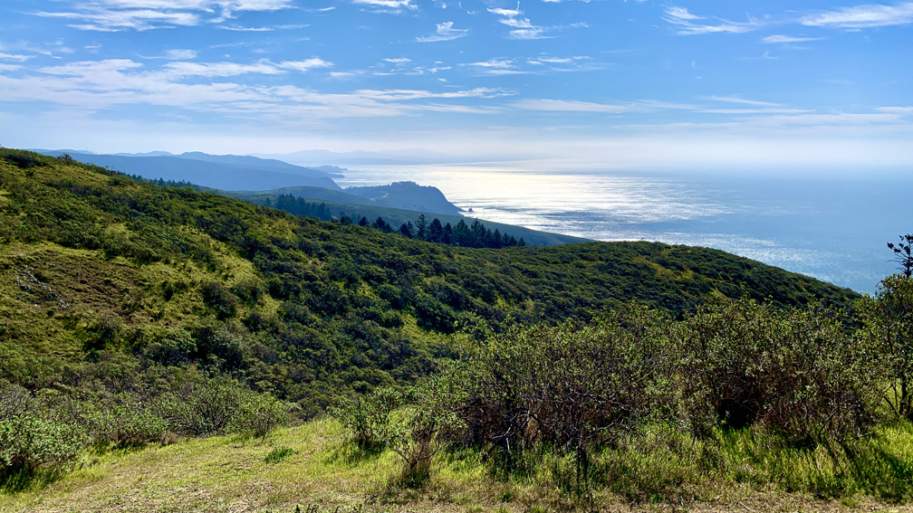
As you continue on, you’ll hike another .8 miles mostly exposed, and you’ll come to Cardiac Hill. Follow the trail on down, and you’ll start descending into Muir Woods under lushy green shade, and after .3 miles, you’ll come to the Ben Johnson Trail and to the left. Take it.
You will descend 1.3 miles on an 11.8 percent grade. This is another stretch where you may want to hike with the assistance of your trekking poles. There are some places with large stair steps. We stopped when got down to Redwood Creek and ate lunch sitting on the side of the bridge before heading toward the front of Muir Woods. We went back on the Hillside Trail. While going this way, you will hike past Bohemian Grove.
We were there on a Saturday, and Muir Woods wasn’t as crowded with people as we thought it would be. The parking lot was full, and where parking was allowed on the side of the road, it was full. There may not have been as many people there because a parking reservation is required, and parking along the sides of the road is prohibited.
Once we got to the front of Muir Woods, we prepared to cross the bridge to continue over Redwood Creek on the trail, but we discovered we had to take a 1 mile detour. One side said the bridge was out, and another said salmon were spawning. We had to hike along Muir Woods Road to Deer Creek Fire Road. When we got to Deer Creek Fire Road, we had to hike up it another half mile to where it met the Dipsea Trail. I’ll be straight up, the extra half mile climb sucked. That portion was on a 12.8 percent grade. The overall 2.25 mile climb back was on an average 10.3 percent.
When we finished with this hike, most in the group said this was very hard, and we are all experienced hikers. Most of us were very sore and tired, and it took some of us a few days for our muscles to recover.
Directions: From Mill Valley, Take Panoramic Highway to Stinson Beach Federal Park in Stinson Beach. Continue to the Stinson Beach Parking Lot here: 37.897491, -122.639847
The Skinny
Trail: Dipsea Trail To Muir Woods National Monument
Trailhead Coordinates: 37.897830, -122.637210
Trailhead Elevation: 27 Feet
Distance: 11.3 Miles – Lollipop
Level Of Difficulty: 🔴
Average Grade: 10.5%
Steepest Grade: 19.0% Over .3 Miles
Ascension: 3207 Feet
Trail Condition: 🟢🟢🟢🟢
Scenery: 🟢🟢🟢
Nearest Town: Stinson Beach
Challenges: Ascension
Traffic: 🥾🥾
Highlights: Redwoods, Ocean Views
Best Time: Spring, Summer, Fall, Winter
Hazards: Temperatures Over 90 Degrees
Wildlife Concerns: Mountain Lions, Rattlesnakes, Ticks
Cell Service: 📱 (AT&T)
Would I Do This Hike Again?: No
Parking: Free
Restrooms: At The Parking Lot