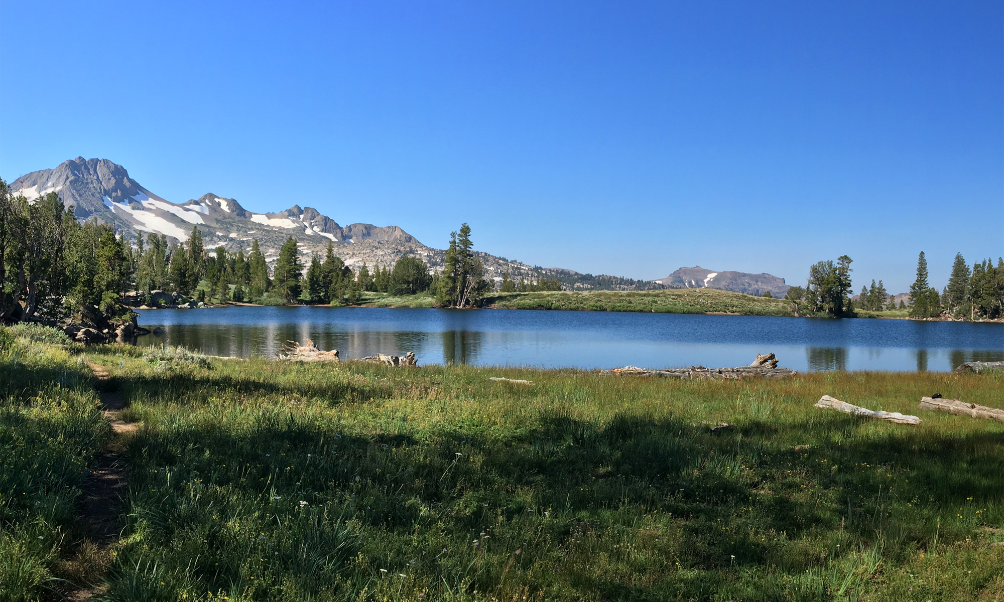
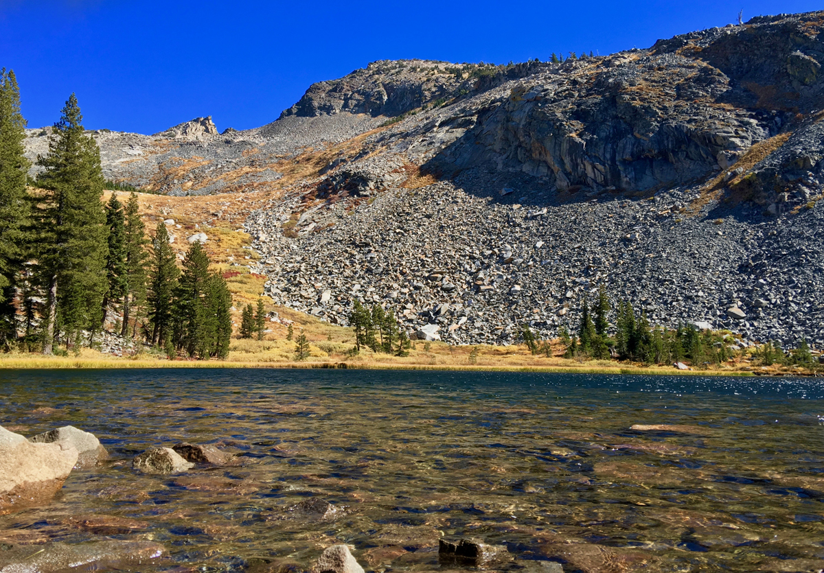
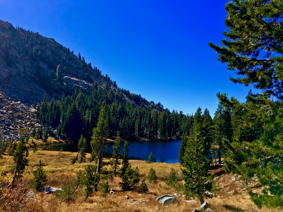
Lake Sylvia is a beautiful lake at 8050 feet in the Sierra Nevadas at the base of Pyramid Peak. The lake is small and beautiful, and the water is clear. It’s also idyllic and lined by pine trees on all but the northeast end, where you can look up at Pyramid Peak.
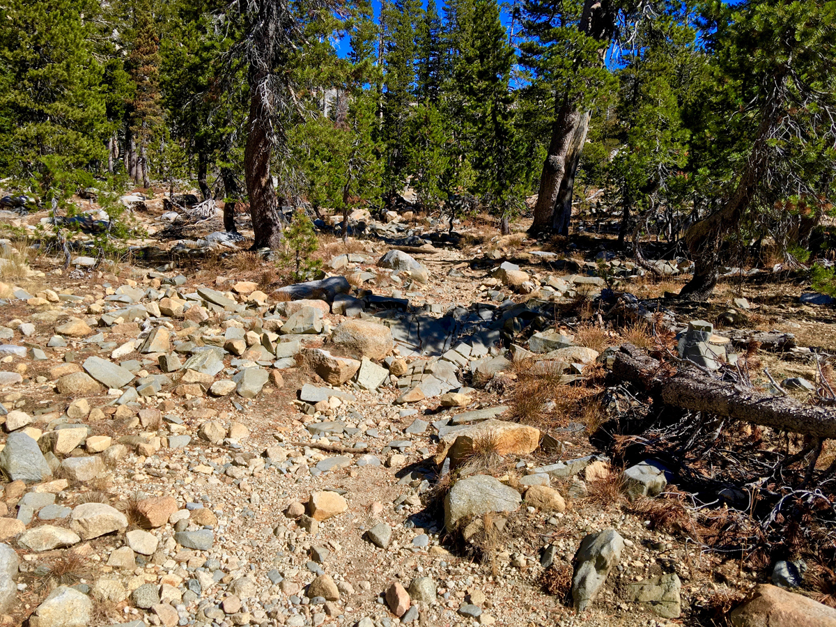
The 5.8-mile hike to Lake Sylvia starts smooth and pleasantly enough on a service road. You are ascending almost the entire way, but sometimes it’s difficult to tell. Once you reach Desolation Wilderness, and even in some places before, the trail gets testy.After about a mile and half in, you start hiking on and over rocks on the trail path, and instead of looking around you, you’re almost constantly looking where you’re going to put your feet next. In many places it looks like the trail follows paths along where streams flow during snowmelt.
When you cross over into Desolation Wilderness, attention to foot placement becomes nearly constant. In several places along the trail, golf ball sized granite stones are scattered over the trail, and it becomes really easy to lose your footing and roll an ankle. If we weren’t wearing boots with upper support on them, we would have surely twisted our ankles at some point.
Depending on the time of year, multiple water crossings may need to be made on the trail. Because we were hiking in the fall, we had to make three crossings on the way to Lake Sylvia over in Desolation Wilderness. If the season was different and water levels higher, some of the crossing could have been difficult to traverse.
Because of the trail terrain, we had to stop and rest a few times, as hiking this upward uneven trail became work. I thought it was just me, so I asked my brother who I was hiking with if it were a dirt trail how it would have been. He said it would have been much easier and wouldn’t have been so tired. To emphasize the kind of physical demand this trail put on me and how much energy it took to complete, this hike took three pounds from me.
Anohter thing to note about this trail is from time to time you may need to stop and assess what way to go. By that, you may have to study where the trail is vs what looks like it could be the trail. Once you read it, it’s not difficult to figure out. If worse comes to worse and you do get off trail, use Lyons Creek as a guide, as the trail mostly parallels it.
In the summertime, the trail before Desolation Wilderness is green alive wildflowers that looks almost like something out of a Disney fairytale movie.
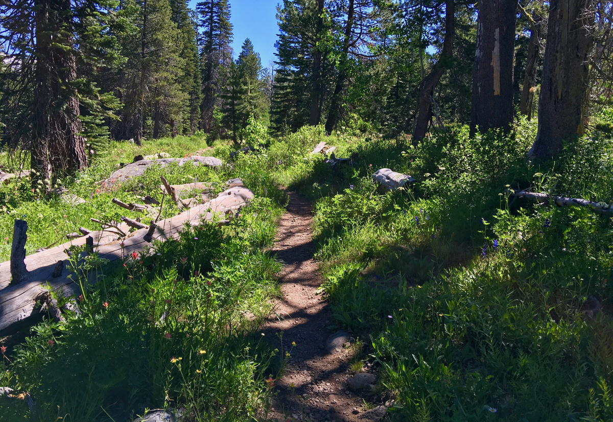
If you don’t want to go all the way on this trail, it is most certainly with hiking at least about .75 miles back where you go and sit by Lyons Creek where is flows beautifully and you dip your feet in if you like. The gushing water coming down from the snowmelt is clear and pristine, and you can see the granite rock under the water like looking through a window. About a mile back, and away from the creek, there is a very large flat rock level to the trail it passes. It’s a great place to sit and have lunch.
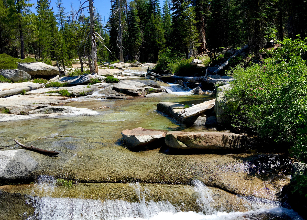
If you don’t want to go all the way on this trail, it is most certainly with hiking in at least about .75 miles where you can go and sit by Lyons Creek where is flows beautifully, and you can dip your feet in if you like. The gushing water coming down from the snowmelt is clear and pristine, and you can see the granite rock under the water like you’re looking through a window. About a mile back, and away from the creek, there is a very large flat rock level to the trail, and it’s a great place to sit and have lunch.
If you plan to hike into Desolation Wilderness, you will need a permit. They are free and at the informational kiosk at the trailhead.
Directions: From Highway 50, turn onto Wrights Lake Road and follow it 4.1 miles to the Lyons Creek Trailhead here 38.810226, -120.239472 on the right side of the road. It’s a small parking area , so it would best to get there earlier in the morning if you plan on going on a weekend. In summer, even during the week it may be filled by people who hike into Desolation Wilderness and camp.
The Skinny
Trail: Lyons Creek Trailhead to Lake Sylvia
Trailhead Coordinates: 38.810250, -120.239456
Trailhead Elevation: 6755 Feet
Distance: 11.3 Miles – Out and Back
Level of Difficulty: 🟠
Average Grade: 5%
Steepest Grade: 10.3% over 0.1 miles
Ascension: 1444 Feet
Trail Condition: 🟢🟢🟢
Scenery: 🟢🟢🟢
Nearest Town: Strawberry
Challenges: The Trail Itself (see summary)
Traffic: 🥾
Highlights: Lake Sylvia
Best Time: Summer, Fall
Hazards: The Trail Itself (see summary)
Wildlife Concerns: Bears, Mountain Lions
Cell Service: 📵 (AT&T)
Would I Do This Hike Again?: Probably Not
Parking: Free
Restrooms: None