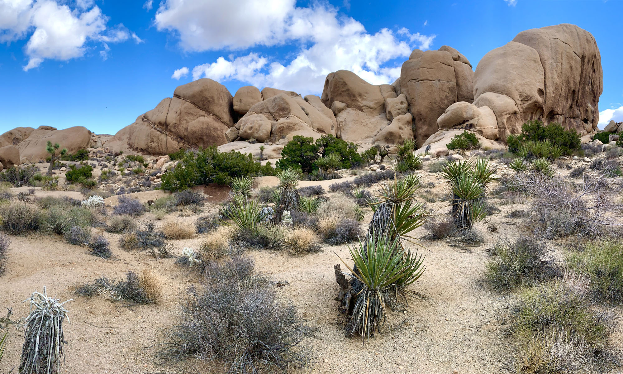
Hiking to Lost Palms at Joshua Tree National Park is like hiking through a desert garden. If you’re up for hiking through the desert, there really is a lot to see as far as plant life goes on this hike, along with great landscape vistas.
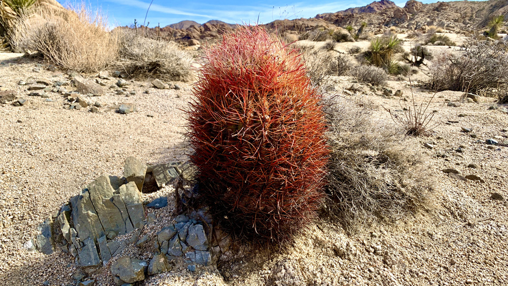
On this hike, you will more than likely come across cholla cacti, indigo bush, jojoba, California juniper, creosote bush, mistletoe, Mojave yucca, Mormon tea, barrel cacti, granite rock, palm trees, but no Joshua trees in this part of the park.
We stayed at Joshua Tree National Park for a few days, so we started our hike from the Cottonwood Campground, but there is a trailhead and parking area here 33.736988, -115.810647, if you want to day hike it. The coordinates below in The Skinny are from where we started out. Where we started out, there was also an interpretive trail with placards identifying plant-life you will come across on the trail.
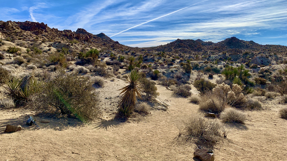
We dropped down into a wash and followed it until we came to the Lost Palms Trailhead at Cottonwood Spring. We hiked down to Cottonwood Spring – where there was no water – and took in the Palm trees and area and then we started out for the Lost Palms Oasis. For 2.7 miles, we did climbed a not very difficult climb with some ups and downs on a 4.1 percent average grade.
After about .8 miles from the trailhead at Cottonwood Spring, there is a junction where you can go to Mastodon Peak. We ventured on to Lost Palms and decided to take this trail on our way back.
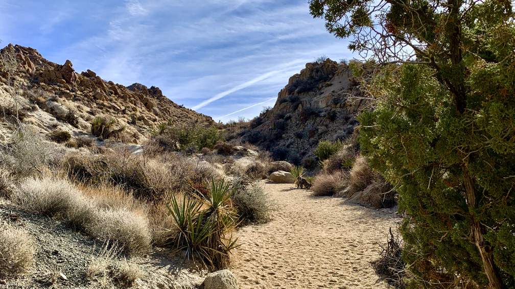
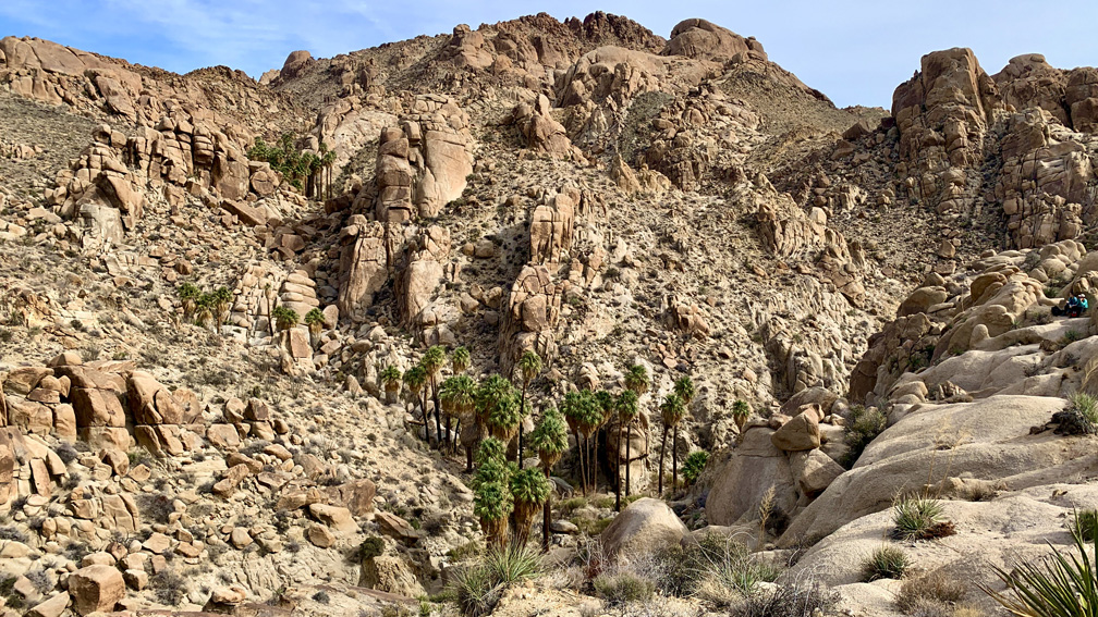
During the climb to the Lost Palms Oasis, taking in the landscape is what it is about. You will probably see all of plant-life mentioned above, and maybe other things as well. The rock formations are also interesting to look at, and at certain points, you can also see out the Salton Sea in the distance. Other than a few birds, a couple of Phainopepla and some turkey vultures and some sparrows, we did not see any wildlife while we were on the trail.
When we got to the Lost Palms Oasis, the trail ended on a ridge overlooking the palm trees. There appeared to be a trail that went down to a lower group of palm trees, but there was a sign saying there was no trail beyond that point to proceed at your own risk. Most people stayed at the top where we did, and we had our lunch overlooking the oasis, but some people ventured down.
We hiked back about 3 miles and took the Mastodon Peak trail we passed previously. Just looking at the hike up to Mastodon Peak can be daunting, but we’d also just finished hiking 7 miles to get to this point, and we were tired. This may have accounted for how we slowed down on this climb. There are steps in the granite to help with the climb, but they weren’t easy in some parts.
We continued to climb up and came to a spot where we could overlook the landscape to the south and once again see the Salton Sea. Because we were so tired, we chose not to make the climb to the top of Mastodon Peak, which was on an off-shoot trail that would have only gone for .1 miles. We headed back, came across where the Mastodon Mine site was, took it in, and then headed back to camp.
A couple of things to note: While we were hiking back on the Lost Palms Oasis Trail, someone wrote in the sand “waterfall this way” with an arrow pointing to the direction of the Lost Palms Oasis. There was on water when we were there, nor is there any indication of a waterfall on any of the maps I have. Do not take on this trail with the notion you may come across water. That would be a dangerous and possibly deadly assumption if the temperatures were high.
The desert landscape, even in January when we did this hike, felt warm under the cloudless sky. Make sure you take plenty of water with you.
Directions: From Indio, take Interstate 10 East for 23.7 miles to Cottonwood Springs Road (Exit 168). Follow Cottonwood Springs Road to Cottonwood Oasis Road and turn right. Follow the road 1.2 miles to the end where the trailhead is. Parking is here: 33.737362, -115.811025
The Skinny
Trail: Lost Palms Oasis & Mastodon Peak
Trailhead Coordinates: 33.744420, -115.812010 (Cottonwood Campground), 33.736988, -115.810647 (Cottonwood Springs)
Trailhead Elevation: 3100 Feet
Distance: 8.6 Miles – Lollipop
Level of Difficulty: 🟡
Average Grade: 4.1%
Steepest Grade: 14.4% Over .2 Miles (On Mastodon Trail)
Ascension: 1146 Feet
Trail Condition: 🟢🟢🟢🟢
Scenery: 🟢🟢🟢
Nearest Town: Indio
Traffic: 🥾🥾
Highlights: The Desert Landscape
Best Time: Fall, Winter, Spring
Hazards: Cacti – Avoid Touching Them!, Heat
Wildlife Concerns: Rattlesnakes
Cell Service: 📵 (AT&T)
Would I Do This Hike Again?: No
Parking: Parking At The Trailhead. $30 To Enter The Park; Good For 7 Days (Cottonwood Springs)
Restrooms: At the Cottonwood Visitor Center, which is here: 33.748460, -115.823940