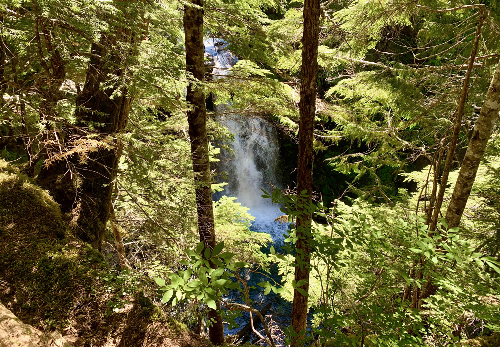
Waimoku Falls on the Pīpīwai Trail at Haleakalā National Park.
The hike to Waimoku Falls on the Pīpīwai Trail is a beautiful lush hike through bamboo forests on the island of Maui. While not a difficult hike, it does offer challenges in the way of heat and humidity. That said, I would do this hike again and again.
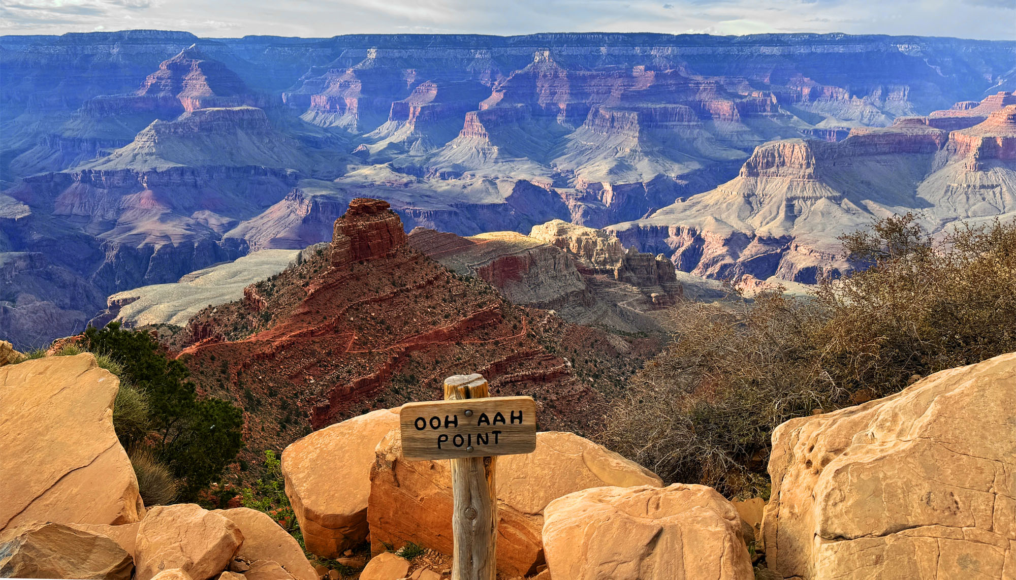
The view from Ohh Ahh Point looking out to the vast horizon of part of the Grand Canyon.
The hike to Ooh Ahh Point, a short one-mile hike, is pretty easy on the way down. The way back up is another story and on an average of 11.2 percent grade for about a mile. Once you get to Ooh Ahh Point, it’s easy to see why it’s named what it is.
Looking out at the Grand Canyon is breathtaking from here. The colors and the vastness of the canyon are awe-inspiring as you look across to the horizon and down into the canyon where you can see the trails far below you go.
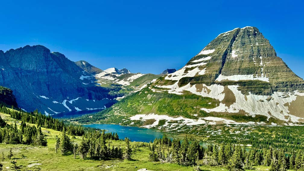
Hidden Lake in Glacier National Park is a sight to behold. From the viewpoint, it can be incredibly breathtaking, and we found it difficult to head back.
Overlooking Hidden Lake in Glacier National Park is awe inspiring, and looking out from here is one of the places where you can see why Montana gets the label “Big Sky Country.” No picture can capture this – it has to be experienced to be understood. The best way to describe it is that the sky above you doesn’t seem to stop, and you can seem to see forever over the horizon.
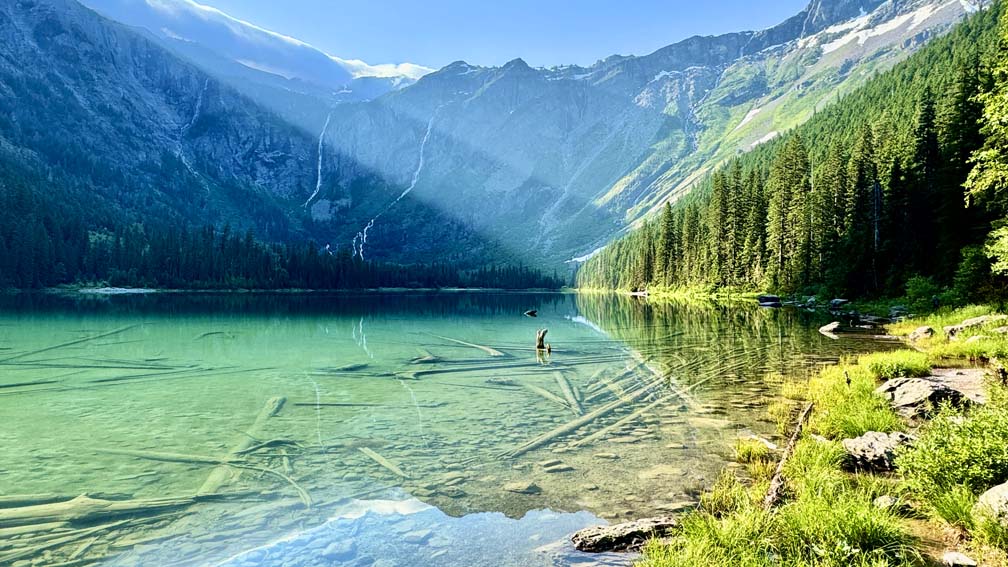
Avalanche Lake at Glacier National Park in the early morning hours.
Avalanche Lake in Glacier National Park will have you agape as you look up at the mountains surrounding you with multiple waterfalls flowing into the crystal-clear waters of the lake.
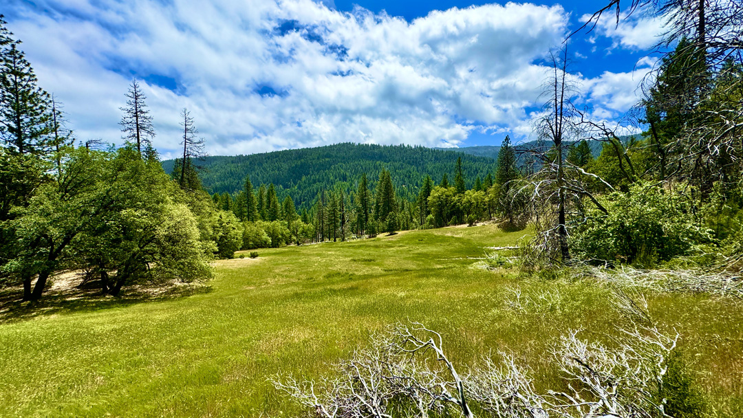
Deafy Glade displays beautiful green grasses in the springtime within the mountains of the Mendocino National Forest.
This is an update to the 2020 summary of the hike from the Deafy Glade Trailhead to Summit Springs due to changing trail conditions that now present a safety hazard to hikers and backpackers.
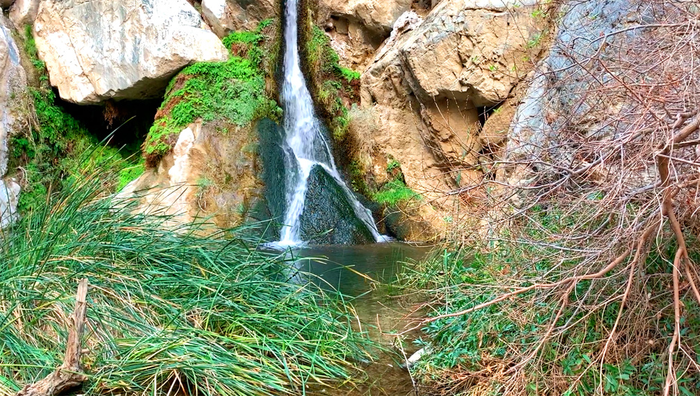
Darwin Falls is a spring-fed waterfall at Death Valley National Park.
A waterfall at Death Valley National Park? Yep, there certainly is, and the hike to Darwin Falls is pretty easy for the most part.
The hike starts off from the parking lot and follows a Darwin Wash back to the waterfall. We didn’t start to notice water until about .7 miles from the trailhead that flowed from the waterfall in a stream. As we ventured further back, we went from a dry desert wash to trees, cattails and other greenery, including ferns, fed by the water.
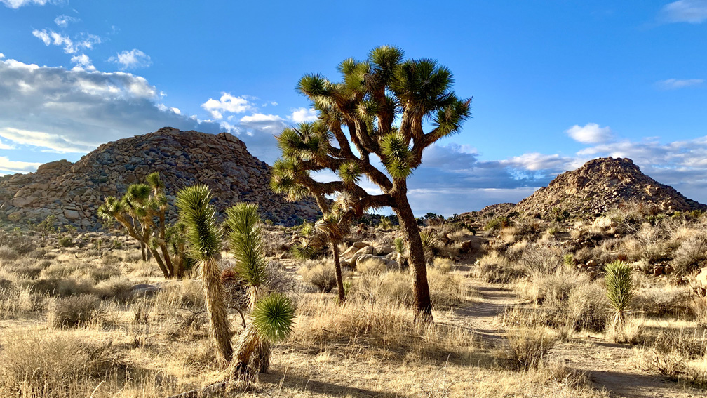
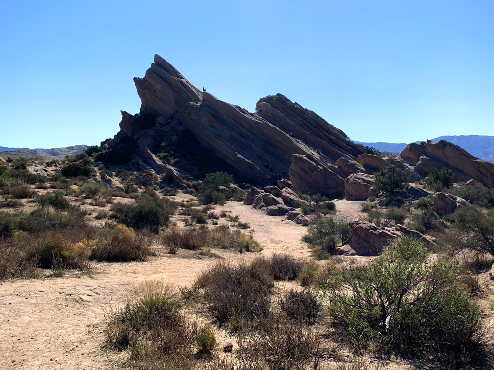
The desert landscape on the Maze hike is full of desert vegetation, trees, and land formations.
I’ve heard for years about The Maze at Joshua Tree National Park, and I finally got the opportunity to hike it. Maybe it was because of the hype I heard that I was expecting more than what it offered, but even with that said, I was in no way disappointed.
The desert landscape at Joshua Tree National Park is striking, but pictures do not do it justice. It needs to be experienced to be truly appreciated.
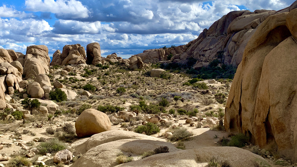
This is the hike that made Joshua Tree National Park my favorite park. The Skull Rock Nature Trail/Split Rock Trail for me were over the top with scenery and ease. The video below and pictures do not do it justice. This hike needs to be experienced.
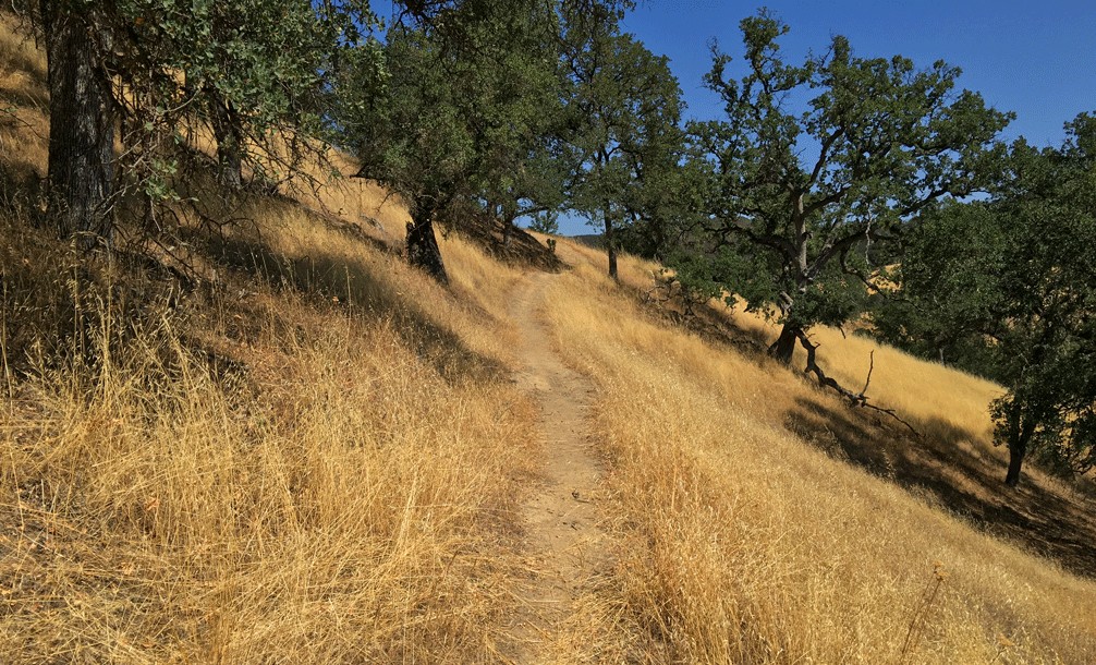
The Redbud Trail meanders through the oak laden hillsides of the Cache Creek Natural Area.
Originally posted June 8, 2018
Updated April 30, 2023
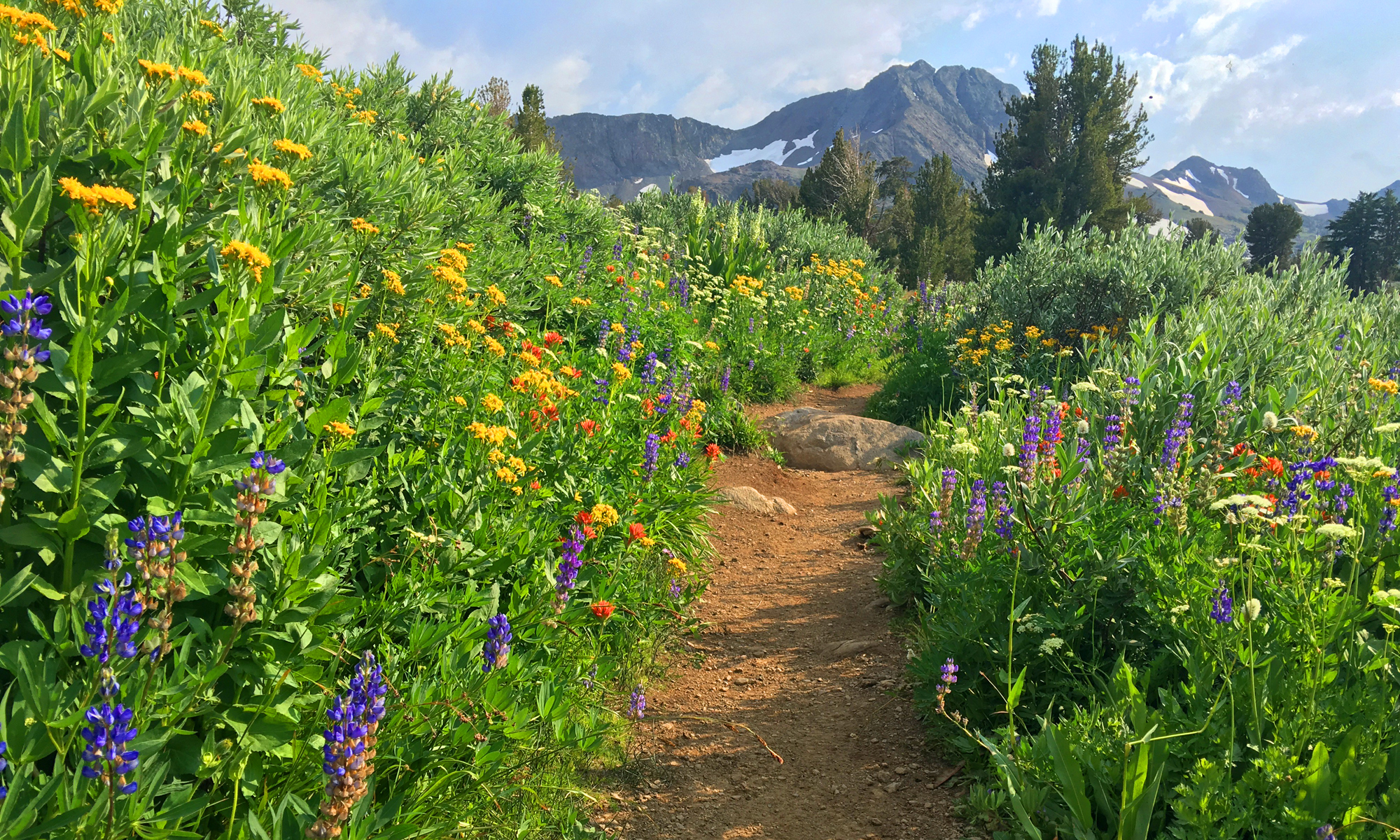
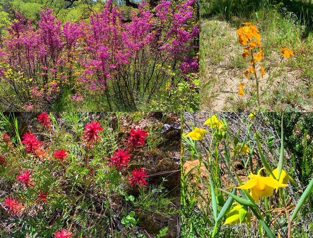
We hiked Redbud Trail in April 2023 after the California’s massive rainstorms earlier in the winter and spring. What resulted were superblooms in locations. For as often as I have hiked the Redbud Trail, I have never seen the wildflowers on the trail I saw in late April. The wildflowers included Indian Paintbrush, Warrior Paintbrush, Common Fiddlestick, Western Wallflower, Diogene’s Lantern, and many other colorful wildflowers.
Hiking the Redbud Trail as it meanders along hillsides next to oak trees and descends down to Baton Flat and Cache Creek is a pleasant hike through the foothills.
The trail starts off out of the parking lot on a service road and then to the right you’ll see a sign with Redbud Trail marked on it. Take the trail away from the road and hike along the edge of the foothills until you come to a creek bed that you have to cross. Continue reading “Hiking Redbud Trail to Baton Flat”
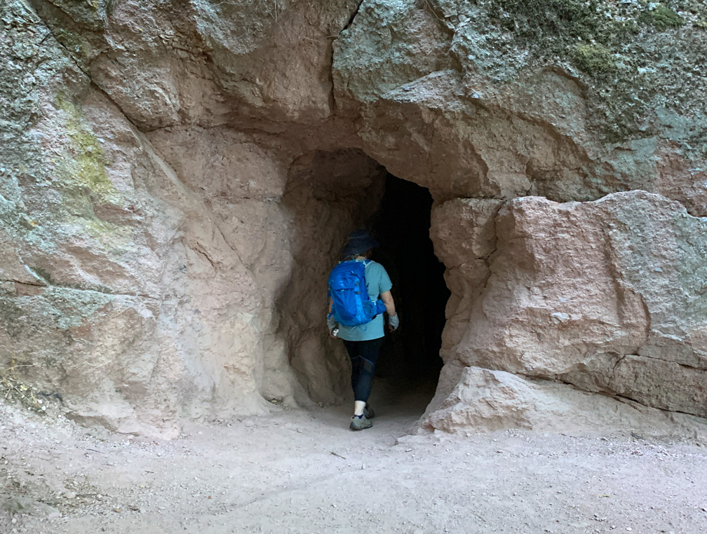
A hiker enters a cave on the Moses Springs Trail to Bear Gulch Reservoir at Pinnacles National Park.
The hike to Bear Gulch Reservoir at Pinnacles National Park starts off on the High Peaks Trail as you hike under oak trees and ascend to the Moses Spring Trail junction.
As the trail ascends, you start to hike amongst rock formations that take you to the caves on the Moses Spring Trail. If you are not comfortable with caves, there is a bypass trail that will also take you to Bear Gulch Reservoir on up past the Moses Spring Trail junction that leads to the Rim Trail, but the caves are worth exploring. Continue reading “Hiking Moses Spring Trail to Bear Gulch Reservoir at Pinnacles National Park”
The hike to Carter Falls is a climb for sure, but it offers a nice view of the falls, and then on up a little further, there’s Madcap Falls is just ahead.
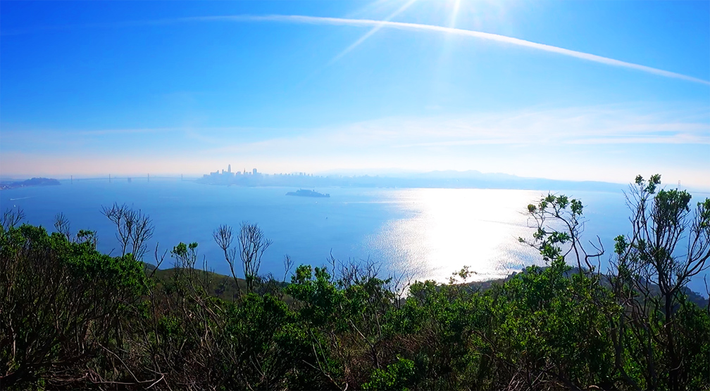
The views from the top of Angel Island offer a 360 degree view of the San Francisco Bay.
The views from the top of Mount Livermore on Angel Island State Park of the San Francisco Bay are incredible on a clear day. You can see the San Francisco Skyline, the East Bay, the Golden Gate Bridge and the hills of Marin County and much more.