Hiking the Steep Ravine Trail – Dipsea Trail Loop

The Steep Ravine Trail on Mount Tamalpias follows Webb Creek through a lush Redwood forest.

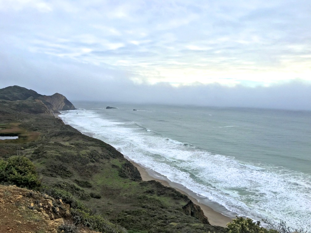
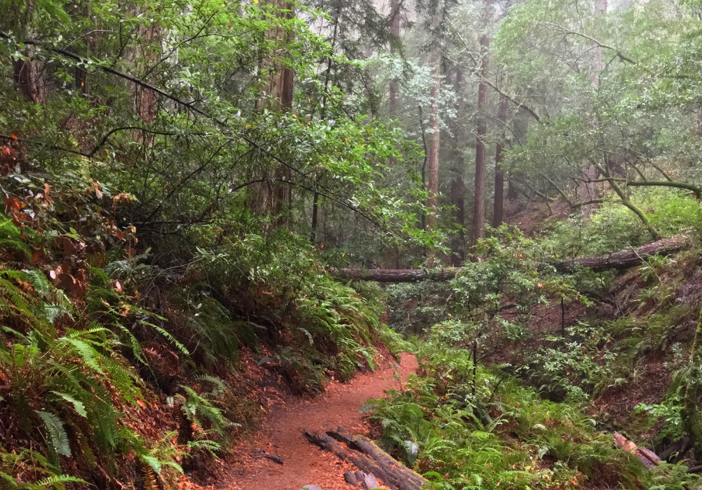
If you like hiking under Redwood trees next to running water and waterfalls, then the Steep Raving Trail is the hike for you if you do it at the right time of the year. By that, it’s good to go during or after a good rain when the waterfalls will be flowing.

The trail is called Steep Ravine for a reason. You will descend 1,084 feet on a 9 percent grade slightly over 2 miles. For the most part, it’s gentle, but the beginning is steep. If the water is running, it’s worth it. Continue reading “Hiking the Steep Ravine Trail – Dipsea Trail Loop”

Hiking to Bassi Falls

Bassi Falls is at its fullest strength in May from the snowmelt runoff. 
Bassi Falls is at its fullest strength in May from the snowmelt runoff.

Updated May 23, 2021

Bassi Falls is a spectacular show of natural force as it tumbles and crashes 109 feet off granite rocks before the water hits the bottom and flows away. To see the falls at their most powerful, it’s best to go before the end of May while the snowmelt is still good. After May, the flow slows and eventually becomes a trickle. Continue reading “Hiking to Bassi Falls”

Hiking Eagle Pass to Paul Thomas Trail

Black Butte Lake from Eagle Pass is a green and alive in the springtime.

The hike from Eagle Pass to the Paul Thomas Trail can only be done in the springtime while the grasses are green before the summer sets in and the weather is still cool enough to be outside in the valley. The view from Eagle Pass you hike up to is incredible. It looks over to Black Butte, the lake itself to the west and the Coastal Mountain Range that spans the horizon running from the north the south that disappears to sight. Continue reading “Hiking Eagle Pass to Paul Thomas Trail”

Couple falls to death with alcohol in system

Ialways knew this post was inevitable, and more a question of “when” and not “if” I was going to write it. 

The “when” has happened. I’ve written about safety and situational awareness, and this falls under both, along with stupidity.  The autopsy report was completed in early January 2019 on married couple Menaskhi Moorthy and Vishnu Viswanath who fell to their deaths in Yosemite National Park in October 2018. They fell while attempting to pose for a selfie. The autopsy report stated they were, “intoxicated with ethyl alcohol prior to death,” according to the San Jose Mercury News.

Continue reading “Couple falls to death with alcohol in system”

Hiking Snow Mountain West Peak

The Sutter Buttes, the Sacramento Valley and the Sierra Nevadas can be seen in the distance from Snow Mountain.

Note: This portion of the forest was severely burned in 2018 shortly after I hiked it, and most the trees are now burned out. See my Snow Mountain East Peak summary for an update.

Peaceful desolation. That’s what the hike up Snow Mountain in the Snow Mountain Wilderness is. The trails are defined, the wildflowers are in bloom in the summer and people are scarce. The trails in this Northern California area are a hidden gem, as they are under-hiked and seemingly unknown to most.

Though not recommended to hike in the summer as the heat can be brutal, I happened to catch the mountain on an unseasonably cool July day with overcast and a smattering of rain. The wildflowers were in bloom from red to purple, yellow, blue and orange. The hike starts out exposed and meanders for a little more than a mile before you start to get under the cover of the tall pine trees as you climb.

Continue reading “Hiking Snow Mountain West Peak”

Hiking Polomarin Trailhead to Wildcat Camp (Coast Trail)

The Coast Trail offers sweeping views of the Pacific Ocean.

Hiking the Coast Trail from the Polomarin trailhead to Wildcamp Camp is like hiking Highway 1. It’s extraordinary with its views of the ocean on one side and forests on the other.

Most take this trail to hike to Alamere Falls, where the trail offshoot is at nearly four miles in. At the time I took this trail, the Alamere Falls cutoff was mostly overgrown and difficult to ascertain. It seemed like it wasn’t being well-maintained. Some say there is a sign there, but I did not see one when I hiked by, but someone made an arrow marker on the ground (not permanent) marking the intersection. Part of the overgrowth was poison oak, but nonetheless that doesn’t deter people from hiking to the falls. But if you go on, there’s more to see. Continue reading “Hiking Polomarin Trailhead to Wildcat Camp (Coast Trail)”

Making Mistakes So You Don’t Have To…

Besides “The Hike is the Destination,” my other tagline should be “Making Mistakes So You Don’t Have To,” or something like that. Everybody knows I’m a huge advocate of checking the weather before you go. I was headed to Emigrant Lake today off of Highway 88, and I did check the weather, but I didn’t realize how bad the wind would be. I got about 100 yards or so on the trail and turned back. “F*ck this, I’m out of here,” I said to myself as my right ear began to ache from the cold when I was on the trail. Continue reading “Making Mistakes So You Don’t Have To…”

Hiking Blue Ridge Trail to Fiske Peak

The view from the Blue Ridge Trail is sweeping as it looks into the Mendocino National Forest in the distance with Cache Creek in the foreground.

I love this hike! Hiking the Blue Ridge Trail to Fiske Peak in Northern California starts with a mild climb through an oak forest. It’s the only canopy you’ll be under during the hike. As the trail meanders up the open hillside, you’ll hike into a clear view of Glascock Mountain across the highway. Once you get to this point, the real ascension quickly begins. Continue reading “Hiking Blue Ridge Trail to Fiske Peak”

Upper Bidwell Park: North Rim Trail to Middle Trail

The North Rim Trail in Upper Bidwell Park comes alive with color in the springtime.

It isn’t often that I hike a city park and let alone write about it, but Upper Bidwell Park in Chico is laden with hiking trails in the hills is an exception. Over the years I’ve heard so much about the hiking trails in Upper Bidwell Park, I finally decided to check it out in the spring. I hiked the North Rim Trail and Middle Trail Loop. Continue reading “Upper Bidwell Park: North Rim Trail to Middle Trail”

Hiking Thunder Mountain

The views to the south of Thunder Mountain can be spectacular if the climatic conditions are right and there is at least some snow on the mountaintops in the distance.

This sometimes heavy breather of a hike to Thunder Mountain has outstanding views of mountaintops and ranges and overlooks vast swaths of trees and granite, meadows and forested hiking. At slightly over three miles in, and after some of the heaviest climbing on the trail, you come to the vista that can make you stop hiking and just gaze at the landscape. As you look to the south, you can see mountain peaks in the distance – probably in the Stanislaus National Forest – some with snow on them. If there are clouds in the over them, it’s an even more powerful view. Continue reading “Hiking Thunder Mountain”

Safety Update: Stebbins Cold Canyon Loop

Stebbins Cold Canyon Loop, Blue Ridge Loop Safety Warning

New safety signs have been posted at the Blue Ridge Loop Trailhead near Lake Berryessa regarding high heat and how much water one person should take (at least 1 gallon) while hiking the Blue Ridge Loop Trail in the summer. Dehydration occurs on this trail frequently in the summer because people don't go prepared.
New safety signs have been posted at the Blue Ridge Loop Trailhead near Lake Berryessa regarding high heat and how much water one person should take (at least 1 gallon) while hiking the Blue Ridge Loop Trail in the summer. Dehydration occurs on this trail frequently in the summer because people don’t go prepared.

Safety Update: The Stebbins-Cold Canyon-Blue Ridge Loop near Lake Berryessa can be a brutal hiking trail in the heat. The maintainers of the trail have posted signs at the trailhead warning of NO COVER from the sun on the ridge and that each person have at least 1 GALLON of water with them and even more for those who have pets. I have seen pet owners carrying their dogs up on the ridge as they hike because their pets are too exhausted to continue under their own power. People are discouraged from using the trail in fire weather. If Cal Fire has issued a red flag warning, it is strongly advised that you do not hike this trail during that time. Continue reading “Safety Update: Stebbins Cold Canyon Loop”

Hiking High Bridge Trail

The views of the summer foothills from High Bridge Trail can be staggering at times.

The High Bridge Trail hike starts off on a brief service road going down to Bear Creek. Follow the trail signs, and they will point you to where the crossing should be, and you can see where the trail picks up on the other side of the creek. However, depending on what the water level is like, you may not be able to safely cross, and you may have to improvise your own way. If the water is running, you will have to use your own best judgment as to if crossing is wise, or if you should try it at another time. Continue reading “Hiking High Bridge Trail”