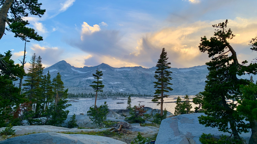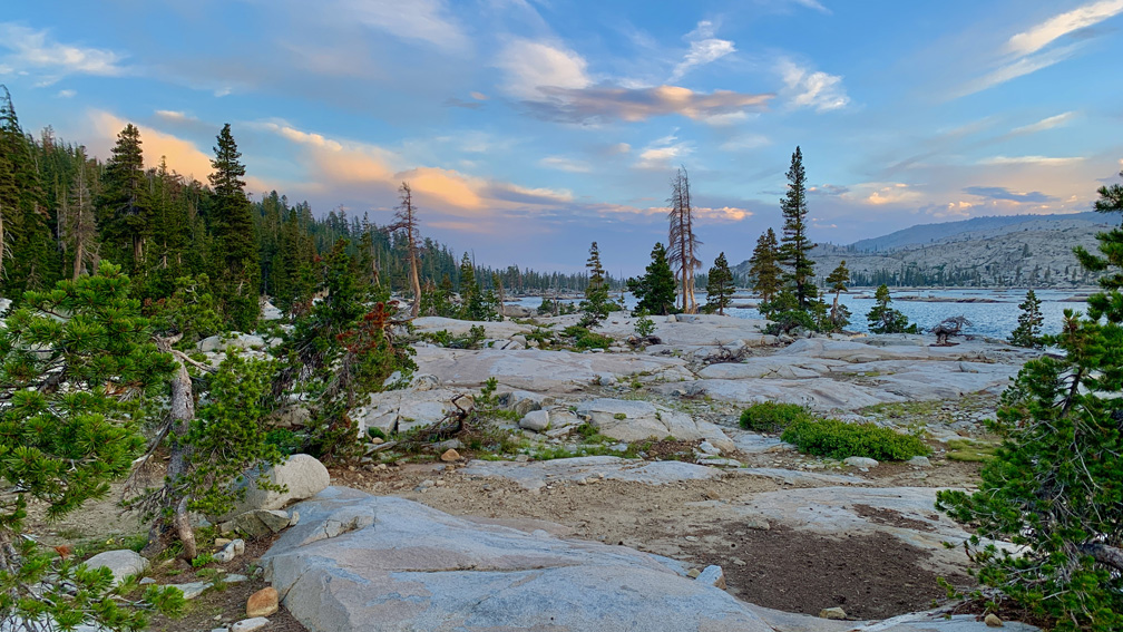
The hike from Echo Lake to Lake Aloha is a beautiful Type 2 Fun hike along the Tahoe Rim Trail/Pacific Crest Trail in the Sierra Nevada Mountain Range. We backpacked into Desolation Wilderness and were there for two nights.
Beginning at Echo Lake, the hike starts off on a gentle climb, and you hike along Lower Echo Lake for about 1.4 miles looking out on the boats and cabins below you and across the lake. The trail is well maintained and easy to hike, but trekking poles are recommended, especially if you are backpacking. They will be really useful further down the trail.
After we passed Lower Echo Lake, we hiked along Upper Echo Lake, which isn’t as visible in some places as Lower Echo Lake because of the thick forest. The trail parallels Upper Echo Lake for a little more than another half a mile. During the right time of year, you can shave off this hiking distance by using the water taxi from the Echo Lake Chalet to Upper Echo Lake for a fee. At the time of this writing the water taxi cost $20 per person one way. But what’s the point in taking the water taxi if you’re there to hike?
After you pass the offshoot trail to the water taxi, you continue to climb through the green forest, which is lush in some places. A lot of the trail on this portion heading to Desolation Wilderness is single track, so you may find yourself hopping to the side of the trail to let others pass from time to time.
Once you start to head up from Upper Echo Lake into Desolation Wilderness, the trail becomes rocky, and you will need to watch your step. We found ourselves watching the trail more and not so much what was around us, and this is where the trekking poles really became useful, as they helped us climb and keep our balance, and kept us from falling at certain points.
You cannot camp until you get to Desolation Wilderness, and on your first night in, you have to camp in a designated zone within wilderness the area you picked when you apply for your permit. We, however, were unable to do this.
We had to stop at Tamarak Lake, the first place with campsites in Desolation Wilderness if you enter from the Echo Lake side. It was unfortunate, but one of the members started feeling very ill as we climbed toward Lake Aloha. This was shortly after we passed the junction for Tamarak Lake. She was too ill to turn back, so we had to call an audible and hoped that if we did encounter a ranger, they would understand our situation and let us stay at Tamarak Lake, which was not in the zone we designated for our first night in Desolation Wilderness. In the morning, she was felt much better, and we continued on to Lake Aloha. We think she suffered from altitude sickness.
We were in too far, and she was too ill to attempt to turn back, and she also was adamant about not pressing the locator beacon button and decided to wait until morning. Overnight, she acclimated to the altitude. At Tamarak Lake, we were at around 7860 feet.
Tamarak Lake, by the way, was beautiful and serene, and it was a wonderful place to camp. When we were there, we did not have a mosquito experience, for which we were grateful. It may have been the time of year we were there – the last week of August.
The trail from Tamarak Lake to the main trail is easy to lose as it is over rocky granite terrain. Just head to the lake, and you should be fine. We also had a GPS device with us to help us stay on the trail.
We rejoined the main trail to Lake Aloha, but the climb for the next .65 miles was not easy, as we had to watch our step because of the rocky trail. The skies were cloudy that day, and we were grateful for that because the climb was exposed. Again, the trekking poles were quite useful in helping us maintain our stability.
When we reached the canopy, the major climbing was done. It did not take us long to get to Lake Aloha from here, and along the way we passed and looked down from above at Lake Margery. The wildflowers we saw along the way included lavender, Indian paintbrush, golden yarrow, and mountain spirea among others.
We made it down the hill and to Lake Aloha, and even though we didn’t hike too far, we decided to make camp there. Our original plan was to go to Dicks Lake at the furthest and then turn back. We did have two more days left for our permit, and we were going to play it by ear the next morning.
When we originally left, the weather forecast was for clouds and a cool day the following day. But we ran into a hiker, and he told us a storm was on the way, and we had to take that into consideration for the next day.
Side note: If you have an iPhone, and you use the default weather app Apple puts on it, do not trust it as your sole source of weather information. At the time of this writing, it’s forecasting is highly inaccurate at times and has gotten us into trouble on more than one occasion because we believed what it told us the weather was going to be like.
The night we stayed at Lake Aloha, the winds came up something fierce, and we woke up several times because the wind our tent blowing against the fly. The next morning, other campers also talked about their lack of sleep because of the heavy wind. We dubbed the experience the Hurricane Aloha.

In the morning, the skies were dark, and we decided it would be best to head back. A couple of hours into our hike back, the rain started to fall. We don’t have a problem hiking in the rain, but our fear was hiking back on the granite rocks and how slick they can be when wet.
As an FYI, we came across several rangers while we were in Desolation Wilderness, and they all asked us if we had a permit. When we saw the first ranger, he was with three others, and he wanted to check our permit. We happily obliged, and he signed off on it indicating he had seen it. The other rangers asked if we had a permit, and we told them who signed our permit. During our conversations with them, they were all very polite and professional.
Also, bears are rampant in the area. We did not see any, but we did see plenty of bear scat around Lake Aloha. A bear canister is required if you are going to backpack into Desolation Wilderness. For information about the area, you may want to download the FarOut app, formally Guthooks, and download the Tahoe Rim Trail map where other backpackers sometimes post their experiences about the area and trail conditions. Note, however we did not have any reception along the trail.
Directions: From Sacramento, take Highway 50 East for 88 miles and turn left onto Johnson Pass Road and then turn left on Echo Summit Road after .6 miles. Follow the road for about a mile to the parking lot on the left. Get there early because during peak season it can fill fast.
The Skinny
Trail: Echo Lake To Lake Aloha
Trailhead Coordinates: 38.834772, -120.044230
Trailhead Elevation: 7445 Feet
Distance: 12.5 Miles – Out And Back
Level Of Difficulty: 🟡
Average Grade On Overall: 2.1%
Steepest Grade: 10.5% Over .8 Miles
Ascension: 2321 Feet
Trail Condition: 🟢🟢🟢🟢
Scenery: 🟢🟢🟢🟢
Nearest Town: Meyers
Traffic: 🥾
Highlights: Scenery
Best Time: Late Spring (After Snow Melt), Summer, Fall
Wildlife Concerns: Bears, Mountain Lions, Rattlesnakes
Trail Hazards: Hiking On Slick Wet Granite
Cell Service: 📵 (AT&T)
Would I Do This Hike Again?: More Than Likely
Parking: Free At The Time Of This Writing
Red Tape: A Wilderness Permit Is Required For Backpacking In Desolation Wilderness
Restrooms: By Echo Chalet
