This summary is going to be a little unusual, as I’m going to combine a hiking and a backpacking summary into one post in that we did both in the same location.
We initially hiked around Sterling Lake in a loop in the Tahoe National Forest, but we liked it so much we decided to return a couple of weeks later to backpack it and stay the night.
When we hiked it, we were impressed with how scenic, isolated and idyllic it was, and that was what made us want to come back and backpack it and stay for a night.
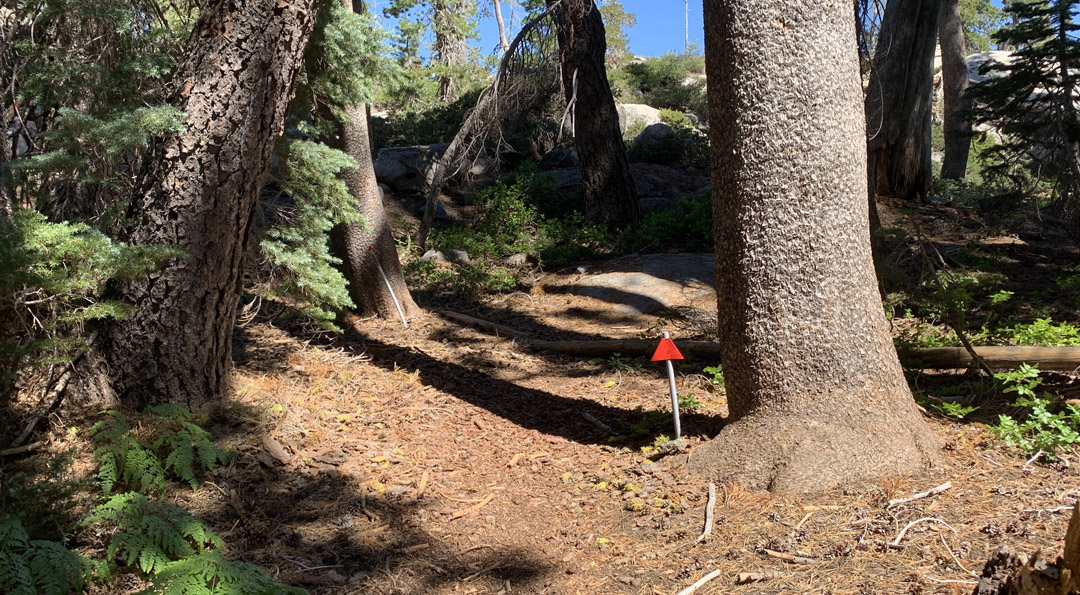
If you’re going to day hike the trail, the best way is to cross the dam and take the “red” trail to the left. The red trail is marked with red markers. At one point, the trail was marked with red marker flags, and remnants of them are still there, so you can use them to still help guide you. In some places, you may only see a white PVC pipe sticking up from the ground that the red flag was affixed to that can guide you. You can also look around for cairns in places. They play a much more crucial role on the “blue” side.

As I mentioned, this trail is idyllic, and it is isolated. When we day hiked it, we only saw three other hikers. When we backpacked it, we only saw two hikers. Even though the trail is not very long, once you cross the dam and leave the starting point at the campground, it feels like you’re in the deep backcountry in an isolated area.
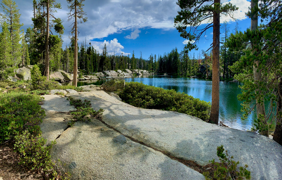
The ponds we hiked by were beautiful and picturesque. They were still, but they had lily pads in them and were surrounded by forest canopy. While hiking in the shaded areas, the mosquitos on the red side made their presence known in force.

We followed the red trail to a service road about 1.8 miles from where the red trail and blue trail split. We headed east on the service road for about half a mile and came to mossy pond, which looked like a lake after last year’s epic snow that ran off. It was incredibly beautiful. After admiring the pond, we decided to head back on the blue trail, but there was a problem.
The map showed a trail where there was no trail. None, and after searching for a while off trail, we were perplexed. We did not want to hike back on the red trail, as there would have been a fairly steep climb back up on the service road. If you are going to hike this, download my track. The turn is not where it should be on a map. And the trail is not marked with blue markers until much later.
I’m not sure what got us to step off the road where we did, but I hiked back just a little it and found a what looked like a cairn and went to it on a hunch. We looked around and saw what looked like it could be another cairn a little ways away. The cairns were not well defined, but we did know the direction we were supposed to head back in to Sterling Lake as well, and that helped. We did some guessing, made a couple wrong turns, found what looked like was a trail at one point but no longer maintained, and kind of started following it. About .3 miles in, we found the remnants of a blue marker on the ground, and we knew we were on the right path.
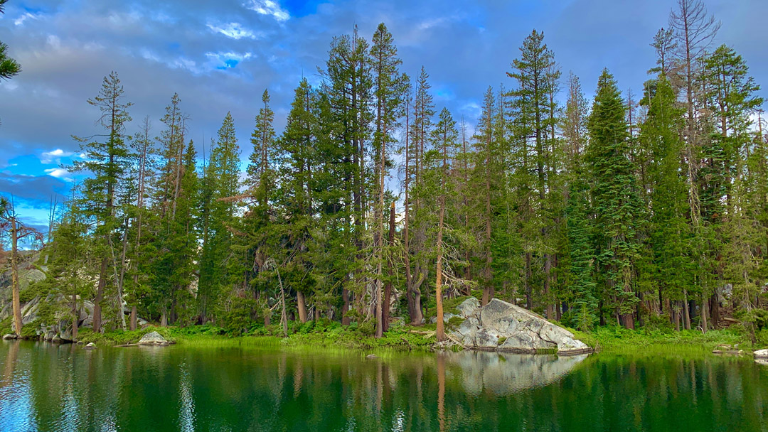
The blue trail, in our opinion, was more beautiful than the red trail. And, on this day, we did not encounter the mosquitos like we did on the red side. The ponds on this side were gorgeous with their stillness and reflections of the granite and forest in them. We decided this is where we would come backpack to, but we would come in from the blue side.
From this point, once we left the ponds, the trail was not well marked. There were some ties in some of the trees, but they were not blue. We followed them anyway, and they appeared to follow the trail out. There were times we lost the trail, and I had to rely on my GPS for assistance, but the map was not correct either, as it had a trail on it that was not there in real life.
We came to an unnamed pond on the map that showed the trail running on a hill next to it. It was not there, and we were confused. We ended up hiking along the side of the pond and eventually found the trail there. There were no blue markers until we got past the pond. In some areas, since there were no markers, someone painted blue marks on rocks to follow.
From the pond, we hiked another .3 miles and Sterling Lake came into view, but the trail did some weird things. It wasn’t well marked, and we had to take what looked like a trail but was not. It was very confusing, and we got lost and had to double back for a bit and find the trail. It was overgrown in places, and we had to bushwhack parts of it until we picked it up again. We followed it through the forest and back to the dam and crossed it and headed back to where we parked next to the campground.
It is easier to go in on the blue trail than to come out on it, and this is what we did when we backpacked back to the ponds on the blue trail. Even though we knew the way out this time, we still lost the trail a bit on the way out, but it was much easier to find this time.
Also, when we backpacked, it was only 1.8 miles from the campground/trailhead, but it felt isolated, and it kind of creeped me out because it was so isolated and nobody was around. I didn’t feel unsafe, but I did feel uneasy at night. There were a lot of gunshots not far from us – somebody had an AK and what sounded like a semi-automatic pistol and shot for around an hour and then left. I think the rain drove him or her out when it started. The person was close by, but we couldn’t tell where.
In spite of feeling uneasy, I would do this backpacking trip again, but I would go with more people.
Directions: From Colfax, take Interstate 80 East for 32 miles and take exit 165 (Cisco Road). Turn left on Cisco road and follow it to .2 miles to Hampshire Rocks Road and right onto Forest Route 85. Drive it for about 4.9 miles and turn on Sterling Lake Road for 1.1 miles. High clearance and 4WD is recommended, but I did see non-high clearance 2WD vehicles at the Sterling Lake campground.
The Skinny
Trail: Sterling Lake Loop
Trailhead Coordinates: 39.353660, -120.493810
Trailhead Elevation: 7080 feet
Distance: 5.58 Miles – Lollipop – Hiking, 5.4 Miles – Out and Back – Backpacking
Level Of Difficulty: 🟡
Average Grade On Overall: Hiking .5%, Backpacking 1%
Steepest Grade: Hiking 9% over 113 feet, Backpacking 7.5% over 104 feet
Ascension: Hiking 630 feet, Backpacking 633 feet
Trail Condition: 🟢🟢🟢
Scenery: 🟢🟢🟢🟢
Nearest Town: Truckee
Traffic: 🥾
Highlights: Scenery
Best Time: Late Spring/Summer/Fall
Wildlife Concerns: Bears, Mosquitos, Mountain Lions, Rattle Snakes
Trail Hazards: Losing the trail
Cell Service: 📵 (AT&T)
Would I Do This Hike Again?: More Than Likely
Parking: Free if you don’t park in a designated campground area
Restrooms: None
