The hike from Yosemite Valley up to Vernal Falls and then over to Nevada Falls is incredible, and one of many of many spectacular attractions of Yosemite National Park. But even hiking through the beauty of the forests, it does take work to make it to the top of either waterfall.
The hike starts out on the Mist Trail and is level for about 400 feet before the climbing starts. You’ll hike about .8 miles on up and down overall 9.2 percent grade to the bridge over the Merced River. The steepest grade to the bridge is 47.5 percent over a 380 foot stretch. Stop and take breaks along the way and enjoy the views. Take your time getting to the bridge because you will have a lot more climbing in front of you.
When you get to the bridge at the Merced River, there is a restroom and a water fixture there. It will be your last chance to use a toilet or get water before you start to climb up to the falls.
As you climb up, you will see and hear the rush of the Merced River to your left. About 1.1 miles from the trailhead, you will come to a junction. If you want to go to Vernal Falls, go straight, and if you want to go to Nevada Falls, take a right and head up the John Muir Trail. Either way will loop you back around to where you are if you want to see both falls. We wanted to climb to the Vernal Falls first, as I did not want to come down that way.

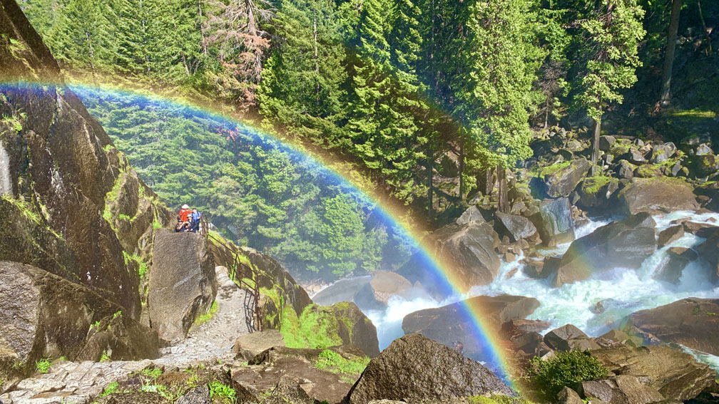
The climb to Vernal Falls is beautiful where you can see rainbows through the mists. I’ve climbed to the top of Vernal Falls twice, with one year having much more snow runoff than the other. The hike up can be very wet from the mist in the air, so you may want to consider taking a rain poncho with you as it can be very wet.
From the junction, it’s only about a half mile to the top of Vernal Falls, but it’s on a nearly 18 percent grade. It can be wet and slick, and it is heavily trafficked. There are spots to stop and rest, and other hikers can pass you at these points. Also watch your step on the stone trail, as steps have been carved in the granite stone to help make the climb easier. The most difficult part of the climb is around 250 feet or so on the final push to the top where it becomes single track. This part can be quite cumbersome if someone is coming back down. We didn’t encounter many people coming back down the day we hiked, as most people went on to Nevada Falls from here.
Once you make it to the top of Vernal Falls, take in the view of the Merced River below from the railing. The sights are magnificent.
From here you can go back down, or you can head on to Nevada Fall. We pressed on.
From here, it’s a 1.2-mile climb on an overall 14 percent grade to the top as you near Nevada Fall. The trail is easy to follow and well trafficked. The climb takes you under canopy, over granite rock, rock steps built into the trail and forest dirt in places. If the flow from Nevada Falls is strong, you may also hike through mist at points. It’s not an easy hike to the top, but it is worth it.

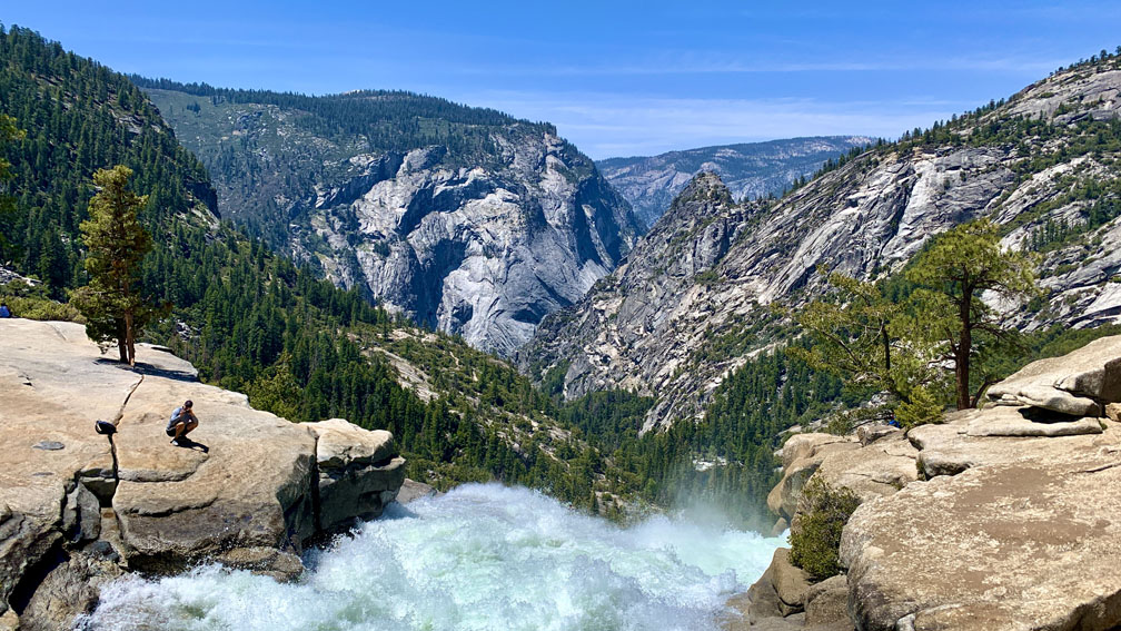
Once you make it to the top, it’s an easy .2 mile hike in a southerly direction to where the Merced River spills down from where you came. If you go northeasterly, you’ll head away from the falls on the John Muir Trail. The hike to the falls is beautiful. When we were there, one hiker looked back at the Merced River as it flowed toward the falls and said, “This is what the gates of Heaven look like.” I don’t know about that, but it was beautiful. There are various places to sit and take in the falls and the river, as the views below the falls. Take your time here and absorb it all. Hang out and have your lunch here before you head back down.
When we headed back down, we took the John Muir Trail back toward Yosemite Valley.
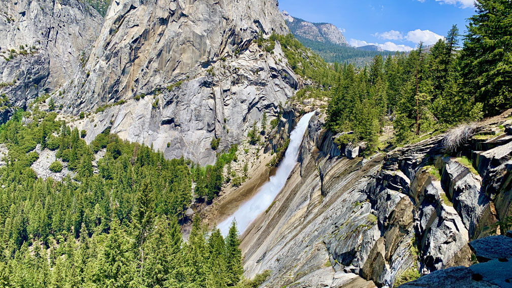
This leg of the John Muir Trail descends 1339 feet over 2.5 miles on an overall 10 percent grade. Portions of the trail actually look like it may have been a road at one point. Some of this hike is exposed, and on a hot day, this leg can get to you, especially if there’s not much of a breeze. We counted 22 switchbacks, depending on how you count them. Some people may count them as 20, but either way, that’s quite a few switchbacks. But the hike down from this trail offers a fantastic view of Nevada Fall as you look back on it.
After the 2.5-mile descent, you will end back up on the Mist Trail. Follow it out the way you came in from the valley for another 1.1 miles and enjoy the scenery.
Directions: From Groveland, take Highway 120 East to Curry Village in Yosemite National Park.
The Skinny
Trail: Mist Trail To Nevada Fall
Trailhead Coordinates: 37.732760, -119.557820
Trailhead Elevation: 4070 Feet
Distance: 6.7 Mile Lollipop
Level Of Difficulty: 🟠
Average Grade: 14%
Steepest Grade: 71% Over 335 Feet
Ascension: 3460 Feet
Trail Condition: 🟢🟢🟢🟢
Scenery: 🟢🟢🟢🟢
Nearest Civilization: Yosemite Valley
Challenges: The Climb
Traffic: 🥾🥾🥾
Highlights: Scenery, Waterfalls
Best Time: Spring
Hazards: Climbing On Wet Granite
Wildlife Concerns: Bears, Mountain Lions, Rattlesnakes
Cell Service: 📵 & 📱
Would I Do This Hike Again?: Possibly
Parking: $35 Entrance Fee At The Time Of This Writing Good For Seven Days To Yosemite National Park
Restrooms: At The First Merced River Crossing, At The Top Near Vernal Falls, At The Top Near Nevada Falls
