

The hike to Waimoku Falls on the Pīpīwai Trail is a beautiful lush hike through bamboo forests on the island of Maui. While not a difficult hike, it does offer challenges in the way of heat and humidity. That said, I would do this hike again and again.
The hike starts out at the Kīpahula Vistor Center on the western side of Haleakalā National Park.
Going to the falls is about a 1.9-mile ascent over about 1030 feet to the point to see falls. It wasn’t a bad climb, but take your time, as it can be steep in places.
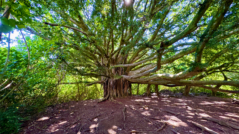
You will come to the Banyon tree on the trail. It’s a spectacular tree to take in, especially since they seem to only grow in the Pacific and parts of Asia. Be careful to not trip over the exposed roots as you hike around the tree.
Before the bamboo forest, you’ll be able to look down on Makahiku Falls. They fall for about 200 feet.

Once you cross the bridges over the Pīpīwali Stream and Palikea Stream, you will enter the bamboo forest. Stop and listen to it. You can hear the trees as they move and sway in the breeze. The trail also becomes a little easier to hike as a lot of it is covered by wood planks. But in other places it does get rocky, and you may need to watch your step.
As you come closer to the end of the trail to see Waimoku Falls, it starts to climb up and down. You will have to cross some streams, but you’re so close. You’ll come to a vista point where you can observe the falls. Once you taken your pictures and enjoyed the area, you’ll need to turn back, but it’s pretty much downhill all the way.
The vista point is where we encountered most people, so you may have to wait a bit to get your pictures.
Directions: From Kahului Airport, take State Highway 36 and HI-360 for 60.7 miles until you reach the Kīpahula Visitor Center. This is also known as the Road to Hana. It has more than 600 curves and more than 50 one-lane bridges. Both driving the road and riding as a passenger can be exhaustive. Many of the curves are tight, and when you get to HI-360, there are narrow blind corners in places. Once you’ve done this route, you can say you survived the Road to Hana and maybe be able to pick up a souvenir that also says that. It’s best to start out early in the morning before traffic on the road picks up. Going in we had it light, but coming back was noticeably heavier. Parking is here: 20.661825, -156.045540
The Skinny
Trail: Pīpīwai Trail – Out And Back
Trailhead Coordinates: 20.662389, -156.044333
Trailhead Elevation: 144 Feet
Distance: 3.8 Miles
Level Of Difficulty: 🟢
Average Grade: .8.8%
Steepest Grade: 80% Over 117 Feet
Ascension: 1165 Feet
Trail Condition: 🟢🟢🟢🟢
Scenery: 🟢🟢🟢🟢
Nearest Town: Hana
Challenges: Humidity
Traffic: 🥾 (When We Were There)
Highlights: Bamboo Forest, Banyon Tree, Waimoku Falls
Best Time: Spring, Summer, Fall, Winter
Hazards: Heat, Dehydration
Cell Service: 📵 (Verizon)
Would I Do This Hike Again?: Yes
Parking: $30 Valid For 3 Days At The Time Of This Writing.
Restrooms: At Trailhead