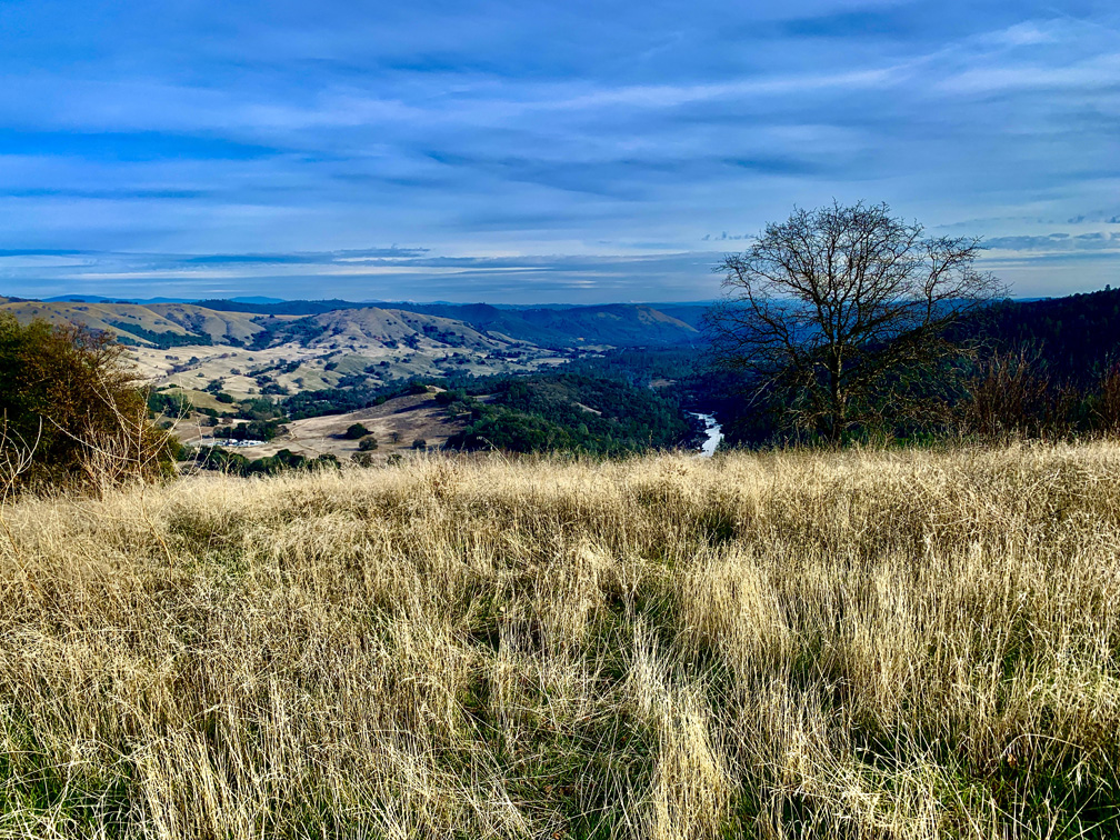
The views from Valentine Vista Trail in Moore Creek Park can be peaceful.
The hike to “Top Secret Swimming Hole” in Moore Creek Park is a beautiful foothill and forest hike. Most of the hike is under canopy, which provides good shade on warm or hot days, but parts of the hike can also challenge you.
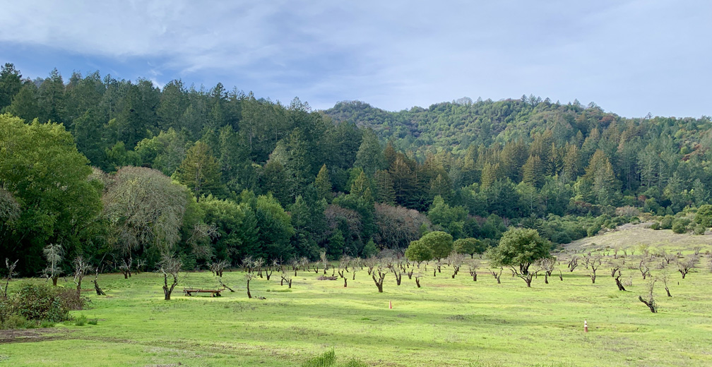
The Historic Orchard at Jack London State Historic Park once produced apples, apricots, pears, plums, and prunes.
The hike to the Historic Orchard at Jack London State Historic Park is mild. The one-time 100 acre orchard once produced apples, apricots, pears, plums, and prunes. The orchard is a casual hike, but getting there is a hike up and down hills and through forests.
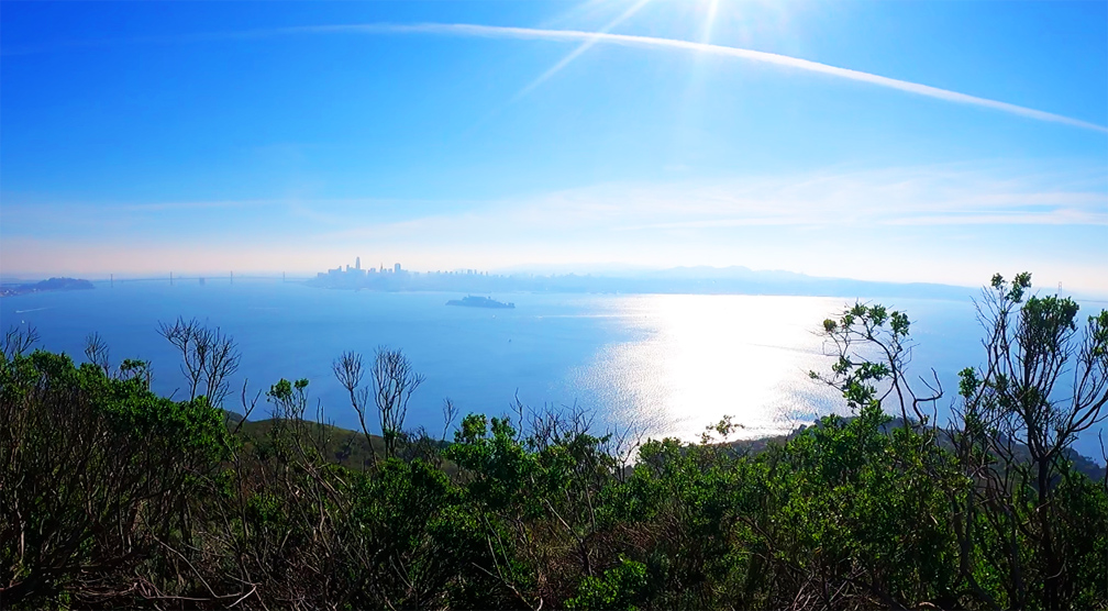
The views from the top of Angel Island offer a 360 degree view of the San Francisco Bay.
The views from the top of Mount Livermore on Angel Island State Park of the San Francisco Bay are incredible on a clear day. You can see the San Francisco Skyline, the East Bay, the Golden Gate Bridge and the hills of Marin County and much more.
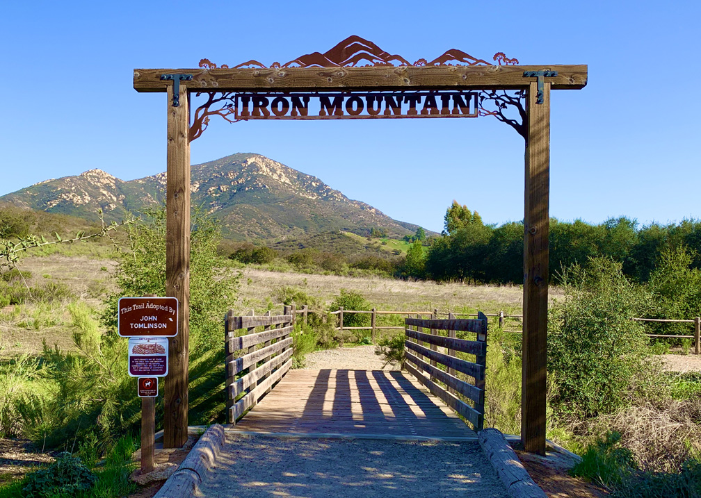
The climb up Iron Mountain near San Diego is a good climb. We didn’t take the direct route though; instead we took a longer hike up the Ellie Lane Trail. It was work, but it was worth it.
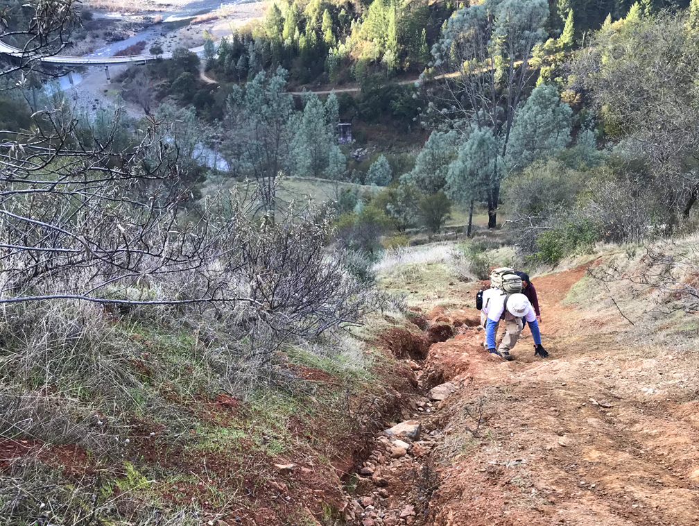
The climb up Kickass Hill has to be done with both hands and feet in places.
Kickass Hill in the Auburn State Recreation Area lives up to its name as soon as you start climbing. The hike is a complete workout and can give you a sense of accomplishment on a 31 percent grade over a heart pounding half mile.
On a clear day, from Sky Ridge Trail at Cronan Ranch Regional Trails Park, you see the Sierra Nevada Mountain Range as you look east.
Cronan Ranch Regional Trails Park is a playground of trails in the foothills. We hiked in the valleys and over high points that showed off the snowcapped Sierra Nevada Mountain range in the distance.
On this hike, we covered portions of several trails on our 11.5 mile hike. We hiked the River Trail to the Gerle Loop Trail; Down and Up Trail to the Cronan Ranch Road; South Fork American River Trail to the West Ridge Trail. We hiked back to the Cronan Ranch Road and the Down & Up Trail to Sky Ridge Trail. We reconnected with the Connector Trail and back to the Gerle Loop Trail. Wow, that’s a lot of trails!
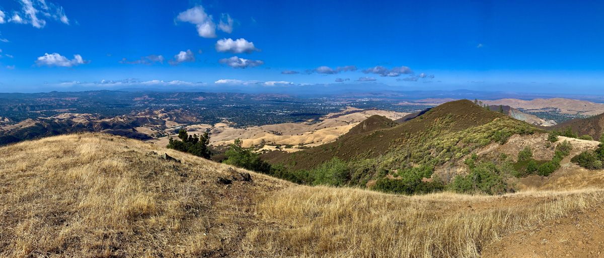
This hike up Burma Road, the Burma Blast, at Mount Diablo State Park is a son of a b*tch. So a friend really wanted to this hike because it was labeled the “the toughest hike in the Bay Area.” I don’t know if it’s the toughest, but it was a challenge. And the views over the Bay Area, to the north, east and south were worth it.
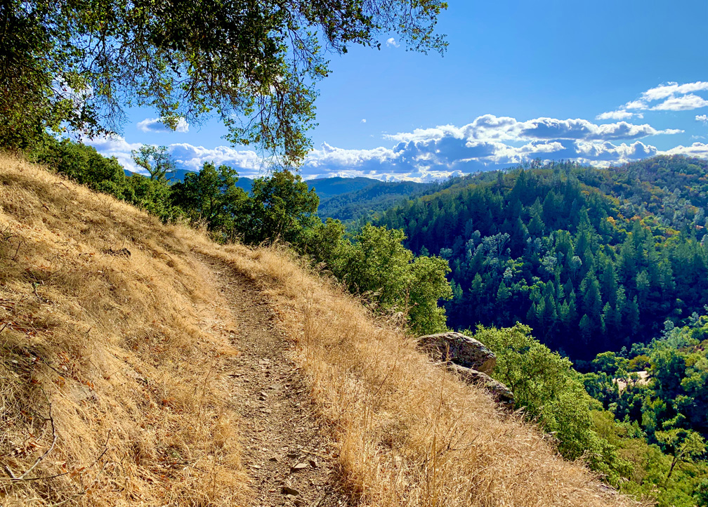
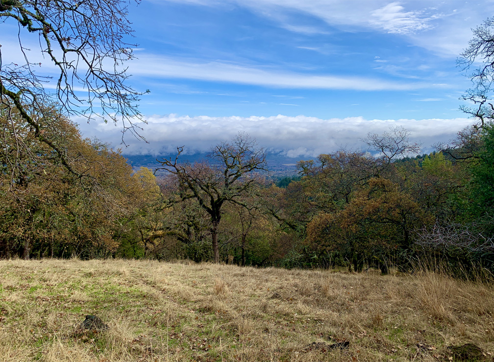
The view from the high point on Mountain Trail at Jack London State Historic Park is spectacular.
Jack London State Historic Park is becoming one of my favorite places to hike. It has redwoods, oak forests, foothills, ridges and very scenic views. The hike up Mountain Trail to High Point is worth the effort and is spectacular.
The hike starts off on the Lake Trail to London Lake from the Upper Parking Lot. As you begin, you hike past a picnic area, winery ruins and the distillery and turn and hike past a vineyard. Follow Mountain Trail which is a service road next to the wooded area. We stayed on Mountain Road as we passed an intersection where another trail leads to London Lake.
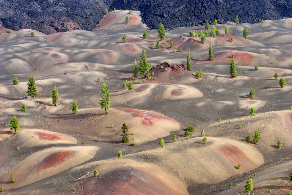
The Painted Dunes in Lassen Volcanic National Park from the top of Cinder Cone.
The views from Cinder Cone over the Painted Dunes at Lassen Volcanic National Park offer an incredibly “artistic” view of the landscape. But if you want to see this incredible view, you will have to work for it.
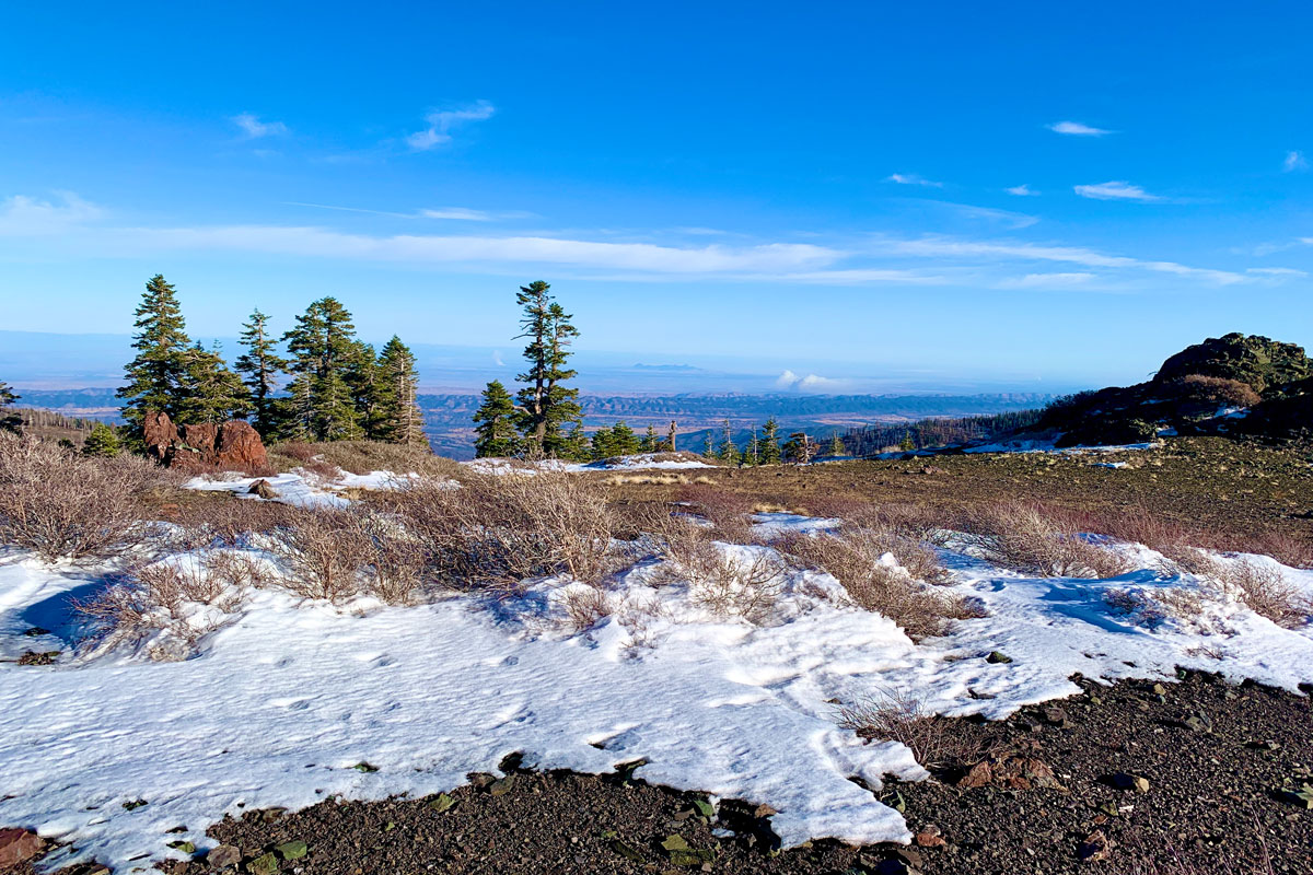
The view from Snow Mountain East Peak into the Sacramento Valley.
As when I wrote about my hike to the West Peak of Snow Mountain, the same two words apply: “peaceful desolation,” but the scenery has drastically changed since 2018 when I was there last.
A little less than a month after I hiked to the West Peak, the Ranch Fire broke out, and the area was closed for nearly two years for restoration. Then it was opened it up, but then the August Fire broke out in 2020, and the forest closed back down for a few months.
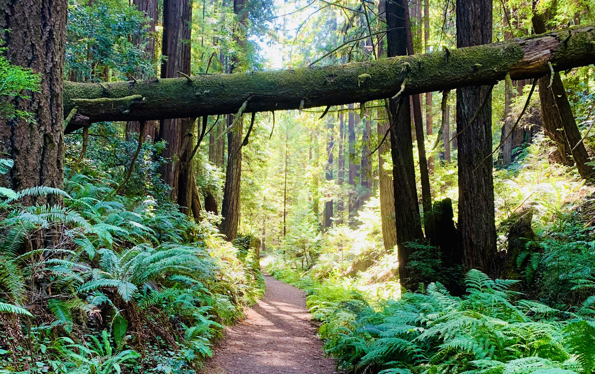
The trail through Fern Canyon is well defined and surrounded by Redwood Trees and ferns.
Up on the Northern California Coast just south of Fort Bragg in the Van Damme State Park is Fern Canyon. The deeper you go into the canyon, the better it gets. You will hike among the redwoods and lush ferns.