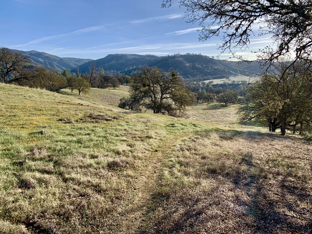
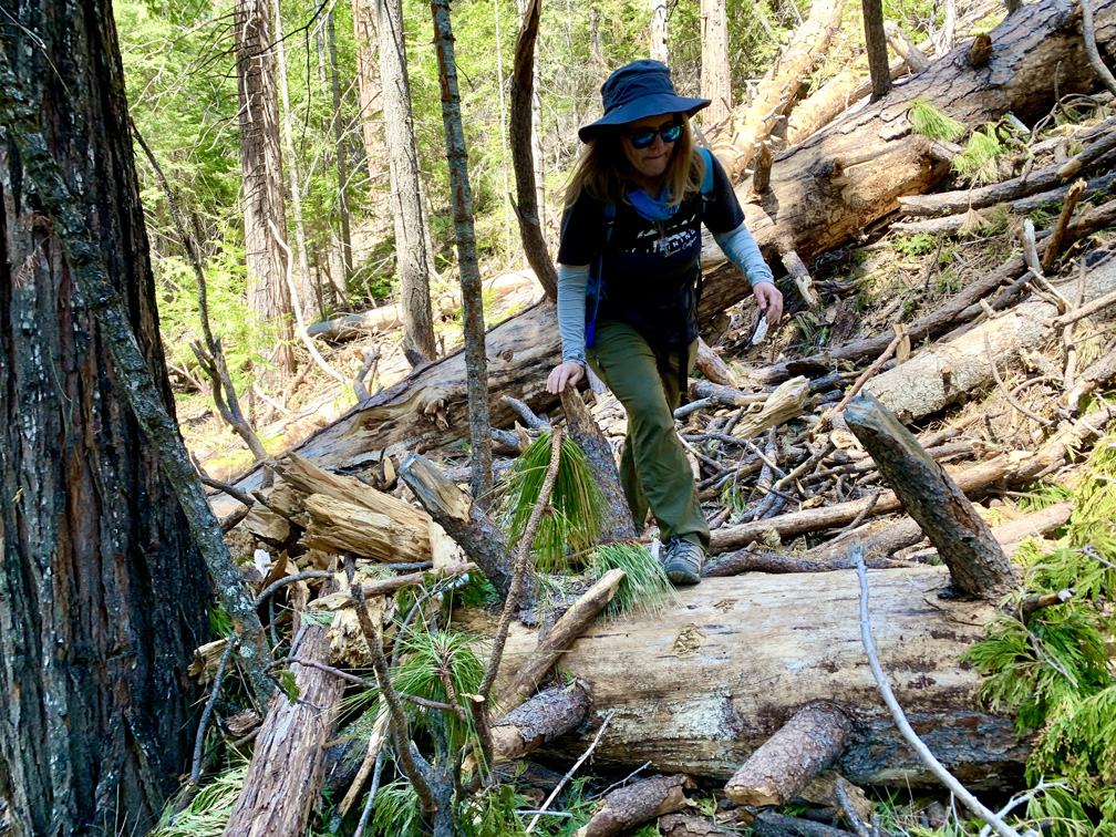
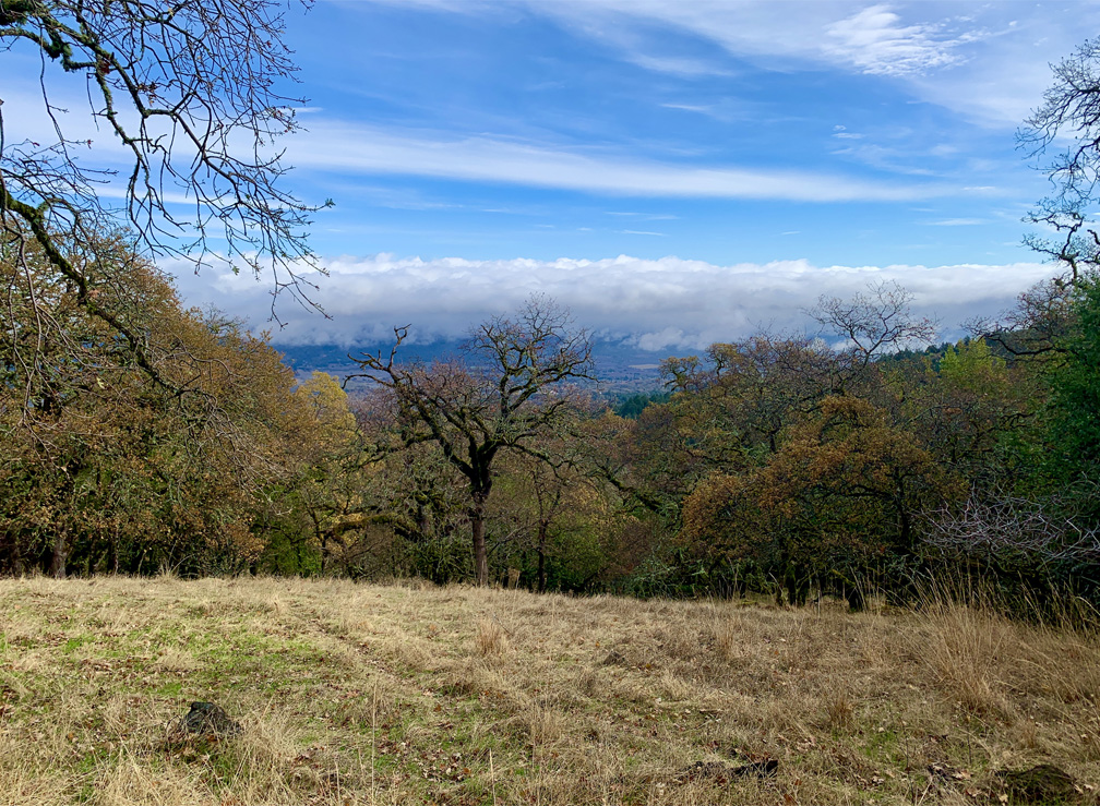
The trail through Fern Canyon is well defined and surrounded by Redwood Trees and ferns.
Up on the Northern California Coast just south of Fort Bragg in the Van Damme State Park is Fern Canyon. The deeper you go into the canyon, the better it gets. You will hike among the redwoods and lush ferns.
The view from top of Mt. Lassen looks out over Lassen Volcanic National Park and beyond.
The trail up to Lassen Peak is loaded with switchbacks and is nothing but a climb, but the trail itself is very nicely maintained and views get better and better the higher you go. Once you reach the top, you should feel a real sense of accomplishment.
Cooney Lake on the Virginia Lakes Trail has really clear water through which the bottom can be seen.
Virginia Lakes in the Eastern Sierra’s is a feast for the eyes but a workout on the lungs. The peak on this trail reaches approximately 11,120 feet give or take, with a starting elevation of 9,846 feet.
The hike along Redbud Trail takes you through the scenic foothills of the Cache Creek Wilderness Area.
This is a continuation of the Redbud Trail summary I wrote about in 2018. The total length of Redbud Trail (one way) is about 7.5 miles to Wilson Valley where it meets the Judge Davis Trail at Cache Creek. To read about the first 2.5 miles of the hike, see my Redbud Trail to Baton Flat summary. We pick up here at Baton Flat.
River Canyon Trail at Calaveras Big Trees State Park is the poorest maintained trail I’ve ever hiked. Parts of the trail should be closed as a safety hazard due to the poor upkeep of it. If the trail were maintained, this could be a really nice hike through the forest down to the North Fork of the Stanislaus River. Instead, I should have worn my heavier off-trail boots for parts of this trail.
I hate to start the hiking season off with a downer summary, but I want to get the word out before anybody might consider going to this state park.
Lake Aloha and Lake of the Woods dot the landscape into Desolation Wilderness.
The views from Ralston Peak are some of the most spectacular I’ve seen. You’re looking out at Lake Tahoe, Lake of the Woods, Lake Aloha, Ralston Lake, Upper Echo Lake, Mt. Tallac, Pyramid Peak, Mt. Rose and so much more from 9239 feet.
Hiking to Donner Peak is easy to moderate, and Donner Peak is the high-point of this hike – no question about it. Donner Peak overlooks Donner Lake, and once you make it there, you can take in the views and then head back the way you came. While there’s more, I won’t lie; I’d head back the way I came if I were to do this hike again.
The Caples Creek Trail follows the cascades of Caples Creek through the forest, and during June and July there are usually wildflowers along the way. The trail starts off on an incline that continues for a little more than 3.5 miles, but overall it isn’t a bad slope as you hike through the forest.
Sky Trail is a beautiful hike meanders along greenery and under pine trees.
Sky Trail at Point Reyes National Seashore is an awesome hike, and at the right time of the year when the wildflowers are in bloom, it’s a feast for the eyes. For the most part, the hike is not too difficult and is actually relaxing as you hike under the pine forests next to ferns and greenery.
Wildflowers burst with color along the Schneider Camp Trail in the Eldorado National Forest.
At the right time of the year, this is another “blow your mind” hike where wildflowers abound on the Schneider Camp Trail before you start the serious ascent to the junction that goes on to Showers Lake.
The view from Bald Mountain is sweeping. This panoramic photograph does not capture the curvature of the earth as you turn 360 degrees to look around you.
You have to work for it, but the view from the top of Bald Mountain is spectacular on a clear day. What makes it so spectacular is that as you take in a 360 degree view from the top, you can see the earth curve as you turn your head from landmark to landmark in all directions – something no picture can capture.
Once you climb high enough, you look out into the Sacramento Valley from the Deafy Glade Trail.
There is an update to Deafy Glade trail that will be posed here. If you are contemplating doing this hike, as there are safety concerns and trail hazards to be aware of.
Deafy Glade Trail is a butt kicker. After about a mile in and a creek crossing, it’s 3.5 miles of climbing that pulls on your calves, hamstrings and other lower body muscles. If you want buns of steel, this trail can make it happen for you. The view from the top where the Deafy Glade Trail meets the Summit Springs Trail offers views down into the Sacramento Valley and even the Sutter Buttes on a clear day.
Sandy Kelham Beach at Point Reyes National Seashore is backed by a cliff wall along its expanse.
Bear Valley Trail is probably the most popular trail at Point Reyes National Seashore, and I’ve hiked it countless times. This family-friendly trail is wide and follows the Bear Valley Creek under lush canopy almost all the way where it intersects with the Coast Trail.