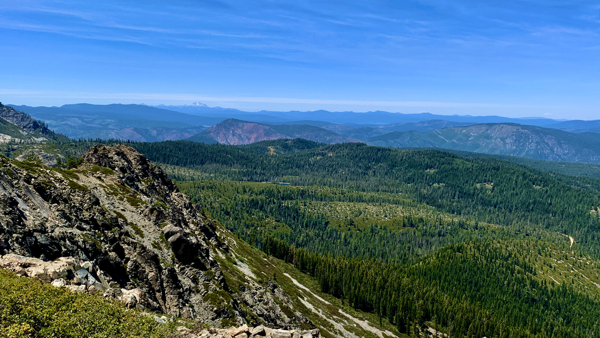
The view from the top of Spanish Peak is vast and sweeping with Mt. Lassen vaguely visible in the distance.
In 2021, the Dixie Fireburned much of the area, so the landscape may be different now than when we were there about a month or so before the fire occurred.
Hiking to Spanish Peak from Silver Lake in the Plumas National Forest is not easy, but the views are a spectacular payoff. The terrain is diverse. You start off in the forested area at Silver Lake, then you hike exposed over granite as you climb, and then you hike through forested areas again.
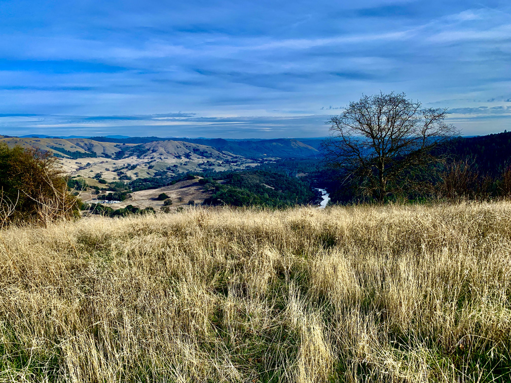
On a clear day, from Sky Ridge Trail at Cronan Ranch Regional Trails Park, you see the Sierra Nevada Mountain Range as you look east.
Cronan Ranch Regional Trails Park is a playground of trails in the foothills. We hiked in the valleys and over high points that showed off the snowcapped Sierra Nevada Mountain range in the distance.
On this hike, we covered portions of several trails on our 11.5 mile hike. We hiked the River Trail to the Gerle Loop Trail; Down and Up Trail to the Cronan Ranch Road; South Fork American River Trail to the West Ridge Trail. We hiked back to the Cronan Ranch Road and the Down & Up Trail to Sky Ridge Trail. We reconnected with the Connector Trail and back to the Gerle Loop Trail. Wow, that’s a lot of trails!
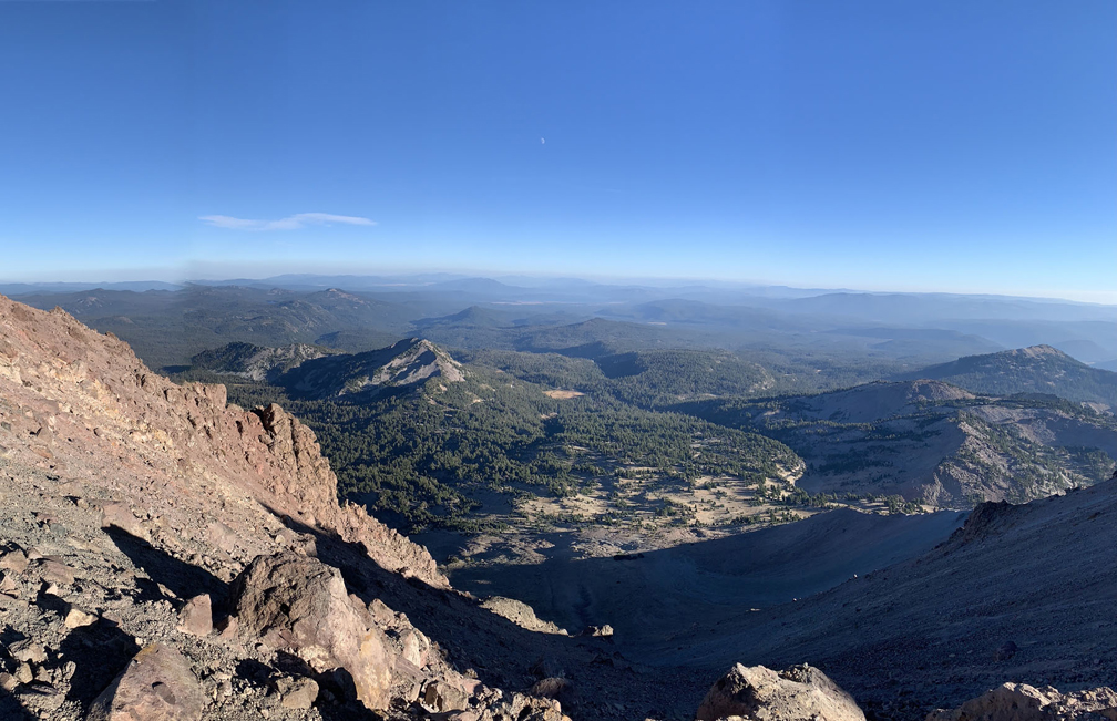
The view from top of Mt. Lassen looks out over Lassen Volcanic National Park and beyond.
The trail up to Lassen Peak is loaded with switchbacks and is nothing but a climb, but the trail itself is very nicely maintained and views get better and better the higher you go. Once you reach the top, you should feel a real sense of accomplishment.
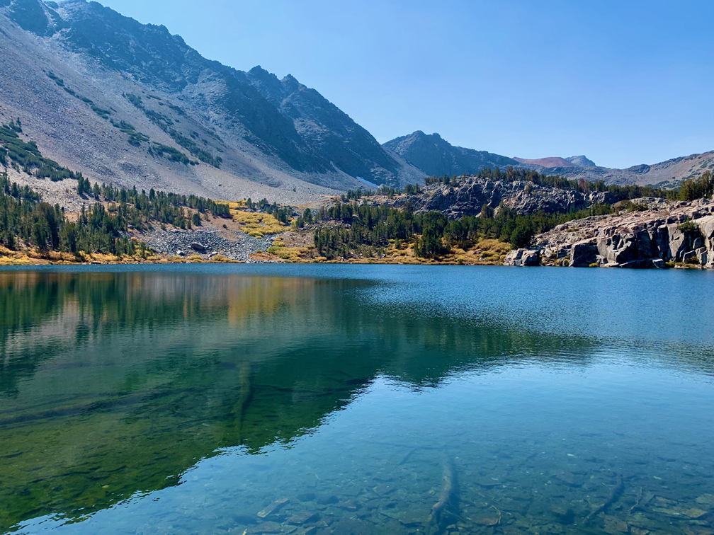
Cooney Lake on the Virginia Lakes Trail has really clear water through which the bottom can be seen.
Virginia Lakes in the Eastern Sierra’s is a feast for the eyes but a workout on the lungs. The peak on this trail reaches approximately 11,120 feet give or take, with a starting elevation of 9,846 feet.
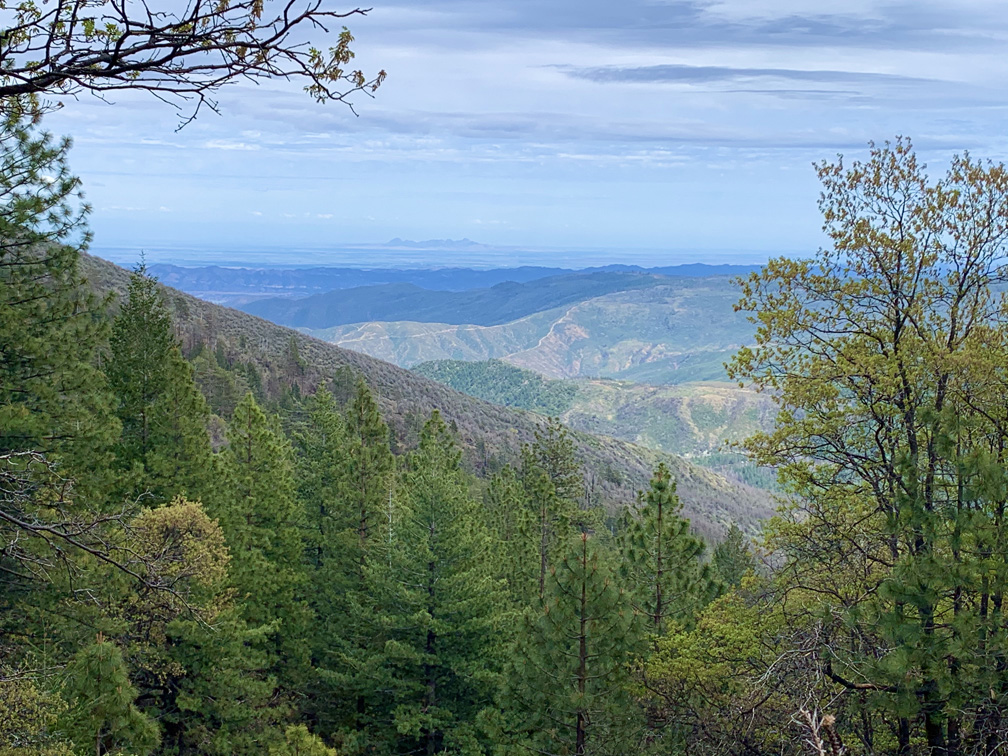
Once you climb high enough, you look out into the Sacramento Valley from the Deafy Glade Trail.
There is an update to Deafy Glade trail that will be posed here. If you are contemplating doing this hike, as there are safety concerns and trail hazards to be aware of.
Deafy Glade Trail is a butt kicker. After about a mile in and a creek crossing, it’s 3.5 miles of climbing that pulls on your calves, hamstrings and other lower body muscles. If you want buns of steel, this trail can make it happen for you. The view from the top where the Deafy Glade Trail meets the Summit Springs Trail offers views down into the Sacramento Valley and even the Sutter Buttes on a clear day.
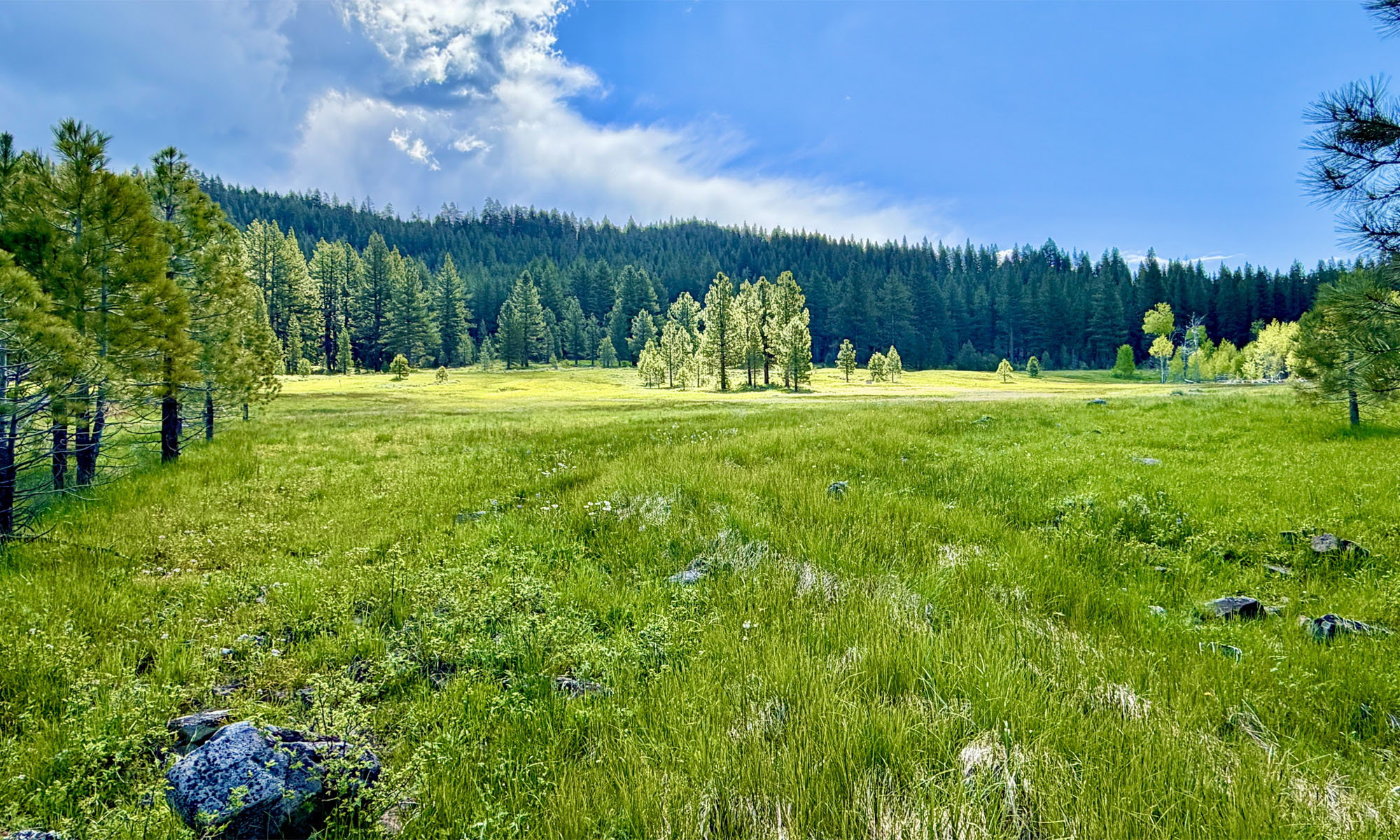
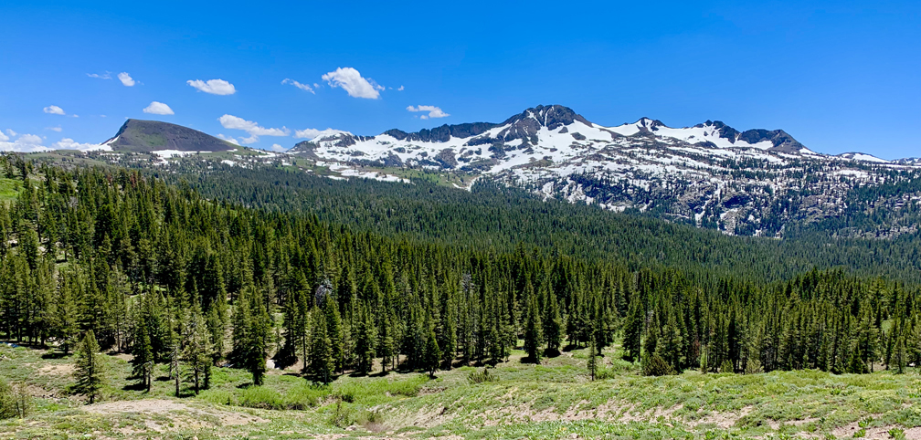
Elephants Back, Round Top Mountain and Sisters can be seen from the trail to Meiss Meadow.
From the trailhead, the hike to Meiss Meadow follows the Pacific Crest Trail to the Upper Truckee River you’ll have to cross and proceed up to the Showers Lake.
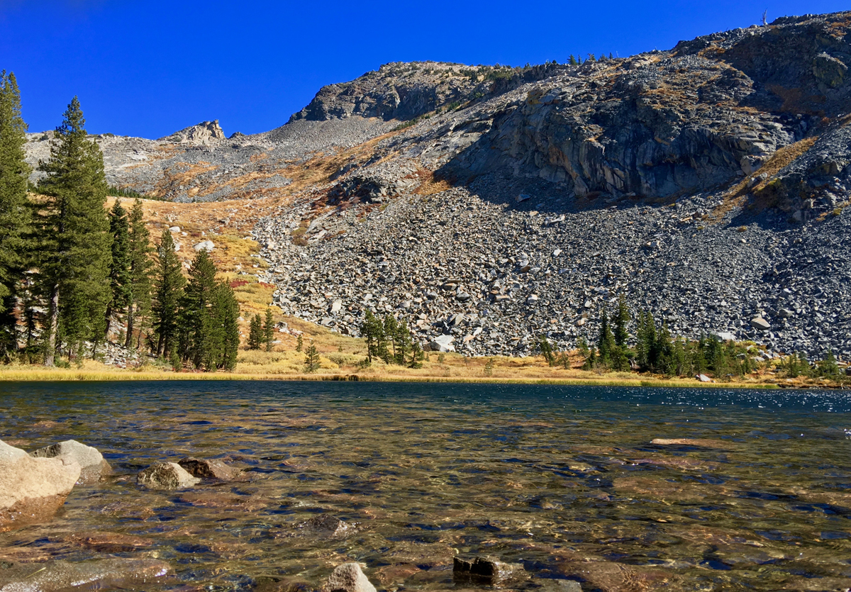
Lake Sylvia with its clear water sits up high at 8050 feet in Desolation Wilderness.
Lake Sylvia is a beautiful lake at 8050 feet in the Sierra Nevadas at the base of Pyramid Peak. The lake is small and beautiful, and the water is clear. It’s also idyllic and lined by pine trees on all but the northeast end, where you can look up at Pyramid Peak.
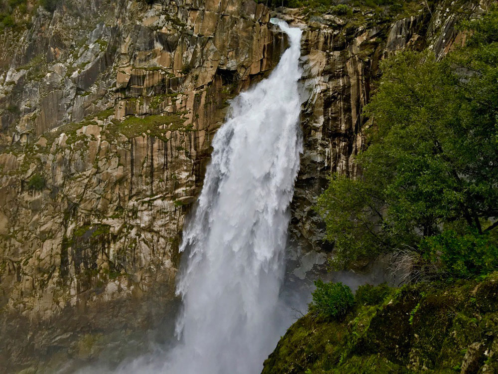
Feather Falls in Butte County plummets more than 400 feet down into the Feather River.
How can you be a hiker in Northern California and not hike to Feather Falls? The falls are an awesome to sight to behold, and the hike isn’t so bad either – depending on when you go and the condition of the trail. At about .4 miles from the trailhead, you’ll have decision to make when you come to fork.
If you want to make a loop out of this hike, it might be best to go to the left, as the trail will head downhill. Coming back up this way could be strenuous. If you do decide to come back up this way, there are a series of benches along the trail for resting. This way is shorter taking about 3.3 miles to get to the overlook. Continue reading “Hiking to Feather Falls”
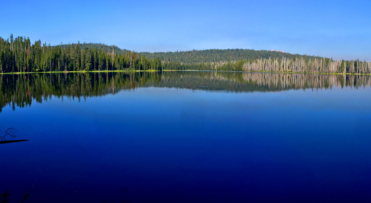
Horseshoe Lake is peacefully serene in the morning. Stop and take it in.
Horseshoe Lake in Lassen Volcanic National Park offers an awesome view, and is what makes this hike worth it. I got to experience the lake early in the morning before I saw any other hikers. It was beautiful, and even though I consider the entire hike the destination, just looking at Horseshoe Lake is a destination. Continue reading “Hiking Juniper Lake to Horseshoe Lake”
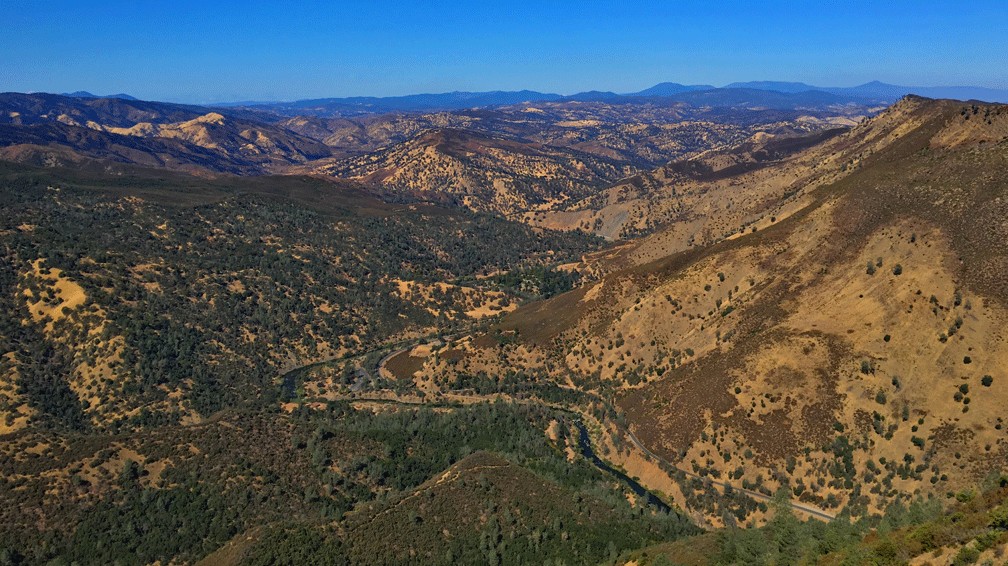
The view from the Blue Ridge Trail is sweeping as it looks into the Mendocino National Forest in the distance with Cache Creek in the foreground.
I love this hike! Hiking the Blue Ridge Trail to Fiske Peak in Northern California starts with a mild climb through an oak forest. It’s the only canopy you’ll be under during the hike. As the trail meanders up the open hillside, you’ll hike into a clear view of Glascock Mountain across the highway. Once you get to this point, the real ascension quickly begins. Continue reading “Hiking Blue Ridge Trail to Fiske Peak”
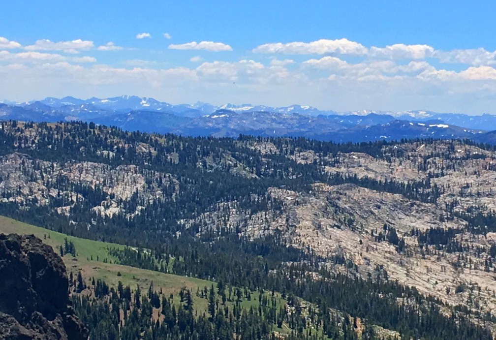
The views to the south of Thunder Mountain can be spectacular if the climatic conditions are right and there is at least some snow on the mountaintops in the distance.
This sometimes heavy breather of a hike to Thunder Mountain has outstanding views of mountaintops and ranges and overlooks vast swaths of trees and granite, meadows and forested hiking. At slightly over three miles in, and after some of the heaviest climbing on the trail, you come to the vista that can make you stop hiking and just gaze at the landscape. As you look to the south, you can see mountain peaks in the distance – probably in the Stanislaus National Forest – some with snow on them. If there are clouds in the over them, it’s an even more powerful view. Continue reading “Hiking Thunder Mountain”
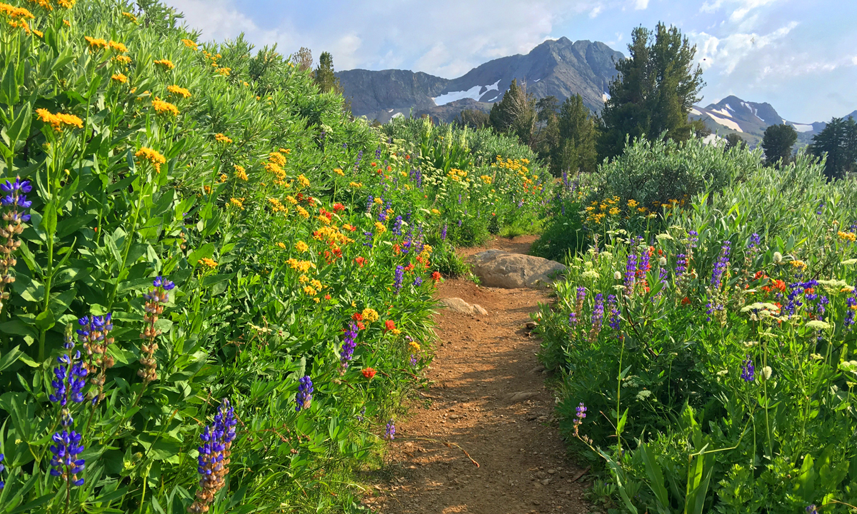
A summer wildflower explosion of color lines the trail from Carson Pass to Winnemucca Lake with Round Top Mountain the background.
Ihave written about hiking to Round Top Lake and Winnemucca Lake in a previous post, but I want to revisit the hike from a different way. If you like summer wildflowers, this is absolutely the hike for you.
Instead of starting out at Woods Lake, on this hike you start from Carson Pass, just a few more miles up on Highway 88.
The wildflower display on the trail to Winnemucca Lake, I’m told, is “world renowned.” I don’t know if that’s true, but I can attest to the beauty along the trail to the lake like I’ve never encountered on in the wild before. There is lupine, Indian Paintbrush, and a host of flowers I don’t know the names of, but are blue, purple, yellow and white. It’s an explosion of color, and in all the times I’ve hiked this trail, I’ve seen not only hikers, but photographers out on the trail too. About 1.5 miles in, you get into the wildflower burst. There is some uphill, but it’s not bad to this point, so it’s more than worth going just for this. If you were to just go to Winnemucca Lake and turn back, the wildflowers alone would make it a five-star day and the lake a bonus. Continue reading “Carson Pass to Fourth of July Peak”